Tel : +63(2)-7729-8168
|
Email Us : gallery@gop.com.ph
My Account
Remember Me
Register
19 Item(s)
-
₱
912,200.00
Intérieur d'une case bicole [Interior of a Bicolano House]
1 x
₱
6,600.00
Isla de Paragua o Palawan Sur pl. 25 (Southern Palawan)
1 x
₱
6,600.00
Entrée de la baie de Manille, (Iles Philippines) Entrevue nocturne de l'Auteur avec les petits noirs des Montagnes. [Entrance of Manila Bay (Philippine Islands) Nocturnal Meeting of the Author With the Native Mountain People]
1 x
₱
298,000.00
Anona Squamosa. L. [English: Sweetsop. Tagalog: Atis]
1 x
₱
49,500.00
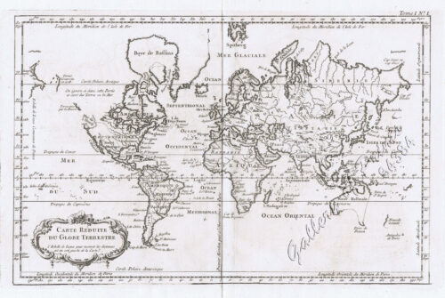
Carte Reduite du Globe Terrestre
1 x
₱
55,900.00
Philippine Islands. Samar and Leyte. San Juanico Strait and Approaches. From the United States Government Surveys to 1935. With Additions and Corrections from the Philippine Gov't. Charts to 1957. inset: 1) Northern Entrance to San Juanico Strait. From the United States Government Surveys of 1925. With Additions and Corrections from the Philippine Gov't. Charts to 1957.
1 x
₱
11,000.00
Nymphaea Lotus
1 x
₱
13,200.00
Manilla Banca
1 x
₱
5,500.00
Mapa de Filipinas, Joló y norte de Borneo
1 x
₱
7,700.00
Luzon Island. inset : Vicinity of Manila
1 x
₱
5,500.00
Campagnard Tagal, pres de Manille (Iles Philippines.) [Tagalog Man from the Countryside near Manila]
1 x
₱
290,000.00
Interior of the Crater of the Volcano at Taal
1 x
₱
8,800.00
Rajah Malais et sa Femme (voy. p. 102) [Malay Rajah and Spouse]
1 x
₱
4,400.00
Memoria Dirigida al Senado Por el Capitán General D. Fernando Primo de Rivera y Sobremonte Acerca de Su Gestión en Filipinas Agosto de 1898
1 x
₱
59,000.00
Katalog des Ethnographischen Reichsmuseums Band XX Philippinen [Catalog of the Ethnographic Reichsmuseum Volume XX Philippines]
1 x
₱
15,700.00
Plans in the Philippine Island. insets: 1) Luzon - North Coast. Aparri. From the Philippine Government Chart of 1954. 2) Bataan I. Basco. From the Philippine Government Chart of 1954. 3) Luzon - West Coast. Santa Cruz. From the Philippine Government Chart of 1952. 4) Bataan I. Balugan Bay. From the Philippine Government Chart of 1953.
1 x
₱
11,000.00
Carte des Indes et de la Chine…
1 x
₱
39,600.00
Manille (Oceanie)
1 x
₱
13,200.00
Philippine Islands. Tagolo Point to Cuyo Islands. Including Sebu , Negros and Parts of Panay and Palawan. From the United States Coast Survey Charts to 1923.
1 x
₱
11,000.00
View Cart
Checkout
Home
About Us
Publications
Shop Online
Framing Services
Exhibits
Picture Hanging System
Contact Us
View cart
“Philippine Islands. Tagolo Point to Cuyo Islands. Including Sebu , Negros and Parts of Panay and Palawan. From the United States Coast Survey Charts to 1923.” has been added to your cart.
Sort by
Name
Sort by
Default Order
Sort by
Name
Sort by
Price
Sort by
Date
Sort by
Popularity
Show
30 Products
Show
30 Products
Show
60 Products
Show
90 Products
Anchorages of Luzon, Mindoro and Marinduque. insets: 1) Luzo...
₱
11,000.00
Add to cart
Details
China Sea – Macclesfield Bank. Surveyed by Commander W...
₱
6,600.00
Add to cart
Details
China Sea – Philippine Islands. San Bernardino Strait ...
₱
11,000.00
Add to cart
Details
China Sea. Philippine Islands. San Bernardino Strait and App...
₱
11,000.00
Add to cart
Details
Eastern Archipelago. Philippine Islands and Adjacent Seas. F...
₱
11,000.00
Add to cart
Details
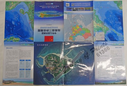
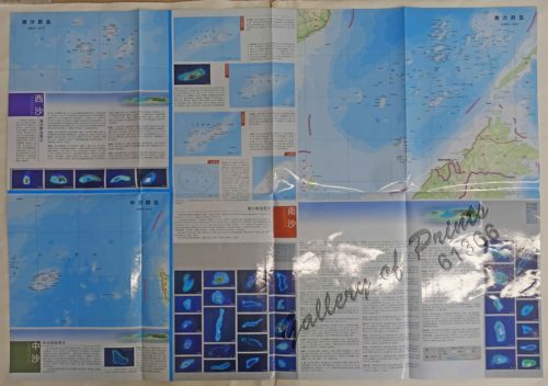
F7320, Map of Sansha City (South China Sea Map), China Offic...
₱
3,300.00
Add to cart
Details
Philippine Islands – Mindanao. Davao Gulf. From the Ph...
₱
11,000.00
Add to cart
Details
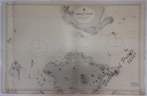
Philippine Islands Mindanao – West Coast – Basil...
₱
11,000.00
Add to cart
Details
Philippine Islands. Anchorages in Northern Luzon and the Bab...
₱
11,000.00
Add to cart
Details
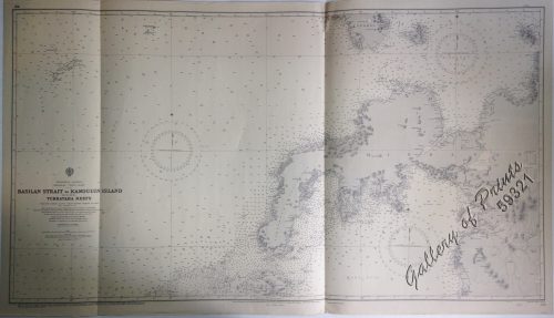
Philippine Islands. Basilan Strait. From the United States G...
₱
11,000.00
Add to cart
Details
Philippine Islands. Camotes Sea with Canigao Chanel. From th...
₱
11,000.00
Add to cart
Details
Philippine Islands. Cuyo East Pass. From the United States G...
₱
11,000.00
Add to cart
Details
Philippine Islands. Cuyo West Pass. From the United States G...
₱
13,200.00
Add to cart
Details
Philippine Islands. Leyte Gulf To Mayo Bay. Including Leyte,...
₱
11,000.00
Add to cart
Details
Philippine Islands. Luzon Island. North of Latitude 16° 20...
₱
11,000.00
Add to cart
Details
Philippine Islands. Luzon Island. North of Latitude 16° 20...
₱
11,000.00
Add to cart
Details
Philippine Islands. Luzon-West and East Coasts. Cabra I. to ...
₱
11,000.00
Add to cart
Details
Philippine Islands. Mindoro and Adjacent Islands. Cuyo Is. T...
₱
11,000.00
Add to cart
Details
Philippine Islands. Mindoro Strait. From the United States G...
₱
11,000.00
Add to cart
Details
Philippine Islands. Samar and Leyte. San Juanico Strait and ...
₱
11,000.00
Add to cart
Details
Philippine Islands. Sibuyan Sea to San Bernardino Strait. Fr...
₱
11,000.00
Add to cart
Details
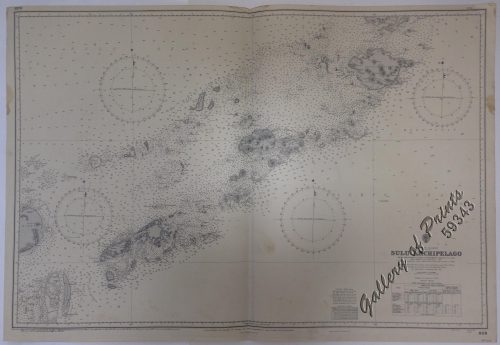
Philippine Islands. Sulu Archipelago. From the United States...
₱
11,000.00
Add to cart
Details
Philippine Islands. Surigao Srait with Leyte Gulf and Hinatu...
₱
11,000.00
Add to cart
Details
Philippine Islands. Tablas Strait with Part of Sibuyan Sea. ...
₱
11,000.00
Add to cart
Details
Philippine Islands. Tagolo Point to Cuyo Islands. Including ...
₱
11,000.00
Add to cart
Details
Philippine Islands. Tagolo Point to Cuyo Islands. Including ...
₱
11,000.00
Add to cart
Details
Philippine Islands. The Passages Between Panay. Negros and C...
₱
11,000.00
Add to cart
Details
Philippine Islands. Verde Island Passage. From the United St...
₱
11,000.00
Add to cart
Details
Philippine Islands. Western Part of Mindanao Sea with Bohol ...
₱
11,000.00
Add to cart
Details
1
2
Next
Shopping Cart
Philippine Islands. Tagolo Point to Cuyo Islands. Including Sebu , Negros and Parts of Panay and Palawan. From the United States Coast Survey Charts to 1923.
1
Manille (Oceanie)
1
Carte des Indes et de la Chine…
1
Plans in the Philippine Island. insets: 1) Luzon - North Coast. Aparri. From the Philippine Government Chart of 1954. 2) Bataan I. Basco. From the Philippine Government Chart of 1954. 3) Luzon - West Coast. Santa Cruz. From the Philippine Government Chart of 1952. 4) Bataan I. Balugan Bay. From the Philippine Government Chart of 1953.
1
Katalog des Ethnographischen Reichsmuseums Band XX Philippinen [Catalog of the Ethnographic Reichsmuseum Volume XX Philippines]
1
Memoria Dirigida al Senado Por el Capitán General D. Fernando Primo de Rivera y Sobremonte Acerca de Su Gestión en Filipinas Agosto de 1898
1
Rajah Malais et sa Femme (voy. p. 102) [Malay Rajah and Spouse]
1
Interior of the Crater of the Volcano at Taal
1
Campagnard Tagal, pres de Manille (Iles Philippines.) [Tagalog Man from the Countryside near Manila]
1
Luzon Island. inset : Vicinity of Manila
1
Mapa de Filipinas, Joló y norte de Borneo
1
Manilla Banca
1
Nymphaea Lotus
1
Philippine Islands. Samar and Leyte. San Juanico Strait and Approaches. From the United States Government Surveys to 1935. With Additions and Corrections from the Philippine Gov't. Charts to 1957. inset: 1) Northern Entrance to San Juanico Strait. From the United States Government Surveys of 1925. With Additions and Corrections from the Philippine Gov't. Charts to 1957.
1
Carte Reduite du Globe Terrestre
1
Anona Squamosa. L. [English: Sweetsop. Tagalog: Atis]
1
Entrée de la baie de Manille, (Iles Philippines) Entrevue nocturne de l'Auteur avec les petits noirs des Montagnes. [Entrance of Manila Bay (Philippine Islands) Nocturnal Meeting of the Author With the Native Mountain People]
1
Isla de Paragua o Palawan Sur pl. 25 (Southern Palawan)
1
Intérieur d'une case bicole [Interior of a Bicolano House]
1
Cart
Checkout
Continue Shopping
19