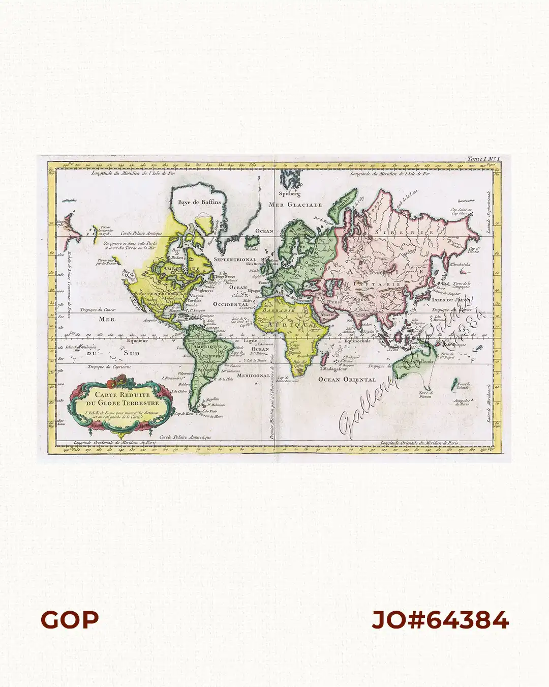
Description
hand-coloured copper engraving. World map from ‘Le Petit Atlas Maritime Recueti de Cartes et Plans des Quatre Parlies du Monde en Cinq Volumes’, tome I, no. 1.
The map shows Australia and New Zealand on the eve of voyages of Captain James Cook, which would substantially advance the European knowledge of the Coastal Regions. The Bay of the West is shown, with limited speculation on the Northwest Passage. The areas visited by the Russians along the coastline of the modern British Columbia are noted. Jacques-Nicolas Bellin (1703-1772) was among the most important mapmakers of the eighteenth century. During his term, the Depot became the center for the publication of sea charts, such as the Neptune François and the Atlas Maritime and the Hydrographie Francaise, popular well into the next Century. In 1721, he became hydrographer to the French Navy and 20 years later at age 38, the first Ingénieur de la Marine of the French Hydrographic Office and Official Hydrographer of the French King.


![Islas de Infanta y Polillo pl. 12 [Quezon Prov., Polilio Is., Pananongan I., Jomalig I.]](https://www.gop.com.ph/wp-content/uploads/2023/08/JO62585-Algue-1900-Quezon-Province-Polilo-Jomalig-Patnanongan-scaled-1-600x750.webp)