Author: not indicated
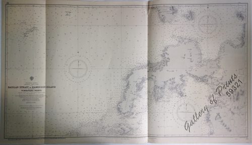
Publisher: Admiralty London, 1st July 1935 under the Superintendence of Rear-Admiral J.A.Edgell, C.B., O.B.E., Hydrographer.
Year: 1958 [1935]
Size: 99.2 x 66.6 cm
Reference:
₱11,000.00
In Stock
In Stock
lithograph. Map#3840. Large corrections 5th Oct.1945 June 1965…23rd Dec.1955…26th April 1958. Small corrections 1959 [many subsequent years stated till] 1964 – Z.c-1958. Seal of the Hydrographic Office – 3 Sea Roses with 360 degrees.
with center fold as issued and with hole in the left slightly affecting plate.