Tel : +63(2)-7729-8168
|
Email Us : gallery@gop.com.ph
My Account
Remember Me
Register
51 Item(s)
-
₱
1,974,440.00
Philippine Islands. Mindoro and Adjacent Islands. Cuyo Is. To Cabra I. Including Mindoro Strait and Sibuyan Sea. From the United States Cost Survey Charts to 1922.
1 x
₱
11,000.00
Interior of the Crater of the Volcano at Taal
1 x
₱
8,800.00
Philippine Islands. Anchorages in Northern Luzon and the Babuyan Islands. Insets: 1) Babuyan Is. - Fuga I. Musa Bay. From the United States Government Chart to 1931. 2) Babuyan Is. - Camiguin I. Port San Pio Quinto. From the United States Government Chart to 1931. 3) Luzon-North-East Coast Port San Vicente. From the United States Government Chart to 1938. 4) Luzon - East Coast Mauban Anchorage. From the Philippine Government Chart of 1957. 5) Luzon - West Coast. Salomague Harbour and Lapog Bay. From the United States Government Chart of 1934. 6) Luzon - West Coast Port Currimao and Gan Bay. From the United States Government Chart of 1934. 7) Luzon - West Coast Solvec Cove. From the United States Government Chart of 1934. 8) Luzon - West Coast Lingayen Gulf. Port Sual with Cabalitian Bay. From the United States Government Chart of 1922. 9) Luzon - West Coast San Fernando Harbour. From the United States Government Chart of 1936.
1 x
₱
11,000.00
Cochinchine - Philippines 1. Femmes Cochinchinoises. 2. Tagals
1 x
₱
39,600.00
Citrus Decumana. L. [English: Pomelo. Tagalog: Suha]
1 x
₱
26,400.00
1. Panguingui (Card-playing) in Manilla; 2. Planting Rice in Manilla.
1 x
₱
7,700.00
The Philippines in the 19th Century (A Collection of Prints)
1 x
₱
3,500.00
Mapping the World: Maps and Their History
1 x
₱
5,500.00
Indie Orientale [Indochina] [China, Korea, Philippines] [Japan, Guam, Pacific]
1 x
₱
790,000.00
The Philippine Insurrection: The Four Truths
1 x
₱
750.00
Ethnography of the Major Ethnolinguistic Groups in the Cordillera
1 x
₱
1,100.00
The Philippine Islands
1 x
₱
7,700.00
Dalea Bicolor [Silver Prarie Clover]
1 x
₱
5,500.00
Japanese Page
1 x
₱
4,400.00
The Murillo Bulletin, Journal of PHIMCOS, Special World War II Issue
1 x
₱
600.00
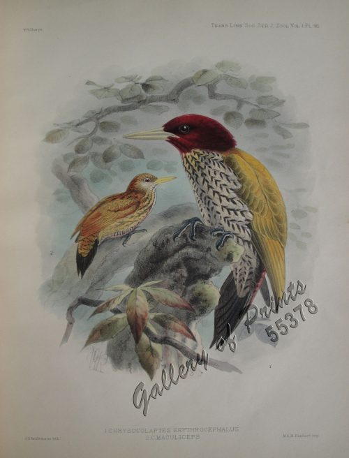
Chrysocolaptes Erythrocephalus (Fig. 1) [Crimson-backed Woodpecker] C. maculiceps (Fig. 2) pl.46
1 x
₱
22,000.00
The 36th IMCoS Symposium. Manila 2018. Insulae Indiae Orientalis
1 x
₱
3,500.00
Sketches from Manilla and Hong-Kong. "Soiree Musicale" at Manilla.
1 x
₱
5,500.00
Cavite (Islas Filipinas). - La Calle del Arsenal.
1 x
₱
6,600.00
Sketches in Manilla. 1. Chinese Chow-chow sellers at Manilla; 2. The Meat Market at Manilla.
1 x
₱
7,700.00
1. Embarquement des troupes pour Cuba, a Tampa 2. Depart du "Peking", transportant des troupes a Manille
1 x
₱
5,500.00
Manila (Filipinas). - El Río Pasig.
1 x
₱
5,500.00
Atlas des Voiliers et Pirogues du monde au début du XIXème siècle [Atlas of Sailboats and Pirogues of the World at the Beginning of the 19th Century]
1 x
₱
4,500.00
[Cloudless Sulphur Butterfly and Caterpillar with Moth]
1 x
₱
6,600.00
1. Oriolus Vulneratus (female) [Black-and-crimson Oriole] 2. Prioniturus Cyaneiceps (female) [Blue Racket-Tailed Parakeet]
1 x
₱
13,200.00
Discovering America. Journeys in Search of the New World
1 x
₱
4,400.00
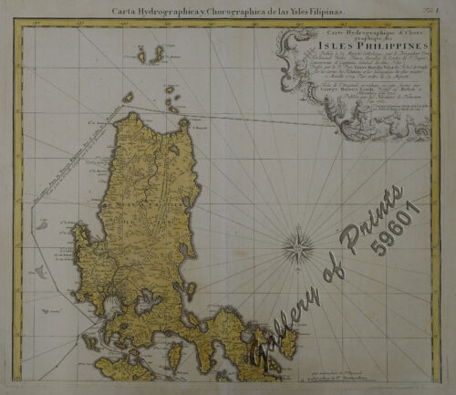
Carte Hydrographique & Chorographique des Isles Philippines (Carta Hydrographica y Chorographica de las Ysles Filipinas)
1 x
₱
425,000.00
Areca Catechu. - Linn. - Blanco. Miq. [Local Name: Nut Palm Tree]
1 x
₱
39,600.00
Sarcophagus Steerii (male & female) (Wattled Broadbill)
1 x
₱
22,000.00
The Cartography of the East Indian Islands, Insulae Indiae Orientalis.
1 x
₱
6,600.00
Harper's Weekly - A Journal of Civilization with frontispiece: The Sovereigns at the with frontispiece: In The Bitter Cold.
1 x
₱
11,000.00
Antique Maps - Christie's Collectors Guide
1 x
₱
2,500.00
Hot Springs at Tivi [Tiwi, Albay]
1 x
₱
6,600.00
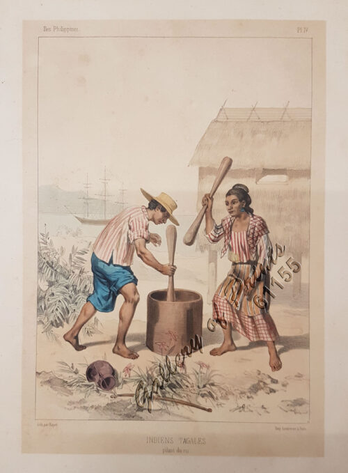
Indiens Tagales pilant du riz [Tagal Indians pounding rice.]
1 x
₱
61,600.00
The Murillo Bulletin, Journal of PHIMCOS, Issue No. 16
1 x
₱
790.00
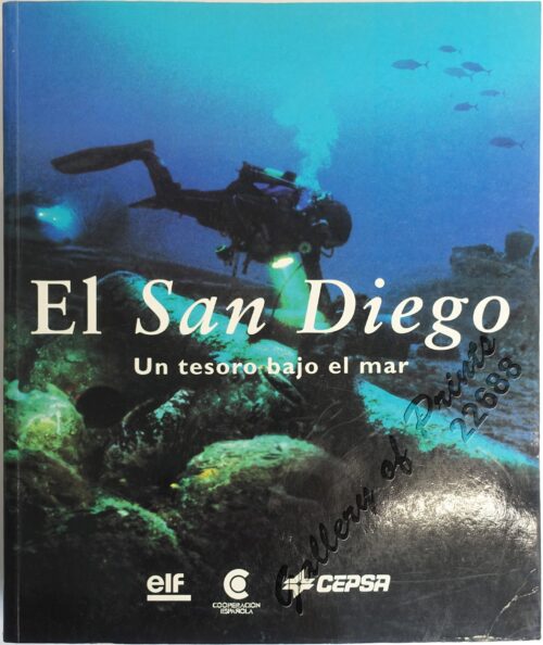
El San Diego Un tesoro bajo el mar [San Diego, A Treasure Under the Sea] [Galleon Sunk in the Philippines in 1600]
1 x
₱
5,500.00
Acacia Linifolia [White Wattle or Flax Wattle]
1 x
₱
5,500.00
The Sea Chart: The Illustrated History of Nautical Maps and Navigational Charts.
1 x
₱
3,500.00
Crinum Hildebrandti Vatke [Hildebrandt's Crinum Lily]
1 x
₱
7,700.00
Plan de La Baie de Manille
1 x
₱
39,600.00
Embarcaciones Filipinas. - "Cascos" en la laguna de Bay (Manila). [inset: Cross Section of a Casco]
1 x
₱
5,500.00
A view of Cape Espiritu Santo, on Samal, one of the Phillippine Islands… Centurion engag'd and took the Spanish Galeon call'd Nostra Seigniora de Cabadonga, from Acapulco bound to Manila.
1 x
₱
49,000.00
Port et Rade de Manille (Philippines)
1 x
₱
6,600.00
Andrés Bonifacio, titulado (Presidente) de La República Tagala.
1 x
₱
5,500.00
[Luzon & Visayas]]
1 x
₱
165,000.00
Philippine Islands. Samar and Leyte. San Juanico Strait and Approaches. From the United States Government Surveys to 1935. With Additions and Corrections from the Philippine Gov't. Charts to 1957. inset: 1) Northern Entrance to San Juanico Strait. From the United States Government Surveys of 1925. With Additions and Corrections from the Philippine Gov't. Charts to 1957.
1 x
₱
11,000.00
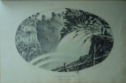
Cascada del Botocan. Provincia de la Laguna. [Botocan Falls]
1 x
₱
49,500.00
Advertisements [whole page] [page 1048]
1 x
₱
5,500.00
Philippine Islands. Luzon Island. North of Latitude 16° 20' North. From the United States Cost Survey Charts to 1925.
1 x
₱
11,000.00
Mandayaniederlassung am Tágum.
1 x
₱
8,800.00
Philippine Islands. Leyte Gulf To Mayo Bay. Including Leyte,Parts of Sebu and Bohol and the North-Eastern Cost of Mindanao. From the United States Cost Survey Charts to 1922.
1 x
₱
11,000.00
View Cart
Checkout
Home
About Us
Publications
Shop Online
Framing Services
Exhibits
Picture Hanging System
Contact Us
View cart
“Philippine Islands. Leyte Gulf To Mayo Bay. Including Leyte,Parts of Sebu and Bohol and the North-Eastern Cost of Mindanao. From the United States Cost Survey Charts to 1922.” has been added to your cart.
Sort by
Date
Sort by
Default Order
Sort by
Name
Sort by
Price
Sort by
Date
Sort by
Popularity
Show
30 Products
Show
30 Products
Show
60 Products
Show
90 Products
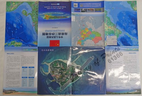
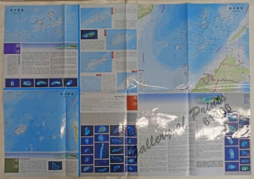
F7320, Map of Sansha City (South China Sea Map), China Offic...
₱
3,300.00
Add to cart
Details
Eastern Archipelago. Philippine Islands and Adjacent Seas. F...
₱
11,000.00
Add to cart
Details
Philippine Islands. Cuyo West Pass. From the United States G...
₱
13,200.00
Add to cart
Details
Philippine Islands. Western Part of Mindanao Sea with Bohol ...
₱
13,200.00
Add to cart
Details
Ports in the Philippine Islands. insets: 1) Luzon I. –...
₱
13,200.00
Add to cart
Details
Philippine Islands. Tagolo Point to Cuyo Islands. Including ...
₱
11,000.00
Add to cart
Details
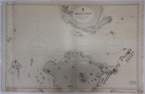
Philippine Islands. Basilan Strait. From the United States G...
₱
11,000.00
Add to cart
Details
Plans in the Philippine Island. insets: 1) Luzon – Nor...
₱
11,000.00
Add to cart
Details
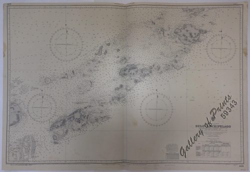
Philippine Islands. Sulu Archipelago. From the United States...
₱
11,000.00
Add to cart
Details
Philippine Islands – Mindanao. Davao Gulf. From the Ph...
₱
11,000.00
Add to cart
Details
China Sea. Philippine Islands. San Bernardino Strait and App...
₱
11,000.00
Add to cart
Details
Anchorages of Luzon, Mindoro and Marinduque. insets: 1) Luzo...
₱
11,000.00
Add to cart
Details
Philippine Islands. Surigao Srait with Leyte Gulf and Hinatu...
₱
11,000.00
Add to cart
Details
China Sea – Philippine Islands. San Bernardino Strait ...
₱
11,000.00
Add to cart
Details
Ports in the Philippine Islands. insets: 1) Luzon I. –...
₱
11,000.00
Add to cart
Details
Philippine Islands. Anchorages in Northern Luzon and the Bab...
₱
11,000.00
Add to cart
Details
Philippine Islands. Luzon Island. North of Latitude 16° 20...
₱
11,000.00
Add to cart
Details
Philippine Islands. Luzon-West and East Coasts. Cabra I. to ...
₱
11,000.00
Add to cart
Details
Philippine Islands. Mindoro and Adjacent Islands. Cuyo Is. T...
₱
11,000.00
Add to cart
Details
Philippine Islands. Leyte Gulf To Mayo Bay. Including Leyte,...
₱
11,000.00
Add to cart
Details
Philippine Islands. Camotes Sea with Canigao Chanel. From th...
₱
11,000.00
Add to cart
Details
Philippine Islands. Sibuyan Sea to San Bernardino Strait. Fr...
₱
11,000.00
Add to cart
Details
Philippine Islands. Western Part of Mindanao Sea with Bohol ...
₱
11,000.00
Add to cart
Details
Philippine Islands. Luzon Island. North of Latitude 16° 20...
₱
11,000.00
Add to cart
Details
Philippine Islands. Cuyo East Pass. From the United States G...
₱
11,000.00
Add to cart
Details
Philippine Islands. The Passages Between Panay. Negros and C...
₱
11,000.00
Add to cart
Details
Philippine Islands. Samar and Leyte. San Juanico Strait and ...
₱
11,000.00
Add to cart
Details
Philippine Islands. Verde Island Passage. From the United St...
₱
11,000.00
Add to cart
Details
Philippine Islands. Tablas Strait with Part of Sibuyan Sea. ...
₱
11,000.00
Add to cart
Details
1
2
Next
Shopping Cart
Philippine Islands. Leyte Gulf To Mayo Bay. Including Leyte,Parts of Sebu and Bohol and the North-Eastern Cost of Mindanao. From the United States Cost Survey Charts to 1922.
1
Mandayaniederlassung am Tágum.
1
Philippine Islands. Luzon Island. North of Latitude 16° 20' North. From the United States Cost Survey Charts to 1925.
1
Advertisements [whole page] [page 1048]
1
Cascada del Botocan. Provincia de la Laguna. [Botocan Falls]
1
Philippine Islands. Samar and Leyte. San Juanico Strait and Approaches. From the United States Government Surveys to 1935. With Additions and Corrections from the Philippine Gov't. Charts to 1957. inset: 1) Northern Entrance to San Juanico Strait. From the United States Government Surveys of 1925. With Additions and Corrections from the Philippine Gov't. Charts to 1957.
1
[Luzon & Visayas]]
1
Andrés Bonifacio, titulado (Presidente) de La República Tagala.
1
Port et Rade de Manille (Philippines)
1
A view of Cape Espiritu Santo, on Samal, one of the Phillippine Islands… Centurion engag'd and took the Spanish Galeon call'd Nostra Seigniora de Cabadonga, from Acapulco bound to Manila.
1
Embarcaciones Filipinas. - "Cascos" en la laguna de Bay (Manila). [inset: Cross Section of a Casco]
1
Plan de La Baie de Manille
1
Crinum Hildebrandti Vatke [Hildebrandt's Crinum Lily]
1
The Sea Chart: The Illustrated History of Nautical Maps and Navigational Charts.
1
Acacia Linifolia [White Wattle or Flax Wattle]
1
El San Diego Un tesoro bajo el mar [San Diego, A Treasure Under the Sea] [Galleon Sunk in the Philippines in 1600]
1
The Murillo Bulletin, Journal of PHIMCOS, Issue No. 16
-
Quantity
+
Indiens Tagales pilant du riz [Tagal Indians pounding rice.]
1
Hot Springs at Tivi [Tiwi, Albay]
1
Antique Maps - Christie's Collectors Guide
1
Harper's Weekly - A Journal of Civilization with frontispiece: The Sovereigns at the with frontispiece: In The Bitter Cold.
1
The Cartography of the East Indian Islands, Insulae Indiae Orientalis.
1
Sarcophagus Steerii (male & female) (Wattled Broadbill)
1
Areca Catechu. - Linn. - Blanco. Miq. [Local Name: Nut Palm Tree]
1
Carte Hydrographique & Chorographique des Isles Philippines (Carta Hydrographica y Chorographica de las Ysles Filipinas)
1
Discovering America. Journeys in Search of the New World
1
1. Oriolus Vulneratus (female) [Black-and-crimson Oriole] 2. Prioniturus Cyaneiceps (female) [Blue Racket-Tailed Parakeet]
1
[Cloudless Sulphur Butterfly and Caterpillar with Moth]
1
Atlas des Voiliers et Pirogues du monde au début du XIXème siècle [Atlas of Sailboats and Pirogues of the World at the Beginning of the 19th Century]
1
Manila (Filipinas). - El Río Pasig.
1
1. Embarquement des troupes pour Cuba, a Tampa 2. Depart du "Peking", transportant des troupes a Manille
1
Sketches in Manilla. 1. Chinese Chow-chow sellers at Manilla; 2. The Meat Market at Manilla.
1
Cavite (Islas Filipinas). - La Calle del Arsenal.
1
Sketches from Manilla and Hong-Kong. "Soiree Musicale" at Manilla.
1
The 36th IMCoS Symposium. Manila 2018. Insulae Indiae Orientalis
-
Quantity
+
Chrysocolaptes Erythrocephalus (Fig. 1) [Crimson-backed Woodpecker] C. maculiceps (Fig. 2) pl.46
1
The Murillo Bulletin, Journal of PHIMCOS, Special World War II Issue
1
Japanese Page
1
Dalea Bicolor [Silver Prarie Clover]
1
The Philippine Islands
1
Ethnography of the Major Ethnolinguistic Groups in the Cordillera
1
The Philippine Insurrection: The Four Truths
1
Indie Orientale [Indochina] [China, Korea, Philippines] [Japan, Guam, Pacific]
1
Mapping the World: Maps and Their History
1
The Philippines in the 19th Century (A Collection of Prints)
-
Quantity
+
1. Panguingui (Card-playing) in Manilla; 2. Planting Rice in Manilla.
1
Citrus Decumana. L. [English: Pomelo. Tagalog: Suha]
1
Cochinchine - Philippines 1. Femmes Cochinchinoises. 2. Tagals
1
Philippine Islands. Anchorages in Northern Luzon and the Babuyan Islands. Insets: 1) Babuyan Is. - Fuga I. Musa Bay. From the United States Government Chart to 1931. 2) Babuyan Is. - Camiguin I. Port San Pio Quinto. From the United States Government Chart to 1931. 3) Luzon-North-East Coast Port San Vicente. From the United States Government Chart to 1938. 4) Luzon - East Coast Mauban Anchorage. From the Philippine Government Chart of 1957. 5) Luzon - West Coast. Salomague Harbour and Lapog Bay. From the United States Government Chart of 1934. 6) Luzon - West Coast Port Currimao and Gan Bay. From the United States Government Chart of 1934. 7) Luzon - West Coast Solvec Cove. From the United States Government Chart of 1934. 8) Luzon - West Coast Lingayen Gulf. Port Sual with Cabalitian Bay. From the United States Government Chart of 1922. 9) Luzon - West Coast San Fernando Harbour. From the United States Government Chart of 1936.
1
Interior of the Crater of the Volcano at Taal
1
Philippine Islands. Mindoro and Adjacent Islands. Cuyo Is. To Cabra I. Including Mindoro Strait and Sibuyan Sea. From the United States Cost Survey Charts to 1922.
1
Cart
Checkout
Continue Shopping
51