Tel : +63(2)-7729-8168 | Mobile: +63 917 806 4291
|
Email: gallery@gop.com.ph
My Account
Remember Me
Register
16 Item(s)
-
₱
277,100.00
Harper's Weekly - A Journal of Civilization with frontispiece: The Sovereigns at the Theatre at Stuttgardt.
1 x
₱
13,200.00
1) Carta dell'Isole Filippine [1st sheet]. 2) Carta dell'Isole Filippine di Mr. Bellin Ingegnere della Marine Foglio 1 mo [2nd sheet]
1 x
₱
61,600.00
Cardnus acauli-pratensis. Hybrid between Dwarf and Meadow Thistles.
1 x
₱
4,400.00
The Cruise of the U.S. Flagship Olympia, from 1895-1899, from San Francisco to Manila Bay: part two, The Bounding Pillow (1899)
1 x
₱
2,200.00
Manille - Die Stadt Manille [reverse picture] [City of Manila]
1 x
₱
22,000.00
Vue prise a Pulo-Penang.
1 x
₱
25,200.00
Sarcophagus Steerii (male & female) (Wattled Broadbill)
1 x
₱
9,900.00
Rand McNally Popular Map of Philippine Islands. insets: 1) Philippine Islands and China Sea. 2) Batan and Babuyan Islands.
1 x
₱
4,400.00
Anchorages of Luzon, Mindoro and Marinduque. insets: 1) Luzon - West Coast. Bolinao Harbour. From the United States Government Survey of 1904. With additions and corrections from Philippine Gov't. Charts to 1964. 2) Luzon - West Coast. Port Masinloc and Port Matalvi. From the United States Government Surveys of 1937. With additions and corrections from Philippine Gov't. Charts to 1964. 3) Luzon - West Coast. Mariveles Harbour. From the United States Government Chart of 1940. With additions and corrections from Philippine Gov't. Charts to 1964. 4) Luzon - South - West Coast. Batangas. From the Philippine Government Chart of 1956. With additions and corrections to 1964. 5) Luzon - South - West Coast. Nasugbu Bay. From the Philippine Government Chart of 1956. 6) Marinduque. Port Balanacan. From the United States Government Survey of 1908. With additions and corrections from Philippine Gov't. Charts to 1964. 7) Marinduque. Santa Cruz Harbour. From the United States Government Survey of 1908. With additions and corrections from Philippine Gov't. Charts to 1964. 8) Mindoro - North Coast. Port Galera and Varadero Bay. From the United States Government Surveys to 1939. With additions and corrections from Philippine Gov't. Charts to 1964.
1 x
₱
11,000.00
The Chinese in Philippine Life 1850-1898
1 x
₱
5,500.00
Philippine Islands. Luzon Island. North of Latitude 16° 20' North. From the United States Cost Survey Charts to 1925.
1 x
₱
11,000.00
The Voyage of the Frigate Pallada [1852-1855]
1 x
₱
3,300.00
Bacolod Fort
1 x
₱
3,300.00
Carte du Theatre de la Guerre Hispano - Americaine [Map of the Spanish-American War Theatre] (inset Philippines)
1 x
₱
4,400.00
Die Ostindischen Inseln nach den neuesten Berichtigungen dargestellt [The East Indies Presented According to the Latest Corrections]
1 x
₱
18,700.00
Port de Manille
1 x
₱
77,000.00
View Cart
Checkout
Home
About Us
Publications
Shop Online
Framing Services
Exhibits
Picture Hanging System
Contact Us
Blogs
View cart
“Port de Manille” has been added to your cart.
Sort by
Date
Sort by
Default Order
Sort by
Name
Sort by
Price
Sort by
Date
Sort by
Popularity
Show
30 Products
Show
30 Products
Show
60 Products
Show
90 Products
Map of the North Atlantic Ocean showing European Colonial Po...
₱
6,600.00
Add to cart
Details
Map of the China Seas showing Philippine Islands and Adjacen...
₱
6,600.00
Add to cart
Details
Yesterdays in the Philippines
₱
9,900.00
Add to cart
Details
Map of Batan Island
₱
6,600.00
Add to cart
Details
Central Luzon. inset: Manila and Vicinity
₱
4,400.00
Add to cart
Details
Rue Saint-Roque a Manille, apres le tremblement de terre (vo...
₱
5,500.00
Add to cart
Details
Sammlung gemeinverständlicher wissenschaftlicher Vorträge ...
₱
15,700.00
Add to cart
Details
Lichtensteinipicus fuliginosus [Sooty Woodpecker]
₱
5,500.00
Add to cart
Details
Halcyon lindsayi lindsayi [Lindsay’s Kingfisher] (uppe...
₱
5,500.00
Add to cart
Details
Gallicolumba keayi [Negros Puñalada]
₱
5,500.00
Add to cart
Details
The Murillo Bulletin, Journal of PHIMCOS, Issue No.5
₱
540.00
Add to cart
Details
The Murillo Bulletin, Journal of PHIMCOS, Issue No.4
₱
540.00
Add to cart
Details
The Murillo Bulletin, Journal of PHIMCOS, Issue No.3
₱
450.00
Add to cart
Details
The Murillo Bulletin, Journal of PHIMCOS, Issue No.2
₱
900.00
Add to cart
Details
The Murillo Bulletin, Journal of PHIMCOS, Issue No.1
₱
350.00
Add to cart
Details
Terrain Handbook 41 Manila (Philippine Series)
₱
22,000.00
Add to cart
Details
Typus Fpeti Manilensis [sic], Detroit de Manilles, [Straits ...
₱
39,600.00
Add to cart
Details
Aus der Umgebung von Manila: Die Vorstadt Binondo. (View fro...
₱
5,500.00
Add to cart
Details
Exposicion de Filipinas en el Parque de Madrid. 1. Puente de...
₱
11,000.00
Add to cart
Details
Insulae Indiae Orientalis praecipuae, In quibus Moluccae cel...
₱
185,000.00
Add to cart
Details
Census of the Philippine Islands: 1903. Vol. 1 – Geogr...
₱
50,600.00
Add to cart
Details
MADRID. – Exposicion de Filipinas: Exterior de los edi...
₱
8,800.00
Add to cart
Details
A Triumphal Parade of Insurgent Troops in Manila
₱
14,700.00
Add to cart
Details
Isles Philippines a Paris chez le Rouge
₱
22,000.00
Add to cart
Details
Die Ostindischen Inseln nach den neuesten Berichtigungen dar...
₱
18,700.00
Add to cart
Details
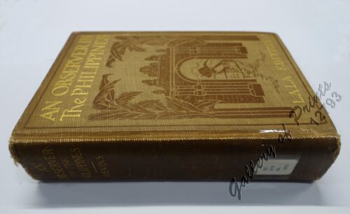
An Observer in the Philippines or Life in Our New Possession...
₱
8,800.00
Add to cart
Details
El Indicador del Viajero en las Islas Filipinas
₱
77,000.00
Add to cart
Details
The Fleet that did not go to the Philippines Admiral Camara&...
₱
11,000.00
Add to cart
Details
Map of the United States showing the Territorial Expansion o...
₱
33,100.00
Add to cart
Details
East India Archipelago [Eastern Passages to China and Japan]...
₱
39,600.00
Add to cart
Details
Previous
1
2
3
…
44
45
46
47
48
49
50
…
61
62
63
Next
Shopping Cart
Port de Manille
1
Die Ostindischen Inseln nach den neuesten Berichtigungen dargestellt [The East Indies Presented According to the Latest Corrections]
1
Carte du Theatre de la Guerre Hispano - Americaine [Map of the Spanish-American War Theatre] (inset Philippines)
1
Bacolod Fort
1
The Voyage of the Frigate Pallada [1852-1855]
1
Philippine Islands. Luzon Island. North of Latitude 16° 20' North. From the United States Cost Survey Charts to 1925.
1
The Chinese in Philippine Life 1850-1898
1
Anchorages of Luzon, Mindoro and Marinduque. insets: 1) Luzon - West Coast. Bolinao Harbour. From the United States Government Survey of 1904. With additions and corrections from Philippine Gov't. Charts to 1964. 2) Luzon - West Coast. Port Masinloc and Port Matalvi. From the United States Government Surveys of 1937. With additions and corrections from Philippine Gov't. Charts to 1964. 3) Luzon - West Coast. Mariveles Harbour. From the United States Government Chart of 1940. With additions and corrections from Philippine Gov't. Charts to 1964. 4) Luzon - South - West Coast. Batangas. From the Philippine Government Chart of 1956. With additions and corrections to 1964. 5) Luzon - South - West Coast. Nasugbu Bay. From the Philippine Government Chart of 1956. 6) Marinduque. Port Balanacan. From the United States Government Survey of 1908. With additions and corrections from Philippine Gov't. Charts to 1964. 7) Marinduque. Santa Cruz Harbour. From the United States Government Survey of 1908. With additions and corrections from Philippine Gov't. Charts to 1964. 8) Mindoro - North Coast. Port Galera and Varadero Bay. From the United States Government Surveys to 1939. With additions and corrections from Philippine Gov't. Charts to 1964.
1
Rand McNally Popular Map of Philippine Islands. insets: 1) Philippine Islands and China Sea. 2) Batan and Babuyan Islands.
1
Sarcophagus Steerii (male & female) (Wattled Broadbill)
1
Vue prise a Pulo-Penang.
1
Manille - Die Stadt Manille [reverse picture] [City of Manila]
1
The Cruise of the U.S. Flagship Olympia, from 1895-1899, from San Francisco to Manila Bay: part two, The Bounding Pillow (1899)
1
Cardnus acauli-pratensis. Hybrid between Dwarf and Meadow Thistles.
1
1) Carta dell'Isole Filippine [1st sheet]. 2) Carta dell'Isole Filippine di Mr. Bellin Ingegnere della Marine Foglio 1 mo [2nd sheet]
1
Harper's Weekly - A Journal of Civilization with frontispiece: The Sovereigns at the Theatre at Stuttgardt.
1
Cart
Checkout
Continue Shopping
16