Tel : +63(2)-7729-8168
|
Email Us : gallery@gop.com.ph
My Account
Remember Me
Register
15 Item(s)
-
₱
923,550.00
Philippine Islands. Mindoro and Adjacent Islands. Cuyo Is. To Cabra I. Including Mindoro Strait and Sibuyan Sea. From the United States Cost Survey Charts to 1922.
1 x
₱
11,000.00
Interior of the Crater of the Volcano at Taal
1 x
₱
8,800.00
Philippine Islands. Anchorages in Northern Luzon and the Babuyan Islands. Insets: 1) Babuyan Is. - Fuga I. Musa Bay. From the United States Government Chart to 1931. 2) Babuyan Is. - Camiguin I. Port San Pio Quinto. From the United States Government Chart to 1931. 3) Luzon-North-East Coast Port San Vicente. From the United States Government Chart to 1938. 4) Luzon - East Coast Mauban Anchorage. From the Philippine Government Chart of 1957. 5) Luzon - West Coast. Salomague Harbour and Lapog Bay. From the United States Government Chart of 1934. 6) Luzon - West Coast Port Currimao and Gan Bay. From the United States Government Chart of 1934. 7) Luzon - West Coast Solvec Cove. From the United States Government Chart of 1934. 8) Luzon - West Coast Lingayen Gulf. Port Sual with Cabalitian Bay. From the United States Government Chart of 1922. 9) Luzon - West Coast San Fernando Harbour. From the United States Government Chart of 1936.
1 x
₱
11,000.00
Cochinchine - Philippines 1. Femmes Cochinchinoises. 2. Tagals
1 x
₱
39,600.00
Citrus Decumana. L. [English: Pomelo. Tagalog: Suha]
1 x
₱
26,400.00
1. Panguingui (Card-playing) in Manilla; 2. Planting Rice in Manilla.
1 x
₱
7,700.00
The Philippines in the 19th Century (A Collection of Prints)
1 x
₱
3,500.00
Mapping the World: Maps and Their History
1 x
₱
5,500.00
Indie Orientale [Indochina] [China, Korea, Philippines] [Japan, Guam, Pacific]
1 x
₱
790,000.00
The Philippine Insurrection: The Four Truths
1 x
₱
750.00
Ethnography of the Major Ethnolinguistic Groups in the Cordillera
1 x
₱
1,100.00
The Philippine Islands
1 x
₱
7,700.00
Dalea Bicolor [Silver Prarie Clover]
1 x
₱
5,500.00
Japanese Page
1 x
₱
4,400.00
The Murillo Bulletin, Journal of PHIMCOS, Special World War II Issue
1 x
₱
600.00
View Cart
Checkout
Home
About Us
Publications
Shop Online
Framing Services
Exhibits
Picture Hanging System
Contact Us
View cart
“The Murillo Bulletin, Journal of PHIMCOS, Special World War II Issue” has been added to your cart.
Sort by
Name
Sort by
Default Order
Sort by
Name
Sort by
Price
Sort by
Date
Sort by
Popularity
Show
30 Products
Show
30 Products
Show
60 Products
Show
90 Products
Manila and the Philippines
₱
11,000.00
Add to cart
Details
Manila Galleon
₱
2,950.00
Add to cart
Details
Mapping the Philippine Seas
₱
5,900.00
Add to cart
Details
Mapping the World: Maps and Their History
₱
5,500.00
Add to cart
Details
Nachrichten von den Pelew-Inseln -in der Westgegend des Stil...
₱
2,200.00
Add to cart
Details
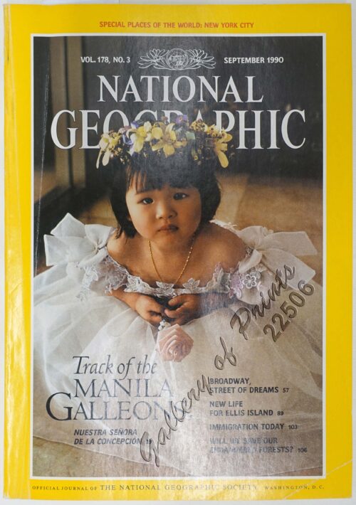
National Geographic September, 1990, Vol. 178, No. 3. Track ...
₱
3,300.00
Add to cart
Details
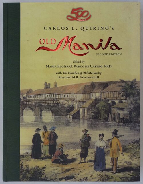
Old Manila
₱
9,900.00
Add to cart
Details
Old Manila
₱
4,500.00
Add to cart
Details
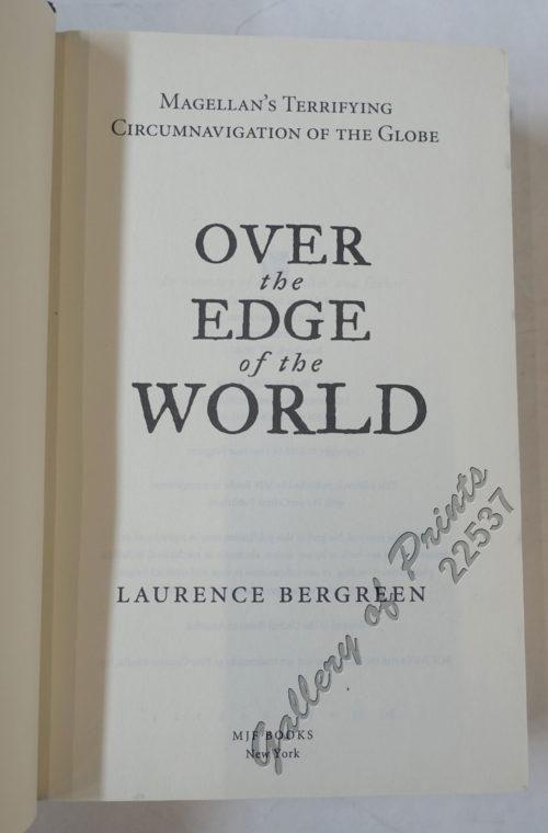
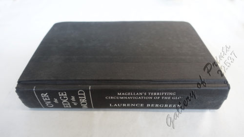
Over the Edge of the World Magellan’s Terrifying Circ...
₱
4,400.00
Add to cart
Details
Philippine Air Lines Travel Information World Routes
₱
3,300.00
Add to cart
Details
Philippine Cartography
₱
6,600.00
Add to cart
Details
Philippine Cartography
₱
22,000.00
Add to cart
Details
Planos de ciudades Iberoamericanas y Filipinas existentes en...
₱
15,600.00
Add to cart
Details
Postcards
₱
990.00
Add to cart
Details
Recollections of a Voyage to the Philippines [1875]
₱
980.00
Add to cart
Details
Rizal – Without the Overcoat
₱
1,500.00
Add to cart
Details
Sea Monsters on Medieval and Renaissance Maps
₱
2,200.00
Add to cart
Details
Shipwrecks & Sunken Treasures in Southeast Asia
₱
4,400.00
Add to cart
Details
Sucesos de las Islas Filipinas
₱
4,400.00
Add to cart
Details
The 36th IMCoS Symposium. Manila 2018. Insulae Indiae Orient...
₱
3,500.00
Add to cart
Details
The 36th IMCoS Symposium. Manila 2018. Insulae Indiae Orient...
₱
1,500.00
Add to cart
Details
The Cartography of the East Indian Islands, Insulae Indiae O...
₱
6,600.00
Add to cart
Details
The Charting of the Oceans; Ten Centuries of Maritime Maps
₱
3,700.00
Add to cart
Details
The Chinese in Philippine Life 1850-1898
₱
9,900.00
Add to cart
Details
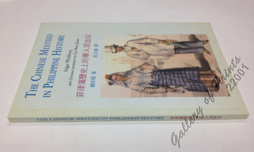
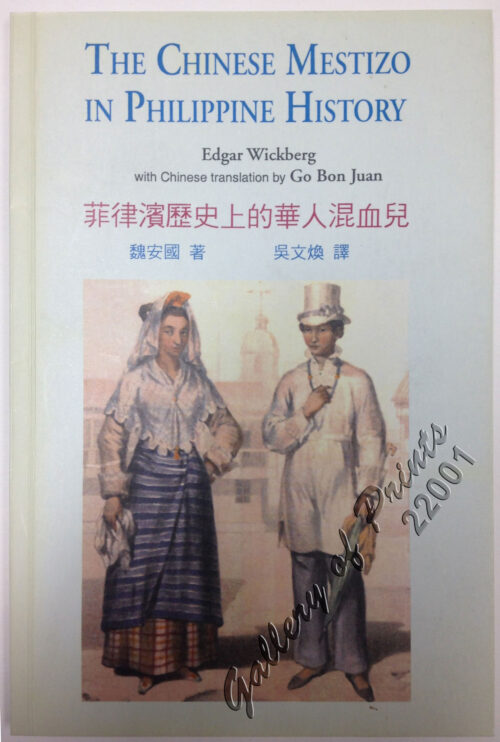
The Chinese Mestizo in Philippine History
₱
3,300.00
Add to cart
Details
The Devil’s Causeway. The True Story of America’...
₱
2,900.00
Add to cart
Details
The First Philippine Republic & the United States. 1898-...
₱
990.00
Add to cart
Details
The Hakluyt Society. The Travels and Controversies of Friar ...
₱
6,600.00
Add to cart
Details
The Likhaan Anthology of Philippine Literature in English fr...
₱
1,100.00
Add to cart
Details
The Making of the Modern Philippines. Pieces of a Jigsaw Sta...
₱
2,950.00
Add to cart
Details
Previous
1
2
3
4
5
Next
Shopping Cart
The Murillo Bulletin, Journal of PHIMCOS, Special World War II Issue
1
Japanese Page
1
Dalea Bicolor [Silver Prarie Clover]
1
The Philippine Islands
1
Ethnography of the Major Ethnolinguistic Groups in the Cordillera
1
The Philippine Insurrection: The Four Truths
1
Indie Orientale [Indochina] [China, Korea, Philippines] [Japan, Guam, Pacific]
1
Mapping the World: Maps and Their History
1
The Philippines in the 19th Century (A Collection of Prints)
-
Quantity
+
1. Panguingui (Card-playing) in Manilla; 2. Planting Rice in Manilla.
1
Citrus Decumana. L. [English: Pomelo. Tagalog: Suha]
1
Cochinchine - Philippines 1. Femmes Cochinchinoises. 2. Tagals
1
Philippine Islands. Anchorages in Northern Luzon and the Babuyan Islands. Insets: 1) Babuyan Is. - Fuga I. Musa Bay. From the United States Government Chart to 1931. 2) Babuyan Is. - Camiguin I. Port San Pio Quinto. From the United States Government Chart to 1931. 3) Luzon-North-East Coast Port San Vicente. From the United States Government Chart to 1938. 4) Luzon - East Coast Mauban Anchorage. From the Philippine Government Chart of 1957. 5) Luzon - West Coast. Salomague Harbour and Lapog Bay. From the United States Government Chart of 1934. 6) Luzon - West Coast Port Currimao and Gan Bay. From the United States Government Chart of 1934. 7) Luzon - West Coast Solvec Cove. From the United States Government Chart of 1934. 8) Luzon - West Coast Lingayen Gulf. Port Sual with Cabalitian Bay. From the United States Government Chart of 1922. 9) Luzon - West Coast San Fernando Harbour. From the United States Government Chart of 1936.
1
Interior of the Crater of the Volcano at Taal
1
Philippine Islands. Mindoro and Adjacent Islands. Cuyo Is. To Cabra I. Including Mindoro Strait and Sibuyan Sea. From the United States Cost Survey Charts to 1922.
1
Cart
Checkout
Continue Shopping
15