")
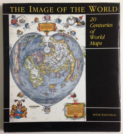
Author: Whitfield, Peter
Publisher: The British Library, London.
Year: 1996
Size: 29.5 x 27.2 cm
Reference:
₱3,700.00
In Stock
In Stock
viii 136 pp. With index. First edition. This superbly illustrated book traces the history of charts not as technical documents but as eloquent witnesses to the discovery of the world beyond Europe, and to man’s evolving knowledge of the oceans. These charts employed a vivid artistic idiom which expressed man’s passionate feeling for the sea: the gilded compasses, the nightmarish sea-creatures, the stately ships, the royal crests – all these were fused into a minor art-form which flourished for four centuries.
hard covers with dust jacket, very clean copy, binding cracked in rear.