Tel : +63(2)-7729-8168 | Mobile: +63 917 806 4291
|
Email: gallery@gop.com.ph
My Account
Remember Me
Register
20 Item(s)
-
₱
449,725.00
A Chart of the Coast of China from Cambodia to Nanquam with part of Japan.
1 x
₱
155,000.00
Atlas of Military History. An Illustrated Global Survey of Warfare from Antiquity to the Present Day
1 x
₱
4,400.00
Boxer Codex: A Modern Spanish Transcription and English Translation of Early Exploration Accounts of Ancient East and Southeast Asia
1 x
₱
1,545.00
Manila y sus arrabales
1 x
₱
26,400.00
General Map of the East Indies inset: Philippine Islands
1 x
₱
18,700.00
The World [Western & Eastern Hemisphere]
1 x
₱
6,600.00
Filipinas, lám.I Filipinas
1 x
₱
6,600.00
When Britain Ruled the Philippines 1762-1764
1 x
₱
2,200.00
AAF Cloth Chart - Philippine Series No. C-41, Mindoro Island [Mindoro & Palawan Islands, Sulu Sea] inset: [Palawan] No. C-42, Samar Island [VERSO] [South Luzon, Samar & Visayan Islands]
1 x
₱
46,500.00
Philippine Islands - Mindanao. Davao Gulf. From the Philippine Government Charts to 1956. With additions and corrections to 1962. insets: 1) Talomo Bay. From U.S Government Chart of 1933. With additions and corrections to 1962. 2) Lais. From U.S Government Chart of 1933. With additions and corrections to 1962. 3) Malita. From U.S Government Chart of 1933. With additions and corrections to 1962. 4) Port of Davao. From the Philippine Government Chart of 1956. With additions and corrections to 1962. 5) Pakiputan Strait. From U.S Government Chart of 1933. With additions and corrections to 1962.
1 x
₱
11,000.00
East India Archipelago [Eastern Passages to China and Japan][Chart No.4] London, Published by James Imray and Son, 89 & 102 Minories, 1884
1 x
₱
49,600.00
Océanique: Isles du Scarborough. 'pl. 16 Note sur le nouv. Hollande. Pour le commencement voyez la carte no. 29 ... Pour la suite voyez la carte no. 17. [Notes on New Holland. For the beginning please go to map no. 29….For the continuation please see map no. 17]
1 x
₱
8,800.00
Philippine Islands. Surigao Srait with Leyte Gulf and Hinatuan Passage. From the United States Government Charts to 1933. With addition and correctionsto 1954.
1 x
₱
11,000.00
Japan A Cartographic Vision
1 x
₱
4,400.00
Karte der Nordpolarregion [Map of the Northern Polar Region] insets: Nowaja Semlja; Spitzbergen und die Bären Insel; Süd-West Grönland; Küste von Ost-Grönland….
1 x
₱
4,400.00
The National Geographic Magazine September, 1952, vol. CII, No.3 New 10-Color Map of the Far East
1 x
₱
1,100.00
Manila [with a fleet of Adm. Joris van Spilberghen & a smoking Taal]
1 x
₱
62,000.00
The Manila Railway Company [1906] Limited 4% "A" Debenture Bond No. A 00000 £ 20 - [with 97 coupons #2-98] [in brown colour]
1 x
₱
22,000.00
Hot Springs at Tivi [Tiwi, Albay]
1 x
₱
2,200.00
Karte der St. Gotthard-Bahn, Taf.2 [Map of The Gotthard-Railroad, pl. 2]
1 x
₱
5,280.00
View Cart
Checkout
Home
About Us
Publications
Shop Online
Framing Services
Exhibits
Picture Hanging System
Contact Us
Blogs
View cart
“Karte der St. Gotthard-Bahn, Taf.2 [Map of The Gotthard-Railroad, pl. 2]” has been added to your cart.
Sort by
Name
Sort by
Default Order
Sort by
Name
Sort by
Price
Sort by
Date
Sort by
Popularity
Show
30 Products
Show
30 Products
Show
60 Products
Show
90 Products
Philippinen – Exotische Inselwelt La vie exotique des ...
₱
4,400.00
Add to cart
Details
Philippine Religious – Carvings in Ivory
₱
2,500.00
Add to cart
Details
Philippine Pagans. The Autographies of Three Ifugaos
₱
5,500.00
Add to cart
Details
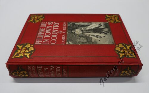
Philippine Life in Town & Country.
₱
8,800.00
Add to cart
Details
Philippine Islands. Western Part of Mindanao Sea with Bohol ...
₱
11,000.00
Add to cart
Details
Philippine Islands. Western Part of Mindanao Sea with Bohol ...
₱
13,200.00
Add to cart
Details
Philippine Islands. Verde Island Passage. From the United St...
₱
11,000.00
Add to cart
Details
Philippine Islands. The Passages Between Panay. Negros and C...
₱
11,000.00
Add to cart
Details
Philippine Islands. Tagolo Point to Cuyo Islands. Including ...
₱
11,000.00
Add to cart
Details
Philippine Islands. Tagolo Point to Cuyo Islands. Including ...
₱
11,000.00
Add to cart
Details
Philippine Islands. Tablas Strait with Part of Sibuyan Sea. ...
₱
11,000.00
Add to cart
Details
Philippine Islands. Tablas Strait with Part of Sibuyan Sea�...
₱
6,600.00
Add to cart
Details
Philippine Islands. Surigao Srait with Leyte Gulf and Hinatu...
₱
11,000.00
Add to cart
Details
Philippine Islands. Sibuyan Sea to San Bernardino Strait. Fr...
₱
11,000.00
Add to cart
Details
Philippine Islands. Samar and Leyte. San Juanico Strait and ...
₱
11,000.00
Add to cart
Details
Philippine Islands. Mindoro Strait. From the United States G...
₱
11,000.00
Add to cart
Details
Philippine Islands. Mindoro and Adjacent Islands. Cuyo Is. T...
₱
11,000.00
Add to cart
Details
Philippine Islands. Luzon-West and East Coasts. Cabra I. to ...
₱
11,000.00
Add to cart
Details
Philippine Islands. Luzon Island. North of Latitude 16° 20...
₱
11,000.00
Add to cart
Details
Philippine Islands. Luzon Island. North of Latitude 16° 20...
₱
11,000.00
Add to cart
Details
Philippine Islands. Leyte Gulf To Mayo Bay. Including Leyte,...
₱
11,000.00
Add to cart
Details
Philippine Islands. insets: 1) Trade Routes of the Orient. 2...
₱
39,600.00
Add to cart
Details
Philippine Islands. insets: 1) Manila to Dagupan; 2) Manila;...
₱
13,200.00
Add to cart
Details
Philippine Islands. inset: Manila Bay
₱
5,500.00
Add to cart
Details
Philippine Islands. Cuyo West Pass. From the United States G...
₱
13,200.00
Add to cart
Details
Philippine Islands. Cuyo East Pass. From the United States G...
₱
11,000.00
Add to cart
Details
Philippine Islands. Camotes Sea with Canigao Chanel. From th...
₱
11,000.00
Add to cart
Details
Philippine Islands. Anchorages in Northern Luzon and the Bab...
₱
11,000.00
Add to cart
Details
Philippine Islands. Agreable to Modern History
₱
110,000.00
Add to cart
Details
Previous
1
2
3
…
17
18
19
20
21
22
23
…
61
62
63
Next
Shopping Cart
Karte der St. Gotthard-Bahn, Taf.2 [Map of The Gotthard-Railroad, pl. 2]
1
Hot Springs at Tivi [Tiwi, Albay]
1
The Manila Railway Company [1906] Limited 4% "A" Debenture Bond No. A 00000 £ 20 - [with 97 coupons #2-98] [in brown colour]
1
Manila [with a fleet of Adm. Joris van Spilberghen & a smoking Taal]
1
The National Geographic Magazine September, 1952, vol. CII, No.3 New 10-Color Map of the Far East
1
Karte der Nordpolarregion [Map of the Northern Polar Region] insets: Nowaja Semlja; Spitzbergen und die Bären Insel; Süd-West Grönland; Küste von Ost-Grönland….
1
Japan A Cartographic Vision
1
Philippine Islands. Surigao Srait with Leyte Gulf and Hinatuan Passage. From the United States Government Charts to 1933. With addition and correctionsto 1954.
1
Océanique: Isles du Scarborough. 'pl. 16 Note sur le nouv. Hollande. Pour le commencement voyez la carte no. 29 ... Pour la suite voyez la carte no. 17. [Notes on New Holland. For the beginning please go to map no. 29….For the continuation please see map no. 17]
1
East India Archipelago [Eastern Passages to China and Japan][Chart No.4] London, Published by James Imray and Son, 89 & 102 Minories, 1884
1
Philippine Islands - Mindanao. Davao Gulf. From the Philippine Government Charts to 1956. With additions and corrections to 1962. insets: 1) Talomo Bay. From U.S Government Chart of 1933. With additions and corrections to 1962. 2) Lais. From U.S Government Chart of 1933. With additions and corrections to 1962. 3) Malita. From U.S Government Chart of 1933. With additions and corrections to 1962. 4) Port of Davao. From the Philippine Government Chart of 1956. With additions and corrections to 1962. 5) Pakiputan Strait. From U.S Government Chart of 1933. With additions and corrections to 1962.
1
AAF Cloth Chart - Philippine Series No. C-41, Mindoro Island [Mindoro & Palawan Islands, Sulu Sea] inset: [Palawan] No. C-42, Samar Island [VERSO] [South Luzon, Samar & Visayan Islands]
1
When Britain Ruled the Philippines 1762-1764
1
Filipinas, lám.I Filipinas
1
The World [Western & Eastern Hemisphere]
1
General Map of the East Indies inset: Philippine Islands
1
Manila y sus arrabales
1
Boxer Codex: A Modern Spanish Transcription and English Translation of Early Exploration Accounts of Ancient East and Southeast Asia
1
Atlas of Military History. An Illustrated Global Survey of Warfare from Antiquity to the Present Day
1
A Chart of the Coast of China from Cambodia to Nanquam with part of Japan.
1
Cart
Checkout
Continue Shopping
20