Tel : +63(2)-7729-8168
|
Email Us : gallery@gop.com.ph
My Account
Remember Me
Register
30 Item(s)
-
₱
1,625,700.00
A Plan of the Bay of Manila / A Plan of the Harbour of Acapulco / A View of 2 of the Ladrone Islands
1 x
₱
39,600.00
Kanton und Kantonstrom (Canton & the River Canton)
1 x
₱
2,200.00
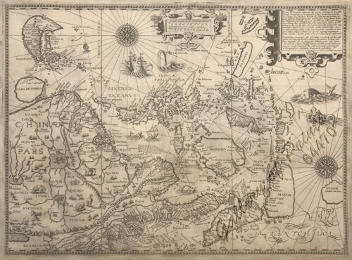
Exacta & accurata delineatio cum orarum maritimarum tum etjam locorum terrestrium quae in Regionibus China, Cauchinchina, Camboja sive Champa, Syao, Malacca, Arracan & Pegu… Waarachtige uitworpinghe ofte afbeeldinge van alle die custen ende landen van China, … [Accurate & Detailed Drawing with Borders Maritime and even Terrestrial Places Located in the Regions of China….]
1 x
₱
1,100,000.00
Amherstia Nobilis [Pride of Burma or Orchid Tree, (Fabaceae family)] [Local Name: Queen of Flowering Trees]
1 x
₱
26,400.00
Rivière Sagaliud, Golfe de Sandakan
1 x
₱
3,300.00
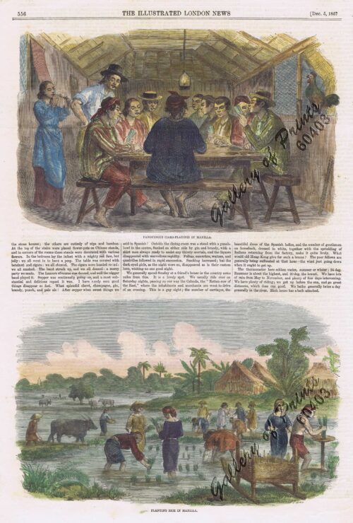
1. Panguingui (Card-playing) in Manilla; 2. Planting Rice in Manilla
1 x
₱
11,000.00
The Hakluyt Society. The Travels and Controversies of Friar Domingo Navarette (1618-1686). Second Series: No. 118 [volume I] Second Series: No. 119 [volume II]
1 x
₱
6,600.00
Épisode de l'attaque des juramentados
1 x
₱
4,400.00
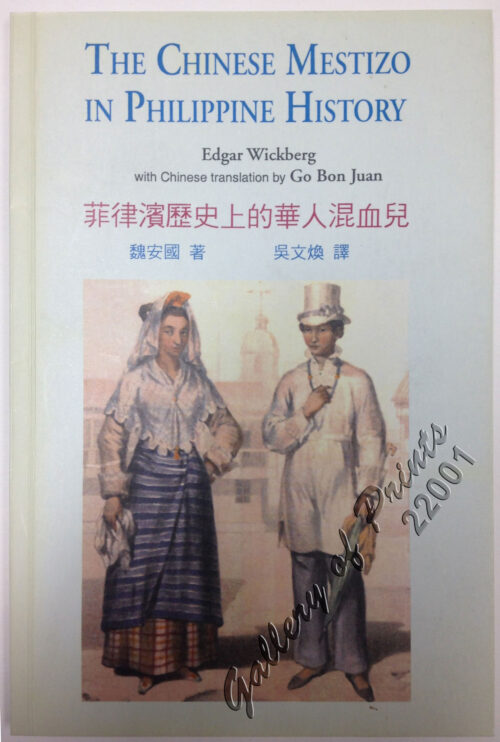
The Chinese Mestizo in Philippine History
1 x
₱
3,300.00
Die Ostindischen Inseln...
1 x
₱
39,600.00
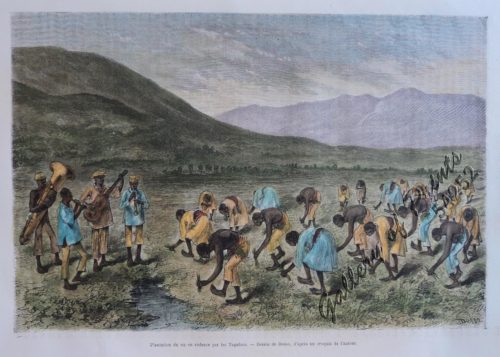
Plantation du riz en cadence par les Tagalocs [Tagalogs Planting Rice in Musical Tact]
1 x
₱
5,500.00
The Philippines in the 19th Century (A Collection of Prints)
1 x
₱
3,500.00
A Map of the East Indies from the latest Authorities and Observations By John Blair L.L.D. & F.R.S. As a Supplement to His Tables of Chronology. [inset:] The Philippine Islands.
1 x
₱
26,400.00
Interior of the Crater of the Volcano at Taal
1 x
₱
8,800.00
Chart of Zamboanga
1 x
₱
4,400.00
Map of the United States showing the Territorial Expansion of a Century 1804 to 1904 insets: 1) The World. 2) Wake Island. 3) Territory of Alaska. 4) Guam Island. 5) Porto Rico. 6) Philippine Islands. 7) Hawaiian Islands. 8) Tutuila, Manua and Smaller Islands of the Samoan Group. 9) Plan of Panama Canal Zone. 10) Plan showing the Thirteen Original States.
1 x
₱
33,100.00
Spathiphyllopsis Minahassae. T. et B. [Spathiphyllum]
1 x
₱
26,400.00
Cochinchine - Philippines 1. Femmes Cochinchinoises. 2. Tagals
1 x
₱
39,600.00
Die Igorot Bergvölker in den Philippinen heute [Mountain Tribes in the Philippines Today] Leitfaden zu der Ausstellung [Guide to the Exhibit]
1 x
₱
2,900.00
1) Vue de la rivière Passig dans l'île Luçon. 2) Vue de Manila, capitale de l'île Luçon. (Iles Philippines.)
1 x
₱
99,000.00
Park in Tokio
1 x
₱
4,400.00
Map showing Locations of Temporary Field Works Erected by the Spanish for The Land Defense of Havana, 1897-1898.
1 x
₱
13,200.00
Bibliography of the Philippine Islands. Printed and Manuscript. Preceded by a Descriptive Account of the most important Archives and Collections containing Philippina
1 x
₱
4,400.00
Archipel des Indes Orientales, qui comprend Les Isles de la Sonde, Moluques et Philippines… inset: Isles Marianes ou des Larons.
1 x
₱
34,100.00
Hong-Kong: Central Portion of the Town of Victoria.
1 x
₱
7,700.00
Ponte di Manilla
1 x
₱
22,000.00
Travelling by Palkee
1 x
₱
4,400.00
Plan de La Baie de Manille
1 x
₱
39,600.00
Geologie der Insel Luzon
1 x
₱
2,200.00
Un Village de Lucon (voy. p. 114) [Luzon Village] [Naga]
1 x
₱
7,700.00
View Cart
Checkout
Home
About Us
Publications
Shop Online
Framing Services
Exhibits
Picture Hanging System
Contact Us
Sort by
Price
Sort by
Default Order
Sort by
Name
Sort by
Price
Sort by
Date
Sort by
Popularity
Show
30 Products
Show
30 Products
Show
60 Products
Show
90 Products
The New America and the Far East: Philippines, Japan
₱
3,300.00
Add to cart
Details
España, Sus Monumento y Artes…. …..Cuba Puerto-...
₱
17,600.00
Add to cart
Details
Shopping Cart
Un Village de Lucon (voy. p. 114) [Luzon Village] [Naga]
1
Geologie der Insel Luzon
1
Plan de La Baie de Manille
1
Travelling by Palkee
1
Ponte di Manilla
1
Hong-Kong: Central Portion of the Town of Victoria.
1
Archipel des Indes Orientales, qui comprend Les Isles de la Sonde, Moluques et Philippines… inset: Isles Marianes ou des Larons.
1
Bibliography of the Philippine Islands. Printed and Manuscript. Preceded by a Descriptive Account of the most important Archives and Collections containing Philippina
1
Map showing Locations of Temporary Field Works Erected by the Spanish for The Land Defense of Havana, 1897-1898.
1
Park in Tokio
1
1) Vue de la rivière Passig dans l'île Luçon. 2) Vue de Manila, capitale de l'île Luçon. (Iles Philippines.)
1
Die Igorot Bergvölker in den Philippinen heute [Mountain Tribes in the Philippines Today] Leitfaden zu der Ausstellung [Guide to the Exhibit]
1
Cochinchine - Philippines 1. Femmes Cochinchinoises. 2. Tagals
1
Spathiphyllopsis Minahassae. T. et B. [Spathiphyllum]
1
Map of the United States showing the Territorial Expansion of a Century 1804 to 1904 insets: 1) The World. 2) Wake Island. 3) Territory of Alaska. 4) Guam Island. 5) Porto Rico. 6) Philippine Islands. 7) Hawaiian Islands. 8) Tutuila, Manua and Smaller Islands of the Samoan Group. 9) Plan of Panama Canal Zone. 10) Plan showing the Thirteen Original States.
1
Chart of Zamboanga
1
Interior of the Crater of the Volcano at Taal
1
A Map of the East Indies from the latest Authorities and Observations By John Blair L.L.D. & F.R.S. As a Supplement to His Tables of Chronology. [inset:] The Philippine Islands.
1
The Philippines in the 19th Century (A Collection of Prints)
-
Quantity
+
Plantation du riz en cadence par les Tagalocs [Tagalogs Planting Rice in Musical Tact]
1
Die Ostindischen Inseln...
1
The Chinese Mestizo in Philippine History
1
Épisode de l'attaque des juramentados
1
The Hakluyt Society. The Travels and Controversies of Friar Domingo Navarette (1618-1686). Second Series: No. 118 [volume I] Second Series: No. 119 [volume II]
1
1. Panguingui (Card-playing) in Manilla; 2. Planting Rice in Manilla
1
Rivière Sagaliud, Golfe de Sandakan
1
Amherstia Nobilis [Pride of Burma or Orchid Tree, (Fabaceae family)] [Local Name: Queen of Flowering Trees]
1
Exacta & accurata delineatio cum orarum maritimarum tum etjam locorum terrestrium quae in Regionibus China, Cauchinchina, Camboja sive Champa, Syao, Malacca, Arracan & Pegu… Waarachtige uitworpinghe ofte afbeeldinge van alle die custen ende landen van China, … [Accurate & Detailed Drawing with Borders Maritime and even Terrestrial Places Located in the Regions of China….]
1
Kanton und Kantonstrom (Canton & the River Canton)
1
A Plan of the Bay of Manila / A Plan of the Harbour of Acapulco / A View of 2 of the Ladrone Islands
1
Cart
Checkout
Continue Shopping
30