Tel : +63(2)-7729-8168 | Mobile: +63 917 806 4291
|
Email: gallery@gop.com.ph
My Account
Remember Me
Register
17 Item(s)
-
₱
245,200.00
Manilla Water-Carrier.
1 x
₱
5,500.00
Les Isles Philippines et celles des Larrons… [with original text page]
1 x
₱
30,900.00
Japan A Cartographic Vision
1 x
₱
4,400.00
Report on the Geology of the Philippine Islands… Ueber tertiäre Fossilien von den Philippinen (1895) [Concerning Tertiary Fossils in the Philippines]
1 x
₱
7,700.00
Plan de La Baie de Manille
1 x
₱
39,600.00
Documents Illustrating the British Conquest of Manila 1762-1763
1 x
₱
3,700.00
Karte des südlichen Theiles von Luzon und benachbarter Inseln auf Grundlage der Coello'schen [Map of Southern Luzon and Adjacent Islands Based on Coello's Map]. insets: 1. Untere Fortsetzung [Lower Continuation]. 2. Übersichtskarte der Philippinen [Map of the Philippines]. . Die Kieselbrunnen Naglegbeng bei Tibi in Prov. Albáy [Paved Wells Neglegbeng near Tiwi in Albay Province]
1 x
₱
77,000.00
Le Pic verd de l'Isle de Luçon. [The Green Woodpecker in the Island of Luzon]
1 x
₱
6,600.00
Dalea Bicolor [Silver Prarie Clover]
1 x
₱
5,500.00
Sketches from Manilla and Hongkong. 1. "Soiree Musicale" at Manilla; 2. Chinese Nursemaid on the Parade- Ground, Hongkong
1 x
₱
9,900.00
Plan De La Baie De Bongo.
1 x
₱
6,600.00
Philippine Islands. Anchorages in Northern Luzon and the Babuyan Islands. Insets: 1) Babuyan Is. - Fuga I. Musa Bay. From the United States Government Chart to 1931. 2) Babuyan Is. - Camiguin I. Port San Pio Quinto. From the United States Government Chart to 1931. 3) Luzon-North-East Coast Port San Vicente. From the United States Government Chart to 1938. 4) Luzon - East Coast Mauban Anchorage. From the Philippine Government Chart of 1957. 5) Luzon - West Coast. Salomague Harbour and Lapog Bay. From the United States Government Chart of 1934. 6) Luzon - West Coast Port Currimao and Gan Bay. From the United States Government Chart of 1934. 7) Luzon - West Coast Solvec Cove. From the United States Government Chart of 1934. 8) Luzon - West Coast Lingayen Gulf. Port Sual with Cabalitian Bay. From the United States Government Chart of 1922. 9) Luzon - West Coast San Fernando Harbour. From the United States Government Chart of 1936.
1 x
₱
11,000.00
The Far East Compiled and Drawn in the Cartographic Section of the National Geographic Society for The National Geographic Magazine inset: Korea
1 x
₱
6,600.00
Helvetia Foederata cum ea Region:
1 x
₱
3,300.00
The National Geographic Magazine September, 1930, vol.LVIII, No.3 [The unexplored Philippines from the air, Map-making over jungle lands never before seen by white men]
1 x
₱
3,800.00
Occupied Philippines The Role of Jorge B. Vargas during the Japanese Occupation.
1 x
₱
4,400.00
1) Habitant des Isles Philipine. 2) Femme des Isles Philipine [sic]
1 x
₱
18,700.00
View Cart
Checkout
Home
About Us
Publications
Shop Online
Framing Services
Exhibits
Picture Hanging System
Contact Us
Blogs
View cart
“1) Habitant des Isles Philipine. 2) Femme des Isles Philipine [sic]” has been added to your cart.
Sort by
Name
Sort by
Default Order
Sort by
Name
Sort by
Price
Sort by
Date
Sort by
Popularity
Show
30 Products
Show
30 Products
Show
60 Products
Show
90 Products
The Inhabitants of the Philippines
₱
13,200.00
Add to cart
Details
The Invention of China
₱
2,200.00
Add to cart
Details
The Invention of China
₱
1,800.00
Add to cart
Details
The Life and Achievements of Captain James Cook Adventures a...
₱
1,500.00
Add to cart
Details
The Life of Ferdinand Magellan and the First Circumnavigatio...
₱
11,000.00
Add to cart
Details
The Likhaan Anthology of Philippine Literature in English fr...
₱
1,100.00
Add to cart
Details
The Luneta, Manila
₱
3,300.00
Add to cart
Details
The Luneta, Manila
₱
3,300.00
Add to cart
Details
The Making of the Modern Philippines. Pieces of a Jigsaw Sta...
₱
2,950.00
Add to cart
Details
The Making of the Nuremberg Chronicle
₱
8,800.00
Add to cart
Details
The Man Who Invented History: Travels with Herodotus.
₱
3,300.00
Add to cart
Details
The Manila Galleon
₱
9,500.00
Add to cart
Details
The Manila Railway Company [1906] Limited 4% “A”...
₱
22,000.00
Add to cart
Details
The Manila Railway Company [1906] Limited 4% “B”...
₱
13,200.00
Add to cart
Details
The Manila Railway Company [1906] Limited 4% “B”...
₱
13,200.00
Add to cart
Details
The Manila Railway Company [1906] Limited 4% “B” Debentu...
₱
13,200.00
Add to cart
Details
The Manila Railway Company [1906] Limited. “A” D...
₱
13,200.00
Add to cart
Details
The Manila-Acapulco Galleons: The Treasure Ships of the Paci...
₱
4,400.00
Add to cart
Details
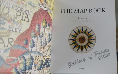
The Map Book
₱
3,300.00
Add to cart
Details
The Mapmaker’s Art (A History of Cartography)
₱
9,900.00
Add to cart
Details
The Mapmakers’ World: A Cultural History of the Europe...
₱
5,500.00
Add to cart
Details
The Mapping of Terra Australis
₱
5,500.00
Add to cart
Details
The Mapping of the Heavens
₱
1,980.00
Add to cart
Details
The Meat Market at Manilla
₱
7,700.00
Add to cart
Details
The Molucca Ilands & C. [The Molucca Islands]
₱
26,400.00
Add to cart
Details
The Murillo Bulletin, Journal of PHIMCOS, Issue No. 12
₱
750.00
Add to cart
Details
The Murillo Bulletin, Journal of PHIMCOS, Issue No. 13
₱
790.00
Add to cart
Details
The Murillo Bulletin, Journal of PHIMCOS, Issue No. 14
₱
790.00
Add to cart
Details
The Murillo Bulletin, Journal of PHIMCOS, Issue No. 15
₱
790.00
Add to cart
Details
The Murillo Bulletin, Journal of PHIMCOS, Issue No. 16
₱
790.00
Add to cart
Details
Previous
1
2
3
…
51
52
53
54
55
56
57
…
61
62
63
Next
Shopping Cart
1) Habitant des Isles Philipine. 2) Femme des Isles Philipine [sic]
1
Occupied Philippines The Role of Jorge B. Vargas during the Japanese Occupation.
1
The National Geographic Magazine September, 1930, vol.LVIII, No.3 [The unexplored Philippines from the air, Map-making over jungle lands never before seen by white men]
1
Helvetia Foederata cum ea Region:
1
The Far East Compiled and Drawn in the Cartographic Section of the National Geographic Society for The National Geographic Magazine inset: Korea
1
Philippine Islands. Anchorages in Northern Luzon and the Babuyan Islands. Insets: 1) Babuyan Is. - Fuga I. Musa Bay. From the United States Government Chart to 1931. 2) Babuyan Is. - Camiguin I. Port San Pio Quinto. From the United States Government Chart to 1931. 3) Luzon-North-East Coast Port San Vicente. From the United States Government Chart to 1938. 4) Luzon - East Coast Mauban Anchorage. From the Philippine Government Chart of 1957. 5) Luzon - West Coast. Salomague Harbour and Lapog Bay. From the United States Government Chart of 1934. 6) Luzon - West Coast Port Currimao and Gan Bay. From the United States Government Chart of 1934. 7) Luzon - West Coast Solvec Cove. From the United States Government Chart of 1934. 8) Luzon - West Coast Lingayen Gulf. Port Sual with Cabalitian Bay. From the United States Government Chart of 1922. 9) Luzon - West Coast San Fernando Harbour. From the United States Government Chart of 1936.
1
Plan De La Baie De Bongo.
1
Sketches from Manilla and Hongkong. 1. "Soiree Musicale" at Manilla; 2. Chinese Nursemaid on the Parade- Ground, Hongkong
1
Dalea Bicolor [Silver Prarie Clover]
1
Le Pic verd de l'Isle de Luçon. [The Green Woodpecker in the Island of Luzon]
1
Karte des südlichen Theiles von Luzon und benachbarter Inseln auf Grundlage der Coello'schen [Map of Southern Luzon and Adjacent Islands Based on Coello's Map]. insets: 1. Untere Fortsetzung [Lower Continuation]. 2. Übersichtskarte der Philippinen [Map of the Philippines]. . Die Kieselbrunnen Naglegbeng bei Tibi in Prov. Albáy [Paved Wells Neglegbeng near Tiwi in Albay Province]
1
Documents Illustrating the British Conquest of Manila 1762-1763
1
Plan de La Baie de Manille
1
Report on the Geology of the Philippine Islands… Ueber tertiäre Fossilien von den Philippinen (1895) [Concerning Tertiary Fossils in the Philippines]
1
Japan A Cartographic Vision
1
Les Isles Philippines et celles des Larrons… [with original text page]
1
Manilla Water-Carrier.
1
Cart
Checkout
Continue Shopping
17