Tel : +63(2)-7729-8168 | Mobile: +63 917 806 4291
|
Email: gallery@gop.com.ph
My Account
Remember Me
Register
14 Item(s)
-
₱
323,600.00
Bal Donné par L'Armée Francaise aux Dames de Mexico, dans La Salle du Théatre [Ball Given by the French Army to the Ladies of Mexico, in The Theater Hall]
1 x
₱
3,300.00
Isla de Luzon pl. 8 (Zambales, Pangasinan, Nueva Ecija, Tarlac.... with Subic Bay - inset)
1 x
₱
6,600.00
Embarcaciones Filipinas. - "Cascos" en la laguna de Bay (Manila). [inset: Cross Section of a Casco]
1 x
₱
5,500.00
Viajes por Filipinas Reisen in den Philippinen [Travels in the Philippines]
1 x
₱
61,600.00
Plano de la Bahia de Manila y puerto de Subig con sus contornos
1 x
₱
39,600.00
Sticklebacks 1. Rough - tailed 2. Half - armed 3. Smooth - tailed 4. Short - spined 5. Four - spined 6. Ten - spined
1 x
₱
5,500.00
A New Map of the East Indies, Taken from Mr. de Fer's Map of Asia, Shewing their Chief Divisions, Cities, Towns, Ports, Rivers, Mountains & c. Dedicated to His Highness William Duke of Glocester.
1 x
₱
49,500.00
1) Plan du port d' Acapulco sur la Côte du Mexique dans la Mer du Sud. 2) Plan de la Baye de Manille
1 x
₱
26,400.00
Homme & Femme des Isles Manilles [Man and Woman from the Manila Islands]
1 x
₱
11,000.00
Ilustracion Filipina: Periodico Quincenal Ano I num. I - Ano II num.24
1 x
₱
49,500.00
The Invention of China
1 x
₱
2,200.00
Les Isles Philippines - Islas de los Ladrones…
1 x
₱
25,500.00
Philippine Islands. Anchorages in Northern Luzon and the Babuyan Islands. Insets: 1) Babuyan Is. - Fuga I. Musa Bay. From the United States Government Chart to 1931. 2) Babuyan Is. - Camiguin I. Port San Pio Quinto. From the United States Government Chart to 1931. 3) Luzon-North-East Coast Port San Vicente. From the United States Government Chart to 1938. 4) Luzon - East Coast Mauban Anchorage. From the Philippine Government Chart of 1957. 5) Luzon - West Coast. Salomague Harbour and Lapog Bay. From the United States Government Chart of 1934. 6) Luzon - West Coast Port Currimao and Gan Bay. From the United States Government Chart of 1934. 7) Luzon - West Coast Solvec Cove. From the United States Government Chart of 1934. 8) Luzon - West Coast Lingayen Gulf. Port Sual with Cabalitian Bay. From the United States Government Chart of 1922. 9) Luzon - West Coast San Fernando Harbour. From the United States Government Chart of 1936.
1 x
₱
11,000.00
Ponte di Manilla
1 x
₱
26,400.00
View Cart
Checkout
Home
About Us
Publications
Shop Online
Framing Services
Exhibits
Picture Hanging System
Contact Us
Blogs
View cart
“Ponte di Manilla” has been added to your cart.
Sort by
Name
Sort by
Default Order
Sort by
Name
Sort by
Price
Sort by
Date
Sort by
Popularity
Show
30 Products
Show
30 Products
Show
60 Products
Show
90 Products
The Inhabitants of the Philippines
₱
13,200.00
Add to cart
Details
The Invention of China
₱
2,200.00
Add to cart
Details
The Invention of China
₱
1,800.00
Add to cart
Details
The Life and Achievements of Captain James Cook Adventures a...
₱
1,500.00
Add to cart
Details
The Life of Ferdinand Magellan and the First Circumnavigatio...
₱
11,000.00
Add to cart
Details
The Likhaan Anthology of Philippine Literature in English fr...
₱
1,100.00
Add to cart
Details
The Luneta, Manila
₱
3,300.00
Add to cart
Details
The Luneta, Manila
₱
3,300.00
Add to cart
Details
The Making of the Modern Philippines. Pieces of a Jigsaw Sta...
₱
2,950.00
Add to cart
Details
The Making of the Nuremberg Chronicle
₱
8,800.00
Add to cart
Details
The Man Who Invented History: Travels with Herodotus.
₱
3,300.00
Add to cart
Details
The Manila Galleon
₱
9,500.00
Add to cart
Details
The Manila Railway Company [1906] Limited 4% “A”...
₱
22,000.00
Add to cart
Details
The Manila Railway Company [1906] Limited 4% “B”...
₱
13,200.00
Add to cart
Details
The Manila Railway Company [1906] Limited 4% “B”...
₱
13,200.00
Add to cart
Details
The Manila Railway Company [1906] Limited 4% “B” Debentu...
₱
13,200.00
Add to cart
Details
The Manila Railway Company [1906] Limited. “A” D...
₱
13,200.00
Add to cart
Details
The Manila-Acapulco Galleons: The Treasure Ships of the Paci...
₱
4,400.00
Add to cart
Details
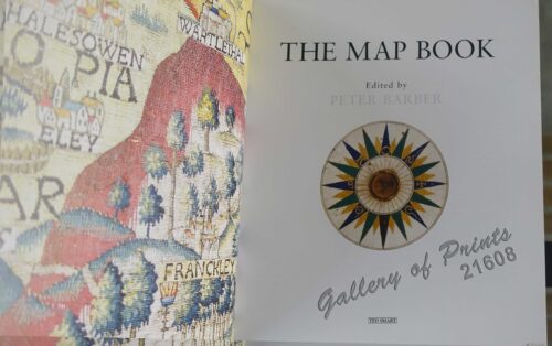
The Map Book
₱
3,300.00
Add to cart
Details
The Mapmaker’s Art (A History of Cartography)
₱
9,900.00
Add to cart
Details
The Mapmakers’ World: A Cultural History of the Europe...
₱
5,500.00
Add to cart
Details
The Mapping of Terra Australis
₱
5,500.00
Add to cart
Details
The Mapping of the Heavens
₱
1,980.00
Add to cart
Details
The Meat Market at Manilla
₱
7,700.00
Add to cart
Details
The Molucca Ilands & C. [The Molucca Islands]
₱
26,400.00
Add to cart
Details
The Murillo Bulletin, Journal of PHIMCOS, Issue No. 12
₱
750.00
Add to cart
Details
The Murillo Bulletin, Journal of PHIMCOS, Issue No. 13
₱
790.00
Add to cart
Details
The Murillo Bulletin, Journal of PHIMCOS, Issue No. 14
₱
790.00
Add to cart
Details
The Murillo Bulletin, Journal of PHIMCOS, Issue No. 15
₱
790.00
Add to cart
Details
The Murillo Bulletin, Journal of PHIMCOS, Issue No. 16
₱
790.00
Add to cart
Details
Previous
1
2
3
…
51
52
53
54
55
56
57
…
61
62
63
Next
Shopping Cart
Ponte di Manilla
1
Philippine Islands. Anchorages in Northern Luzon and the Babuyan Islands. Insets: 1) Babuyan Is. - Fuga I. Musa Bay. From the United States Government Chart to 1931. 2) Babuyan Is. - Camiguin I. Port San Pio Quinto. From the United States Government Chart to 1931. 3) Luzon-North-East Coast Port San Vicente. From the United States Government Chart to 1938. 4) Luzon - East Coast Mauban Anchorage. From the Philippine Government Chart of 1957. 5) Luzon - West Coast. Salomague Harbour and Lapog Bay. From the United States Government Chart of 1934. 6) Luzon - West Coast Port Currimao and Gan Bay. From the United States Government Chart of 1934. 7) Luzon - West Coast Solvec Cove. From the United States Government Chart of 1934. 8) Luzon - West Coast Lingayen Gulf. Port Sual with Cabalitian Bay. From the United States Government Chart of 1922. 9) Luzon - West Coast San Fernando Harbour. From the United States Government Chart of 1936.
1
Les Isles Philippines - Islas de los Ladrones…
1
The Invention of China
1
Ilustracion Filipina: Periodico Quincenal Ano I num. I - Ano II num.24
1
Homme & Femme des Isles Manilles [Man and Woman from the Manila Islands]
1
1) Plan du port d' Acapulco sur la Côte du Mexique dans la Mer du Sud. 2) Plan de la Baye de Manille
1
A New Map of the East Indies, Taken from Mr. de Fer's Map of Asia, Shewing their Chief Divisions, Cities, Towns, Ports, Rivers, Mountains & c. Dedicated to His Highness William Duke of Glocester.
1
Sticklebacks 1. Rough - tailed 2. Half - armed 3. Smooth - tailed 4. Short - spined 5. Four - spined 6. Ten - spined
1
Plano de la Bahia de Manila y puerto de Subig con sus contornos
1
Viajes por Filipinas Reisen in den Philippinen [Travels in the Philippines]
1
Embarcaciones Filipinas. - "Cascos" en la laguna de Bay (Manila). [inset: Cross Section of a Casco]
1
Isla de Luzon pl. 8 (Zambales, Pangasinan, Nueva Ecija, Tarlac.... with Subic Bay - inset)
1
Bal Donné par L'Armée Francaise aux Dames de Mexico, dans La Salle du Théatre [Ball Given by the French Army to the Ladies of Mexico, in The Theater Hall]
1
Cart
Checkout
Continue Shopping
14