Tel : +63(2)-7729-8168 | Mobile: +63 917 806 4291
|
Email: gallery@gop.com.ph
My Account
Remember Me
Register
14 Item(s)
-
₱
139,900.00
The Mysteries of Taal: A Philippine Volcano and Lake, Her Sea Life and Lost Towns
1 x
₱
900.00
a) bezeichnet den Lauf der Gallion Nuestra Señora de Cabadongo von Manila nach Acapulco.; b) Lauf der Gallion von Acapulco bis nach Guam, und von da nach den Philippinischen Inseln, wo diese Gallion am 30 Jun. 1743 von dem Ober Befehlshaber Anson erobert ward.
1 x
₱
26,400.00
San Antonio. Luzon 1:50,000
1 x
₱
9,900.00
Inauguration des Courses de Chevaux a Toulon, les 15 et 16 Aout. [Inauguration of Horse Racing in Toulon, August 15 and 16]
1 x
₱
4,400.00
Volcanic Eruption in the Island of Camiguin, Philippines.
1 x
₱
6,600.00
Philippine Islands. Luzon Island. North of Latitude 16° 20' North. From the United States Cost Survey Charts to 1925.
1 x
₱
11,000.00
A Treaty of Peace Between the United States and Spain. [Message from the President of the United States, A Treaty of Peace Between the United States and Spain, Signed at the City of Paris, on December 10, 1898]… John Hay and William McKinley
1 x
₱
9,900.00
A Map of the East Indies from the latest Authorities and Observations By John Blair L.L.D. & F.R.S. As a Supplement to His Tables of Chronology. [inset:] The Philippine Islands.
1 x
₱
26,400.00
The Charting of the Oceans; Ten Centuries of Maritime Maps
1 x
₱
3,700.00
Prächtige Paradiesblume. Fig. 1170. [Magnificent Paradise flower]; Stachelige Parkinsonie. Fig. 1171. [Thorny Parkinson]; Westindisches Blutholz. Fig. 1172. [West Indian Bloodwood]; Vielstachelige Caesalpinie. Fig. 1173. [Many-thorned Caesalpinia]
1 x
₱
5,500.00
China Sea - Macclesfield Bank. Surveyed by Commander W.U. Moore and the Officers of H.M. Surveying Ship Penguin, 1892. and by Commander A. Mostyn Field and the Officers of H.M. Surveying Ship Egeria,1893.
1 x
₱
6,600.00
Asia Comic
1 x
₱
4,400.00
Philippine Islands. Western Part of Mindanao Sea with Bohol Strait and Part of Tañon Strait. From the United States Government Charts to 1937.
1 x
₱
13,200.00
Philippine Islands. Leyte Gulf To Mayo Bay. Including Leyte,Parts of Sebu and Bohol and the North-Eastern Cost of Mindanao. From the United States Cost Survey Charts to 1922.
1 x
₱
11,000.00
View Cart
Checkout
Home
About Us
Publications
Shop Online
Framing Services
Exhibits
Picture Hanging System
Contact Us
Blogs
View cart
“Philippine Islands. Leyte Gulf To Mayo Bay. Including Leyte,Parts of Sebu and Bohol and the North-Eastern Cost of Mindanao. From the United States Cost Survey Charts to 1922.” has been added to your cart.
Sort by
Popularity
Sort by
Default Order
Sort by
Name
Sort by
Price
Sort by
Date
Sort by
Popularity
Show
30 Products
Show
30 Products
Show
60 Products
Show
90 Products
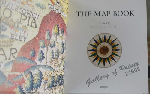
The Map Book
₱
3,300.00
Add to cart
Details
Rizal, Philippine Nationalist and Martyr.
₱
2,900.00
Add to cart
Details
The Calamansi Cook Book, An Expat’s Guide to Eating We...
₱
900.00
Add to cart
Details
The Cruise of the U.S. Flagship Olympia, from 1895-1899, fro...
₱
2,200.00
Add to cart
Details
The German Club Story Centennial Edition 1906 – 2006
₱
2,500.00
Add to cart
Details
Miniature Antique Maps
₱
4,400.00
Add to cart
Details
Magsaysay of the Philippines
₱
7,700.00
Add to cart
Details
Spanning the Decades 1902-2002
₱
2,600.00
Add to cart
Details
[Southeast Asia]
₱
26,400.00
Add to cart
Details
Philippine Islands. A Detailed Map. by Robinson H. E. C. Pt...
₱
34,200.00
Add to cart
Details
The German Club Manila 1986 – 1996 / 1906 – ...
₱
2,500.00
Add to cart
Details
Rare Pacific Voyage Books, part 2
₱
3,300.00
Add to cart
Details
Investing in Maps
₱
2,500.00
Add to cart
Details
Voyage Autour du Monde … 1826, 1827, 1828, et 1829...
₱
19,800.00
Add to cart
Details
Emergent Literature Essays on Philippine Writing
₱
600.00
Add to cart
Details
Admiral Paris’ Native Boats of Asia and the Pacific, 1...
₱
900.00
Add to cart
Details
Kirin, Harbin, Vladivostok
Details
Chart of the World on Mercator’s Projection, showing S...
Details
Map Showing Location of Panama Canal as Recommended by the I...
Details
Map of the Philippines. Prepared By Reduction From the Map o...
Details
City of Manila. Philippine Islands
Details
Trade Routes of the Orient
Details
1) Bird’s Eye View of the Walled City and Immediate En...
Details
Philippine Islands
Details
Beautiful Philippines. A Handbook of General Information
₱
65,600.00
Add to cart
Details
Mapping the Continent of Asia
₱
2,500.00
Add to cart
Details
Collecting Antique Maps
₱
3,300.00
Add to cart
Details
Atlas Journal de la Navigation Autour du Globe de la Fréga...
₱
33,000.00
Add to cart
Details
New Worlds The Great Voyages of Discovery 1400-1600
₱
2,870.00
Add to cart
Details
Map of the Sooloo Sea & Archipelago
₱
9,900.00
Add to cart
Details
Previous
1
2
3
4
5
6
7
8
…
61
62
63
Next
Shopping Cart
Philippine Islands. Leyte Gulf To Mayo Bay. Including Leyte,Parts of Sebu and Bohol and the North-Eastern Cost of Mindanao. From the United States Cost Survey Charts to 1922.
1
Philippine Islands. Western Part of Mindanao Sea with Bohol Strait and Part of Tañon Strait. From the United States Government Charts to 1937.
1
Asia Comic
1
China Sea - Macclesfield Bank. Surveyed by Commander W.U. Moore and the Officers of H.M. Surveying Ship Penguin, 1892. and by Commander A. Mostyn Field and the Officers of H.M. Surveying Ship Egeria,1893.
1
Prächtige Paradiesblume. Fig. 1170. [Magnificent Paradise flower]; Stachelige Parkinsonie. Fig. 1171. [Thorny Parkinson]; Westindisches Blutholz. Fig. 1172. [West Indian Bloodwood]; Vielstachelige Caesalpinie. Fig. 1173. [Many-thorned Caesalpinia]
1
The Charting of the Oceans; Ten Centuries of Maritime Maps
1
A Map of the East Indies from the latest Authorities and Observations By John Blair L.L.D. & F.R.S. As a Supplement to His Tables of Chronology. [inset:] The Philippine Islands.
1
A Treaty of Peace Between the United States and Spain. [Message from the President of the United States, A Treaty of Peace Between the United States and Spain, Signed at the City of Paris, on December 10, 1898]… John Hay and William McKinley
1
Philippine Islands. Luzon Island. North of Latitude 16° 20' North. From the United States Cost Survey Charts to 1925.
1
Volcanic Eruption in the Island of Camiguin, Philippines.
1
Inauguration des Courses de Chevaux a Toulon, les 15 et 16 Aout. [Inauguration of Horse Racing in Toulon, August 15 and 16]
1
San Antonio. Luzon 1:50,000
1
a) bezeichnet den Lauf der Gallion Nuestra Señora de Cabadongo von Manila nach Acapulco.; b) Lauf der Gallion von Acapulco bis nach Guam, und von da nach den Philippinischen Inseln, wo diese Gallion am 30 Jun. 1743 von dem Ober Befehlshaber Anson erobert ward.
1
The Mysteries of Taal: A Philippine Volcano and Lake, Her Sea Life and Lost Towns
1
Cart
Checkout
Continue Shopping
14