Tel : +63(2)-7729-8168 | Mobile: +63 917 806 4291
|
Email: gallery@gop.com.ph
My Account
Remember Me
Register
29 Item(s)
-
₱
710,350.00
Atlas of Geographical Curiosities.
1 x
₱
3,300.00
Vue de Cavite dans la Baie de Manille [View of Cavite in the Bay of Manila]
1 x
₱
39,600.00
Carte des Indes Orientales... (1e et 2e feuille)
1 x
₱
62,850.00
Philippine Islands
1 x
₱
8,800.00
Isla de Paragua o Palawan Sur pl. 25 (Southern Palawan)
1 x
₱
7,700.00
Insulae Indiae Orientalis
1 x
₱
39,600.00
Filipinas. Provincias y distritos de la isla de Luzon
1 x
₱
55,000.00
Eastern Archipelago. Philippine Islands and Adjacent Seas. From Molucca Sea to Manila Bay. From the United States & Netherlands Governments Charts to 1929. With corrections to 1946.
1 x
₱
11,000.00
Stoparola Cerviniventris [Flycatcher] & Pericrocotus Cinereigula [Minivet]
1 x
₱
13,200.00
Philippine Islands. Sibuyan Sea to San Bernardino Strait. From the United States Government Charts to 1934.
1 x
₱
11,000.00
Philippine Islands. Luzon Island. North of Latitude 16° 20' North. From the United States Cost Survey Charts to 1925.
1 x
₱
11,000.00
Japan A Cartographic Vision
1 x
₱
4,400.00
Islas Filipinas - Mapa Etnografico pl. 3, Observatorio de Manila
1 x
₱
6,600.00
Wanderjahre eines jungen Hamburger Kaufmannes - Eine Reise um die Erde in 1000 Tagen [Ramblings of a Young Hamburg Merchant - A Voyage Around the World in 1000 Days]
1 x
₱
5,500.00
The Philippine Islands.
1 x
₱
11,000.00
1) Carte des Isles Philippines (1e feuille) Kaart der Philippines Eilanden, Geschikt op de Spaansche Kaart van Pater Murillo de Velarde 1.ste Blad. Door den Hr. Bellin Ingr. des Fransen Zeevaards. 2) Carte des Isles Philippines (2e feuille) Kaart der Philippines Eilanden, Geschikt op de Spaansche Kaart van Pater Murillo de Velarde 2.de Blad. Door den Hr. Bellin Ingr. des Fransen Zeevaards.
1 x
₱
46,200.00
1. [Skipjack Tuna]. 2. [Atlantic Bluefin Tuna]. 3. [Albacore/Longfin Tuna].
1 x
₱
6,600.00
Ilustracion Filipina: Periodico Quincenal Ano I num. I - Ano II num.24
1 x
₱
49,500.00
Mapping the World, An Illustrated History of Cartography.
1 x
₱
3,300.00
Fernando Valdes Tamon. Report in which, by order of his Catholic Majesty (May God protect him), the strongholds, castles, forts and garrisons of the provinces under his Royal Dominion in the Philippine Islands are listed
1 x
₱
11,000.00
Mittheilungen aus Justus Perthes' Geographischer Anstalt. über wichtige neue Erforschungen auf dem Gesammtgebiete der Geographie von Dr. A. Petermann. - Ergänzungsband XII, 1878 Inhalt: [Supplement Vol. 12 contents] No. 53. Przewalsky's Reise an den Lob-Nor und Altyn-Tag. No. 54. Rittich, die Ethnographie Russlands. No. 55. Behm und Wagner, die Bevölkerung der Erde, V. No. 56. Credner, die Deltas.
1 x
₱
6,000.00
Coryphæna Plümeri [Sand Tilefish] Die Meerpfau. Le Paon de mer. The Sea-Pea-Cock
1 x
₱
4,400.00
Océanique.
1 x
₱
9,900.00
Dr. A. Petermann's Mittheilungen aus Justus Perthes' Geographischer Anstalt. Herausgegeben von Dr. E. Behm. - Ergänzungsband XIII, 1879-1880 Inhalt: [Supplement Vol. 15 contents] No. 57. Soetbeer, Edelmetall-Production. No. 58. Fischer, Studien über das Klima der Mittelmeerländer. No. 59. Rein, der Nakasendô in Japan. No. 60. Lindeman, die Seefischereien.
1 x
₱
6,000.00
Sheet No. 1. Road Map from Mexico to Cabanatuan plotted during Advance of Gen. Young's Brigade of 1st Div. 8th A. C. Maj. Gen. H. W. Lawton U. S. V. Commanding. Prepared under direction of John C. Oakes. 1st Lieut Corps of Engineers Division Engineer.
1 x
₱
13,200.00
Philippinae Insulae
1 x
₱
135,000.00
Die Ostindischen Inseln nach den neuesten Berichtigungen dargestellt [The East Indies Presented According to the Latest Corrections]
1 x
₱
18,700.00
1) Islas Filipinas: Primera Hoja Central; 2) Islas Filipinas: Segunda Hoja Central; 3) Posesiones de Ultramar (Oceania) - Islas Filipinas
1 x
₱
99,000.00
Philippine Islands. Tagolo Point to Cuyo Islands. Including Sebu Negros and Parts of Panay and Palawan. From the United States Coast Survey Charts to 1923.
1 x
₱
11,000.00
View Cart
Checkout
Home
About Us
Publications
Shop Online
Framing Services
Exhibits
Picture Hanging System
Contact Us
Blogs
View cart
“Philippine Islands. Tagolo Point to Cuyo Islands. Including Sebu Negros and Parts of Panay and Palawan. From the United States Coast Survey Charts to 1923.” has been added to your cart.
Sort by
Popularity
Sort by
Default Order
Sort by
Name
Sort by
Price
Sort by
Date
Sort by
Popularity
Show
30 Products
Show
30 Products
Show
60 Products
Show
90 Products
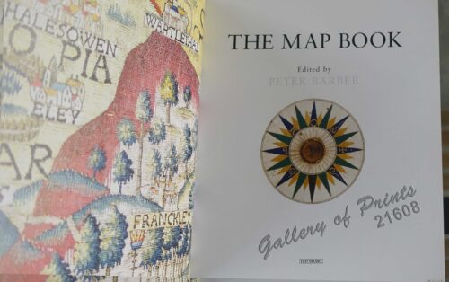
The Map Book
₱
3,300.00
Add to cart
Details
Rizal, Philippine Nationalist and Martyr.
₱
2,900.00
Add to cart
Details
The Calamansi Cook Book, An Expat’s Guide to Eating We...
₱
900.00
Add to cart
Details
The Cruise of the U.S. Flagship Olympia, from 1895-1899, fro...
₱
2,200.00
Add to cart
Details
The German Club Story Centennial Edition 1906 – 2006
₱
2,500.00
Add to cart
Details
Miniature Antique Maps
₱
4,400.00
Add to cart
Details
Magsaysay of the Philippines
₱
7,700.00
Add to cart
Details
Spanning the Decades 1902-2002
₱
2,600.00
Add to cart
Details
[Southeast Asia]
₱
26,400.00
Add to cart
Details
Philippine Islands. A Detailed Map. by Robinson H. E. C. Pt...
₱
34,200.00
Add to cart
Details
The German Club Manila 1986 – 1996 / 1906 – ...
₱
2,500.00
Add to cart
Details
Rare Pacific Voyage Books, part 2
₱
3,300.00
Add to cart
Details
Investing in Maps
₱
2,500.00
Add to cart
Details
Voyage Autour du Monde … 1826, 1827, 1828, et 1829...
₱
19,800.00
Add to cart
Details
Emergent Literature Essays on Philippine Writing
₱
600.00
Add to cart
Details
Admiral Paris’ Native Boats of Asia and the Pacific, 1...
₱
900.00
Add to cart
Details
Kirin, Harbin, Vladivostok
Details
Chart of the World on Mercator’s Projection, showing S...
Details
Map Showing Location of Panama Canal as Recommended by the I...
Details
Map of the Philippines. Prepared By Reduction From the Map o...
Details
City of Manila. Philippine Islands
Details
Trade Routes of the Orient
Details
1) Bird’s Eye View of the Walled City and Immediate En...
Details
Philippine Islands
Details
Beautiful Philippines. A Handbook of General Information
₱
65,600.00
Add to cart
Details
Mapping the Continent of Asia
₱
2,500.00
Add to cart
Details
Collecting Antique Maps
₱
3,300.00
Add to cart
Details
Atlas Journal de la Navigation Autour du Globe de la Fréga...
₱
33,000.00
Add to cart
Details
New Worlds The Great Voyages of Discovery 1400-1600
₱
2,870.00
Add to cart
Details
Map of the Sooloo Sea & Archipelago
₱
9,900.00
Add to cart
Details
Previous
1
2
3
4
5
6
7
8
…
61
62
63
Next
Shopping Cart
Philippine Islands. Tagolo Point to Cuyo Islands. Including Sebu Negros and Parts of Panay and Palawan. From the United States Coast Survey Charts to 1923.
1
1) Islas Filipinas: Primera Hoja Central; 2) Islas Filipinas: Segunda Hoja Central; 3) Posesiones de Ultramar (Oceania) - Islas Filipinas
1
Die Ostindischen Inseln nach den neuesten Berichtigungen dargestellt [The East Indies Presented According to the Latest Corrections]
1
Philippinae Insulae
1
Sheet No. 1. Road Map from Mexico to Cabanatuan plotted during Advance of Gen. Young's Brigade of 1st Div. 8th A. C. Maj. Gen. H. W. Lawton U. S. V. Commanding. Prepared under direction of John C. Oakes. 1st Lieut Corps of Engineers Division Engineer.
1
Dr. A. Petermann's Mittheilungen aus Justus Perthes' Geographischer Anstalt. Herausgegeben von Dr. E. Behm. - Ergänzungsband XIII, 1879-1880 Inhalt: [Supplement Vol. 15 contents] No. 57. Soetbeer, Edelmetall-Production. No. 58. Fischer, Studien über das Klima der Mittelmeerländer. No. 59. Rein, der Nakasendô in Japan. No. 60. Lindeman, die Seefischereien.
1
Océanique.
1
Coryphæna Plümeri [Sand Tilefish] Die Meerpfau. Le Paon de mer. The Sea-Pea-Cock
1
Mittheilungen aus Justus Perthes' Geographischer Anstalt. über wichtige neue Erforschungen auf dem Gesammtgebiete der Geographie von Dr. A. Petermann. - Ergänzungsband XII, 1878 Inhalt: [Supplement Vol. 12 contents] No. 53. Przewalsky's Reise an den Lob-Nor und Altyn-Tag. No. 54. Rittich, die Ethnographie Russlands. No. 55. Behm und Wagner, die Bevölkerung der Erde, V. No. 56. Credner, die Deltas.
1
Fernando Valdes Tamon. Report in which, by order of his Catholic Majesty (May God protect him), the strongholds, castles, forts and garrisons of the provinces under his Royal Dominion in the Philippine Islands are listed
1
Mapping the World, An Illustrated History of Cartography.
1
Ilustracion Filipina: Periodico Quincenal Ano I num. I - Ano II num.24
1
1. [Skipjack Tuna]. 2. [Atlantic Bluefin Tuna]. 3. [Albacore/Longfin Tuna].
1
1) Carte des Isles Philippines (1e feuille) Kaart der Philippines Eilanden, Geschikt op de Spaansche Kaart van Pater Murillo de Velarde 1.ste Blad. Door den Hr. Bellin Ingr. des Fransen Zeevaards. 2) Carte des Isles Philippines (2e feuille) Kaart der Philippines Eilanden, Geschikt op de Spaansche Kaart van Pater Murillo de Velarde 2.de Blad. Door den Hr. Bellin Ingr. des Fransen Zeevaards.
1
The Philippine Islands.
1
Wanderjahre eines jungen Hamburger Kaufmannes - Eine Reise um die Erde in 1000 Tagen [Ramblings of a Young Hamburg Merchant - A Voyage Around the World in 1000 Days]
1
Islas Filipinas - Mapa Etnografico pl. 3, Observatorio de Manila
1
Japan A Cartographic Vision
1
Philippine Islands. Luzon Island. North of Latitude 16° 20' North. From the United States Cost Survey Charts to 1925.
1
Philippine Islands. Sibuyan Sea to San Bernardino Strait. From the United States Government Charts to 1934.
1
Stoparola Cerviniventris [Flycatcher] & Pericrocotus Cinereigula [Minivet]
1
Eastern Archipelago. Philippine Islands and Adjacent Seas. From Molucca Sea to Manila Bay. From the United States & Netherlands Governments Charts to 1929. With corrections to 1946.
1
Filipinas. Provincias y distritos de la isla de Luzon
1
Insulae Indiae Orientalis
1
Isla de Paragua o Palawan Sur pl. 25 (Southern Palawan)
1
Philippine Islands
1
Carte des Indes Orientales... (1e et 2e feuille)
1
Vue de Cavite dans la Baie de Manille [View of Cavite in the Bay of Manila]
1
Atlas of Geographical Curiosities.
1
Cart
Checkout
Continue Shopping
29