Tel : +63(2)-7729-8168 | Mobile: +63 917 806 4291
|
Email: gallery@gop.com.ph
My Account
Remember Me
Register
20 Item(s)
-
₱
447,700.00
Philippine Islands. Anchorages in Northern Luzon and the Babuyan Islands. Insets: 1) Babuyan Is. - Fuga I. Musa Bay. From the United States Government Chart to 1931. 2) Babuyan Is. - Camiguin I. Port San Pio Quinto. From the United States Government Chart to 1931. 3) Luzon-North-East Coast Port San Vicente. From the United States Government Chart to 1938. 4) Luzon - East Coast Mauban Anchorage. From the Philippine Government Chart of 1957. 5) Luzon - West Coast. Salomague Harbour and Lapog Bay. From the United States Government Chart of 1934. 6) Luzon - West Coast Port Currimao and Gan Bay. From the United States Government Chart of 1934. 7) Luzon - West Coast Solvec Cove. From the United States Government Chart of 1934. 8) Luzon - West Coast Lingayen Gulf. Port Sual with Cabalitian Bay. From the United States Government Chart of 1922. 9) Luzon - West Coast San Fernando Harbour. From the United States Government Chart of 1936.
1 x
₱
11,000.00
Carayas ou machines a pecher et Banka de Manille. ["Tarayas" (correctly called "Salambas") or fishing contraptions; and "Banka" from Manila]
1 x
₱
99,000.00
Lichtensteinipicus fuliginosus [Sooty Woodpecker]
1 x
₱
5,500.00
An Accurate Map of Manila, & the rest of the Philippine Islands taken by Adm.l Cornish & Col. Draper Nov.r 6th 1762
1 x
₱
77,000.00
Filipinas. Provincias y distritos de la isla de Luzon
1 x
₱
55,000.00
Filipinas. 1) Filipinas. - Mujer Indigena. 2) Filipinas. - Hombre Indigena. 3) Filipinas. - Manila, Iglesia Sto. Domingo. 4) Filipinas. - Jolo, Entrada a la Ciudad. 5) Filipinas. - Ylo-Ylo, Calle Real. 6) Filipinas. - Manila, Iglesia Sta. Cruz. 7) Filipinas. - Manila, Vendedora. 8) Filipinas. - Aserrio de Maderas. 9) Filipinas. - Arando un Arrozal. 10) Filipinas. - Pagsanyan, Puerta Monumental. 12) Filipinas. - Manila, Calle de la Escolta.
1 x
₱
8,800.00
Douane de Manille [Manila Customs]
1 x
₱
46,200.00
Habitants de Manille Malais de l'îsle Luçon OCÉANIE
1 x
₱
13,200.00
Mittheilungen aus Justus Perthes' Geographischer Anstalt über Wichtige neue Erforschungen auf dem Gesammtgebiete der Geographie von Dr. A. Petermann. - Ergänzungsband III, 1863 u. 1864. Inhalt: [Supplement Vol. 3 contents] No. 9. Halfeld und v. Tschudi, Minas Geraes. No. 12. Koristka, die Hohe Tatra in den Central-Karpathen. No. 13. Die Deutsche Expedition in Ost-Afrika, 1861 und 1862. No. 14. F. Baron Richthofen, die Metall-Produktion Californiens und der angrenzenden Länder. No. 15. Th. v. Heuglin, die Tinne'sche Expedition im westlichen Nil-Quellgebiet, 1863 u. 1864.
1 x
₱
6,000.00
Emergent Literature Essays on Philippine Writing
1 x
₱
600.00
Radeaux mandayas
1 x
₱
5,500.00
Cattleya Amethystoglossa
1 x
₱
5,500.00
War Map Pictorial conflict Maps 1900-1950
1 x
₱
4,400.00
The Philippines. History, Geography, Customs, Agriculture, Industry and Commerce of the Spanish Colonies in Oceania
1 x
₱
900.00
The Cruise of the U.S. Flagship Olympia, from 1895-1899, from San Francisco to Manila Bay: part two, The Bounding Pillow (1899)
1 x
₱
2,200.00
Carte d' Espagne et des principaux etats appartments a Cette Monarchie dans les 4Parties du Monde. 1. Isles Philipines; 2. Duche de Millan; 3. Royaume de Naples; 4. Royaume de Sicille; 5. Isles Antilles; 6. Nouveau Mexique; 7. Nouvelle Espagne; 8. Terre Ferme; 9. Le Perou; 10. Chili; 11. Rio de Plata ou Paraguay; 12. Pais Bas Catolique; 13. Isles de Sardaigne; 14. Isles Canaries ou Isles Fortunees; 15. Espagne.
1 x
₱
22,000.00
Vue prise a Pulo-Penang.
1 x
₱
25,200.00
A New Map of the East Indies, Taken from Mr. de Fer's Map of Asia, Shewing their Chief Divisions, Cities, Towns, Ports, Rivers, Mountains & c. Dedicated to His Highness William Duke of Glocester.
1 x
₱
49,500.00
The Earthquake at Manilla: 3 views 1) Church of St. Domingo, 2) Interior of the Governor's Palace, Manilla, 3) Ruins of Government Tobacco Store
1 x
₱
7,700.00
The German Club Manila 1986 - 1996 / 1906 - 1986
1 x
₱
2,500.00
View Cart
Checkout
Home
About Us
Publications
Shop Online
Framing Services
Exhibits
Picture Hanging System
Contact Us
Blogs
View cart
“The German Club Manila 1986 – 1996 / 1906 – 1986” has been added to your cart.
Sort by
Popularity
Sort by
Default Order
Sort by
Name
Sort by
Price
Sort by
Date
Sort by
Popularity
Show
30 Products
Show
30 Products
Show
60 Products
Show
90 Products
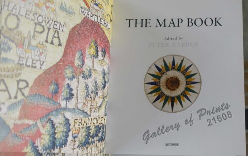
The Map Book
₱
3,300.00
Add to cart
Details
Rizal, Philippine Nationalist and Martyr.
₱
2,900.00
Add to cart
Details
The Calamansi Cook Book, An Expat’s Guide to Eating We...
₱
900.00
Add to cart
Details
The Cruise of the U.S. Flagship Olympia, from 1895-1899, fro...
₱
2,200.00
Add to cart
Details
The German Club Story Centennial Edition 1906 – 2006
₱
2,500.00
Add to cart
Details
Miniature Antique Maps
₱
4,400.00
Add to cart
Details
Magsaysay of the Philippines
₱
7,700.00
Add to cart
Details
Spanning the Decades 1902-2002
₱
2,600.00
Add to cart
Details
[Southeast Asia]
₱
26,400.00
Add to cart
Details
Philippine Islands. A Detailed Map. by Robinson H. E. C. Pt...
₱
34,200.00
Add to cart
Details
The German Club Manila 1986 – 1996 / 1906 – ...
₱
2,500.00
Add to cart
Details
Rare Pacific Voyage Books, part 2
₱
3,300.00
Add to cart
Details
Investing in Maps
₱
2,500.00
Add to cart
Details
Voyage Autour du Monde … 1826, 1827, 1828, et 1829...
₱
19,800.00
Add to cart
Details
Emergent Literature Essays on Philippine Writing
₱
600.00
Add to cart
Details
Admiral Paris’ Native Boats of Asia and the Pacific, 1...
₱
900.00
Add to cart
Details
Kirin, Harbin, Vladivostok
Details
Chart of the World on Mercator’s Projection, showing S...
Details
Map Showing Location of Panama Canal as Recommended by the I...
Details
Map of the Philippines. Prepared By Reduction From the Map o...
Details
City of Manila. Philippine Islands
Details
Trade Routes of the Orient
Details
1) Bird’s Eye View of the Walled City and Immediate En...
Details
Philippine Islands
Details
Beautiful Philippines. A Handbook of General Information
₱
65,600.00
Add to cart
Details
Mapping the Continent of Asia
₱
2,500.00
Add to cart
Details
Collecting Antique Maps
₱
3,300.00
Add to cart
Details
Atlas Journal de la Navigation Autour du Globe de la Fréga...
₱
33,000.00
Add to cart
Details
New Worlds The Great Voyages of Discovery 1400-1600
₱
2,870.00
Add to cart
Details
Map of the Sooloo Sea & Archipelago
₱
9,900.00
Add to cart
Details
Previous
1
2
3
4
5
6
7
8
…
61
62
63
Next
Shopping Cart
The German Club Manila 1986 - 1996 / 1906 - 1986
1
The Earthquake at Manilla: 3 views 1) Church of St. Domingo, 2) Interior of the Governor's Palace, Manilla, 3) Ruins of Government Tobacco Store
1
A New Map of the East Indies, Taken from Mr. de Fer's Map of Asia, Shewing their Chief Divisions, Cities, Towns, Ports, Rivers, Mountains & c. Dedicated to His Highness William Duke of Glocester.
1
Vue prise a Pulo-Penang.
1
Carte d' Espagne et des principaux etats appartments a Cette Monarchie dans les 4Parties du Monde. 1. Isles Philipines; 2. Duche de Millan; 3. Royaume de Naples; 4. Royaume de Sicille; 5. Isles Antilles; 6. Nouveau Mexique; 7. Nouvelle Espagne; 8. Terre Ferme; 9. Le Perou; 10. Chili; 11. Rio de Plata ou Paraguay; 12. Pais Bas Catolique; 13. Isles de Sardaigne; 14. Isles Canaries ou Isles Fortunees; 15. Espagne.
1
The Cruise of the U.S. Flagship Olympia, from 1895-1899, from San Francisco to Manila Bay: part two, The Bounding Pillow (1899)
1
The Philippines. History, Geography, Customs, Agriculture, Industry and Commerce of the Spanish Colonies in Oceania
1
War Map Pictorial conflict Maps 1900-1950
1
Cattleya Amethystoglossa
1
Radeaux mandayas
1
Emergent Literature Essays on Philippine Writing
1
Mittheilungen aus Justus Perthes' Geographischer Anstalt über Wichtige neue Erforschungen auf dem Gesammtgebiete der Geographie von Dr. A. Petermann. - Ergänzungsband III, 1863 u. 1864. Inhalt: [Supplement Vol. 3 contents] No. 9. Halfeld und v. Tschudi, Minas Geraes. No. 12. Koristka, die Hohe Tatra in den Central-Karpathen. No. 13. Die Deutsche Expedition in Ost-Afrika, 1861 und 1862. No. 14. F. Baron Richthofen, die Metall-Produktion Californiens und der angrenzenden Länder. No. 15. Th. v. Heuglin, die Tinne'sche Expedition im westlichen Nil-Quellgebiet, 1863 u. 1864.
1
Habitants de Manille Malais de l'îsle Luçon OCÉANIE
1
Douane de Manille [Manila Customs]
1
Filipinas. 1) Filipinas. - Mujer Indigena. 2) Filipinas. - Hombre Indigena. 3) Filipinas. - Manila, Iglesia Sto. Domingo. 4) Filipinas. - Jolo, Entrada a la Ciudad. 5) Filipinas. - Ylo-Ylo, Calle Real. 6) Filipinas. - Manila, Iglesia Sta. Cruz. 7) Filipinas. - Manila, Vendedora. 8) Filipinas. - Aserrio de Maderas. 9) Filipinas. - Arando un Arrozal. 10) Filipinas. - Pagsanyan, Puerta Monumental. 12) Filipinas. - Manila, Calle de la Escolta.
1
Filipinas. Provincias y distritos de la isla de Luzon
1
An Accurate Map of Manila, & the rest of the Philippine Islands taken by Adm.l Cornish & Col. Draper Nov.r 6th 1762
1
Lichtensteinipicus fuliginosus [Sooty Woodpecker]
1
Carayas ou machines a pecher et Banka de Manille. ["Tarayas" (correctly called "Salambas") or fishing contraptions; and "Banka" from Manila]
1
Philippine Islands. Anchorages in Northern Luzon and the Babuyan Islands. Insets: 1) Babuyan Is. - Fuga I. Musa Bay. From the United States Government Chart to 1931. 2) Babuyan Is. - Camiguin I. Port San Pio Quinto. From the United States Government Chart to 1931. 3) Luzon-North-East Coast Port San Vicente. From the United States Government Chart to 1938. 4) Luzon - East Coast Mauban Anchorage. From the Philippine Government Chart of 1957. 5) Luzon - West Coast. Salomague Harbour and Lapog Bay. From the United States Government Chart of 1934. 6) Luzon - West Coast Port Currimao and Gan Bay. From the United States Government Chart of 1934. 7) Luzon - West Coast Solvec Cove. From the United States Government Chart of 1934. 8) Luzon - West Coast Lingayen Gulf. Port Sual with Cabalitian Bay. From the United States Government Chart of 1922. 9) Luzon - West Coast San Fernando Harbour. From the United States Government Chart of 1936.
1
Cart
Checkout
Continue Shopping
20