Tel : +63(2)-7729-8168 | Mobile: +63 917 806 4291
|
Email: gallery@gop.com.ph
My Account
Remember Me
Register
9 Item(s)
-
₱
638,000.00
Nieuwe Kaart van de Filippynsche, Ladrones, Moluccos of Specery Eilanden, als mede Celebes etc. [New Map of the Philippine, Marianas, Moluccos or Spice Islands, as well as Celebes etc.]
1 x
₱
22,000.00
China Sea. Philippine Islands. San Bernardino Strait and Approaches. From the United States Coast Survey Charts to 1923. With Additions and corrections to 1934
1 x
₱
11,000.00
Sucesos de las Islas Filipinas
1 x
₱
4,400.00
1) Plan of Solsogon Harbour on the South Coast of Luconia. 2) Chart on the Eastern Coast of Bongo Bay in the Island of Mindanao.
1 x
₱
36,500.00
La Guerra en Filipinas. - Las Canteras de Montalbán (Manila), donde fueron derrotados los insurrectos por la columna del comandante Olaguer. [The War in the Philippines. - The Montalban Quarries (Manila), where the insurgents were defeated by Commander Olaguer's column.]
1 x
₱
3,300.00
Historia de la Provincia de Philipinas de la Compañia de Jesus. Segunda Parte, que comprehende los progresos de esta Provincia desde el Año de 1616, hasta el de 1716.
1 x
₱
550,000.00
Maps & Civilization: Cartography in Culture and Society.
1 x
₱
2,200.00
Il Primo Giro del Mondo [The First Around the World] 1) Magellano espone il suo progetto. [Magellan Reveals his Project] 2) Lo stretto di Magellano. [The Strait of Magellan] 3) Morte di Magellano. [Death of Magellan] 4) Ricevimento dal Rajah di Borneo. [Reception by the Rajah of Borneo] 5) Alle Molucche. [To the Moluccas] 6) Ritorno in Spagna. [Return to Spain]
1 x
₱
2,000.00
Map of the North Atlantic Ocean showing European Colonial Possessions under their National Flags. 1898. Mercator's Projection
1 x
₱
6,600.00
View Cart
Checkout
Home
About Us
Publications
Shop Online
Framing Services
Exhibits
Picture Hanging System
Contact Us
Blogs
View cart
“Map of the North Atlantic Ocean showing European Colonial Possessions under their National Flags. 1898. Mercator’s Projection” has been added to your cart.
Sort by
Popularity
Sort by
Default Order
Sort by
Name
Sort by
Price
Sort by
Date
Sort by
Popularity
Show
30 Products
Show
30 Products
Show
60 Products
Show
90 Products
Manila – Insurgent Attack on the Barracks of Co.C, 13t...
₱
11,000.00
Add to cart
Details
Map of the North Atlantic Ocean showing European Colonial Po...
₱
6,600.00
Add to cart
Details
Map of the China Seas showing Philippine Islands and Adjacen...
₱
6,600.00
Add to cart
Details
Yesterdays in the Philippines
₱
9,900.00
Add to cart
Details
Map of Batan Island
₱
6,600.00
Add to cart
Details
Central Luzon. inset: Manila and Vicinity
₱
4,400.00
Add to cart
Details
Rue Saint-Roque a Manille, apres le tremblement de terre (vo...
₱
5,500.00
Add to cart
Details
Sammlung gemeinverständlicher wissenschaftlicher Vorträge ...
₱
15,700.00
Add to cart
Details
Lichtensteinipicus fuliginosus [Sooty Woodpecker]
₱
5,500.00
Add to cart
Details
Halcyon lindsayi lindsayi [Lindsay’s Kingfisher] (uppe...
₱
5,500.00
Add to cart
Details
Gallicolumba keayi [Negros Puñalada]
₱
5,500.00
Add to cart
Details
Terrain Handbook 41 Manila (Philippine Series)
₱
22,000.00
Add to cart
Details
Typus Fpeti Manilensis [sic], Detroit de Manilles, [Straits ...
₱
39,600.00
Add to cart
Details
Aus der Umgebung von Manila: Die Vorstadt Binondo. (View fro...
₱
5,500.00
Add to cart
Details
Exposicion de Filipinas en el Parque de Madrid. 1. Puente de...
₱
11,000.00
Add to cart
Details
Insulae Indiae Orientalis praecipuae, In quibus Moluccae cel...
₱
185,000.00
Add to cart
Details
Census of the Philippine Islands: 1903. Vol. 1 – Geogr...
₱
50,600.00
Add to cart
Details
MADRID. – Exposicion de Filipinas: Exterior de los edi...
₱
8,800.00
Add to cart
Details
A Triumphal Parade of Insurgent Troops in Manila
₱
14,700.00
Add to cart
Details
Isles Philippines a Paris chez le Rouge
₱
22,000.00
Add to cart
Details
Die Ostindischen Inseln nach den neuesten Berichtigungen dar...
₱
18,700.00
Add to cart
Details
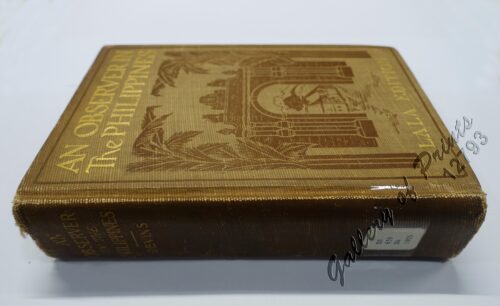
An Observer in the Philippines or Life in Our New Possession...
₱
8,800.00
Add to cart
Details
El Indicador del Viajero en las Islas Filipinas
₱
77,000.00
Add to cart
Details
The Fleet that did not go to the Philippines Admiral Camara&...
₱
11,000.00
Add to cart
Details
Map of the United States showing the Territorial Expansion o...
₱
33,100.00
Add to cart
Details
East India Archipelago [Eastern Passages to China and Japan]...
₱
39,600.00
Add to cart
Details
East India Archipelago [Eastern Passages to China and Japan]...
₱
36,000.00
Add to cart
Details
The Bontoc Igorot. The Ethnological Survey Publications vol....
₱
14,700.00
Add to cart
Details
Previous
1
2
3
…
45
46
47
48
49
50
51
…
61
62
63
Next
Shopping Cart
Map of the North Atlantic Ocean showing European Colonial Possessions under their National Flags. 1898. Mercator's Projection
1
Il Primo Giro del Mondo [The First Around the World] 1) Magellano espone il suo progetto. [Magellan Reveals his Project] 2) Lo stretto di Magellano. [The Strait of Magellan] 3) Morte di Magellano. [Death of Magellan] 4) Ricevimento dal Rajah di Borneo. [Reception by the Rajah of Borneo] 5) Alle Molucche. [To the Moluccas] 6) Ritorno in Spagna. [Return to Spain]
1
Maps & Civilization: Cartography in Culture and Society.
1
Historia de la Provincia de Philipinas de la Compañia de Jesus. Segunda Parte, que comprehende los progresos de esta Provincia desde el Año de 1616, hasta el de 1716.
1
La Guerra en Filipinas. - Las Canteras de Montalbán (Manila), donde fueron derrotados los insurrectos por la columna del comandante Olaguer. [The War in the Philippines. - The Montalban Quarries (Manila), where the insurgents were defeated by Commander Olaguer's column.]
1
1) Plan of Solsogon Harbour on the South Coast of Luconia. 2) Chart on the Eastern Coast of Bongo Bay in the Island of Mindanao.
1
Sucesos de las Islas Filipinas
1
China Sea. Philippine Islands. San Bernardino Strait and Approaches. From the United States Coast Survey Charts to 1923. With Additions and corrections to 1934
1
Nieuwe Kaart van de Filippynsche, Ladrones, Moluccos of Specery Eilanden, als mede Celebes etc. [New Map of the Philippine, Marianas, Moluccos or Spice Islands, as well as Celebes etc.]
1
Cart
Checkout
Continue Shopping
9