Tel : +63(2)-7729-8168 | Mobile: +63 917 806 4291
|
Email: gallery@gop.com.ph
My Account
Remember Me
Register
22 Item(s)
-
₱
452,900.00
The Philippine Crisis: Scenes of the Conflict. 1. A Filipino Village just outside the American Lines near Manila; 2. Outposts in Touch: American on the near side of the Bridge, Filipino beyond; 3. A Spanish Fort at Manila mounted with old Muzzle-loading Guns; 4. At Cavite: a Spanish Gun-boat “Scuppered” by her Crew.
1 x
₱
7,700.00
A Visit to the Philippine Islands in 1858-59
1 x
₱
45,100.00
The Cartography of the East Indian Islands, Insulae Indiae Orientalis.
1 x
₱
6,600.00
Mapa de la Parte del Norte del Mar del Sur, Sacado Dela Carta General Llamada de Cook, Publicada en Paris el Año de 1785. Con La Obra de su Expidecion. Se ha Corregido en Alguhos Puntos, y ha Transportado Del Meridiano de Greenwich al de Tenerife. Madrid Año De 1788.
1 x
₱
13,200.00
1) Plan du port d' Acapulco sur la Côte du Mexique dans la Mer du Sud. 2) Plan de la Baye de Manille
1 x
₱
26,400.00
East India Archipelago (Western Route to China. Chart No.6) London, Published by James Imray and Son, 89 & 102 Minories, 1872
1 x
₱
99,000.00
The Philipine Isles
1 x
₱
88,000.00
Insulae Marianae Aº 1684...
1 x
₱
39,600.00
Leyte
1 x
₱
17,600.00
Ortelius Atlas Maps 2nd revised edition
1 x
₱
5,500.00
1. Le Banyan, ou le Multipliant. 2. Église de Notre-Dame des Anges. 3. Vue de Karikal du Coté de la mer (rive droite de l'Arselar). 4. Debarcadère a Karikal.
1 x
₱
3,300.00
East India Isles
1 x
₱
6,600.00
Island of Luzon. inset map: Islands of the Philippines north of Luzon
1 x
₱
3,300.00
Road Sketch of Operations of Col. Hood's Command, 16th Infty. Drawn By Guy G. Palmer 1st Lieut 16th U.S. Infty.
1 x
₱
6,600.00
1) Phalanger celebensis. [Small Sulawesi Cuscus] 2-3) Phalanger sangirensis. [Sangihe Grey Cuscus]
1 x
₱
5,500.00
Campagne des Environs de Manille (Oceanie) [Countryside near Manila]
1 x
₱
9,900.00
Otophora Alata. Bl. [English: Johore Tree, Malaysian Lepisanthe], Perupoks
1 x
₱
26,400.00
Rizal, Philippine Nationalist and Martyr.
1 x
₱
2,900.00
The Spanish - American War In the Spanish Trenches at Manila: Midday
1 x
₱
4,400.00
Plan of Manila and Suburbs.
1 x
₱
17,700.00
Les Isles de la Sonde, Moluques, Philippines, Carolines, et Mariannes
1 x
₱
11,000.00
Islas Filipinas - Mapa Orografico Observatorio de Manila
1 x
₱
6,600.00
View Cart
Checkout
Home
About Us
Publications
Shop Online
Framing Services
Exhibits
Picture Hanging System
Contact Us
Blogs
View cart
“Islas Filipinas – Mapa Orografico Observatorio de Manila” has been added to your cart.
Sort by
Name
Sort by
Default Order
Sort by
Name
Sort by
Price
Sort by
Date
Sort by
Popularity
Show
30 Products
Show
30 Products
Show
60 Products
Show
90 Products
Philippine Islands. Luzon Island. North of Latitude 16° 20...
₱
11,000.00
Add to cart
Details
Philippine Islands. Luzon Island. North of Latitude 16° 20...
₱
11,000.00
Add to cart
Details
Philippine Islands. Luzon-West and East Coasts. Cabra I. to ...
₱
11,000.00
Add to cart
Details
Philippine Islands. Mindoro and Adjacent Islands. Cuyo Is. T...
₱
11,000.00
Add to cart
Details
Philippine Islands. Mindoro Strait. From the United States G...
₱
11,000.00
Add to cart
Details
Philippine Islands. Samar and Leyte. San Juanico Strait and ...
₱
11,000.00
Add to cart
Details
Philippine Islands. Sibuyan Sea to San Bernardino Strait. Fr...
₱
11,000.00
Add to cart
Details
Philippine Islands. Surigao Srait with Leyte Gulf and Hinatu...
₱
11,000.00
Add to cart
Details
Philippine Islands. Tablas Strait with Part of Sibuyan Sea�...
₱
6,600.00
Add to cart
Details
Philippine Islands. Tablas Strait with Part of Sibuyan Sea. ...
₱
11,000.00
Add to cart
Details
Philippine Islands. Tagolo Point to Cuyo Islands. Including ...
₱
11,000.00
Add to cart
Details
Philippine Islands. Tagolo Point to Cuyo Islands. Including ...
₱
11,000.00
Add to cart
Details
Philippine Islands. The Passages Between Panay. Negros and C...
₱
11,000.00
Add to cart
Details
Philippine Islands. Verde Island Passage. From the United St...
₱
11,000.00
Add to cart
Details
Philippine Islands. Western Part of Mindanao Sea with Bohol ...
₱
11,000.00
Add to cart
Details
Philippine Islands. Western Part of Mindanao Sea with Bohol ...
₱
13,200.00
Add to cart
Details
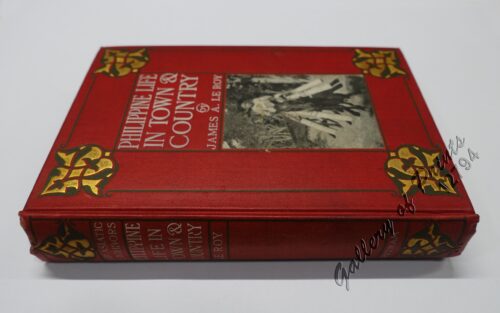
Philippine Life in Town & Country.
₱
8,800.00
Add to cart
Details
Philippine Pagans. The Autographies of Three Ifugaos
₱
5,500.00
Add to cart
Details
Philippine Religious – Carvings in Ivory
₱
2,500.00
Add to cart
Details
Philippinen – Exotische Inselwelt La vie exotique des ...
₱
4,400.00
Add to cart
Details
Philippinen – Exotische Inselwelt La vie exotique des ...
₱
5,500.00
Add to cart
Details
Philippinen – Exotische Inselwelt La vie exotique des ...
₱
5,500.00
Add to cart
Details
Philippinen – Vulcan von Taal [Taal Volcano]
₱
7,700.00
Add to cart
Details
Philippines
₱
5,500.00
Add to cart
Details
Philippines
₱
8,800.00
Add to cart
Details
Philippines – Interieur de L’Ile de Loucon Phili...
₱
4,400.00
Add to cart
Details
Philippines – Manila Philippinen – Manila
₱
5,500.00
Add to cart
Details
Philippines – Volcan de Taal Philippinen – Vulc...
₱
8,800.00
Add to cart
Details
Philippines – Volcan de Taal. Filipinas – Volcan...
₱
6,600.00
Add to cart
Details
Philippines. Propriete de Mr. La Geroniere
₱
6,600.00
Add to cart
Details
Previous
1
2
3
…
41
42
43
44
45
46
47
…
61
62
63
Next
Shopping Cart
Islas Filipinas - Mapa Orografico Observatorio de Manila
1
Les Isles de la Sonde, Moluques, Philippines, Carolines, et Mariannes
1
Plan of Manila and Suburbs.
1
The Spanish - American War In the Spanish Trenches at Manila: Midday
1
Rizal, Philippine Nationalist and Martyr.
1
Otophora Alata. Bl. [English: Johore Tree, Malaysian Lepisanthe], Perupoks
1
Campagne des Environs de Manille (Oceanie) [Countryside near Manila]
1
1) Phalanger celebensis. [Small Sulawesi Cuscus] 2-3) Phalanger sangirensis. [Sangihe Grey Cuscus]
1
Road Sketch of Operations of Col. Hood's Command, 16th Infty. Drawn By Guy G. Palmer 1st Lieut 16th U.S. Infty.
1
Island of Luzon. inset map: Islands of the Philippines north of Luzon
1
East India Isles
1
1. Le Banyan, ou le Multipliant. 2. Église de Notre-Dame des Anges. 3. Vue de Karikal du Coté de la mer (rive droite de l'Arselar). 4. Debarcadère a Karikal.
1
Ortelius Atlas Maps 2nd revised edition
1
Leyte
1
Insulae Marianae Aº 1684...
1
The Philipine Isles
1
East India Archipelago (Western Route to China. Chart No.6) London, Published by James Imray and Son, 89 & 102 Minories, 1872
1
1) Plan du port d' Acapulco sur la Côte du Mexique dans la Mer du Sud. 2) Plan de la Baye de Manille
1
Mapa de la Parte del Norte del Mar del Sur, Sacado Dela Carta General Llamada de Cook, Publicada en Paris el Año de 1785. Con La Obra de su Expidecion. Se ha Corregido en Alguhos Puntos, y ha Transportado Del Meridiano de Greenwich al de Tenerife. Madrid Año De 1788.
1
The Cartography of the East Indian Islands, Insulae Indiae Orientalis.
1
A Visit to the Philippine Islands in 1858-59
1
The Philippine Crisis: Scenes of the Conflict. 1. A Filipino Village just outside the American Lines near Manila; 2. Outposts in Touch: American on the near side of the Bridge, Filipino beyond; 3. A Spanish Fort at Manila mounted with old Muzzle-loading Guns; 4. At Cavite: a Spanish Gun-boat “Scuppered” by her Crew.
1
Cart
Checkout
Continue Shopping
22