Tel : +63(2)-7729-8168 | Mobile: +63 917 806 4291
|
Email: gallery@gop.com.ph
My Account
Remember Me
Register
25 Item(s)
-
₱
315,250.00
Action between 28" Inf. U.S.V. and Filipino Rebels July 17, 1900 at Bario Jalang, Pueblo San Louis, Province of Batangas, Luzon
1 x
₱
5,500.00
Inselfieber Ein Vierteljahrhundert auf den Philippinen
1 x
₱
1,500.00
5. Le Maitre de Carteret abat les Cocotiers de Nitendi. [The Master of Carteret cuts down the Nitendi Coconut Trees] 6. Le Capitaine Marion proclame chef a la Nouvelle-Zélande. [Captain Marion proclaimed leader of New Zealand]
1 x
₱
2,200.00
Eastern Passages to China Sheet III. inset: Plan of Manilla Bay, surveyed in 1792 by Don Felipe Bauza. [Eastern Philippines]
1 x
₱
99,000.00
Sheet No. 10. Road Map from Pasuquin to Bangui plotted during Advance of Gen. Young's Brigade of 1st Div. 8th A. C. Maj. Gen. H. W. Lawton U. S. V. Commanding. Prepared under direction of John C. Oakes. 1st Lieut Corps of Engineers Division Engineer.
1 x
₱
6,600.00
L'Halmature Thétis [Kangaroo] A. Jeune dans le Repos
1 x
₱
6,100.00
Typha Latifolia [Bulrush]
1 x
₱
4,400.00
Chrysophyllum Cainito Linn. [Star Apple]
1 x
₱
4,400.00
Bibliography of the Philippine Islands. Printed and Manuscript. Preceded by a Descriptive Account of the most important Archives and Collections containing Philippina
1 x
₱
4,400.00
The Philippines. inset: [SE-Asia]
1 x
₱
6,600.00
Philippine Islands and the China Sea.
1 x
₱
11,000.00
The Treasures of the Seven Seas: Cleopatra and the Mystery of the San Diego
1 x
₱
2,900.00
Les Iles [The Islands] 1) Les Philippines Rivière de Davao (Mindanao) [Davao River]. 2) Borneo Un Village à Borneo [A Village in Borneo]. 3) Nouvelle Guinée Village Lacustre de Sowek [Sowek Lake Village]. 4) Formose [Taiwan] Ta-kao. 5) Cuba La Havane [Havana]. 6) La Crète La Canée [Chania].
1 x
₱
9,900.00
Ostchina und Korea
1 x
₱
4,400.00
The Murillo Bulletin, Journal of PHIMCOS, Special World War II Issue
1 x
₱
600.00
Le Mayon. - Vue Generale
1 x
₱
6,600.00
Philippine Islands
1 x
₱
17,600.00
Mittheilungen aus Justus Perthes' Geographischer Anstalt. über wichtige neue Erforschungen auf dem Gesammtgebiete der Geographie von Dr. A. Petermann. - Ergänzungsband VI, 1869-71 Inhalt:[Supplement Vol. 6 contents] No. 26. Lindemann, die arktische Fischerei der Deutschen Seestädte 1620-1868 No. 27. Payer, die südlichen Ortler-Alpen No. 28. Koldewey und Petermann, die erste Deutsche Nordpolar-Expedition, 1868 No. 29. Petermann, Australien in 1871. Mit geograph.- statistischem Compendium von Meinicke
1 x
₱
8,600.00
AAF Cloth Chart - Philippine Series No. C-41, Mindoro Island [Mindoro & Palawan Islands, Sulu Sea] inset: [Palawan] No. C-42, Samar Island [VERSO] [South Luzon, Samar & Visayan Islands]
1 x
₱
46,500.00
Expedition and Engagement of Pinauran November !22!1900
1 x
₱
5,500.00
Crabier, des Philippines [Heron] [Bakau] [Ardea sp.]
1 x
₱
14,700.00
Anchorages of Luzon, Mindoro and Marinduque. insets: 1) Luzon - West Coast. Bolinao Harbour. From the United States Government Survey of 1904. With additions and corrections from Philippine Gov't. Charts to 1964. 2) Luzon - West Coast. Port Masinloc and Port Matalvi. From the United States Government Surveys of 1937. With additions and corrections from Philippine Gov't. Charts to 1964. 3) Luzon - West Coast. Mariveles Harbour. From the United States Government Chart of 1940. With additions and corrections from Philippine Gov't. Charts to 1964. 4) Luzon - South - West Coast. Batangas. From the Philippine Government Chart of 1956. With additions and corrections to 1964. 5) Luzon - South - West Coast. Nasugbu Bay. From the Philippine Government Chart of 1956. 6) Marinduque. Port Balanacan. From the United States Government Survey of 1908. With additions and corrections from Philippine Gov't. Charts to 1964. 7) Marinduque. Santa Cruz Harbour. From the United States Government Survey of 1908. With additions and corrections from Philippine Gov't. Charts to 1964. 8) Mindoro - North Coast. Port Galera and Varadero Bay. From the United States Government Surveys to 1939. With additions and corrections from Philippine Gov't. Charts to 1964.
1 x
₱
11,000.00
The Murillo Bulletin, Journal of PHIMCOS, Issue No.6
1 x
₱
1,950.00
1) Mapa de las Islas Filipinas 2) Islas Carolinas 3) Islas Marianas ó de los Ladrones
1 x
₱
15,700.00
Harper's Weekly - A Journal of Civilization with frontispiece: The End of the Coast. - Drawn by A. B. Frost.
1 x
₱
17,600.00
View Cart
Checkout
Home
About Us
Publications
Shop Online
Framing Services
Exhibits
Picture Hanging System
Contact Us
Blogs
View cart
“Harper’s Weekly – A Journal of Civilization with frontispiece: The End of the Coast. – Drawn by A. B. Frost.” has been added to your cart.
Sort by
Name
Sort by
Default Order
Sort by
Name
Sort by
Price
Sort by
Date
Sort by
Popularity
Show
30 Products
Show
30 Products
Show
60 Products
Show
90 Products
Philippine Islands. Luzon Island. North of Latitude 16° 20...
₱
11,000.00
Add to cart
Details
Philippine Islands. Luzon Island. North of Latitude 16° 20...
₱
11,000.00
Add to cart
Details
Philippine Islands. Luzon-West and East Coasts. Cabra I. to ...
₱
11,000.00
Add to cart
Details
Philippine Islands. Mindoro and Adjacent Islands. Cuyo Is. T...
₱
11,000.00
Add to cart
Details
Philippine Islands. Mindoro Strait. From the United States G...
₱
11,000.00
Add to cart
Details
Philippine Islands. Samar and Leyte. San Juanico Strait and ...
₱
11,000.00
Add to cart
Details
Philippine Islands. Sibuyan Sea to San Bernardino Strait. Fr...
₱
11,000.00
Add to cart
Details
Philippine Islands. Surigao Srait with Leyte Gulf and Hinatu...
₱
11,000.00
Add to cart
Details
Philippine Islands. Tablas Strait with Part of Sibuyan Sea�...
₱
6,600.00
Add to cart
Details
Philippine Islands. Tablas Strait with Part of Sibuyan Sea. ...
₱
11,000.00
Add to cart
Details
Philippine Islands. Tagolo Point to Cuyo Islands. Including ...
₱
11,000.00
Add to cart
Details
Philippine Islands. Tagolo Point to Cuyo Islands. Including ...
₱
11,000.00
Add to cart
Details
Philippine Islands. The Passages Between Panay. Negros and C...
₱
11,000.00
Add to cart
Details
Philippine Islands. Verde Island Passage. From the United St...
₱
11,000.00
Add to cart
Details
Philippine Islands. Western Part of Mindanao Sea with Bohol ...
₱
11,000.00
Add to cart
Details
Philippine Islands. Western Part of Mindanao Sea with Bohol ...
₱
13,200.00
Add to cart
Details
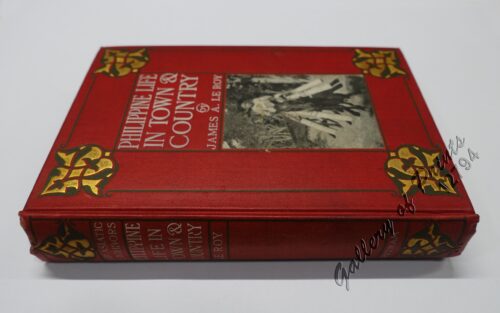
Philippine Life in Town & Country.
₱
8,800.00
Add to cart
Details
Philippine Pagans. The Autographies of Three Ifugaos
₱
5,500.00
Add to cart
Details
Philippine Religious – Carvings in Ivory
₱
2,500.00
Add to cart
Details
Philippinen – Exotische Inselwelt La vie exotique des ...
₱
4,400.00
Add to cart
Details
Philippinen – Exotische Inselwelt La vie exotique des ...
₱
5,500.00
Add to cart
Details
Philippinen – Exotische Inselwelt La vie exotique des ...
₱
5,500.00
Add to cart
Details
Philippinen – Vulcan von Taal [Taal Volcano]
₱
7,700.00
Add to cart
Details
Philippines
₱
5,500.00
Add to cart
Details
Philippines
₱
8,800.00
Add to cart
Details
Philippines – Interieur de L’Ile de Loucon Phili...
₱
4,400.00
Add to cart
Details
Philippines – Manila Philippinen – Manila
₱
5,500.00
Add to cart
Details
Philippines – Volcan de Taal Philippinen – Vulc...
₱
8,800.00
Add to cart
Details
Philippines – Volcan de Taal. Filipinas – Volcan...
₱
6,600.00
Add to cart
Details
Philippines. Propriete de Mr. La Geroniere
₱
6,600.00
Add to cart
Details
Previous
1
2
3
…
41
42
43
44
45
46
47
…
61
62
63
Next
Shopping Cart
Harper's Weekly - A Journal of Civilization with frontispiece: The End of the Coast. - Drawn by A. B. Frost.
1
1) Mapa de las Islas Filipinas 2) Islas Carolinas 3) Islas Marianas ó de los Ladrones
1
The Murillo Bulletin, Journal of PHIMCOS, Issue No.6
1
Anchorages of Luzon, Mindoro and Marinduque. insets: 1) Luzon - West Coast. Bolinao Harbour. From the United States Government Survey of 1904. With additions and corrections from Philippine Gov't. Charts to 1964. 2) Luzon - West Coast. Port Masinloc and Port Matalvi. From the United States Government Surveys of 1937. With additions and corrections from Philippine Gov't. Charts to 1964. 3) Luzon - West Coast. Mariveles Harbour. From the United States Government Chart of 1940. With additions and corrections from Philippine Gov't. Charts to 1964. 4) Luzon - South - West Coast. Batangas. From the Philippine Government Chart of 1956. With additions and corrections to 1964. 5) Luzon - South - West Coast. Nasugbu Bay. From the Philippine Government Chart of 1956. 6) Marinduque. Port Balanacan. From the United States Government Survey of 1908. With additions and corrections from Philippine Gov't. Charts to 1964. 7) Marinduque. Santa Cruz Harbour. From the United States Government Survey of 1908. With additions and corrections from Philippine Gov't. Charts to 1964. 8) Mindoro - North Coast. Port Galera and Varadero Bay. From the United States Government Surveys to 1939. With additions and corrections from Philippine Gov't. Charts to 1964.
1
Crabier, des Philippines [Heron] [Bakau] [Ardea sp.]
1
Expedition and Engagement of Pinauran November !22!1900
1
AAF Cloth Chart - Philippine Series No. C-41, Mindoro Island [Mindoro & Palawan Islands, Sulu Sea] inset: [Palawan] No. C-42, Samar Island [VERSO] [South Luzon, Samar & Visayan Islands]
1
Mittheilungen aus Justus Perthes' Geographischer Anstalt. über wichtige neue Erforschungen auf dem Gesammtgebiete der Geographie von Dr. A. Petermann. - Ergänzungsband VI, 1869-71 Inhalt:[Supplement Vol. 6 contents] No. 26. Lindemann, die arktische Fischerei der Deutschen Seestädte 1620-1868 No. 27. Payer, die südlichen Ortler-Alpen No. 28. Koldewey und Petermann, die erste Deutsche Nordpolar-Expedition, 1868 No. 29. Petermann, Australien in 1871. Mit geograph.- statistischem Compendium von Meinicke
1
Philippine Islands
1
Le Mayon. - Vue Generale
1
The Murillo Bulletin, Journal of PHIMCOS, Special World War II Issue
1
Ostchina und Korea
1
Les Iles [The Islands] 1) Les Philippines Rivière de Davao (Mindanao) [Davao River]. 2) Borneo Un Village à Borneo [A Village in Borneo]. 3) Nouvelle Guinée Village Lacustre de Sowek [Sowek Lake Village]. 4) Formose [Taiwan] Ta-kao. 5) Cuba La Havane [Havana]. 6) La Crète La Canée [Chania].
1
The Treasures of the Seven Seas: Cleopatra and the Mystery of the San Diego
1
Philippine Islands and the China Sea.
1
The Philippines. inset: [SE-Asia]
1
Bibliography of the Philippine Islands. Printed and Manuscript. Preceded by a Descriptive Account of the most important Archives and Collections containing Philippina
1
Chrysophyllum Cainito Linn. [Star Apple]
1
Typha Latifolia [Bulrush]
1
L'Halmature Thétis [Kangaroo] A. Jeune dans le Repos
1
Sheet No. 10. Road Map from Pasuquin to Bangui plotted during Advance of Gen. Young's Brigade of 1st Div. 8th A. C. Maj. Gen. H. W. Lawton U. S. V. Commanding. Prepared under direction of John C. Oakes. 1st Lieut Corps of Engineers Division Engineer.
1
Eastern Passages to China Sheet III. inset: Plan of Manilla Bay, surveyed in 1792 by Don Felipe Bauza. [Eastern Philippines]
1
5. Le Maitre de Carteret abat les Cocotiers de Nitendi. [The Master of Carteret cuts down the Nitendi Coconut Trees] 6. Le Capitaine Marion proclame chef a la Nouvelle-Zélande. [Captain Marion proclaimed leader of New Zealand]
1
Inselfieber Ein Vierteljahrhundert auf den Philippinen
1
Action between 28" Inf. U.S.V. and Filipino Rebels July 17, 1900 at Bario Jalang, Pueblo San Louis, Province of Batangas, Luzon
1
Cart
Checkout
Continue Shopping
25