Tel : +63(2)-7729-8168 | Mobile: +63 917 806 4291
|
Email: gallery@gop.com.ph
My Account
Remember Me
Register
23 Item(s)
-
₱
503,970.00
Coucou, des Philippines [Philippine Coucal] [Sabukot/ Tsabukot] [Centropus Viridis]
1 x
₱
14,700.00
In Spanish Days - The Arsenal at Cavite, P. I.
1 x
₱
2,200.00
Philippine Islands. Leyte Gulf To Mayo Bay. Including Leyte,Parts of Sebu and Bohol and the North-Eastern Cost of Mindanao. From the United States Cost Survey Charts to 1922.
1 x
₱
11,000.00
Wild Flowers of the Transvaal
1 x
₱
3,300.00
City of Manila. Prepared under the direction of the Chief Engineer, GHQ, AFPAC, U.S. Army, by Base Map Plant no. 1, August, 1945.
1 x
₱
41,600.00
Philippine Archipelago Mindanao Island Sarangani Islands and Adjacent Coast From a Spanish survey in 1874.
1 x
₱
5,500.00
[Philippineninsel Luzon. 'Vegetation in der Ebene des Flusses Passig.] [sic] '[Vegetation in the Pasig River Basin]
1 x
₱
61,600.00
Doctrina Christiana: The First Book Printed in the Philippines, Manila, 1593
1 x
₱
22,000.00
El Sitio de Manila (1898) Memorias de un voluntario
1 x
₱
29,400.00
Plan de la Baye et Ville de Manille Capitale des Isles Philippines, Située en l'Isle Luçon . . .
1 x
₱
33,000.00
1) Habitant des Isles Philipine. 2) Femme des Isles Philipine [sic]
1 x
₱
18,700.00
Carayas ou machines a pecher et Banka de Manille. ["Tarayas" (correctly called "Salambas") or fishing contraptions; and "Banka" from Manila]
1 x
₱
99,000.00
Sheet No. 8. Road Map from Santa to Badoc plotted during Advance of Gen. Young's Brigade of 1st Div. 8th A. C. Maj. Gen. H. W. Lawton U. S. V. Commanding. Prepared under direction of John C. Oakes. 1st Lieut Corps of Engineers Division Engineer.
1 x
₱
8,800.00
Vue Generale de Manille.
1 x
₱
7,700.00
Enciclopedia Hispano-Americana Manual de Barnices y Preparacion de Charoles segun los procederes mas recientes. [Manual of Varnishes and Preparation of Patent Leathers according to the most recent procedures.]
1 x
₱
6,600.00
Von den Philippinen: Plaza Alfonso XII, und südlicher Teil der Stadt Ilo=Ilo mit Aussicht auf die Insel Guimaras [Plaza Alfonso XII, and Southern Part of Ilo-Ilo City with View of Guimaras Island]
1 x
₱
6,600.00
San Fabian and Roads to S. Jacinto and Magaldan. Sketch by Horton W. Stickle 2nd Lieut. Corps Engrs. and Paul Bollot, Sergt, Co. A, Batt. Of Engr's Nov. 18, 1899.
1 x
₱
6,600.00
Carte des Isles Philippines
1 x
₱
33,000.00
Philippine Islands. Anchorages in Northern Luzon and the Babuyan Islands. Insets: 1) Babuyan Is. - Fuga I. Musa Bay. From the United States Government Chart to 1931. 2) Babuyan Is. - Camiguin I. Port San Pio Quinto. From the United States Government Chart to 1931. 3) Luzon-North-East Coast Port San Vicente. From the United States Government Chart to 1938. 4) Luzon - East Coast Mauban Anchorage. From the Philippine Government Chart of 1957. 5) Luzon - West Coast. Salomague Harbour and Lapog Bay. From the United States Government Chart of 1934. 6) Luzon - West Coast Port Currimao and Gan Bay. From the United States Government Chart of 1934. 7) Luzon - West Coast Solvec Cove. From the United States Government Chart of 1934. 8) Luzon - West Coast Lingayen Gulf. Port Sual with Cabalitian Bay. From the United States Government Chart of 1922. 9) Luzon - West Coast San Fernando Harbour. From the United States Government Chart of 1936.
1 x
₱
11,000.00
India Orientalis (Parte Seconda Libro V, p. 205)
1 x
₱
39,600.00
British Occupation of Manila and Cavite 1762-1764.
1 x
₱
570.00
Charte von China nach Murdochischer Projection entworfen… inset: Insel-Gruppe Lieu-Kieu oder der Likejos-Inseln Zwischen Formosa und Japan [Map of China in Murdoch Projection with inset: Riu-Kiu Islands]
1 x
₱
39,600.00
The Spice Route
1 x
₱
1,900.00
View Cart
Checkout
Home
About Us
Publications
Shop Online
Framing Services
Exhibits
Picture Hanging System
Contact Us
Blogs
View cart
“The Spice Route” has been added to your cart.
Sort by
Popularity
Sort by
Default Order
Sort by
Name
Sort by
Price
Sort by
Date
Sort by
Popularity
Show
30 Products
Show
30 Products
Show
60 Products
Show
90 Products
Cebu pl. 22 (Isla de Cebu, with inset – Isla de Macta...
₱
7,700.00
Add to cart
Details
Ethnography of the Major Ethnolinguistic Groups in the Cordi...
₱
1,100.00
Add to cart
Details
Amherstia Nobilis [Pride of Burma or Orchid Tree, (Fabaceae...
₱
26,400.00
Add to cart
Details
Another Report About Magellan’s Circumnavigation of th...
₱
900.00
Add to cart
Details
The Murillo Bulletin, Journal of PHIMCOS, Issue No. 13
₱
790.00
Add to cart
Details
International Map Collectors’ Society IMCoS Journal ...
₱
1,400.00
Add to cart
Details
The Murillo Bulletin, Journal of PHIMCOS, Issue No. 12
₱
750.00
Add to cart
Details
A Visit to Manila & Its Environs
₱
2,800.00
Add to cart
Details
Insulae Philippinae
₱
135,000.00
Add to cart
Details
Old Manila
₱
9,900.00
Add to cart
Details
Philippine Cartography
₱
22,000.00
Add to cart
Details
1. Vue Generale de Manille; 2. Nuestro Senor ……&...
₱
8,800.00
Add to cart
Details
The Philippines in Ancient Chinese Maps
₱
2,400.00
Add to cart
Details
Postcards
₱
990.00
Add to cart
Details
East Indies
₱
4,400.00
Add to cart
Details
1. Manilla Woman: Walking Dress; 2. Manilla Girl: Indoor Dre...
₱
9,900.00
Add to cart
Details
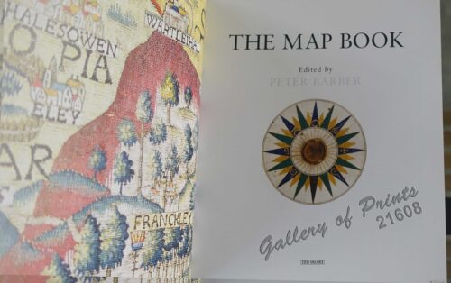
The Map Book
₱
3,300.00
Add to cart
Details
Rizal, Philippine Nationalist and Martyr.
₱
2,900.00
Add to cart
Details
The Calamansi Cook Book, An Expat’s Guide to Eating We...
₱
900.00
Add to cart
Details
Previous
1
2
3
4
5
…
59
60
61
Next
Shopping Cart
The Spice Route
1
Charte von China nach Murdochischer Projection entworfen… inset: Insel-Gruppe Lieu-Kieu oder der Likejos-Inseln Zwischen Formosa und Japan [Map of China in Murdoch Projection with inset: Riu-Kiu Islands]
1
British Occupation of Manila and Cavite 1762-1764.
1
India Orientalis (Parte Seconda Libro V, p. 205)
1
Philippine Islands. Anchorages in Northern Luzon and the Babuyan Islands. Insets: 1) Babuyan Is. - Fuga I. Musa Bay. From the United States Government Chart to 1931. 2) Babuyan Is. - Camiguin I. Port San Pio Quinto. From the United States Government Chart to 1931. 3) Luzon-North-East Coast Port San Vicente. From the United States Government Chart to 1938. 4) Luzon - East Coast Mauban Anchorage. From the Philippine Government Chart of 1957. 5) Luzon - West Coast. Salomague Harbour and Lapog Bay. From the United States Government Chart of 1934. 6) Luzon - West Coast Port Currimao and Gan Bay. From the United States Government Chart of 1934. 7) Luzon - West Coast Solvec Cove. From the United States Government Chart of 1934. 8) Luzon - West Coast Lingayen Gulf. Port Sual with Cabalitian Bay. From the United States Government Chart of 1922. 9) Luzon - West Coast San Fernando Harbour. From the United States Government Chart of 1936.
1
Carte des Isles Philippines
1
San Fabian and Roads to S. Jacinto and Magaldan. Sketch by Horton W. Stickle 2nd Lieut. Corps Engrs. and Paul Bollot, Sergt, Co. A, Batt. Of Engr's Nov. 18, 1899.
1
Von den Philippinen: Plaza Alfonso XII, und südlicher Teil der Stadt Ilo=Ilo mit Aussicht auf die Insel Guimaras [Plaza Alfonso XII, and Southern Part of Ilo-Ilo City with View of Guimaras Island]
1
Enciclopedia Hispano-Americana Manual de Barnices y Preparacion de Charoles segun los procederes mas recientes. [Manual of Varnishes and Preparation of Patent Leathers according to the most recent procedures.]
1
Vue Generale de Manille.
1
Sheet No. 8. Road Map from Santa to Badoc plotted during Advance of Gen. Young's Brigade of 1st Div. 8th A. C. Maj. Gen. H. W. Lawton U. S. V. Commanding. Prepared under direction of John C. Oakes. 1st Lieut Corps of Engineers Division Engineer.
1
Carayas ou machines a pecher et Banka de Manille. ["Tarayas" (correctly called "Salambas") or fishing contraptions; and "Banka" from Manila]
1
1) Habitant des Isles Philipine. 2) Femme des Isles Philipine [sic]
1
Plan de la Baye et Ville de Manille Capitale des Isles Philippines, Située en l'Isle Luçon . . .
1
El Sitio de Manila (1898) Memorias de un voluntario
1
Doctrina Christiana: The First Book Printed in the Philippines, Manila, 1593
1
[Philippineninsel Luzon. 'Vegetation in der Ebene des Flusses Passig.] [sic] '[Vegetation in the Pasig River Basin]
1
Philippine Archipelago Mindanao Island Sarangani Islands and Adjacent Coast From a Spanish survey in 1874.
1
City of Manila. Prepared under the direction of the Chief Engineer, GHQ, AFPAC, U.S. Army, by Base Map Plant no. 1, August, 1945.
1
Wild Flowers of the Transvaal
1
Philippine Islands. Leyte Gulf To Mayo Bay. Including Leyte,Parts of Sebu and Bohol and the North-Eastern Cost of Mindanao. From the United States Cost Survey Charts to 1922.
1
In Spanish Days - The Arsenal at Cavite, P. I.
1
Coucou, des Philippines [Philippine Coucal] [Sabukot/ Tsabukot] [Centropus Viridis]
1
Cart
Checkout
Continue Shopping
23