Tel : +63(2)-7729-8168 | Mobile: +63 917 806 4291
|
Email: gallery@gop.com.ph
My Account
Remember Me
Register
30 Item(s)
-
₱
709,100.00
Irena Ellae, [male], [female]. [Philippine Fairy-blue Bird]
1 x
₱
7,700.00
Philippine Islands Mindanao I. - South East Coast Pujaga Bay
1 x
₱
4,400.00
Asie Ancienne das Alte Asien [Ancient Asia]
1 x
₱
6,600.00
Birds 69. E. Ignitus. Fire-backed Pheasant 70. P. Amherstiae. Amhewsts Pheasant 71. P. Nycthemerus Silver Pheasant 72. P. Numida Meleagris. -Guinea Fowl
1 x
₱
5,500.00
Ilustracion Filipina: Periodico Quincenal Ano I num. I - Ano II num.24
1 x
₱
49,500.00
[Philippineninsel Luzon. 'Vegetation in der Ebene des Flusses Passig.] [sic] '[Vegetation in the Pasig River Basin]
1 x
₱
61,600.00
Manila And Its Surroundings
1 x
₱
18,700.00
1) Chrysocolaptes lucidus erythrocephalus [Red-faced Golden Woodpecker (male type specimen)]. 2) Chrysocolaptes lucidus maculiceps [Basilan Crimson-backed Woodpecker (type specimen young female)]
1 x
₱
5,500.00
Le Barbu de l'Isle de Luçon. [Luzon Island Barbet] [Coppersmith Barbet] [Tuktuk/ Pukpuk] [Megalaima Haemacephala]
1 x
₱
6,600.00
Rand McNally Popular Map of Philippine Islands. insets: 1) Philippine Islands and China Sea. 2) Batan and Babuyan Islands.
1 x
₱
4,400.00
Philippine Islands. Sibuyan Sea to San Bernardino Strait. From the United States Government Charts to 1934.
1 x
₱
11,000.00
Early Mapping of Southeast Asia
1 x
₱
9,600.00
Tabacum Latifolium ( Tobacco plant )
1 x
₱
59,600.00
Isla de Panay pl. 20 (Antique, Capiz, Iloilo, Guimaras ............with inset of Guimaras Strait)
1 x
₱
6,600.00
Anchorages of Luzon, Mindoro and Marinduque. insets: 1) Luzon - West Coast. Bolinao Harbour. From the United States Government Survey of 1904. With additions and corrections from Philippine Gov't. Charts to 1964. 2) Luzon - West Coast. Port Masinloc and Port Matalvi. From the United States Government Surveys of 1937. With additions and corrections from Philippine Gov't. Charts to 1964. 3) Luzon - West Coast. Mariveles Harbour. From the United States Government Chart of 1940. With additions and corrections from Philippine Gov't. Charts to 1964. 4) Luzon - South - West Coast. Batangas. From the Philippine Government Chart of 1956. With additions and corrections to 1964. 5) Luzon - South - West Coast. Nasugbu Bay. From the Philippine Government Chart of 1956. 6) Marinduque. Port Balanacan. From the United States Government Survey of 1908. With additions and corrections from Philippine Gov't. Charts to 1964. 7) Marinduque. Santa Cruz Harbour. From the United States Government Survey of 1908. With additions and corrections from Philippine Gov't. Charts to 1964. 8) Mindoro - North Coast. Port Galera and Varadero Bay. From the United States Government Surveys to 1939. With additions and corrections from Philippine Gov't. Charts to 1964.
1 x
₱
11,000.00
The Spanish Seaborne Empire
1 x
₱
2,900.00
Carte des Isles Philippines (1e feuille)
1 x
₱
15,600.00
Exposicion de Filipinas en el Parque de Madrid. 1. Pabellon Flotante para pasear por el lago. 2. Pabellon del Jurado. 3. Operacion de extraer la fibra ....... 4. Tiro de lanza y Ballesta por los Igorrotes. 5. Parque de los Ciervos.
1 x
₱
9,900.00
Die Philippinischen Inselen auf dem Asiatischen Meer [inset text: short history of the Philippines incl. British Invasion]
1 x
₱
77,000.00
Saraca Declinata. Mig. [English: Saracca]
1 x
₱
26,400.00
A New Map of the Philippine Islands, Drawn from the best Authorities
1 x
₱
49,500.00
Rivière Sagaliud, Golfe de Sandakan
1 x
₱
3,300.00
Compagnie Générale des Philippines pour de développement du Commerce et de l'Industrie Capital Social : 3,000,000 de francs Action Ordinaire No. 10304
1 x
₱
9,900.00
South Part of Samar
1 x
₱
4,400.00
Sketches in Manilla. 1. Cock-Fighting at Manilla; 2. Nipa Houses at Manilla; 3. Market women of Manilla; 4. The Rainy Season, Manilla
1 x
₱
9,900.00
1. D. Francisco Lopez Arteaga. 2. La vida en Las Islas Filipinas. - Una fonda en el Arrabal de Binondo.
1 x
₱
4,400.00
Philippine Islands. Tablas Strait with Part of Sibuyan Sea. From the United States Government Charts of 1935.
1 x
₱
11,000.00
Indiae Orientalis insularumque adiacientium typus
1 x
₱
156,000.00
Филиппины [Philippines] 3 inset maps & 1 legend: 1) Экономическая Карта [Economic Map], 2) Карта народов [Peoples Map], 3) Климатическая Карта [Climate Map]
1 x
₱
26,400.00
Philippine Islands. A Detailed Map. by Robinson H. E. C. Pty. Ltd. [cartouche:] Philippine Is. Mercators Projection [inset: Southeast-Asia, China, Japan, Marianas Is., Australia]
1 x
₱
34,200.00
View Cart
Checkout
Home
About Us
Publications
Shop Online
Framing Services
Exhibits
Picture Hanging System
Contact Us
Blogs
View cart
“Philippine Islands. A Detailed Map. by Robinson H. E. C. Pty. Ltd. [cartouche:] Philippine Is. Mercators Projection [inset: Southeast-Asia, China, Japan, Marianas Is., Australia]” has been added to your cart.
Sort by
Default Order
Sort by
Default Order
Sort by
Name
Sort by
Price
Sort by
Date
Sort by
Popularity
Show
30 Products
Show
30 Products
Show
60 Products
Show
90 Products
Voyage Autour du Monde … 1826, 1827, 1828, et 1829...
₱
19,800.00
Add to cart
Details
Investing in Maps
₱
2,500.00
Add to cart
Details
Rare Pacific Voyage Books, part 2
₱
3,300.00
Add to cart
Details
The German Club Manila 1986 – 1996 / 1906 – ...
₱
2,500.00
Add to cart
Details
Philippine Islands. A Detailed Map. by Robinson H. E. C. Pt...
₱
34,200.00
Add to cart
Details
[Southeast Asia]
₱
26,400.00
Add to cart
Details
Spanning the Decades 1902-2002
₱
2,600.00
Add to cart
Details
Magsaysay of the Philippines
₱
7,700.00
Add to cart
Details
Miniature Antique Maps
₱
4,400.00
Add to cart
Details
The German Club Story Centennial Edition 1906 – 2006
₱
2,500.00
Add to cart
Details
The Cruise of the U.S. Flagship Olympia, from 1895-1899, fro...
₱
2,200.00
Add to cart
Details
The Calamansi Cook Book, An Expat’s Guide to Eating We...
₱
900.00
Add to cart
Details
Rizal, Philippine Nationalist and Martyr.
₱
2,900.00
Add to cart
Details
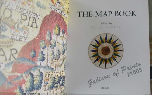
The Map Book
₱
3,300.00
Add to cart
Details
Previous
1
2
3
…
18
19
20
21
Shopping Cart
Philippine Islands. A Detailed Map. by Robinson H. E. C. Pty. Ltd. [cartouche:] Philippine Is. Mercators Projection [inset: Southeast-Asia, China, Japan, Marianas Is., Australia]
1
Филиппины [Philippines] 3 inset maps & 1 legend: 1) Экономическая Карта [Economic Map], 2) Карта народов [Peoples Map], 3) Климатическая Карта [Climate Map]
1
Indiae Orientalis insularumque adiacientium typus
1
Philippine Islands. Tablas Strait with Part of Sibuyan Sea. From the United States Government Charts of 1935.
1
1. D. Francisco Lopez Arteaga. 2. La vida en Las Islas Filipinas. - Una fonda en el Arrabal de Binondo.
1
Sketches in Manilla. 1. Cock-Fighting at Manilla; 2. Nipa Houses at Manilla; 3. Market women of Manilla; 4. The Rainy Season, Manilla
1
South Part of Samar
1
Compagnie Générale des Philippines pour de développement du Commerce et de l'Industrie Capital Social : 3,000,000 de francs Action Ordinaire No. 10304
1
Rivière Sagaliud, Golfe de Sandakan
1
A New Map of the Philippine Islands, Drawn from the best Authorities
1
Saraca Declinata. Mig. [English: Saracca]
1
Die Philippinischen Inselen auf dem Asiatischen Meer [inset text: short history of the Philippines incl. British Invasion]
1
Exposicion de Filipinas en el Parque de Madrid. 1. Pabellon Flotante para pasear por el lago. 2. Pabellon del Jurado. 3. Operacion de extraer la fibra ....... 4. Tiro de lanza y Ballesta por los Igorrotes. 5. Parque de los Ciervos.
1
Carte des Isles Philippines (1e feuille)
1
The Spanish Seaborne Empire
1
Anchorages of Luzon, Mindoro and Marinduque. insets: 1) Luzon - West Coast. Bolinao Harbour. From the United States Government Survey of 1904. With additions and corrections from Philippine Gov't. Charts to 1964. 2) Luzon - West Coast. Port Masinloc and Port Matalvi. From the United States Government Surveys of 1937. With additions and corrections from Philippine Gov't. Charts to 1964. 3) Luzon - West Coast. Mariveles Harbour. From the United States Government Chart of 1940. With additions and corrections from Philippine Gov't. Charts to 1964. 4) Luzon - South - West Coast. Batangas. From the Philippine Government Chart of 1956. With additions and corrections to 1964. 5) Luzon - South - West Coast. Nasugbu Bay. From the Philippine Government Chart of 1956. 6) Marinduque. Port Balanacan. From the United States Government Survey of 1908. With additions and corrections from Philippine Gov't. Charts to 1964. 7) Marinduque. Santa Cruz Harbour. From the United States Government Survey of 1908. With additions and corrections from Philippine Gov't. Charts to 1964. 8) Mindoro - North Coast. Port Galera and Varadero Bay. From the United States Government Surveys to 1939. With additions and corrections from Philippine Gov't. Charts to 1964.
1
Isla de Panay pl. 20 (Antique, Capiz, Iloilo, Guimaras ............with inset of Guimaras Strait)
1
Tabacum Latifolium ( Tobacco plant )
1
Early Mapping of Southeast Asia
1
Philippine Islands. Sibuyan Sea to San Bernardino Strait. From the United States Government Charts to 1934.
1
Rand McNally Popular Map of Philippine Islands. insets: 1) Philippine Islands and China Sea. 2) Batan and Babuyan Islands.
1
Le Barbu de l'Isle de Luçon. [Luzon Island Barbet] [Coppersmith Barbet] [Tuktuk/ Pukpuk] [Megalaima Haemacephala]
1
1) Chrysocolaptes lucidus erythrocephalus [Red-faced Golden Woodpecker (male type specimen)]. 2) Chrysocolaptes lucidus maculiceps [Basilan Crimson-backed Woodpecker (type specimen young female)]
1
Manila And Its Surroundings
1
[Philippineninsel Luzon. 'Vegetation in der Ebene des Flusses Passig.] [sic] '[Vegetation in the Pasig River Basin]
1
Ilustracion Filipina: Periodico Quincenal Ano I num. I - Ano II num.24
1
Birds 69. E. Ignitus. Fire-backed Pheasant 70. P. Amherstiae. Amhewsts Pheasant 71. P. Nycthemerus Silver Pheasant 72. P. Numida Meleagris. -Guinea Fowl
1
Asie Ancienne das Alte Asien [Ancient Asia]
1
Philippine Islands Mindanao I. - South East Coast Pujaga Bay
1
Irena Ellae, [male], [female]. [Philippine Fairy-blue Bird]
1
Cart
Checkout
Continue Shopping
30