Tel : +63(2)-7729-8168 | Mobile: +63 917 806 4291
|
Email: gallery@gop.com.ph
My Account
Remember Me
Register
17 Item(s)
-
₱
278,400.00
Cavite (Islas Filipinas). - Carretera Real de Nagsubú [sic] [Nasugbu]
1 x
₱
3,300.00
Yo vi la caida de Filipinas [I Saw The Fall of the Philippines]
1 x
₱
5,500.00
Sheet No. 5. Road Map from Sto. Tomas to S. Juan plotted during Advance of Gen. Young's Brigade of 1st Div. 8th A. C. Maj. Gen. H. W. Lawton U. S. V. Commanding. Prepared under direction of John C. Oakes. 1st Lieut Corps of Engineers Division Engineer.
1 x
₱
8,800.00
Environs of Manila
1 x
₱
11,000.00
Itinéraire de l'ascension de l'Apó;… {Itinerary of the Mount Apo Conquest]
1 x
₱
6,600.00
Mittheilungen aus Justus Perthes' Geographischer Anstalt. über wichtige neue Erforschungen auf dem Gesammtgebiete der Geographie von Dr. A. Petermann. - Ergänzungsband XI, 1876-1877 Inhalt: [Supplement Vol. 11 contents] No. 48. Czerny, die Wirkungen der Winde auf die Gestaltung der Erde. No. 49. Behm und Wagner, die Bevölkerung der Erde, IV. No. 50. Zöppritz, Pruyssenaere's Resien im Nilgebiete, 1. Hälfe. No. 51. Zöppritz, Pruyssenaere's Resien im Nilgebiete, 2. Hälfe. No. 52. Forsyth, Ost-Turkestan und das Pamir-Plateau.
1 x
₱
6,000.00
Flamants.
1 x
₱
5,500.00
[Bàye la baye.] (Gulf of Albay]
1 x
₱
26,400.00
1. Vue de la partie ….. l'atoll Suadiva…..[Maldives]. 2. Vue des ruines de fort St. David …..[Coromandel]. 3. Vue de la partie ….. Ile Nicobar….. [Malacca]. 4. Vue de pulo Jamar…..Iles Aru …..[Malacca]. 5. Vues du Mont Parcelar….. [Malay]. 6. Vues du Mont Parcelar et des terres….. [Malay]. 7. Vues du Mont Parcelar …..Callam….. [Malay]. 8. Vue de la Ville de Malacca et des terres…..[Malay]. 9. Vue de l'Arsenal et du Mouillage de Cavite dans la Baie de Manille (Ile Luçon, Philippines.)………. [View of Cavite Arsenal and Anchorage in Manila Bay (Luzon Island)] Entrée de l'Arsenal [Arsenal Entry] Télégraphe Partie du Mouillage où se tiennent les bâtimens marchands. [Part of the Anchorage where the merchant ships are located] Pointe Sangloy [Sangley Point] 10. Vue de la Ville de Manille (Ile Luçon, Philippines.) [View of Manila City (Luzon Island...)] Entrée de la Rivière [River Entrance] Phare [Lighthouse] Faubourg de Binondo [Binondo Suburb] Ville de Manille [Manila City] Cathédrale et Gouvernement
1 x
₱
30,400.00
Eastern Passages to China Sheet III. inset: Plan of Manilla Bay, surveyed in 1792 by Don Felipe Bauza. [Eastern Philippines]
1 x
₱
99,000.00
1) La Escolta, principale rue de la ville marchande. 2) Le fleuve Pasig. 3) Une Espagnole de Manille. 4) Un marchè aux environs de Manille.
1 x
₱
7,700.00
Mindanao - Philippine Islands
1 x
₱
17,600.00
Japan Makes Stand on Leyte
1 x
₱
11,000.00
Philippine Islands. Anchorages in Northern Luzon and the Babuyan Islands. Insets: 1) Babuyan Is. - Fuga I. Musa Bay. From the United States Government Chart to 1931. 2) Babuyan Is. - Camiguin I. Port San Pio Quinto. From the United States Government Chart to 1931. 3) Luzon-North-East Coast Port San Vicente. From the United States Government Chart to 1938. 4) Luzon - East Coast Mauban Anchorage. From the Philippine Government Chart of 1957. 5) Luzon - West Coast. Salomague Harbour and Lapog Bay. From the United States Government Chart of 1934. 6) Luzon - West Coast Port Currimao and Gan Bay. From the United States Government Chart of 1934. 7) Luzon - West Coast Solvec Cove. From the United States Government Chart of 1934. 8) Luzon - West Coast Lingayen Gulf. Port Sual with Cabalitian Bay. From the United States Government Chart of 1922. 9) Luzon - West Coast San Fernando Harbour. From the United States Government Chart of 1936.
1 x
₱
11,000.00
Manila (Islas Filipinas). - Una calle de Caloocán.
1 x
₱
3,300.00
Port of Manila, Trade Center of the Pacific Year Book 1936
1 x
₱
8,800.00
Location of Troops in the Philippine Islands March 31, 1900.
1 x
₱
16,500.00
View Cart
Checkout
Home
About Us
Publications
Shop Online
Framing Services
Exhibits
Picture Hanging System
Contact Us
Blogs
View cart
“Location of Troops in the Philippine Islands March 31, 1900.” has been added to your cart.
Sort by
Date
Sort by
Default Order
Sort by
Name
Sort by
Price
Sort by
Date
Sort by
Popularity
Show
30 Products
Show
30 Products
Show
60 Products
Show
90 Products
Class VII Umbrellate, Class VIII Caryophyllous, Class IX Lil...
₱
4,400.00
Add to cart
Details
Orders: 1. Siliculosa; 2. Siliquosa; 3. Polygamia Æqualis; ...
₱
5,500.00
Add to cart
Details
Elaeocarpus Dentatus, Vahl.
₱
5,500.00
Add to cart
Details
The Luneta, Manila
₱
3,300.00
Add to cart
Details
Itinéraire de l’ascension de l’Apó;… {Itiner...
₱
6,600.00
Add to cart
Details
1. Igorot Spinster House in the Mountain Province of Bontoc;...
₱
4,400.00
Add to cart
Details
The Revolt in the Philippine Islands. 1. Philippine Aborigin...
₱
5,500.00
Add to cart
Details
The Spanish – American War. 1. The Governor’s Pa...
₱
3,300.00
Add to cart
Details
The Spanish – American War In the Spanish Trenches at ...
₱
4,400.00
Add to cart
Details
Voyage aux Philippines et en Malaisie
₱
6,600.00
Add to cart
Details
Location of Troops in the Philippine Islands March 31, 1900....
₱
16,500.00
Add to cart
Details
The Philippine Islands (Around the World Program)
₱
4,400.00
Add to cart
Details
Sketch of General Progress – Philippine Islands pl. 2...
₱
5,500.00
Add to cart
Details
Iloílo Straits – From a survey, 1900-1901
₱
7,700.00
Add to cart
Details
The Bontoc Igorot. The Ethnological Survey Publications vol....
₱
14,700.00
Add to cart
Details
East India Archipelago [Eastern Passages to China and Japan]...
₱
36,000.00
Add to cart
Details
East India Archipelago [Eastern Passages to China and Japan]...
₱
39,600.00
Add to cart
Details
Map of the United States showing the Territorial Expansion o...
₱
33,100.00
Add to cart
Details
The Fleet that did not go to the Philippines Admiral Camara&...
₱
11,000.00
Add to cart
Details
El Indicador del Viajero en las Islas Filipinas
₱
77,000.00
Add to cart
Details
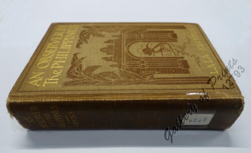
An Observer in the Philippines or Life in Our New Possession...
₱
8,800.00
Add to cart
Details
Die Ostindischen Inseln nach den neuesten Berichtigungen dar...
₱
18,700.00
Add to cart
Details
Isles Philippines a Paris chez le Rouge
₱
22,000.00
Add to cart
Details
A Triumphal Parade of Insurgent Troops in Manila
₱
14,700.00
Add to cart
Details
MADRID. – Exposicion de Filipinas: Exterior de los edi...
₱
8,800.00
Add to cart
Details
Census of the Philippine Islands: 1903. Vol. 1 – Geogr...
₱
50,600.00
Add to cart
Details
Previous
1
2
3
…
13
14
15
16
17
18
19
…
61
62
63
Next
Shopping Cart
Location of Troops in the Philippine Islands March 31, 1900.
1
Port of Manila, Trade Center of the Pacific Year Book 1936
1
Manila (Islas Filipinas). - Una calle de Caloocán.
1
Philippine Islands. Anchorages in Northern Luzon and the Babuyan Islands. Insets: 1) Babuyan Is. - Fuga I. Musa Bay. From the United States Government Chart to 1931. 2) Babuyan Is. - Camiguin I. Port San Pio Quinto. From the United States Government Chart to 1931. 3) Luzon-North-East Coast Port San Vicente. From the United States Government Chart to 1938. 4) Luzon - East Coast Mauban Anchorage. From the Philippine Government Chart of 1957. 5) Luzon - West Coast. Salomague Harbour and Lapog Bay. From the United States Government Chart of 1934. 6) Luzon - West Coast Port Currimao and Gan Bay. From the United States Government Chart of 1934. 7) Luzon - West Coast Solvec Cove. From the United States Government Chart of 1934. 8) Luzon - West Coast Lingayen Gulf. Port Sual with Cabalitian Bay. From the United States Government Chart of 1922. 9) Luzon - West Coast San Fernando Harbour. From the United States Government Chart of 1936.
1
Japan Makes Stand on Leyte
1
Mindanao - Philippine Islands
1
1) La Escolta, principale rue de la ville marchande. 2) Le fleuve Pasig. 3) Une Espagnole de Manille. 4) Un marchè aux environs de Manille.
1
Eastern Passages to China Sheet III. inset: Plan of Manilla Bay, surveyed in 1792 by Don Felipe Bauza. [Eastern Philippines]
1
1. Vue de la partie ….. l'atoll Suadiva…..[Maldives]. 2. Vue des ruines de fort St. David …..[Coromandel]. 3. Vue de la partie ….. Ile Nicobar….. [Malacca]. 4. Vue de pulo Jamar…..Iles Aru …..[Malacca]. 5. Vues du Mont Parcelar….. [Malay]. 6. Vues du Mont Parcelar et des terres….. [Malay]. 7. Vues du Mont Parcelar …..Callam….. [Malay]. 8. Vue de la Ville de Malacca et des terres…..[Malay]. 9. Vue de l'Arsenal et du Mouillage de Cavite dans la Baie de Manille (Ile Luçon, Philippines.)………. [View of Cavite Arsenal and Anchorage in Manila Bay (Luzon Island)] Entrée de l'Arsenal [Arsenal Entry] Télégraphe Partie du Mouillage où se tiennent les bâtimens marchands. [Part of the Anchorage where the merchant ships are located] Pointe Sangloy [Sangley Point] 10. Vue de la Ville de Manille (Ile Luçon, Philippines.) [View of Manila City (Luzon Island...)] Entrée de la Rivière [River Entrance] Phare [Lighthouse] Faubourg de Binondo [Binondo Suburb] Ville de Manille [Manila City] Cathédrale et Gouvernement
1
[Bàye la baye.] (Gulf of Albay]
1
Flamants.
1
Mittheilungen aus Justus Perthes' Geographischer Anstalt. über wichtige neue Erforschungen auf dem Gesammtgebiete der Geographie von Dr. A. Petermann. - Ergänzungsband XI, 1876-1877 Inhalt: [Supplement Vol. 11 contents] No. 48. Czerny, die Wirkungen der Winde auf die Gestaltung der Erde. No. 49. Behm und Wagner, die Bevölkerung der Erde, IV. No. 50. Zöppritz, Pruyssenaere's Resien im Nilgebiete, 1. Hälfe. No. 51. Zöppritz, Pruyssenaere's Resien im Nilgebiete, 2. Hälfe. No. 52. Forsyth, Ost-Turkestan und das Pamir-Plateau.
1
Itinéraire de l'ascension de l'Apó;… {Itinerary of the Mount Apo Conquest]
1
Environs of Manila
1
Sheet No. 5. Road Map from Sto. Tomas to S. Juan plotted during Advance of Gen. Young's Brigade of 1st Div. 8th A. C. Maj. Gen. H. W. Lawton U. S. V. Commanding. Prepared under direction of John C. Oakes. 1st Lieut Corps of Engineers Division Engineer.
1
Yo vi la caida de Filipinas [I Saw The Fall of the Philippines]
1
Cavite (Islas Filipinas). - Carretera Real de Nagsubú [sic] [Nasugbu]
1
Cart
Checkout
Continue Shopping
17