")
")
Author: Noguera, Juan / Coello, Francisco / Desbuissons / Bacot
Publisher: D. Francisco Coello, Madrid.
Year: 1849
Size: 76 x 104.4 cm
Reference: Quirino, pp. 64, 110-111; Palau 56186; Phillips (Atlases) 3137; Phillips (Phil. Is.) 184, 186, 191.
₱61,600.00
In Stock
In Stock
pale original outline-colour engraving.
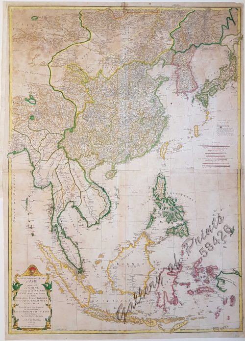
“Single Sheet: Islas Filipinas. Primera Hoja Central (1849) – [Luzon and Mindoro, with 11 insets]
Francisco Coello de Portugal y Quesada (1822-1898), was one of the most important 19th C. Spanish cartographers. With geographer Antonio Morata, he created this most important and first accurate, modern, and complete topographical 19th C. map of the Philippines, based on scientific surveys by Bauzá and others from 1792 onwards. – A must in any serious Philippine map collection.
The work is part of Coello’s unfinished mapping project, the ‘Atlas de España y sus posesiones de Ultramar’ as part of the ‘Diccionario geográfico-estadístico-histórico’, published in Madrid.
Coello’s work was the basis for many other maps by several cartographers and voyagers and was extensively used by all protagonists during the Spanish-American War (1898) and the Philippine-American War (1899-1902).
folded into pocket size, with hard bound printed cover, toning on some folds, otherwise very good condition. SCARCE uncut edition.