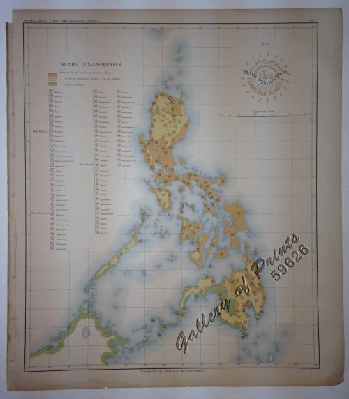
Author: Algue, Jose
Publisher: US Coast and Geodetic Survey / Gov't. Printing Office, Washington.
Year: 1900 [1899]
Size: 34.7 x 29.6 cm
Reference: Quirino p. 132 / 65 / 66; Phillips # 3325
₱6,600.00
In Stock
In Stock
original-colour lithograph.
Map from ‘Atlas de Filipinas’; done in 1899. Considered as the most complete and accurate survey of the archipelago made at that time. Father Algue was the director of the Manila Observatory then. The technical work on the atlas was executed wholly by Filipino draftsmen (acknowledged in the introduction), and prepared at the Jesuit Observatory. IT IS THE FIRST EXTENSIVE AND ACCURATE ATLAS OF THE PHILIPPINES.
professionally repaired tear on lower left into image.