Description
outline hand-coloured copper engraving. Map from ‘Atlas General’. Engraved map on 2 sheets, showing country boundaries, relief shown pictorially, includes geographic notes and ornamental cartouche.
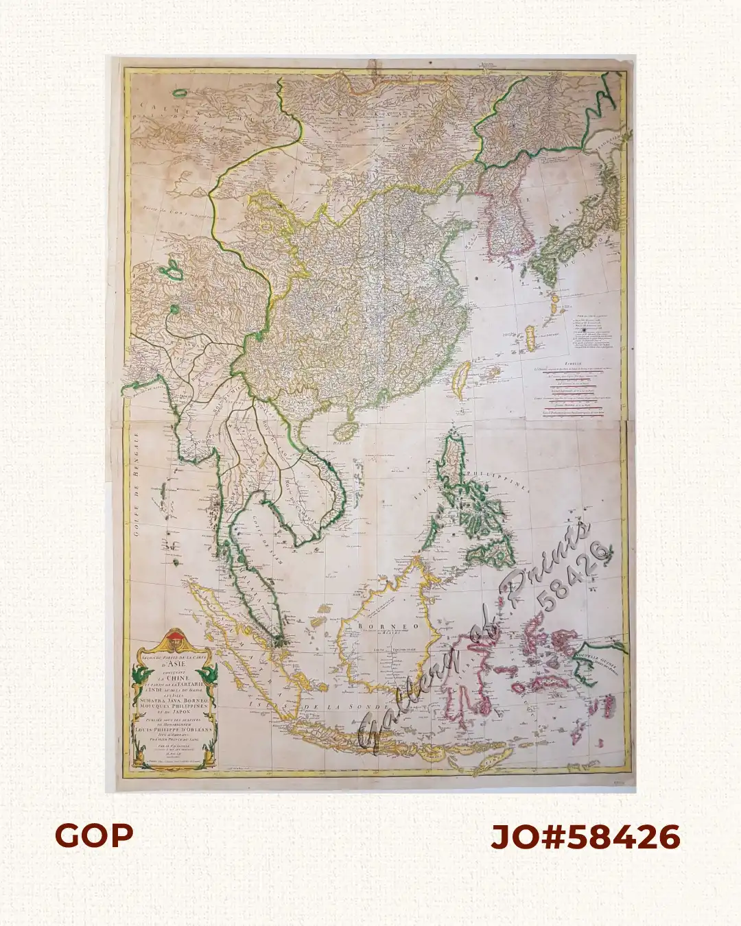
Author: Anville, Jean Baptiste / Bourguignon d' / Delahaye, Guillaume [engr.]
Publisher: J.B.B. D'Anville in Paris.
Year: 1752
Size: 95.5 x 68.5 cm
Reference: Phillips 572
outline hand-coloured copper engraving. Map from ‘Atlas General’. Engraved map on 2 sheets, showing country boundaries, relief shown pictorially, includes geographic notes and ornamental cartouche.
with folds as issued, paper toning, paper a bit wavy, cleaned, ballpen writings on verso, not shining through, paper creases, old professional repair on top centerfold, with stain minimally into plate.