Carte d’ Espagne et des principaux etats appartments a Cette Monarchie dans les Parties du Monde. 1. Isles Philipines. 2. Duche de Millan. 3. Royaume de Naples. 4. Royaume de Sicille. 5. Isles Antilles. 6. Nouveau Mexique. 7. Nouvelle Espagne. 8. Terre Ferme. 9. Le Perou. 10. Chili. 11. Rio de Plata ou Paraguay. 12. Pais Bas Catolique. 13. Isles de Sardaigne. 14. Isles Canaries ou Isles Fortunees. 15. Espagne.

39,600.00

In Stock

In Stock

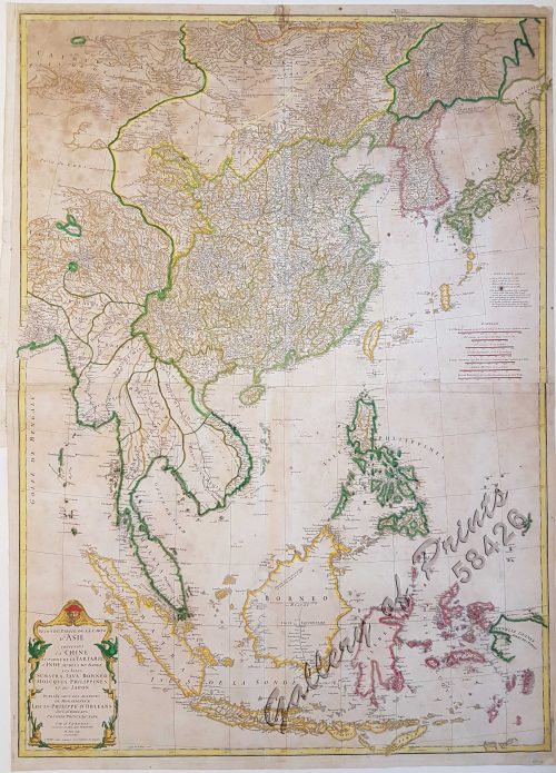
Author: Chatelain, Henri Abraham

Publisher: published in Amsterdam [second state].

Year: c1713

Size: 33 x 43.8 cm

Reference: not in Quirino; Koeman Cha1
SKU: 57660 Category: Tags: ,

Description

hand-coloured copper engraving.

Map from the ‘Atlas historique….’, plate no. 34, originally 1, then extended to 7 vols. The colonial power SPAIN with the large central map surrounded with small depictions of all colonies.

Condition

Very good to excellent condition.

Shopping Cart
There are no products in the cart!
Continue Shopping
0