Tel : +63(2)-7729-8168 | Mobile: +63 917 806 4291
|
Email: gallery@gop.com.ph
My Account
Remember Me
Register
16 Item(s)
-
₱
485,840.00
Spathiphyllopsis Minahassae. T. et B. [Spathiphyllum]
1 x
₱
26,400.00
The Murillo Bulletin, Journal of PHIMCOS, Issue No.4
1 x
₱
540.00
Islas Filipinas. Division territorial moderna 1879. por Manuel Scheidnagel.
1 x
₱
88,000.00
Plano de Manila y Arrabales [Map of Manila and Suburbs]
1 x
₱
55,900.00
Les Isles Philippines et celles des Larrons…
1 x
₱
39,600.00
Plan des principaux ports de la côte d'Illocos … [Map of the Principal Ports of the Ilocos Coast]
1 x
₱
11,000.00
Archipiélago Filipino - Isla de Mindanao Plano del Puerto de Pollok
1 x
₱
4,400.00
Map Showing Operations January 4, February 8, 1900 by the First Division, Eighth Corps, Major General J. C. Bates, Commanding.
1 x
₱
13,200.00
Campaña de Filipinas
1 x
₱
50,600.00
Filipinas. - El General Lawton y su séquito en un descanso.
1 x
₱
5,500.00
Map of the North Atlantic Ocean showing European Colonial Possessions under their National Flags. 1898. Mercator's Projection
1 x
₱
6,600.00
India Tercera Nuova Tavola
1 x
₱
39,600.00
Vertooning van de kust vant Eyland Luconia digt by Manila.' & 't Eyland Pulo Condore op 8 mylen van t land'. [Relief of the coast of Luconia Island nearby Manila & Map of Pulo Condore Island 8 miles away from the coast]
1 x
₱
15,700.00
Mapping the World: Maps and Their History
1 x
₱
5,500.00
Plan of the Bay of Manilla in the Isle of Luconia, the Principal of the Philippine Islands, Surveyed by Señor Alexandro Malaspina and Communicated By Captn. G.G. Richardson.
1 x
₱
120,000.00
Two Ethnographic Collectors in the Late Spanish Philippines: Alexander Schadenberg & P.K.A. Meerkamp van Embden
1 x
₱
3,300.00
View Cart
Checkout
Home
About Us
Publications
Shop Online
Framing Services
Exhibits
Picture Hanging System
Contact Us
Blogs
Sort by
Date
Sort by
Default Order
Sort by
Name
Sort by
Price
Sort by
Date
Sort by
Popularity
Show
30 Products
Show
30 Products
Show
60 Products
Show
90 Products
La Chine (China)
₱
13,200.00
Add to cart
Details
East India Archipelago [Western route to China. Chart No. 4...
₱
49,500.00
Add to cart
Details
Census of the Philippine Islands: 1903. Vol. 1 – Geogr...
₱
50,600.00
Add to cart
Details
Die Ostindischen Inseln nach den neuesten Berichtigungen dar...
₱
18,700.00
Add to cart
Details
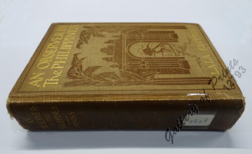
An Observer in the Philippines or Life in Our New Possession...
₱
8,800.00
Add to cart
Details
Shopping Cart
Two Ethnographic Collectors in the Late Spanish Philippines: Alexander Schadenberg & P.K.A. Meerkamp van Embden
1
Plan of the Bay of Manilla in the Isle of Luconia, the Principal of the Philippine Islands, Surveyed by Señor Alexandro Malaspina and Communicated By Captn. G.G. Richardson.
1
Mapping the World: Maps and Their History
1
Vertooning van de kust vant Eyland Luconia digt by Manila.' & 't Eyland Pulo Condore op 8 mylen van t land'. [Relief of the coast of Luconia Island nearby Manila & Map of Pulo Condore Island 8 miles away from the coast]
1
India Tercera Nuova Tavola
1
Map of the North Atlantic Ocean showing European Colonial Possessions under their National Flags. 1898. Mercator's Projection
1
Filipinas. - El General Lawton y su séquito en un descanso.
1
Campaña de Filipinas
1
Map Showing Operations January 4, February 8, 1900 by the First Division, Eighth Corps, Major General J. C. Bates, Commanding.
1
Archipiélago Filipino - Isla de Mindanao Plano del Puerto de Pollok
1
Plan des principaux ports de la côte d'Illocos … [Map of the Principal Ports of the Ilocos Coast]
1
Les Isles Philippines et celles des Larrons…
1
Plano de Manila y Arrabales [Map of Manila and Suburbs]
1
Islas Filipinas. Division territorial moderna 1879. por Manuel Scheidnagel.
1
The Murillo Bulletin, Journal of PHIMCOS, Issue No.4
-
Quantity
+
Spathiphyllopsis Minahassae. T. et B. [Spathiphyllum]
1
Cart
Checkout
Continue Shopping
16