Tel : +63(2)-7729-8168 | Mobile: +63 917 806 4291
|
Email: gallery@gop.com.ph
My Account
Remember Me
Register
34 Item(s)
-
₱
1,413,700.00
1. Quartier Chinois a Manille - Cuartel Chino en Manila. [Chinese Quarters in Manila]. 2. Combat de Coqs - Combate de Gallos [Cockfights].
1 x
₱
4,400.00
Italy Invades. How Italians Conquered the World.
1 x
₱
2,200.00
[Luzon & Visayas]]
1 x
₱
145,000.00
Juglans Nigra. Schwarze Wallnuss. [Black Walnut]
1 x
₱
13,200.00
La comune accoutre ala polonoise. Ung Capitaine de Iapan [Clothes of a Japanese nobleman and ordinary Japanese men dressed like Polish] A. gentleman with bow and arrow and heavy dress. B. others armed with muskets.]
1 x
₱
50,600.00
Cadavres des juramentados réunis après l'attaque
1 x
₱
6,600.00
Karte von den Philippinischen Celebes und Molukkischen Eylanden
1 x
₱
26,400.00
Carte des Nouvelles Philippines - Kaart der Nieuwe Philippynsche Eylanden. [Map of the New Philippines]
1 x
₱
11,000.00
1) A Dangerous Shoal… 2) Joseph Freewills Island. 3) The South End of Mindanao.
1 x
₱
13,500.00
Isla de Luzon
1 x
₱
26,400.00
Map Showing Operations in the Provinces of North and South Camarines Luzon. P.I. under the direction of Maj. Gen. Bates. (Bell's Exfeditionary Brigade) Feb'y and Mar. 1900. inset: [Albay]
1 x
₱
7,700.00
[Carte Reduite] Carte Réduite des Isles Philippines Pour Servir Aux Vaisseaux du Roy Dressée au Dépost des Cartes Plans et Journaux de la Marine
1 x
₱
425,000.00
India Orientalis
1 x
₱
39,600.00
Einfahrt in den Pasig-Fluss in Manila [Mouth of the Pasig River]
1 x
₱
11,000.00
1) Carte des Isles Philippines (1e feuille); 2) Carte des Isles Philippines (2e feuille)
1 x
₱
32,800.00
Plan of the Port of Subec, in the Isle of Luconia
1 x
₱
56,400.00
AAF Aeronautical Chart No. 620, Babuyan Islands Scale 1:1,000,000
1 x
₱
11,000.00
Plano de la Bahia de Manila y puerto de Subig con sus contornos
1 x
₱
39,600.00
Plano de La Ciudad de Francfort del Mein
1 x
₱
3,300.00
Bacolod Fort
1 x
₱
3,300.00
Die Länder Asie nach ihrer gelegenheit… [The Countries of Asia as Situated till….]
1 x
₱
88,000.00
East India Archipelago [Eastern Passages to China and Japan][Chart No.6] London, Published by James Imray and Son, 89 & 102 Minories, 1872
1 x
₱
110,000.00
Nieuwe Kaart van't Keizerryk Japan na de Nieuste ontdekkingen uitgegeven te Amsterdam door Isaak Tirion. [New Map of the Empire of Japan after the New Discoveries published in Amsterdam by Isaak Tirion.]
1 x
₱
13,200.00
Eastern Passages to China Sheet III. inset: Plan of Manilla Bay, surveyed in 1792 by Don Felipe Bauza. [Eastern Philippines]
1 x
₱
99,000.00
Spanish Operations in 1896-97. [showing Manila, Cavite and Batangas]
1 x
₱
11,000.00
Philippine Islands insets: 1) Manila to Dagupan 2) Manila 3) Philippine Islands and the China Sea 4) Batanes (Bashee) and Babuyanes Is. 5) Sulu Archipelago
1 x
₱
17,200.00
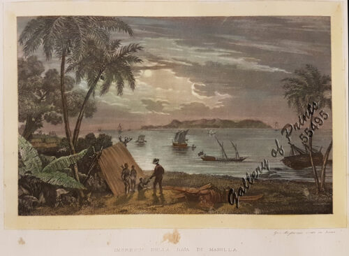
Ingresso della baja de Manilla [Entrance of Manila Bay ]
1 x
₱
8,800.00
1) Sooloo Riding; 2) Sooloo Arms
1 x
₱
4,400.00
East Indies
1 x
₱
13,200.00
Le Combat Naval Devant Manille … 1. L' <>, croiseur espagnol; 2. Le <>, croiseur espagnol.
1 x
₱
5,500.00
Iloílo Straits - From a survey, 1900-1901
1 x
₱
7,700.00
Asiae Recentissima Delineatio, Qua Status ex Imperia Totius Orientis
1 x
₱
39,600.00
Philippine Islands Siargao and Bukas Islands Dapâ Channel and Port Sibonga From a Spanish survey in 1863
1 x
₱
5,500.00
1) Carta dell'Isole Filippine [1st sheet]. 2) Carta dell'Isole Filippine di Mr. Bellin Ingegnere della Marine Foglio 1 mo [2nd sheet]
1 x
₱
61,600.00
View Cart
Checkout
Home
About Us
Publications
Shop Online
Framing Services
Exhibits
Picture Hanging System
Contact Us
Blogs
View cart
“1) Carta dell’Isole Filippine [1st sheet]. 2) Carta dell’Isole Filippine di Mr. Bellin Ingegnere della Marine Foglio 1 mo [2nd sheet]” has been added to your cart.
Sort by
Default Order
Sort by
Default Order
Sort by
Name
Sort by
Price
Sort by
Date
Sort by
Popularity
Show
30 Products
Show
30 Products
Show
60 Products
Show
90 Products
Southern Philippine Islands
₱
13,200.00
Add to cart
Details
F.v. Richthofen’s Reisen in China Sept. 1868 – 3...
₱
6,600.00
Add to cart
Details
Océanie
₱
5,500.00
Add to cart
Details
India Orientalis (Parte Seconda Libro V, p. 205)
₱
39,600.00
Add to cart
Details
Oostindië
₱
7,700.00
Add to cart
Details
City of Manila. Prepared under the direction of the Chief En...
₱
41,600.00
Add to cart
Details
A Chart of the China Sea, and Philippine Islands, with the A...
₱
780,000.00
Add to cart
Details
Isole dell’ India cioè le Molucche le Filippine e dal...
₱
110,000.00
Add to cart
Details
The Philippine Islands and others of the East Indies
₱
27,280.00
Add to cart
Details
Plan de Manila, su bahia y puerto de Cavite
₱
220,000.00
Add to cart
Details
Expedition and Engagement of Pinauran November !22!1900
₱
5,500.00
Add to cart
Details
Action between 28″ Inf. U.S.V. and Filipino Rebels Jul...
₱
5,500.00
Add to cart
Details
Sketch of Navitac and Vicinity
₱
4,400.00
Add to cart
Details
Carta Universal de Ptolomeo
₱
5,500.00
Add to cart
Details
Mapa de la Republica de Filipinas. inset: Parte Central de l...
₱
4,400.00
Add to cart
Details
A Chart of the Channel in the Phillippine Islands through wh...
₱
44,000.00
Add to cart
Details
China
₱
33,900.00
Add to cart
Details
Rio Grande of Mindanao
₱
11,000.00
Add to cart
Details
Ostindische Inseln (Spezialkarten)
₱
8,800.00
Add to cart
Details
Harbors South Side of Busuanga Island
₱
5,500.00
Add to cart
Details
Indie Orientali … – Indie III. Foglio
₱
17,600.00
Add to cart
Details
Isole Molucche
₱
33,000.00
Add to cart
Details
India Orientalis
₱
39,600.00
Add to cart
Details
Philippine Islands. insets: 1) Manila to Dagupan; 2) Manila;...
₱
13,200.00
Add to cart
Details
Insulae Philippinae
₱
135,000.00
Add to cart
Details
General Map of the East Indies inset: Philippine Islands
₱
18,700.00
Add to cart
Details
Map of Northern Luzon Showing a portion of the field of oper...
₱
46,100.00
Add to cart
Details
Opulentissimum Sinarum Imperium juxta Recentissimam Delinea...
₱
61,600.00
Add to cart
Details
A Chart of the Coast of China from Cambodia to Nanquam with ...
₱
155,000.00
Add to cart
Details
A Chart of the Pacific Ocean from the Equinoctial to the Lat...
₱
15,400.00
Add to cart
Details
Previous
1
2
3
…
6
7
8
9
10
11
12
…
19
20
21
Next
Shopping Cart
1) Carta dell'Isole Filippine [1st sheet]. 2) Carta dell'Isole Filippine di Mr. Bellin Ingegnere della Marine Foglio 1 mo [2nd sheet]
1
Philippine Islands Siargao and Bukas Islands Dapâ Channel and Port Sibonga From a Spanish survey in 1863
1
Asiae Recentissima Delineatio, Qua Status ex Imperia Totius Orientis
1
Iloílo Straits - From a survey, 1900-1901
1
Le Combat Naval Devant Manille … 1. L' <>, croiseur espagnol; 2. Le <>, croiseur espagnol.
1
East Indies
1
1) Sooloo Riding; 2) Sooloo Arms
1
Ingresso della baja de Manilla [Entrance of Manila Bay ]
1
Philippine Islands insets: 1) Manila to Dagupan 2) Manila 3) Philippine Islands and the China Sea 4) Batanes (Bashee) and Babuyanes Is. 5) Sulu Archipelago
1
Spanish Operations in 1896-97. [showing Manila, Cavite and Batangas]
1
Eastern Passages to China Sheet III. inset: Plan of Manilla Bay, surveyed in 1792 by Don Felipe Bauza. [Eastern Philippines]
1
Nieuwe Kaart van't Keizerryk Japan na de Nieuste ontdekkingen uitgegeven te Amsterdam door Isaak Tirion. [New Map of the Empire of Japan after the New Discoveries published in Amsterdam by Isaak Tirion.]
1
East India Archipelago [Eastern Passages to China and Japan][Chart No.6] London, Published by James Imray and Son, 89 & 102 Minories, 1872
1
Die Länder Asie nach ihrer gelegenheit… [The Countries of Asia as Situated till….]
1
Bacolod Fort
1
Plano de La Ciudad de Francfort del Mein
1
Plano de la Bahia de Manila y puerto de Subig con sus contornos
1
AAF Aeronautical Chart No. 620, Babuyan Islands Scale 1:1,000,000
1
Plan of the Port of Subec, in the Isle of Luconia
1
1) Carte des Isles Philippines (1e feuille); 2) Carte des Isles Philippines (2e feuille)
1
Einfahrt in den Pasig-Fluss in Manila [Mouth of the Pasig River]
1
India Orientalis
1
[Carte Reduite] Carte Réduite des Isles Philippines Pour Servir Aux Vaisseaux du Roy Dressée au Dépost des Cartes Plans et Journaux de la Marine
1
Map Showing Operations in the Provinces of North and South Camarines Luzon. P.I. under the direction of Maj. Gen. Bates. (Bell's Exfeditionary Brigade) Feb'y and Mar. 1900. inset: [Albay]
1
Isla de Luzon
1
1) A Dangerous Shoal… 2) Joseph Freewills Island. 3) The South End of Mindanao.
1
Carte des Nouvelles Philippines - Kaart der Nieuwe Philippynsche Eylanden. [Map of the New Philippines]
1
Karte von den Philippinischen Celebes und Molukkischen Eylanden
1
Cadavres des juramentados réunis après l'attaque
1
La comune accoutre ala polonoise. Ung Capitaine de Iapan [Clothes of a Japanese nobleman and ordinary Japanese men dressed like Polish] A. gentleman with bow and arrow and heavy dress. B. others armed with muskets.]
1
Juglans Nigra. Schwarze Wallnuss. [Black Walnut]
1
[Luzon & Visayas]]
1
Italy Invades. How Italians Conquered the World.
1
1. Quartier Chinois a Manille - Cuartel Chino en Manila. [Chinese Quarters in Manila]. 2. Combat de Coqs - Combate de Gallos [Cockfights].
1
Cart
Checkout
Continue Shopping
34