Tel : +63(2)-7729-8168 | Mobile: +63 917 806 4291
|
Email: gallery@gop.com.ph
My Account
Remember Me
Register
23 Item(s)
-
₱
515,800.00
Chart of the Coasts of America & Asia from California to Macao
1 x
₱
9,900.00
[Rear Page #254 with many great advertisements including The Improved Boston Garter and "Six Trains Daily for Chicago - New York Central" [at the bottom]
1 x
₱
4,400.00
the Whisper & the Vision The Voyages of the Astronomers
1 x
₱
4,400.00
Philippine Life in Town & Country.
1 x
₱
8,800.00
Soirée d'une famille tagale
1 x
₱
8,800.00
Western Hemisphere
1 x
₱
2,200.00
Maps & Civilization: Cartography in Culture and Society.
1 x
₱
2,200.00
Harpactes Whiteheadi [Whitehead's Trogon]
1 x
₱
13,200.00
Vue générale de la ville de Manille, ravagée par un tremblement de terre. [General View of Manila City after the Earthquake]
1 x
₱
8,800.00
Indes Néerlandaises - Iles Philippines - Rapport. Présenté par M. René Brezet, Planteur, Délégué de la Chambre d'Agriculture de la Cochinchine, Chargé de Mission.1922
1 x
₱
39,600.00
Girl of the Isle of Luzon
1 x
₱
7,700.00
El indio viejo [The Old Indio]
1 x
₱
49,500.00
Indiens Tagales pilant du riz [Tagalog Natives Pounding Rice]
1 x
₱
110,000.00
The Escolta, The Principal Thoroughfare of Manila.
1 x
₱
4,400.00
The Chatelain Atlas
1 x
₱
500.00
Philippine Islands - Mindanao. Davao Gulf. From the Philippine Government Charts to 1956. With additions and corrections to 1962. insets: 1) Talomo Bay. From U.S Government Chart of 1933. With additions and corrections to 1962. 2) Lais. From U.S Government Chart of 1933. With additions and corrections to 1962. 3) Malita. From U.S Government Chart of 1933. With additions and corrections to 1962. 4) Port of Davao. From the Philippine Government Chart of 1956. With additions and corrections to 1962. 5) Pakiputan Strait. From U.S Government Chart of 1933. With additions and corrections to 1962.
1 x
₱
11,000.00
Map of Northern Luzon Prepared under the direction of Brigadier General S.B.M. Young. U.S.A. Commanding Provisional Cavalry Brigade, Fall Campaign of 1899.
1 x
₱
88,000.00
Manila Harbor Complimentary Map of the City of Manila.
1 x
₱
20,100.00
The Harbour, Manila.
1 x
₱
6,600.00
Sketches in Manilla. 1. Chinese Musical Party in Manilla; 2. Billiard-Room in Manilla
1 x
₱
11,000.00
1) Carta dell'Isole Filippine [1st sheet]. 2) Carta dell'Isole Filippine di Mr. Bellin Ingegnere della Marine Foglio 1 mo [2nd sheet]
1 x
₱
61,600.00
El Periodismo Filipino, 1811-1910 The First Century of Philippine Journalism Volume III Aparato Bibliografico de la Historia General de Filipinas
1 x
₱
3,500.00
Islas Filipinas
1 x
₱
39,600.00
View Cart
Checkout
Home
About Us
Publications
Shop Online
Framing Services
Exhibits
Picture Hanging System
Contact Us
Blogs
View cart
“Islas Filipinas” has been added to your cart.
Sort by
Name
Sort by
Default Order
Sort by
Name
Sort by
Price
Sort by
Date
Sort by
Popularity
Show
30 Products
Show
30 Products
Show
60 Products
Show
90 Products
VII. Provintiae seu Belgiu Foederatum exhibita Iohan Michael...
₱
3,300.00
Add to cart
Details
Village mandaya (centre Mindanao)
₱
9,900.00
Add to cart
Details
Village of San Juento. Manila
₱
6,900.00
Add to cart
Details
Ville de Manille / De Stad Manilha
₱
26,400.00
Add to cart
Details
Vingboons-Atlas
₱
49,500.00
Add to cart
Details
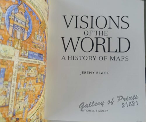
Visions of the World A History of Maps
₱
3,300.00
Add to cart
Details
Vista general del pueblo y rada de parang en la costa s. o d...
₱
26,400.00
Add to cart
Details
Vögel VII… [Voegel] 1) L’Oiseau de Paradis (Pa...
₱
13,200.00
Add to cart
Details
Volcan Bulusan desde el S. S. O.
₱
4,400.00
Add to cart
Details
Volcanic Eruption in the Island of Camiguin, Philippines.
₱
6,600.00
Add to cart
Details
Vom amerikanisch=spanischen Kriegsschauplatz (American-Span...
₱
9,900.00
Add to cart
Details
Vom amerikanisch=spanischen Kriegsschauplatz [American-Span...
₱
9,900.00
Add to cart
Details
Vom amerikanisch=spanischen Kriegsschauplatz – Befesti...
₱
5,500.00
Add to cart
Details
Von den Philippinen: Ansichten von Ilo-Ilo & den Inseln ...
₱
8,800.00
Add to cart
Details
Von den Philippinen: Ansichten von Ilo-Ilo. 1) Das kaiserl....
₱
8,800.00
Add to cart
Details
Von den Philippinen: Plaza Alfonso XII, und südlicher Teil ...
₱
6,600.00
Add to cart
Details
Von Luzon nach Hongkong
₱
2,200.00
Add to cart
Details
Voyage Around The World On The Corvette La Favorite 1830, 18...
₱
2,200.00
Add to cart
Details
Voyage Autour du Monde … 1826, 1827, 1828, et 1829...
₱
19,800.00
Add to cart
Details
Voyage aux Philippines et en Malaisie
₱
6,600.00
Add to cart
Details
Voyage Pittoresque Autour du Monde Resumé Général des Voy...
₱
34,100.00
Add to cart
Details
Vue de Cavite dans la Baie de Manille [View of Cavite in the...
₱
39,600.00
Add to cart
Details
Vue de Cavite dans la Baie de Manille [View of Cavite in the...
₱
14,700.00
Add to cart
Details
Vue de Hong-Kong
₱
5,500.00
Add to cart
Details
Vue de l’ile de Romero sur le Pasig [View of Romero I...
₱
2,200.00
Add to cart
Details
Vue de Manille [Manila View]
₱
50,600.00
Add to cart
Details
Previous
1
2
3
…
57
58
59
60
61
62
63
Next
Shopping Cart
Islas Filipinas
1
El Periodismo Filipino, 1811-1910 The First Century of Philippine Journalism Volume III Aparato Bibliografico de la Historia General de Filipinas
1
1) Carta dell'Isole Filippine [1st sheet]. 2) Carta dell'Isole Filippine di Mr. Bellin Ingegnere della Marine Foglio 1 mo [2nd sheet]
1
Sketches in Manilla. 1. Chinese Musical Party in Manilla; 2. Billiard-Room in Manilla
1
The Harbour, Manila.
1
Manila Harbor Complimentary Map of the City of Manila.
1
Map of Northern Luzon Prepared under the direction of Brigadier General S.B.M. Young. U.S.A. Commanding Provisional Cavalry Brigade, Fall Campaign of 1899.
1
Philippine Islands - Mindanao. Davao Gulf. From the Philippine Government Charts to 1956. With additions and corrections to 1962. insets: 1) Talomo Bay. From U.S Government Chart of 1933. With additions and corrections to 1962. 2) Lais. From U.S Government Chart of 1933. With additions and corrections to 1962. 3) Malita. From U.S Government Chart of 1933. With additions and corrections to 1962. 4) Port of Davao. From the Philippine Government Chart of 1956. With additions and corrections to 1962. 5) Pakiputan Strait. From U.S Government Chart of 1933. With additions and corrections to 1962.
1
The Chatelain Atlas
1
The Escolta, The Principal Thoroughfare of Manila.
1
Indiens Tagales pilant du riz [Tagalog Natives Pounding Rice]
1
El indio viejo [The Old Indio]
1
Girl of the Isle of Luzon
1
Indes Néerlandaises - Iles Philippines - Rapport. Présenté par M. René Brezet, Planteur, Délégué de la Chambre d'Agriculture de la Cochinchine, Chargé de Mission.1922
1
Vue générale de la ville de Manille, ravagée par un tremblement de terre. [General View of Manila City after the Earthquake]
1
Harpactes Whiteheadi [Whitehead's Trogon]
1
Maps & Civilization: Cartography in Culture and Society.
1
Western Hemisphere
1
Soirée d'une famille tagale
1
Philippine Life in Town & Country.
1
the Whisper & the Vision The Voyages of the Astronomers
1
[Rear Page #254 with many great advertisements including The Improved Boston Garter and "Six Trains Daily for Chicago - New York Central" [at the bottom]
1
Chart of the Coasts of America & Asia from California to Macao
1
Cart
Checkout
Continue Shopping
23