Tel : +63(2)-7729-8168 | Mobile: +63 917 806 4291
|
Email: gallery@gop.com.ph
My Account
Remember Me
Register
14 Item(s)
-
₱
1,040,530.00
China Sea - Philippine Islands. San Bernardino Strait and Approaches. From the United States Coast Survey Charts to 1923. with additions and corrections to 1934.
1 x
₱
11,000.00
Die Insel Formosa neu abgemessen auf Befehl Kaysers Kamhi. [The Island of Formosa As Newly Surveyed By Order of Emperor Kamhi]
1 x
₱
49,500.00
The World of the Manila-Acapulco Galleons. The Global and Human Context
1 x
₱
2,500.00
The Ransom of Manilla; or, England's Ally. An Historical Play in Five Acts.
1 x
₱
9,900.00
Masbate I. Bay of Nin and Port Mandao
1 x
₱
4,400.00
East India Isles
1 x
₱
6,600.00
Karte der St. Gotthard-Bahn, Taf.2 [Map of The Gotthard-Railroad, pl. 2]
1 x
₱
5,280.00
The Murillo Bulletin, Journal of PHIMCOS, Issue No. 12
1 x
₱
750.00
National Geographic August, 1972, Vol.142, No.2 [The Tasadays, Stone age cavemen of Mindanao]
1 x
₱
1,200.00
A Chart of the China Sea, and Philippine Islands, with the Archipelagos of Felicia and Sooloo, shewing… …Canton and Balambangan,… composed from an original drawing, communicated by Capt. Robert Carr. and compared with the map of Pedro Murillo de Velarde, engraved at Manilla in 1734…. insets: 1) The Ports of Ylocos, on the West Coast of Luzon. 2) The Bay of Subic, on the West Coast of Luzon.
1 x
₱
780,000.00
Map of the Sooloo Sea & Archipelago
1 x
₱
9,900.00
Map showing Theatre of Operations 39th U.S. Vol. Infty. Col. Robert L. Bullard commanding prepared for The 39th U.S. Vol. Infty. Assn.
1 x
₱
49,500.00
Les Isles Philippines - Islas de los Ladrones... ou Isles des Larrons
1 x
₱
33,000.00
The Philipine Isles
1 x
₱
77,000.00
View Cart
Checkout
Home
About Us
Publications
Shop Online
Framing Services
Exhibits
Picture Hanging System
Contact Us
Blogs
View cart
“The Philipine Isles” has been added to your cart.
Sort by
Name
Sort by
Default Order
Sort by
Name
Sort by
Price
Sort by
Date
Sort by
Popularity
Show
30 Products
Show
30 Products
Show
60 Products
Show
90 Products
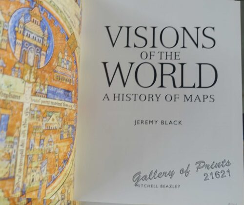
Visions of the World A History of Maps
₱
3,300.00
Add to cart
Details
Vista general del pueblo y rada de parang en la costa s. o d...
₱
26,400.00
Add to cart
Details
Vögel VII… [Voegel] 1) L’Oiseau de Paradis (Pa...
₱
13,200.00
Add to cart
Details
Volcan Bulusan desde el S. S. O.
₱
4,400.00
Add to cart
Details
Volcanic Eruption in the Island of Camiguin, Philippines.
₱
6,600.00
Add to cart
Details
Vom amerikanisch=spanischen Kriegsschauplatz (American-Span...
₱
9,900.00
Add to cart
Details
Vom amerikanisch=spanischen Kriegsschauplatz [American-Span...
₱
9,900.00
Add to cart
Details
Vom amerikanisch=spanischen Kriegsschauplatz – Befesti...
₱
5,500.00
Add to cart
Details
Von den Philippinen: Ansichten von Ilo-Ilo & den Inseln ...
₱
8,800.00
Add to cart
Details
Von den Philippinen: Ansichten von Ilo-Ilo. 1) Das kaiserl....
₱
8,800.00
Add to cart
Details
Von den Philippinen: Plaza Alfonso XII, und südlicher Teil ...
₱
6,600.00
Add to cart
Details
Von Luzon nach Hongkong
₱
2,200.00
Add to cart
Details
Voyage Around The World On The Corvette La Favorite 1830, 18...
₱
2,200.00
Add to cart
Details
Voyage Autour du Monde … 1826, 1827, 1828, et 1829...
₱
19,800.00
Add to cart
Details
Voyage aux Philippines et en Malaisie
₱
6,600.00
Add to cart
Details
Voyage Pittoresque Autour du Monde Resumé Général des Voy...
₱
34,100.00
Add to cart
Details
Vue de Cavite dans la Baie de Manille [View of Cavite in the...
₱
39,600.00
Add to cart
Details
Vue de Cavite dans la Baie de Manille [View of Cavite in the...
₱
14,700.00
Add to cart
Details
Vue de Hong-Kong
₱
5,500.00
Add to cart
Details
Vue de l’ile de Romero sur le Pasig [View of Romero I...
₱
2,200.00
Add to cart
Details
Vue de Manille [Manila View]
₱
50,600.00
Add to cart
Details
Vue de Sambouangue [View of Zamboanga]
₱
26,400.00
Add to cart
Details
Vüe du Fort de Sambouangue [View of Zamboanga Fort]
₱
26,400.00
Add to cart
Details
Vue générale de la ville de Manille, ravagée par un tremb...
₱
11,000.00
Add to cart
Details
Vue générale de la ville de Manille, ravagée par un tremb...
₱
8,800.00
Add to cart
Details
Vue Generale de Manille.
₱
7,700.00
Add to cart
Details
Vue generale du village de Bahele (voy. p. 378). [General Vu...
₱
5,500.00
Add to cart
Details
Vue prise a Pulo-Penang.
₱
25,200.00
Add to cart
Details
Wanderjahre eines jungen Hamburger Kaufmannes – Eine R...
₱
5,500.00
Add to cart
Details
Previous
1
2
3
…
57
58
59
60
61
62
63
Next
Shopping Cart
The Philipine Isles
1
Les Isles Philippines - Islas de los Ladrones... ou Isles des Larrons
1
Map showing Theatre of Operations 39th U.S. Vol. Infty. Col. Robert L. Bullard commanding prepared for The 39th U.S. Vol. Infty. Assn.
1
Map of the Sooloo Sea & Archipelago
1
A Chart of the China Sea, and Philippine Islands, with the Archipelagos of Felicia and Sooloo, shewing… …Canton and Balambangan,… composed from an original drawing, communicated by Capt. Robert Carr. and compared with the map of Pedro Murillo de Velarde, engraved at Manilla in 1734…. insets: 1) The Ports of Ylocos, on the West Coast of Luzon. 2) The Bay of Subic, on the West Coast of Luzon.
1
National Geographic August, 1972, Vol.142, No.2 [The Tasadays, Stone age cavemen of Mindanao]
1
The Murillo Bulletin, Journal of PHIMCOS, Issue No. 12
-
Quantity
+
Karte der St. Gotthard-Bahn, Taf.2 [Map of The Gotthard-Railroad, pl. 2]
1
East India Isles
1
Masbate I. Bay of Nin and Port Mandao
1
The Ransom of Manilla; or, England's Ally. An Historical Play in Five Acts.
1
The World of the Manila-Acapulco Galleons. The Global and Human Context
1
Die Insel Formosa neu abgemessen auf Befehl Kaysers Kamhi. [The Island of Formosa As Newly Surveyed By Order of Emperor Kamhi]
1
China Sea - Philippine Islands. San Bernardino Strait and Approaches. From the United States Coast Survey Charts to 1923. with additions and corrections to 1934.
1
Cart
Checkout
Continue Shopping
14