Tel : +63(2)-7729-8168 | Mobile: +63 917 806 4291
|
Email: gallery@gop.com.ph
My Account
Remember Me
Register
25 Item(s)
-
₱
478,200.00
The Philippine Crisis: Scenes of the Conflict. 1. A Filipino Village just outside the American Lines near Manila; 2. Outposts in Touch: American on the near side of the Bridge, Filipino beyond; 3. A Spanish Fort at Manila mounted with old Muzzle-loading Guns; 4. At Cavite: a Spanish Gun-boat “Scuppered” by her Crew.
1 x
₱
7,700.00
A Visit to the Philippine Islands in 1858-59
1 x
₱
45,100.00
The Cartography of the East Indian Islands, Insulae Indiae Orientalis.
1 x
₱
6,600.00
Mapa de la Parte del Norte del Mar del Sur, Sacado Dela Carta General Llamada de Cook, Publicada en Paris el Año de 1785. Con La Obra de su Expidecion. Se ha Corregido en Alguhos Puntos, y ha Transportado Del Meridiano de Greenwich al de Tenerife. Madrid Año De 1788.
1 x
₱
13,200.00
1) Plan du port d' Acapulco sur la Côte du Mexique dans la Mer du Sud. 2) Plan de la Baye de Manille
1 x
₱
26,400.00
East India Archipelago (Western Route to China. Chart No.6) London, Published by James Imray and Son, 89 & 102 Minories, 1872
1 x
₱
99,000.00
The Philipine Isles
1 x
₱
88,000.00
Insulae Marianae Aº 1684...
1 x
₱
39,600.00
Leyte
1 x
₱
17,600.00
Ortelius Atlas Maps 2nd revised edition
1 x
₱
5,500.00
1. Le Banyan, ou le Multipliant. 2. Église de Notre-Dame des Anges. 3. Vue de Karikal du Coté de la mer (rive droite de l'Arselar). 4. Debarcadère a Karikal.
1 x
₱
3,300.00
East India Isles
1 x
₱
6,600.00
Island of Luzon. inset map: Islands of the Philippines north of Luzon
1 x
₱
3,300.00
Road Sketch of Operations of Col. Hood's Command, 16th Infty. Drawn By Guy G. Palmer 1st Lieut 16th U.S. Infty.
1 x
₱
6,600.00
1) Phalanger celebensis. [Small Sulawesi Cuscus] 2-3) Phalanger sangirensis. [Sangihe Grey Cuscus]
1 x
₱
5,500.00
Campagne des Environs de Manille (Oceanie) [Countryside near Manila]
1 x
₱
9,900.00
Otophora Alata. Bl. [English: Johore Tree, Malaysian Lepisanthe], Perupoks
1 x
₱
26,400.00
Rizal, Philippine Nationalist and Martyr.
1 x
₱
2,900.00
The Spanish - American War In the Spanish Trenches at Manila: Midday
1 x
₱
4,400.00
Plan of Manila and Suburbs.
1 x
₱
17,700.00
Les Isles de la Sonde, Moluques, Philippines, Carolines, et Mariannes
1 x
₱
11,000.00
Islas Filipinas - Mapa Orografico Observatorio de Manila
1 x
₱
6,600.00
Manille.
1 x
₱
4,400.00
Zambales
1 x
₱
17,600.00
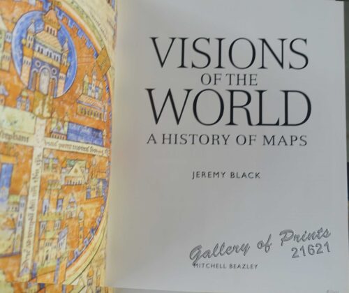
Visions of the World A History of Maps
1 x
₱
3,300.00
View Cart
Checkout
Home
About Us
Publications
Shop Online
Framing Services
Exhibits
Picture Hanging System
Contact Us
Blogs
View cart
“Visions of the World A History of Maps” has been added to your cart.
Sort by
Name
Sort by
Default Order
Sort by
Name
Sort by
Price
Sort by
Date
Sort by
Popularity
Show
30 Products
Show
30 Products
Show
60 Products
Show
90 Products
VII. Provintiae seu Belgiu Foederatum exhibita Iohan Michael...
₱
3,300.00
Add to cart
Details
Village mandaya (centre Mindanao)
₱
9,900.00
Add to cart
Details
Village of San Juento. Manila
₱
6,900.00
Add to cart
Details
Ville de Manille / De Stad Manilha
₱
26,400.00
Add to cart
Details
Vingboons-Atlas
₱
49,500.00
Add to cart
Details
Visions of the World A History of Maps
₱
3,300.00
Add to cart
Details
Vista general del pueblo y rada de parang en la costa s. o d...
₱
26,400.00
Add to cart
Details
Vögel VII… [Voegel] 1) L’Oiseau de Paradis (Pa...
₱
13,200.00
Add to cart
Details
Volcan Bulusan desde el S. S. O.
₱
4,400.00
Add to cart
Details
Volcanic Eruption in the Island of Camiguin, Philippines.
₱
6,600.00
Add to cart
Details
Vom amerikanisch=spanischen Kriegsschauplatz (American-Span...
₱
9,900.00
Add to cart
Details
Vom amerikanisch=spanischen Kriegsschauplatz [American-Span...
₱
9,900.00
Add to cart
Details
Vom amerikanisch=spanischen Kriegsschauplatz – Befesti...
₱
5,500.00
Add to cart
Details
Von den Philippinen: Ansichten von Ilo-Ilo & den Inseln ...
₱
8,800.00
Add to cart
Details
Von den Philippinen: Ansichten von Ilo-Ilo. 1) Das kaiserl....
₱
8,800.00
Add to cart
Details
Von den Philippinen: Plaza Alfonso XII, und südlicher Teil ...
₱
6,600.00
Add to cart
Details
Von Luzon nach Hongkong
₱
2,200.00
Add to cart
Details
Voyage Around The World On The Corvette La Favorite 1830, 18...
₱
2,200.00
Add to cart
Details
Voyage Autour du Monde … 1826, 1827, 1828, et 1829...
₱
19,800.00
Add to cart
Details
Voyage aux Philippines et en Malaisie
₱
6,600.00
Add to cart
Details
Voyage Pittoresque Autour du Monde Resumé Général des Voy...
₱
34,100.00
Add to cart
Details
Vue de Cavite dans la Baie de Manille [View of Cavite in the...
₱
39,600.00
Add to cart
Details
Vue de Cavite dans la Baie de Manille [View of Cavite in the...
₱
14,700.00
Add to cart
Details
Vue de Hong-Kong
₱
5,500.00
Add to cart
Details
Vue de l’ile de Romero sur le Pasig [View of Romero I...
₱
2,200.00
Add to cart
Details
Vue de Manille [Manila View]
₱
50,600.00
Add to cart
Details
Previous
1
2
3
…
57
58
59
60
61
62
63
Next
Shopping Cart
Visions of the World A History of Maps
1
Zambales
1
Manille.
1
Islas Filipinas - Mapa Orografico Observatorio de Manila
1
Les Isles de la Sonde, Moluques, Philippines, Carolines, et Mariannes
1
Plan of Manila and Suburbs.
1
The Spanish - American War In the Spanish Trenches at Manila: Midday
1
Rizal, Philippine Nationalist and Martyr.
1
Otophora Alata. Bl. [English: Johore Tree, Malaysian Lepisanthe], Perupoks
1
Campagne des Environs de Manille (Oceanie) [Countryside near Manila]
1
1) Phalanger celebensis. [Small Sulawesi Cuscus] 2-3) Phalanger sangirensis. [Sangihe Grey Cuscus]
1
Road Sketch of Operations of Col. Hood's Command, 16th Infty. Drawn By Guy G. Palmer 1st Lieut 16th U.S. Infty.
1
Island of Luzon. inset map: Islands of the Philippines north of Luzon
1
East India Isles
1
1. Le Banyan, ou le Multipliant. 2. Église de Notre-Dame des Anges. 3. Vue de Karikal du Coté de la mer (rive droite de l'Arselar). 4. Debarcadère a Karikal.
1
Ortelius Atlas Maps 2nd revised edition
1
Leyte
1
Insulae Marianae Aº 1684...
1
The Philipine Isles
1
East India Archipelago (Western Route to China. Chart No.6) London, Published by James Imray and Son, 89 & 102 Minories, 1872
1
1) Plan du port d' Acapulco sur la Côte du Mexique dans la Mer du Sud. 2) Plan de la Baye de Manille
1
Mapa de la Parte del Norte del Mar del Sur, Sacado Dela Carta General Llamada de Cook, Publicada en Paris el Año de 1785. Con La Obra de su Expidecion. Se ha Corregido en Alguhos Puntos, y ha Transportado Del Meridiano de Greenwich al de Tenerife. Madrid Año De 1788.
1
The Cartography of the East Indian Islands, Insulae Indiae Orientalis.
1
A Visit to the Philippine Islands in 1858-59
1
The Philippine Crisis: Scenes of the Conflict. 1. A Filipino Village just outside the American Lines near Manila; 2. Outposts in Touch: American on the near side of the Bridge, Filipino beyond; 3. A Spanish Fort at Manila mounted with old Muzzle-loading Guns; 4. At Cavite: a Spanish Gun-boat “Scuppered” by her Crew.
1
Cart
Checkout
Continue Shopping
25