Tel : +63(2)-7729-8168 | Mobile: +63 917 806 4291
|
Email: gallery@gop.com.ph
My Account
Remember Me
Register
24 Item(s)
-
₱
505,200.00
A Chart of the Coast of China from Cambodia to Nanquam with part of Japan.
1 x
₱
155,000.00
Saïgon.(1866)Manille.
1 x
₱
46,200.00
Pie-griêche d'Antigue. [Antique Shrike]
1 x
₱
6,600.00
The National Geographic Magazine, vol.XXIII, no. 9. Head-Hunters of Northern Luzon
1 x
₱
4,400.00
Philippine Islands - Mindanao. Davao Gulf. From the Philippine Government Charts to 1956. With additions and corrections to 1962. insets: 1) Talomo Bay. From U.S Government Chart of 1933. With additions and corrections to 1962. 2) Lais. From U.S Government Chart of 1933. With additions and corrections to 1962. 3) Malita. From U.S Government Chart of 1933. With additions and corrections to 1962. 4) Port of Davao. From the Philippine Government Chart of 1956. With additions and corrections to 1962. 5) Pakiputan Strait. From U.S Government Chart of 1933. With additions and corrections to 1962.
1 x
₱
11,000.00
VII. Provintiae seu Belgiu Foederatum exhibita Iohan Michael Probst Augusta Vindelicomaro. [insets:] 1. Ost India Hollan. 2. West India Hollan
1 x
₱
3,300.00
Der grosschuppige Drachenkopf - Scorpaena scrofa. LaGrabbe de Biarrits. [The Large-Scaled Scorpion Fish]
1 x
₱
4,400.00
East India Archipelago [Eastern Passages to China and Japan][Chart No.4] London, Published by James Imray and Son, 89 & 102 Minories, 1884
1 x
₱
49,600.00
The Age of Trade The Manila Galleons and the Dawn of the Global Economy
1 x
₱
6,600.00
Typus Fpeti Manilensis [sic], Detroit de Manilles, [Straits of Manila]
1 x
₱
39,600.00
Manila [with a fleet of Adm. Joris van Spilberghen & a smoking Taal]
1 x
₱
49,500.00
The National Geographic Magazine September, 1952, vol. CII, No.3 New 10-Color Map of the Far East
1 x
₱
1,100.00
Spanish Galleon 1530 - 1690 New Vanguard # 96
1 x
₱
2,200.00
National Geographic August, 1972, Vol.142, No.2 [The Tasadays, Stone age cavemen of Mindanao]
1 x
₱
1,200.00
[Emperor Moth]
1 x
₱
6,600.00
Philippine Islands. Mindoro and Adjacent Islands. Cuyo Is. To Cabra I. Including Mindoro Strait and Sibuyan Sea. From the United States Cost Survey Charts to 1922.
1 x
₱
11,000.00
Les Isles Philippines Molucques et de La Sonde Les Isles du Iapon
1 x
₱
26,400.00
Habts. des iles Philippines. [Inhabitants of the Philippine Islands] Habts. de la Nouvelle Hollande. [Inhabitants of New Holland]
1 x
₱
6,600.00
A Canal in Manila.
1 x
₱
4,400.00
Theobroma Cacao. - Linn. - Blanco. - DC. [Philippine Name: Cacao] [English: Cocoa]
1 x
₱
46,100.00
Haricot Flageolet Beurre Sanguin a Rames [Peas / Small Bean]
1 x
₱
5,500.00
1. State of the Philippines in 1810; 2. Philippine Progress Prior to 1898
1 x
₱
4,400.00
Philippine Islands. Leyte Gulf To Mayo Bay. Including Leyte,Parts of Sebu and Bohol and the North-Eastern Cost of Mindanao. From the United States Cost Survey Charts to 1922.
1 x
₱
11,000.00
Investing in Maps
1 x
₱
2,500.00
View Cart
Checkout
Home
About Us
Publications
Shop Online
Framing Services
Exhibits
Picture Hanging System
Contact Us
Blogs
View cart
“Investing in Maps” has been added to your cart.
Sort by
Popularity
Sort by
Default Order
Sort by
Name
Sort by
Price
Sort by
Date
Sort by
Popularity
Show
30 Products
Show
30 Products
Show
60 Products
Show
90 Products
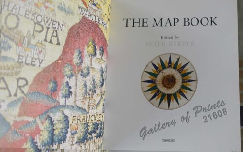
The Map Book
₱
3,300.00
Add to cart
Details
Rizal, Philippine Nationalist and Martyr.
₱
2,900.00
Add to cart
Details
The Calamansi Cook Book, An Expat’s Guide to Eating We...
₱
900.00
Add to cart
Details
The Cruise of the U.S. Flagship Olympia, from 1895-1899, fro...
₱
2,200.00
Add to cart
Details
The German Club Story Centennial Edition 1906 – 2006
₱
2,500.00
Add to cart
Details
Miniature Antique Maps
₱
4,400.00
Add to cart
Details
Magsaysay of the Philippines
₱
7,700.00
Add to cart
Details
Spanning the Decades 1902-2002
₱
2,600.00
Add to cart
Details
[Southeast Asia]
₱
26,400.00
Add to cart
Details
Philippine Islands. A Detailed Map. by Robinson H. E. C. Pt...
₱
34,200.00
Add to cart
Details
The German Club Manila 1986 – 1996 / 1906 – ...
₱
2,500.00
Add to cart
Details
Rare Pacific Voyage Books, part 2
₱
3,300.00
Add to cart
Details
Investing in Maps
₱
2,500.00
Add to cart
Details
Voyage Autour du Monde … 1826, 1827, 1828, et 1829...
₱
19,800.00
Add to cart
Details
Emergent Literature Essays on Philippine Writing
₱
600.00
Add to cart
Details
Admiral Paris’ Native Boats of Asia and the Pacific, 1...
₱
900.00
Add to cart
Details
Kirin, Harbin, Vladivostok
Details
Chart of the World on Mercator’s Projection, showing S...
Details
Map Showing Location of Panama Canal as Recommended by the I...
Details
Map of the Philippines. Prepared By Reduction From the Map o...
Details
City of Manila. Philippine Islands
Details
Trade Routes of the Orient
Details
1) Bird’s Eye View of the Walled City and Immediate En...
Details
Philippine Islands
Details
Beautiful Philippines. A Handbook of General Information
₱
65,600.00
Add to cart
Details
Mapping the Continent of Asia
₱
2,500.00
Add to cart
Details
Collecting Antique Maps
₱
3,300.00
Add to cart
Details
Atlas Journal de la Navigation Autour du Globe de la Fréga...
₱
33,000.00
Add to cart
Details
New Worlds The Great Voyages of Discovery 1400-1600
₱
2,870.00
Add to cart
Details
Map of the Sooloo Sea & Archipelago
₱
9,900.00
Add to cart
Details
Previous
1
2
3
4
5
6
7
8
…
61
62
63
Next
Shopping Cart
Investing in Maps
1
Philippine Islands. Leyte Gulf To Mayo Bay. Including Leyte,Parts of Sebu and Bohol and the North-Eastern Cost of Mindanao. From the United States Cost Survey Charts to 1922.
1
1. State of the Philippines in 1810; 2. Philippine Progress Prior to 1898
1
Haricot Flageolet Beurre Sanguin a Rames [Peas / Small Bean]
1
Theobroma Cacao. - Linn. - Blanco. - DC. [Philippine Name: Cacao] [English: Cocoa]
1
A Canal in Manila.
1
Habts. des iles Philippines. [Inhabitants of the Philippine Islands] Habts. de la Nouvelle Hollande. [Inhabitants of New Holland]
1
Les Isles Philippines Molucques et de La Sonde Les Isles du Iapon
1
Philippine Islands. Mindoro and Adjacent Islands. Cuyo Is. To Cabra I. Including Mindoro Strait and Sibuyan Sea. From the United States Cost Survey Charts to 1922.
1
[Emperor Moth]
1
National Geographic August, 1972, Vol.142, No.2 [The Tasadays, Stone age cavemen of Mindanao]
1
Spanish Galleon 1530 - 1690 New Vanguard # 96
1
The National Geographic Magazine September, 1952, vol. CII, No.3 New 10-Color Map of the Far East
1
Manila [with a fleet of Adm. Joris van Spilberghen & a smoking Taal]
1
Typus Fpeti Manilensis [sic], Detroit de Manilles, [Straits of Manila]
1
The Age of Trade The Manila Galleons and the Dawn of the Global Economy
1
East India Archipelago [Eastern Passages to China and Japan][Chart No.4] London, Published by James Imray and Son, 89 & 102 Minories, 1884
1
Der grosschuppige Drachenkopf - Scorpaena scrofa. LaGrabbe de Biarrits. [The Large-Scaled Scorpion Fish]
1
VII. Provintiae seu Belgiu Foederatum exhibita Iohan Michael Probst Augusta Vindelicomaro. [insets:] 1. Ost India Hollan. 2. West India Hollan
1
Philippine Islands - Mindanao. Davao Gulf. From the Philippine Government Charts to 1956. With additions and corrections to 1962. insets: 1) Talomo Bay. From U.S Government Chart of 1933. With additions and corrections to 1962. 2) Lais. From U.S Government Chart of 1933. With additions and corrections to 1962. 3) Malita. From U.S Government Chart of 1933. With additions and corrections to 1962. 4) Port of Davao. From the Philippine Government Chart of 1956. With additions and corrections to 1962. 5) Pakiputan Strait. From U.S Government Chart of 1933. With additions and corrections to 1962.
1
The National Geographic Magazine, vol.XXIII, no. 9. Head-Hunters of Northern Luzon
1
Pie-griêche d'Antigue. [Antique Shrike]
1
Saïgon.(1866)Manille.
1
A Chart of the Coast of China from Cambodia to Nanquam with part of Japan.
1
Cart
Checkout
Continue Shopping
24