Tel : +63(2)-7729-8168 | Mobile: +63 917 806 4291
|
Email: gallery@gop.com.ph
My Account
Remember Me
Register
29 Item(s)
-
₱
493,900.00
Philippines. Propriete de Mr. La Geroniere
1 x
₱
8,800.00
Brachyurus Steerii, ad. et jur. (Steere's Pitta)
1 x
₱
9,900.00
Von den Philippinen: Ansichten von Ilo-Ilo & den Inseln Guimaras und Negros. 1. Landschaft in der Nähe von Ilo-Ilo bei Ebbe und Sonnenuntergang. [Landscape near Ilo-Ilo at Low Tide and Sunset.] 2. Dorf Salog auf Guimaras. [Salog Village in Guimaras.] 3. Ein Dorf auf Negros. [A Village in Negros.]
1 x
₱
8,800.00
Mapping the Philippine Seas
1 x
₱
5,900.00
Der stille Ocean und die spanischen Besitzungen im ostindischen Archipel [The Pacific Ocean and the Spanish Colonies in the East Indian Archipelago]
1 x
₱
4,200.00
Brug over de rio Tagulaya [Bamboo Bridge over Tagulaya River]
1 x
₱
4,400.00
A Chart of the Pelew Islands…
1 x
₱
39,600.00
Ports in the Philippine Islands. insets: 1) Luzon I. - West Coast. Manila and Cavite Anchorages. From the United States Government Charts to 1950. With additions and corrections to 1959. 2) Luzon I. - West Coast. Manila Harbour. From the United States Government Charts to 1950. With additions and corrections to 1959.
1 x
₱
13,200.00
Philippine Islands. Luzon-West and East Coasts. Cabra I. to San Fernando Pt. and Diapitan B. to San Miguel B. From the United States Coast Survey Charts 1909-23. with additions and corrections to 1933.
1 x
₱
11,000.00
Rivière de Davao (Mindanao)
1 x
₱
9,900.00
Karte von den Philippinischen Celebes und Molukkischen Eylanden
1 x
₱
26,400.00
Carte Générale des Iles Philippines avec Les Itinéraires du Dr. J. Montano 1879 - 1881 inset: Partie de la Province d'Albay (Lucon) [General Map of the Philippine Islands with the Itineraries of…]
1 x
₱
11,000.00
Philippine Air Lines Travel Information World Routes
1 x
₱
3,300.00
Gemeine Petersilge. Fig. 996; Coptische Haardolde. Fig. 997; Aechter Kreutzkümmel. Fig. 998; Gifttiger Wasserschierting. Fig. 999; Gervöhnliche Sellerie. Fig. 1000.
1 x
₱
5,500.00
East India Archipelago [Western route to China. Chart No. 4] insets: 1) South-West Extremity of Palawan Island. 2) Ambong Bay & C. 3) Balambangan Island. 4) Bruni and Labouan. 5) Coastal Profile of Mt. Kini Balu. 6) Coastal profile of Sampadian I. 7) Coastal profile of Cape Sipang. 8) Coastal profile of Cape Datou. 9) Kudat Harbour.
1 x
₱
49,500.00
Early Maps of South-East Asia
1 x
₱
4,400.00
Für die Sennores Padres zu Manilla.
1 x
₱
11,000.00
Mapa Etnográfico del Archipiélago Filipino
1 x
₱
11,000.00
De Javaasche Phaisant met den Vuurkleurigen Rug. [Javanese Pheasant]
1 x
₱
9,900.00
Töchter eines Tagabawahäuptlings im Ballkostüme. [Daughters of a Tagbanua Chief in Festive Costume]
1 x
₱
7,700.00
Atas du volcan Apó
1 x
₱
9,900.00
Zamboanga
1 x
₱
11,000.00
Les Isles Philippines Molucques et de La Sonde Les Isles du Iapon
1 x
₱
26,400.00
Les Isles Philippines Molucques et de la Sonde…
1 x
₱
49,500.00
Philippine Islands. The Passages Between Panay. Negros and Cebu. North of Latitude 10° 17' North. From the United States Government Charts of 1933. With Additions and Corrections from the Philippine Gov't. Charts to 1963.
1 x
₱
11,000.00
Plano de Manila (inset: 1. Vista por la Playa del Mar, 2. Vista por Tierra)
1 x
₱
55,900.00
India Orien
1 x
₱
31,900.00
Dr. A. Petermann's Mittheilungen aus Justus Perthes' Geographischer Anstalt. Versuch einer Ethnographie der Philippinen [Preliminary Analysis of Philippine Ethnography]
1 x
₱
3,300.00
Die Ostindischen Inseln...
1 x
₱
39,600.00
View Cart
Checkout
Home
About Us
Publications
Shop Online
Framing Services
Exhibits
Picture Hanging System
Contact Us
Blogs
View cart
“Die Ostindischen Inseln…” has been added to your cart.
Sort by
Name
Sort by
Default Order
Sort by
Name
Sort by
Price
Sort by
Date
Sort by
Popularity
Show
30 Products
Show
30 Products
Show
60 Products
Show
90 Products
The Fleet that did not go to the Philippines Admiral Camara&...
₱
11,000.00
Add to cart
Details
The German Club Manila 1986 – 1996 / 1906 – ...
₱
2,500.00
Add to cart
Details
The German Club Story Centennial Edition 1906 – 2006
₱
2,500.00
Add to cart
Details
The Golden Atlas: The Greatest Explorations, Quests and Dis...
₱
3,300.00
Add to cart
Details
The Hakluyt Society. The Travels and Controversies of Friar ...
₱
4,400.00
Add to cart
Details
The Half-Way Sun. Life among the Headhunters of the Philippi...
₱
6,600.00
Add to cart
Details
The Harbour, Manila.
₱
6,600.00
Add to cart
Details
The History of Seafaring: Navigating the World’s Ocean...
₱
5,040.00
Add to cart
Details
The Illustrated London News Vol. 32 – No. 897
₱
6,600.00
Add to cart
Details
The Illustrated London News Vol. 36 – No. 1015
₱
6,600.00
Add to cart
Details
The Inhabitants of the Philippines
₱
13,200.00
Add to cart
Details
The Invention of China
₱
2,200.00
Add to cart
Details
The Invention of China
₱
1,800.00
Add to cart
Details
The Life and Achievements of Captain James Cook Adventures a...
₱
1,500.00
Add to cart
Details
The Life of Ferdinand Magellan and the First Circumnavigatio...
₱
11,000.00
Add to cart
Details
The Likhaan Anthology of Philippine Literature in English fr...
₱
1,100.00
Add to cart
Details
The Luneta, Manila
₱
3,300.00
Add to cart
Details
The Luneta, Manila
₱
3,300.00
Add to cart
Details
The Making of the Modern Philippines. Pieces of a Jigsaw Sta...
₱
2,950.00
Add to cart
Details
The Making of the Nuremberg Chronicle
₱
8,800.00
Add to cart
Details
The Man Who Invented History: Travels with Herodotus.
₱
3,300.00
Add to cart
Details
The Manila Railway Company [1906] Limited 4% “A”...
₱
22,000.00
Add to cart
Details
The Manila Railway Company [1906] Limited 4% “B”...
₱
13,200.00
Add to cart
Details
The Manila Railway Company [1906] Limited 4% “B”...
₱
13,200.00
Add to cart
Details
The Manila Railway Company [1906] Limited 4% “B” Debentu...
₱
13,200.00
Add to cart
Details
The Manila Railway Company [1906] Limited. “A” D...
₱
13,200.00
Add to cart
Details
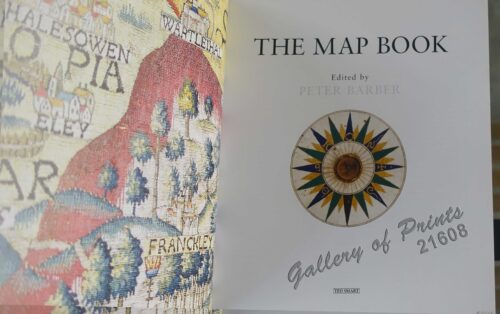
The Map Book
₱
3,300.00
Add to cart
Details
The Mapmaker’s Art (A History of Cartography)
₱
9,900.00
Add to cart
Details
The Mapmakers’ World: A Cultural History of the Europe...
₱
5,500.00
Add to cart
Details
The Mapping of Terra Australis
₱
5,500.00
Add to cart
Details
Previous
1
2
3
…
50
51
52
53
54
55
56
…
60
61
62
Next
Shopping Cart
Die Ostindischen Inseln...
1
Dr. A. Petermann's Mittheilungen aus Justus Perthes' Geographischer Anstalt. Versuch einer Ethnographie der Philippinen [Preliminary Analysis of Philippine Ethnography]
1
India Orien
1
Plano de Manila (inset: 1. Vista por la Playa del Mar, 2. Vista por Tierra)
1
Philippine Islands. The Passages Between Panay. Negros and Cebu. North of Latitude 10° 17' North. From the United States Government Charts of 1933. With Additions and Corrections from the Philippine Gov't. Charts to 1963.
1
Les Isles Philippines Molucques et de la Sonde…
1
Les Isles Philippines Molucques et de La Sonde Les Isles du Iapon
1
Zamboanga
1
Atas du volcan Apó
1
Töchter eines Tagabawahäuptlings im Ballkostüme. [Daughters of a Tagbanua Chief in Festive Costume]
1
De Javaasche Phaisant met den Vuurkleurigen Rug. [Javanese Pheasant]
1
Mapa Etnográfico del Archipiélago Filipino
1
Für die Sennores Padres zu Manilla.
1
Early Maps of South-East Asia
1
East India Archipelago [Western route to China. Chart No. 4] insets: 1) South-West Extremity of Palawan Island. 2) Ambong Bay & C. 3) Balambangan Island. 4) Bruni and Labouan. 5) Coastal Profile of Mt. Kini Balu. 6) Coastal profile of Sampadian I. 7) Coastal profile of Cape Sipang. 8) Coastal profile of Cape Datou. 9) Kudat Harbour.
1
Gemeine Petersilge. Fig. 996; Coptische Haardolde. Fig. 997; Aechter Kreutzkümmel. Fig. 998; Gifttiger Wasserschierting. Fig. 999; Gervöhnliche Sellerie. Fig. 1000.
1
Philippine Air Lines Travel Information World Routes
1
Carte Générale des Iles Philippines avec Les Itinéraires du Dr. J. Montano 1879 - 1881 inset: Partie de la Province d'Albay (Lucon) [General Map of the Philippine Islands with the Itineraries of…]
1
Karte von den Philippinischen Celebes und Molukkischen Eylanden
1
Rivière de Davao (Mindanao)
1
Philippine Islands. Luzon-West and East Coasts. Cabra I. to San Fernando Pt. and Diapitan B. to San Miguel B. From the United States Coast Survey Charts 1909-23. with additions and corrections to 1933.
1
Ports in the Philippine Islands. insets: 1) Luzon I. - West Coast. Manila and Cavite Anchorages. From the United States Government Charts to 1950. With additions and corrections to 1959. 2) Luzon I. - West Coast. Manila Harbour. From the United States Government Charts to 1950. With additions and corrections to 1959.
1
A Chart of the Pelew Islands…
1
Brug over de rio Tagulaya [Bamboo Bridge over Tagulaya River]
1
Der stille Ocean und die spanischen Besitzungen im ostindischen Archipel [The Pacific Ocean and the Spanish Colonies in the East Indian Archipelago]
1
Mapping the Philippine Seas
-
Quantity
+
Von den Philippinen: Ansichten von Ilo-Ilo & den Inseln Guimaras und Negros. 1. Landschaft in der Nähe von Ilo-Ilo bei Ebbe und Sonnenuntergang. [Landscape near Ilo-Ilo at Low Tide and Sunset.] 2. Dorf Salog auf Guimaras. [Salog Village in Guimaras.] 3. Ein Dorf auf Negros. [A Village in Negros.]
1
Brachyurus Steerii, ad. et jur. (Steere's Pitta)
1
Philippines. Propriete de Mr. La Geroniere
1
Cart
Checkout
Continue Shopping
29