Tel : +63(2)-7729-8168 | Mobile: +63 917 806 4291
|
Email: gallery@gop.com.ph
My Account
Remember Me
Register
30 Item(s)
-
₱
740,160.00
The East Indies drawn from the Latest Discoveries by T. Jefferys, Geographer, to his Royal Highness the Prince of Wales
1 x
₱
45,900.00
Nuestro Senor de Longos - Eglise de Benondo.
1 x
₱
5,500.00
Plans in the Philippine Island. insets: 1) Luzon - North Coast. Aparri. From the Philippine Government Chart of 1954. 2) Bataan I. Basco. From the Philippine Government Chart of 1954. 3) Luzon - West Coast. Santa Cruz. From the Philippine Government Chart of 1952. 4) Bataan I. Balugan Bay. From the Philippine Government Chart of 1953.
1 x
₱
11,000.00
Mapa de las Islas de la Sonda, y de las Malúcas. [inset:] Verdaderas Malúcas
1 x
₱
13,200.00
The Expansion of Good Government and Commerce [written on the American Flag] 1900 [written on Naked Baby Boy's Sash] Philippine Islands [written over both Horns of a Water Buffalo] [A smiling Uncle Sam holding the American Flag behind an equally happy Baby Boy Philippines riding a Carabao, with a panorama of warships' silhouettes on a curved horizon.] AWAY DOWN EAST
1 x
₱
13,200.00
Philippine Cartography
1 x
₱
22,000.00
Manila Harbor Complimentary Map of the City of Manila
1 x
₱
22,000.00
Dr. A. Petermann's Mittheilungen aus Justus Perthes' Geographischer Anstalt. Herausgegeben von Prof. Dr. A. Supan. - Ergänzungsband XVII, 1884-1885 Inhalt: [Supplement Vol. 17 contents] No. 76. Regel, Entwickelung der Ortschaften im Thüringerwald. No. 77. Stolze und Andreas, die Handelsverhältnisse Persiens. No. 78. Fritsche, ein Beitrag zur Geographie und Lehre vom Erdmagnetismus Asiens und Europas. No. 79. Mohn, die Strömungen des europäischen Nordmeeres. No. 80. Boas, Baffin-Land.
1 x
₱
6,000.00
International Map Collectors' Society IMCoS Journal December 2021 No.167
1 x
₱
1,400.00
The Philippine Islands and others of the East Indies
1 x
₱
27,280.00
Indes Néerlandaises - Iles Philippines - Rapport. Présenté par M. René Brezet, Planteur, Délégué de la Chambre d'Agriculture de la Cochinchine, Chargé de Mission.1922
1 x
₱
39,600.00
Insulae Philippinae alias Manilhae dictae
1 x
₱
44,000.00
El Periodismo Filipino, 1811-1910 The First Century of Philippine Journalism Volume III Aparato Bibliografico de la Historia General de Filipinas
1 x
₱
3,500.00
The Meat Market at Manilla
1 x
₱
7,700.00
Reise Charte durch das Königreich Polen mit allen darzu gehörigen Laendern herausgegeben von Ioh. Michael, Probst in Augsburg
1 x
₱
3,300.00
Island of Luzon. inset map: Islands of the Philippines north of Luzon
1 x
₱
3,300.00
Mittheilungen aus Justus Perthes' Geographischer Anstalt. über wichtige neue Erforschungen auf dem Gesammtgebiete der Geographie von Dr. A. Petermann. - 23. Band, 1877
1 x
₱
39,600.00
[Luzon & Visayas]]
1 x
₱
165,000.00
Campagne des Environs de Manille (Oceanie) [Countryside near Manila]
1 x
₱
9,900.00
Chart of the East India Islands...
1 x
₱
6,600.00
Die Palau - Inseln im Stillen Ocean Reiseerlebnisse.
1 x
₱
17,700.00
A Map of the East Indies from the latest Authorities and Observations By John Blair L.L.D. & F.R.S. As a Supplement to His Tables of Chronology. [inset:] The Philippine Islands.
1 x
₱
26,400.00
Les Isles Philippines, celle de Formose, le Sud de la Chine, les Royaumes de Tunkin, de Cochinchine, de Camboge, de Siam, des Laos… inset: 1) Isle de Guam. 2) [Isles Marianes]
1 x
₱
11,000.00
Tabacum Latifolium ( Tobacco plant )
1 x
₱
59,600.00
Recollections of a Voyage to the Philippines [1875]
1 x
₱
980.00
Cranobrontes waldeni [Lord Walden's Hornbill]
1 x
₱
5,500.00
Plan of the Port of Subec, in the Isle of Luconia
1 x
₱
56,400.00
[Luzon: Obere Savannengegend] [Upper Savanna Landscape]
1 x
₱
61,600.00
Doldentraubige Bauhinie. Fig. 1182. [Raceme bauhinia]; Scharlachrothe Brownea. Fig. 1183. [Scarlet Brownea]; Bohnenförmige Dickhütse. Fig. 1184 [Bean-shaped thickhut]; Prächtige Schotie. Fig. 1185. [Magnificent Shotty]; Martius'scher Lokustbaum. Fig. 1185. [Martiusian locust tree]
1 x
₱
5,500.00
1) Phalanger celebensis. [Small Sulawesi Cuscus] 2-3) Phalanger sangirensis. [Sangihe Grey Cuscus]
1 x
₱
5,500.00
View Cart
Checkout
Home
About Us
Publications
Shop Online
Framing Services
Exhibits
Picture Hanging System
Contact Us
Blogs
Sort by
Popularity
Sort by
Default Order
Sort by
Name
Sort by
Price
Sort by
Date
Sort by
Popularity
Show
30 Products
Show
30 Products
Show
60 Products
Show
90 Products
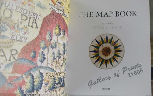
The Map Book
₱
3,300.00
Add to cart
Details
Rizal, Philippine Nationalist and Martyr.
₱
2,900.00
Add to cart
Details
The Calamansi Cook Book, An Expat’s Guide to Eating We...
₱
900.00
Add to cart
Details
The Cruise of the U.S. Flagship Olympia, from 1895-1899, fro...
₱
2,200.00
Add to cart
Details
The German Club Story Centennial Edition 1906 – 2006
₱
2,500.00
Add to cart
Details
Miniature Antique Maps
₱
4,400.00
Add to cart
Details
Magsaysay of the Philippines
₱
7,700.00
Add to cart
Details
Spanning the Decades 1902-2002
₱
2,600.00
Add to cart
Details
[Southeast Asia]
₱
26,400.00
Add to cart
Details
Philippine Islands. A Detailed Map. by Robinson H. E. C. Pt...
₱
34,200.00
Add to cart
Details
The German Club Manila 1986 – 1996 / 1906 – ...
₱
2,500.00
Add to cart
Details
Rare Pacific Voyage Books, part 2
₱
3,300.00
Add to cart
Details
Investing in Maps
₱
2,500.00
Add to cart
Details
Voyage Autour du Monde … 1826, 1827, 1828, et 1829...
₱
19,800.00
Add to cart
Details
Emergent Literature Essays on Philippine Writing
₱
600.00
Add to cart
Details
Admiral Paris’ Native Boats of Asia and the Pacific, 1...
₱
900.00
Add to cart
Details
Kirin, Harbin, Vladivostok
Details
Chart of the World on Mercator’s Projection, showing S...
Details
Map Showing Location of Panama Canal as Recommended by the I...
Details
Map of the Philippines. Prepared By Reduction From the Map o...
Details
City of Manila. Philippine Islands
Details
Trade Routes of the Orient
Details
1) Bird’s Eye View of the Walled City and Immediate En...
Details
Philippine Islands
Details
Beautiful Philippines. A Handbook of General Information
₱
65,600.00
Add to cart
Details
Mapping the Continent of Asia
₱
2,500.00
Add to cart
Details
Collecting Antique Maps
₱
3,300.00
Add to cart
Details
Atlas Journal de la Navigation Autour du Globe de la Fréga...
₱
33,000.00
Add to cart
Details
New Worlds The Great Voyages of Discovery 1400-1600
₱
2,870.00
Add to cart
Details
Map of the Sooloo Sea & Archipelago
₱
9,900.00
Add to cart
Details
Previous
1
2
3
4
5
6
7
8
…
61
62
63
Next
Shopping Cart
1) Phalanger celebensis. [Small Sulawesi Cuscus] 2-3) Phalanger sangirensis. [Sangihe Grey Cuscus]
1
Doldentraubige Bauhinie. Fig. 1182. [Raceme bauhinia]; Scharlachrothe Brownea. Fig. 1183. [Scarlet Brownea]; Bohnenförmige Dickhütse. Fig. 1184 [Bean-shaped thickhut]; Prächtige Schotie. Fig. 1185. [Magnificent Shotty]; Martius'scher Lokustbaum. Fig. 1185. [Martiusian locust tree]
1
[Luzon: Obere Savannengegend] [Upper Savanna Landscape]
1
Plan of the Port of Subec, in the Isle of Luconia
1
Cranobrontes waldeni [Lord Walden's Hornbill]
1
Recollections of a Voyage to the Philippines [1875]
1
Tabacum Latifolium ( Tobacco plant )
1
Les Isles Philippines, celle de Formose, le Sud de la Chine, les Royaumes de Tunkin, de Cochinchine, de Camboge, de Siam, des Laos… inset: 1) Isle de Guam. 2) [Isles Marianes]
1
A Map of the East Indies from the latest Authorities and Observations By John Blair L.L.D. & F.R.S. As a Supplement to His Tables of Chronology. [inset:] The Philippine Islands.
1
Die Palau - Inseln im Stillen Ocean Reiseerlebnisse.
1
Chart of the East India Islands...
1
Campagne des Environs de Manille (Oceanie) [Countryside near Manila]
1
[Luzon & Visayas]]
1
Mittheilungen aus Justus Perthes' Geographischer Anstalt. über wichtige neue Erforschungen auf dem Gesammtgebiete der Geographie von Dr. A. Petermann. - 23. Band, 1877
1
Island of Luzon. inset map: Islands of the Philippines north of Luzon
1
Reise Charte durch das Königreich Polen mit allen darzu gehörigen Laendern herausgegeben von Ioh. Michael, Probst in Augsburg
1
The Meat Market at Manilla
1
El Periodismo Filipino, 1811-1910 The First Century of Philippine Journalism Volume III Aparato Bibliografico de la Historia General de Filipinas
1
Insulae Philippinae alias Manilhae dictae
1
Indes Néerlandaises - Iles Philippines - Rapport. Présenté par M. René Brezet, Planteur, Délégué de la Chambre d'Agriculture de la Cochinchine, Chargé de Mission.1922
1
The Philippine Islands and others of the East Indies
1
International Map Collectors' Society IMCoS Journal December 2021 No.167
1
Dr. A. Petermann's Mittheilungen aus Justus Perthes' Geographischer Anstalt. Herausgegeben von Prof. Dr. A. Supan. - Ergänzungsband XVII, 1884-1885 Inhalt: [Supplement Vol. 17 contents] No. 76. Regel, Entwickelung der Ortschaften im Thüringerwald. No. 77. Stolze und Andreas, die Handelsverhältnisse Persiens. No. 78. Fritsche, ein Beitrag zur Geographie und Lehre vom Erdmagnetismus Asiens und Europas. No. 79. Mohn, die Strömungen des europäischen Nordmeeres. No. 80. Boas, Baffin-Land.
1
Manila Harbor Complimentary Map of the City of Manila
1
Philippine Cartography
1
The Expansion of Good Government and Commerce [written on the American Flag] 1900 [written on Naked Baby Boy's Sash] Philippine Islands [written over both Horns of a Water Buffalo] [A smiling Uncle Sam holding the American Flag behind an equally happy Baby Boy Philippines riding a Carabao, with a panorama of warships' silhouettes on a curved horizon.] AWAY DOWN EAST
1
Mapa de las Islas de la Sonda, y de las Malúcas. [inset:] Verdaderas Malúcas
1
Plans in the Philippine Island. insets: 1) Luzon - North Coast. Aparri. From the Philippine Government Chart of 1954. 2) Bataan I. Basco. From the Philippine Government Chart of 1954. 3) Luzon - West Coast. Santa Cruz. From the Philippine Government Chart of 1952. 4) Bataan I. Balugan Bay. From the Philippine Government Chart of 1953.
1
Nuestro Senor de Longos - Eglise de Benondo.
1
The East Indies drawn from the Latest Discoveries by T. Jefferys, Geographer, to his Royal Highness the Prince of Wales
1
Cart
Checkout
Continue Shopping
30