Tel : +63(2)-7729-8168 | Mobile: +63 917 806 4291
|
Email: gallery@gop.com.ph
My Account
Remember Me
Register
28 Item(s)
-
₱
878,450.00
Anchorages of Luzon, Mindoro and Marinduque. insets: 1) Luzon - West Coast. Bolinao Harbour. From the United States Government Survey of 1904. With additions and corrections from Philippine Gov't. Charts to 1964. 2) Luzon - West Coast. Port Masinloc and Port Matalvi. From the United States Government Surveys of 1937. With additions and corrections from Philippine Gov't. Charts to 1964. 3) Luzon - West Coast. Mariveles Harbour. From the United States Government Chart of 1940. With additions and corrections from Philippine Gov't. Charts to 1964. 4) Luzon - South - West Coast. Batangas. From the Philippine Government Chart of 1956. With additions and corrections to 1964. 5) Luzon - South - West Coast. Nasugbu Bay. From the Philippine Government Chart of 1956. 6) Marinduque. Port Balanacan. From the United States Government Survey of 1908. With additions and corrections from Philippine Gov't. Charts to 1964. 7) Marinduque. Santa Cruz Harbour. From the United States Government Survey of 1908. With additions and corrections from Philippine Gov't. Charts to 1964. 8) Mindoro - North Coast. Port Galera and Varadero Bay. From the United States Government Surveys to 1939. With additions and corrections from Philippine Gov't. Charts to 1964.
1 x
₱
11,000.00
El indio viejo [The Old Indio]
1 x
₱
49,500.00
Petr Petrovich Semenov: Travels in the Tian' - Shan' 1856 - 1857
1 x
₱
2,750.00
Map of the World on Mercators Projection
1 x
₱
6,600.00
Accion [stock certificate] No. 082362 Capital Social 50,000,000 de pesetas de 500 pesetas completamente liberada [Bodegas Bilbainas Shares]
1 x
₱
4,400.00
Musa Coccinea. Andr. [Tagalog: Flowering Banana]
1 x
₱
34,100.00
The Bontoc Igorot. The Ethnological Survey Publications vol. 1.
1 x
₱
14,700.00
Girl of the Isle of Luzon
1 x
₱
7,700.00
1) Plan of Solsogon Harbour on the South Coast of Luconia. 2) Chart on the Eastern Coast of Bongo Bay in the Island of Mindanao.
1 x
₱
36,500.00
[Carte Reduite] Carte Réduite des Isles Philippines Pour Servir Aux Vaisseaux du Roy Dressée au Dépost des Cartes Plans et Journaux de la Marine
1 x
₱
450,000.00
La Vie Illustrée No. 18 16 Février 1899
1 x
₱
12,900.00
Atlas des Voiliers et Pirogues du monde au début du XIXème siècle [Atlas of Sailboats and Pirogues of the World at the Beginning of the 19th Century]
1 x
₱
4,500.00
[Indochina] Indien jenseits deß Ganges theilet sich: …
1 x
₱
31,900.00
Philippine Islands. Tablas Strait with Part of Sibuyan Sea…Sources: United States Government Charts to 1935
1 x
₱
6,600.00
Manila y sus arrabales
1 x
₱
26,400.00
Lucon et Palaouan [Map of Luzon / Visayas]
1 x
₱
7,700.00
The Harbour, Manila.
1 x
₱
6,600.00
Coaconut Plantation, Zambooanga, Philippine Islands.
1 x
₱
4,400.00
Lasiocampidæ. Fig. 1, a, b, c. Gastropacha Quercifolia. Fig. 2. Lasiocampa Pruni. Fig. 3, a, b, c. Lasiocampa Pini. Fig. 4, a, b, c. Lasiocampa Potatoria. Fig. 5. Clisiocampa Populi. Fig. 6, a, b. Clisiocampa Neustria. Fig. 7, a, b, c. Clisiocampa Castrensis. Fig. 8, a, b. Eriogaster Catax. A. Leafy-branched Spurge. [Euphorbia Esula]. B. Plum. [Prunus Domestica.]. C. Scotch Fir. [Pinus Sylvestris.]
1 x
₱
3,300.00
A Map of the East Indies from the latest Authorities and Observations By John Blair L.L.D. & F.R.S. As a Supplement to His Tables of Chronology. [inset:] The Philippine Islands.
1 x
₱
26,400.00
Map showing Locations of Temporary Field Works Erected by the Spanish for The Land Defense of Havana, 1897-1898.
1 x
₱
13,200.00
[ Mayon Volcano]
1 x
₱
4,400.00
Manila and the Philippine Islands. An Up-to-date Handbook of Facts
1 x
₱
8,800.00
La bataille d'autre nous et contre cieux de Manille faicte le 14 Decembre ano 1600 [The battle between us and those of Manila on 14 December of the year 1600]
1 x
₱
77,000.00
In the Shape of Tradition. Indigenous Art of the Northern Philippines.
1 x
₱
9,500.00
1. Magellan pénètre dans la Mer du Sud. [Magellan entered the South Sea] 2. Le Rajah de Ternate visite Drake. [The Rajah of Ternate visits Drake]
1 x
₱
2,200.00
Sketches in Manilla. 1. Cock-Fighting at Manilla; 2. Nipa Houses at Manilla; 3. Market women of Manilla; 4. The Rainy Season, Manilla
1 x
₱
9,900.00
Men and Women of St. John (one of the Philippine Islands) in their respective habits.
1 x
₱
5,500.00
View Cart
Checkout
Home
About Us
Publications
Shop Online
Framing Services
Exhibits
Picture Hanging System
Contact Us
Blogs
View cart
“Men and Women of St. John (one of the Philippine Islands) in their respective habits.” has been added to your cart.
Sort by
Name
Sort by
Default Order
Sort by
Name
Sort by
Price
Sort by
Date
Sort by
Popularity
Show
30 Products
Show
30 Products
Show
60 Products
Show
90 Products
Von den Philippinen: Plaza Alfonso XII, und südlicher Teil ...
₱
6,600.00
Add to cart
Details
Von den Philippinen: Ansichten von Ilo-Ilo. 1) Das kaiserl....
₱
8,800.00
Add to cart
Details
Von den Philippinen: Ansichten von Ilo-Ilo & den Inseln ...
₱
8,800.00
Add to cart
Details
Vom amerikanisch=spanischen Kriegsschauplatz – Befesti...
₱
5,500.00
Add to cart
Details
Vom amerikanisch=spanischen Kriegsschauplatz [American-Span...
₱
9,900.00
Add to cart
Details
Vom amerikanisch=spanischen Kriegsschauplatz (American-Span...
₱
9,900.00
Add to cart
Details
Volcanic Eruption in the Island of Camiguin, Philippines.
₱
6,600.00
Add to cart
Details
Volcan Bulusan desde el S. S. O.
₱
4,400.00
Add to cart
Details
Vögel VII… [Voegel] 1) L’Oiseau de Paradis (Pa...
₱
13,200.00
Add to cart
Details
Vista general del pueblo y rada de parang en la costa s. o d...
₱
26,400.00
Add to cart
Details
Vista de Manila por la parte del mar.
₱
5,500.00
Add to cart
Details
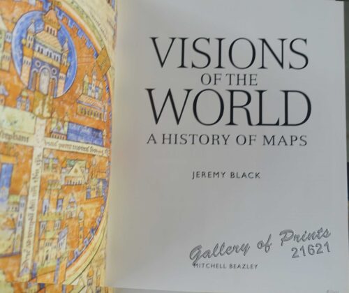
Visions of the World A History of Maps
₱
3,300.00
Add to cart
Details
Vingboons-Atlas
₱
49,500.00
Add to cart
Details
Ville de Manille / De Stad Manilha
₱
26,400.00
Add to cart
Details
Village of San Juento. Manila
₱
6,900.00
Add to cart
Details
Village mandaya (centre Mindanao)
₱
9,900.00
Add to cart
Details
VII. Provintiae seu Belgiu Foederatum exhibita Iohan Michael...
₱
3,300.00
Add to cart
Details
Viajes por Filipinas Reisen in den Philippinen [Travels in...
₱
61,600.00
Add to cart
Details
Viaje a Filipinas. – Moros-Moros, comedia y baile en e...
₱
11,000.00
Add to cart
Details
Viaje a Filipinas – Camino entre San Juan y Quinabla...
₱
11,000.00
Add to cart
Details
Vertooning van de kust vant Eyland Luconia digt by Manila.&#...
₱
15,700.00
Add to cart
Details
Unofficial Letters of an Official’s Wife
₱
13,200.00
Add to cart
Details
Ung habitant de lysle Capul [A native of the island of Capu...
₱
110,000.00
Add to cart
Details
Ung Batteau de Iapan dút Champan [A ship from Japan which t...
₱
50,600.00
Add to cart
Details
Previous
1
2
3
4
5
6
7
…
61
62
63
Next
Shopping Cart
Men and Women of St. John (one of the Philippine Islands) in their respective habits.
1
Sketches in Manilla. 1. Cock-Fighting at Manilla; 2. Nipa Houses at Manilla; 3. Market women of Manilla; 4. The Rainy Season, Manilla
1
1. Magellan pénètre dans la Mer du Sud. [Magellan entered the South Sea] 2. Le Rajah de Ternate visite Drake. [The Rajah of Ternate visits Drake]
1
In the Shape of Tradition. Indigenous Art of the Northern Philippines.
1
La bataille d'autre nous et contre cieux de Manille faicte le 14 Decembre ano 1600 [The battle between us and those of Manila on 14 December of the year 1600]
1
Manila and the Philippine Islands. An Up-to-date Handbook of Facts
1
[ Mayon Volcano]
1
Map showing Locations of Temporary Field Works Erected by the Spanish for The Land Defense of Havana, 1897-1898.
1
A Map of the East Indies from the latest Authorities and Observations By John Blair L.L.D. & F.R.S. As a Supplement to His Tables of Chronology. [inset:] The Philippine Islands.
1
Lasiocampidæ. Fig. 1, a, b, c. Gastropacha Quercifolia. Fig. 2. Lasiocampa Pruni. Fig. 3, a, b, c. Lasiocampa Pini. Fig. 4, a, b, c. Lasiocampa Potatoria. Fig. 5. Clisiocampa Populi. Fig. 6, a, b. Clisiocampa Neustria. Fig. 7, a, b, c. Clisiocampa Castrensis. Fig. 8, a, b. Eriogaster Catax. A. Leafy-branched Spurge. [Euphorbia Esula]. B. Plum. [Prunus Domestica.]. C. Scotch Fir. [Pinus Sylvestris.]
1
Coaconut Plantation, Zambooanga, Philippine Islands.
1
The Harbour, Manila.
1
Lucon et Palaouan [Map of Luzon / Visayas]
1
Manila y sus arrabales
1
Philippine Islands. Tablas Strait with Part of Sibuyan Sea…Sources: United States Government Charts to 1935
1
[Indochina] Indien jenseits deß Ganges theilet sich: …
1
Atlas des Voiliers et Pirogues du monde au début du XIXème siècle [Atlas of Sailboats and Pirogues of the World at the Beginning of the 19th Century]
1
La Vie Illustrée No. 18 16 Février 1899
1
[Carte Reduite] Carte Réduite des Isles Philippines Pour Servir Aux Vaisseaux du Roy Dressée au Dépost des Cartes Plans et Journaux de la Marine
1
1) Plan of Solsogon Harbour on the South Coast of Luconia. 2) Chart on the Eastern Coast of Bongo Bay in the Island of Mindanao.
1
Girl of the Isle of Luzon
1
The Bontoc Igorot. The Ethnological Survey Publications vol. 1.
1
Musa Coccinea. Andr. [Tagalog: Flowering Banana]
1
Accion [stock certificate] No. 082362 Capital Social 50,000,000 de pesetas de 500 pesetas completamente liberada [Bodegas Bilbainas Shares]
1
Map of the World on Mercators Projection
1
Petr Petrovich Semenov: Travels in the Tian' - Shan' 1856 - 1857
1
El indio viejo [The Old Indio]
1
Anchorages of Luzon, Mindoro and Marinduque. insets: 1) Luzon - West Coast. Bolinao Harbour. From the United States Government Survey of 1904. With additions and corrections from Philippine Gov't. Charts to 1964. 2) Luzon - West Coast. Port Masinloc and Port Matalvi. From the United States Government Surveys of 1937. With additions and corrections from Philippine Gov't. Charts to 1964. 3) Luzon - West Coast. Mariveles Harbour. From the United States Government Chart of 1940. With additions and corrections from Philippine Gov't. Charts to 1964. 4) Luzon - South - West Coast. Batangas. From the Philippine Government Chart of 1956. With additions and corrections to 1964. 5) Luzon - South - West Coast. Nasugbu Bay. From the Philippine Government Chart of 1956. 6) Marinduque. Port Balanacan. From the United States Government Survey of 1908. With additions and corrections from Philippine Gov't. Charts to 1964. 7) Marinduque. Santa Cruz Harbour. From the United States Government Survey of 1908. With additions and corrections from Philippine Gov't. Charts to 1964. 8) Mindoro - North Coast. Port Galera and Varadero Bay. From the United States Government Surveys to 1939. With additions and corrections from Philippine Gov't. Charts to 1964.
1
Cart
Checkout
Continue Shopping
28