Tel : +63(2)-7729-8168 | Mobile: +63 917 806 4291
|
Email: gallery@gop.com.ph
My Account
Remember Me
Register
8 Item(s)
-
₱
135,500.00
Group of Natives
1 x
₱
5,500.00
Unofficial Letters of an Official's Wife
1 x
₱
13,200.00
Environs de Samboangan (Ile Mindanao)
1 x
₱
33,900.00
Map of scout made by Troop F 3Cavaly from Apl. 8 - May 3 1900
1 x
₱
9,900.00
Anchorages of Luzon, Mindoro and Marinduque. insets: 1) Luzon - West Coast. Bolinao Harbour. From the United States Government Survey of 1904. With additions and corrections from Philippine Gov't. Charts to 1964. 2) Luzon - West Coast. Port Masinloc and Port Matalvi. From the United States Government Surveys of 1937. With additions and corrections from Philippine Gov't. Charts to 1964. 3) Luzon - West Coast. Mariveles Harbour. From the United States Government Chart of 1940. With additions and corrections from Philippine Gov't. Charts to 1964. 4) Luzon - South - West Coast. Batangas. From the Philippine Government Chart of 1956. With additions and corrections to 1964. 5) Luzon - South - West Coast. Nasugbu Bay. From the Philippine Government Chart of 1956. 6) Marinduque. Port Balanacan. From the United States Government Survey of 1908. With additions and corrections from Philippine Gov't. Charts to 1964. 7) Marinduque. Santa Cruz Harbour. From the United States Government Survey of 1908. With additions and corrections from Philippine Gov't. Charts to 1964. 8) Mindoro - North Coast. Port Galera and Varadero Bay. From the United States Government Surveys to 1939. With additions and corrections from Philippine Gov't. Charts to 1964.
1 x
₱
11,000.00
A Chart of the Channel in the Phillippine Islands through which the Manila Galleon Passes Together with the Adjacent Islands
1 x
₱
44,000.00
Plano de Malaga.
1 x
₱
3,300.00
Coucou, des Philippines [Philippine Coucal] [Sabukot/ Tsabukot] [Centropus Viridis]
1 x
₱
14,700.00
View Cart
Checkout
Home
About Us
Publications
Shop Online
Framing Services
Exhibits
Picture Hanging System
Contact Us
Blogs
View cart
“Coucou, des Philippines [Philippine Coucal] [Sabukot/ Tsabukot] [Centropus Viridis]” has been added to your cart.
Sort by
Date
Sort by
Default Order
Sort by
Name
Sort by
Price
Sort by
Date
Sort by
Popularity
Show
30 Products
Show
30 Products
Show
60 Products
Show
90 Products
Halcyon lindsayi lindsayi [Lindsay’s Kingfisher] (uppe...
₱
5,500.00
Add to cart
Details
Gallicolumba keayi [Negros Puñalada]
₱
5,500.00
Add to cart
Details
The Murillo Bulletin, Journal of PHIMCOS, Issue No.5
₱
540.00
Add to cart
Details
The Murillo Bulletin, Journal of PHIMCOS, Issue No.4
₱
540.00
Add to cart
Details
The Murillo Bulletin, Journal of PHIMCOS, Issue No.3
₱
450.00
Add to cart
Details
The Murillo Bulletin, Journal of PHIMCOS, Issue No.2
₱
900.00
Add to cart
Details
The Murillo Bulletin, Journal of PHIMCOS, Issue No.1
₱
350.00
Add to cart
Details
Terrain Handbook 41 Manila (Philippine Series)
₱
22,000.00
Add to cart
Details
Typus Fpeti Manilensis [sic], Detroit de Manilles, [Straits ...
₱
39,600.00
Add to cart
Details
Aus der Umgebung von Manila: Die Vorstadt Binondo. (View fro...
₱
5,500.00
Add to cart
Details
Exposicion de Filipinas en el Parque de Madrid. 1. Puente de...
₱
11,000.00
Add to cart
Details
Insulae Indiae Orientalis praecipuae, In quibus Moluccae cel...
₱
185,000.00
Add to cart
Details
Census of the Philippine Islands: 1903. Vol. 1 – Geogr...
₱
50,600.00
Add to cart
Details
MADRID. – Exposicion de Filipinas: Exterior de los edi...
₱
8,800.00
Add to cart
Details
A Triumphal Parade of Insurgent Troops in Manila
₱
14,700.00
Add to cart
Details
Isles Philippines a Paris chez le Rouge
₱
22,000.00
Add to cart
Details
Die Ostindischen Inseln nach den neuesten Berichtigungen dar...
₱
18,700.00
Add to cart
Details
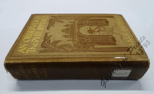
An Observer in the Philippines or Life in Our New Possession...
₱
8,800.00
Add to cart
Details
El Indicador del Viajero en las Islas Filipinas
₱
77,000.00
Add to cart
Details
The Fleet that did not go to the Philippines Admiral Camara&...
₱
11,000.00
Add to cart
Details
Map of the United States showing the Territorial Expansion o...
₱
33,100.00
Add to cart
Details
East India Archipelago [Eastern Passages to China and Japan]...
₱
39,600.00
Add to cart
Details
East India Archipelago [Eastern Passages to China and Japan]...
₱
36,000.00
Add to cart
Details
The Bontoc Igorot. The Ethnological Survey Publications vol....
₱
14,700.00
Add to cart
Details
Iloílo Straits – From a survey, 1900-1901
₱
7,700.00
Add to cart
Details
Sketch of General Progress – Philippine Islands pl. 2...
₱
5,500.00
Add to cart
Details
The Philippine Islands (Around the World Program)
₱
4,400.00
Add to cart
Details
Location of Troops in the Philippine Islands March 31, 1900....
₱
16,500.00
Add to cart
Details
Previous
1
2
3
…
44
45
46
47
48
49
50
…
61
62
63
Next
Shopping Cart
Coucou, des Philippines [Philippine Coucal] [Sabukot/ Tsabukot] [Centropus Viridis]
1
Plano de Malaga.
1
A Chart of the Channel in the Phillippine Islands through which the Manila Galleon Passes Together with the Adjacent Islands
1
Anchorages of Luzon, Mindoro and Marinduque. insets: 1) Luzon - West Coast. Bolinao Harbour. From the United States Government Survey of 1904. With additions and corrections from Philippine Gov't. Charts to 1964. 2) Luzon - West Coast. Port Masinloc and Port Matalvi. From the United States Government Surveys of 1937. With additions and corrections from Philippine Gov't. Charts to 1964. 3) Luzon - West Coast. Mariveles Harbour. From the United States Government Chart of 1940. With additions and corrections from Philippine Gov't. Charts to 1964. 4) Luzon - South - West Coast. Batangas. From the Philippine Government Chart of 1956. With additions and corrections to 1964. 5) Luzon - South - West Coast. Nasugbu Bay. From the Philippine Government Chart of 1956. 6) Marinduque. Port Balanacan. From the United States Government Survey of 1908. With additions and corrections from Philippine Gov't. Charts to 1964. 7) Marinduque. Santa Cruz Harbour. From the United States Government Survey of 1908. With additions and corrections from Philippine Gov't. Charts to 1964. 8) Mindoro - North Coast. Port Galera and Varadero Bay. From the United States Government Surveys to 1939. With additions and corrections from Philippine Gov't. Charts to 1964.
1
Map of scout made by Troop F 3Cavaly from Apl. 8 - May 3 1900
1
Environs de Samboangan (Ile Mindanao)
1
Unofficial Letters of an Official's Wife
1
Group of Natives
1
Cart
Checkout
Continue Shopping
8