Tel : +63(2)-7729-8168 | Mobile: +63 917 806 4291
|
Email: gallery@gop.com.ph
My Account
Remember Me
Register
38 Item(s)
-
₱
483,000.00
Notes on the Spanish-American War
1 x
₱
11,000.00
Yesterdays in the Philippines
1 x
₱
9,900.00
Philippine Air Lines Travel Information World Routes
1 x
₱
3,300.00
Fructus Jambosae Domesticae. Rumph. [English: Malaysian Apple] [Local Name: Makopa]
1 x
₱
34,100.00
Philippine Islands - Mindanao. Davao Gulf. From the Philippine Government Charts to 1956. With additions and corrections to 1962. insets: 1) Talomo Bay. From U.S Government Chart of 1933. With additions and corrections to 1962. 2) Lais. From U.S Government Chart of 1933. With additions and corrections to 1962. 3) Malita. From U.S Government Chart of 1933. With additions and corrections to 1962. 4) Port of Davao. From the Philippine Government Chart of 1956. With additions and corrections to 1962. 5) Pakiputan Strait. From U.S Government Chart of 1933. With additions and corrections to 1962.
1 x
₱
11,000.00
Antique Maps - Christie's Collectors Guide
1 x
₱
2,500.00
[Bàye la baye.] (Gulf of Albay]
1 x
₱
26,400.00
New York- A Suggestion For the Improvement of the Hudson River Water-front presented before the Architectural League by Milton See Drawn by HM. Pettit from the architect's plans - [see Page 241]
1 x
₱
3,300.00
Rue Saint-Roque a Manille, apres le tremblement de terre (voy. p. 198). (San Roque St. after the earthquake at Manila)
1 x
₱
5,500.00
East India Archipelago (Western Route to China. Chart No.6) London, Published by James Imray and Son, 89 & 102 Minories, 1872
1 x
₱
99,000.00
El Sitio de Manila (1898). Memorias de un voluntario
1 x
₱
6,600.00
Mouth of the Bay of Manilla.
1 x
₱
4,400.00
Retrospect - Some of the Filipino Leaders. 1) Gregorio del Pilar. 2) Isidoro Torres. 3) Artimo Ricardo. 4) Tomas Mascardo. 5) Gen. Emilio Aguinaldo. 6) José Ignacio Pana. 7) Pantaleon Garcia. 8) Brig.-Gen. Cardeñas. 9) Francisco Prieto. 10) Aguinaldo's Wife. 11) Aguinaldo's Carriage at Malolos. 12) Aguinaldo's Father-in-Law. 13) Gen. Luna's Fencing-School in Manila. 14) Vilo Bellarmino. 15) Antonio Luna. 16) Felipe Agoncello. 17) Pedro Alejandro Paterno. 18) Pedro Lionzon. 19) Pio del Pilar.
1 x
₱
8,800.00
Admiral George Dewey, U.S.N. From His latest photograph, taken on board the flag-ship "Olympia," Manila.
1 x
₱
13,200.00
1) Philippine Islands (to United States). 2) Tasmania. 3) North Borneo, Brunei & Sarawak (British) with prints on verso: 1. Borneo, Sumatra, Java, Etc. 2. Fiji Islands.
1 x
₱
6,600.00
Filipinas. 1) Filipinas. - Mujer Indigena. 2) Filipinas. - Hombre Indigena. 3) Filipinas. - Manila, Iglesia Sto. Domingo. 4) Filipinas. - Jolo, Entrada a la Ciudad. 5) Filipinas. - Ylo-Ylo, Calle Real. 6) Filipinas. - Manila, Iglesia Sta. Cruz. 7) Filipinas. - Manila, Vendedora. 8) Filipinas. - Aserrio de Maderas. 9) Filipinas. - Arando un Arrozal. 10) Filipinas. - Pagsanyan, Puerta Monumental. 12) Filipinas. - Manila, Calle de la Escolta.
1 x
₱
8,800.00
Manila Harbor Complimentary Map of the City of Manila.
1 x
₱
20,100.00
Mindanao - Philippine Islands
1 x
₱
17,600.00
Twenty Years in the Philippine Islands: [A critical review with excerpts from the work of P. de la Gironiere. A rare original article from the Blackwood's Edinburgh Magazine.]
1 x
₱
6,600.00
1. State of the Philippines in 1810; 2. Philippine Progress Prior to 1898
1 x
₱
4,400.00
Dr. A. Petermann's Mittheilungen aus Justus Perthes' Geographischer Anstalt. Herausgegeben von Dr. E. Behm. - Ergänzungsband XIV, 1880-1881 Inhalt: [Supplement Vol. 14 contents] No. 61. Rivoli, die Serra da Estrella. No. 62. Behm und Wagner, die Bevölkerung der Erde, VI. No. 63. Mohn, die Norwegische Nordmeer-Expedition. No. 64. Fischer, die Dattelpalme. No. 65. Berlepsch, die Gotthard-Bahn.
1 x
₱
6,000.00
Zambales
1 x
₱
17,600.00
Tabula Geographica oder Stätt-Zeiger darin[n]en zusehen die Distantien Zwischen den Vornehmsten Stätten in Europa. [Distance Table in French Miles Between European Cities]
1 x
₱
3,300.00
Two Ethnographic Collectors in the Late Spanish Philippines: Alexander Schadenberg & P.K.A. Meerkamp van Embden
1 x
₱
3,300.00
Islas de Leyte pl. 19, inset: Tacloban
1 x
₱
6,600.00
The Disturbances in China. Peking - The Forbidden City, as seen from the Imperial City
1 x
₱
5,500.00
Borneo
1 x
₱
4,400.00
Philippine Islands. Luzon Island. North of Latitude 16° 20' North. From the United States Cost Survey Charts to 1925. With additions and correctionsfrom the Philippine Gov't. Charts to 1963. Soundings in hairline enlarged from smaller scale charts.
1 x
₱
11,000.00
Die Ostindischen Inseln
1 x
₱
9,900.00
Anchorages of Luzon, Mindoro and Marinduque. insets: 1) Luzon - West Coast. Bolinao Harbour. From the United States Government Survey of 1904. With additions and corrections from Philippine Gov't. Charts to 1964. 2) Luzon - West Coast. Port Masinloc and Port Matalvi. From the United States Government Surveys of 1937. With additions and corrections from Philippine Gov't. Charts to 1964. 3) Luzon - West Coast. Mariveles Harbour. From the United States Government Chart of 1940. With additions and corrections from Philippine Gov't. Charts to 1964. 4) Luzon - South - West Coast. Batangas. From the Philippine Government Chart of 1956. With additions and corrections to 1964. 5) Luzon - South - West Coast. Nasugbu Bay. From the Philippine Government Chart of 1956. 6) Marinduque. Port Balanacan. From the United States Government Survey of 1908. With additions and corrections from Philippine Gov't. Charts to 1964. 7) Marinduque. Santa Cruz Harbour. From the United States Government Survey of 1908. With additions and corrections from Philippine Gov't. Charts to 1964. 8) Mindoro - North Coast. Port Galera and Varadero Bay. From the United States Government Surveys to 1939. With additions and corrections from Philippine Gov't. Charts to 1964.
1 x
₱
11,000.00
Philippine Islands insets: 1) Manila to Dagupan 2) Manila 3) Philippine Islands and the China Sea 4) Batanes (Bashee) and Babuyanes Is. 5) Sulu Archipelago
1 x
₱
17,200.00
Leyte
1 x
₱
17,600.00
Calamion or Culion I. Port Culion
1 x
₱
4,400.00
Memoria geológico-minera de las Islas Filipinas [Geological-Mining Report of the Philippine Islands]
1 x
₱
39,600.00
Dr. A. Petermann's Mittheilungen aus Justus Perthes' Geographischer Anstalt. Herausgegeben von Dr. E. Behm. - Ergänzungsband XVI, 1883-1884 Inhalt: [Supplement Vol. 16 contents] No. 71. Choroschchin und v. Stein, die russischen Kosakenheere. No. 72. Schuver, Reisen im oberen Nilgebiet. No. 73. Schumann, kristische Untersuchungen über die Zimtländer. No. 74. Drude, die Florenreiche der Erde. No. 75. v. Lendenfeld, der Tasman-Gletscher und seine Umrandung.
1 x
₱
6,000.00
Manila - Insurgent Attack on the Barracks of Co.C, 13th Minnesota Volunteers, during the Tondo fire.
1 x
₱
11,000.00
Régates de Saumur. [Saumur regattas]
1 x
₱
3,300.00
Maps & Civilization: Cartography in Culture and Society.
1 x
₱
2,200.00
View Cart
Checkout
Home
About Us
Publications
Shop Online
Framing Services
Exhibits
Picture Hanging System
Contact Us
Blogs
View cart
“Maps & Civilization: Cartography in Culture and Society.” has been added to your cart.
Sort by
Name
Sort by
Default Order
Sort by
Name
Sort by
Price
Sort by
Date
Sort by
Popularity
Show
30 Products
Show
30 Products
Show
60 Products
Show
90 Products
Von den Philippinen: Plaza Alfonso XII, und südlicher Teil ...
₱
6,600.00
Add to cart
Details
Von den Philippinen: Ansichten von Ilo-Ilo. 1) Das kaiserl....
₱
8,800.00
Add to cart
Details
Von den Philippinen: Ansichten von Ilo-Ilo & den Inseln ...
₱
8,800.00
Add to cart
Details
Vom amerikanisch=spanischen Kriegsschauplatz – Befesti...
₱
5,500.00
Add to cart
Details
Vom amerikanisch=spanischen Kriegsschauplatz [American-Span...
₱
9,900.00
Add to cart
Details
Vom amerikanisch=spanischen Kriegsschauplatz (American-Span...
₱
9,900.00
Add to cart
Details
Volcanic Eruption in the Island of Camiguin, Philippines.
₱
6,600.00
Add to cart
Details
Volcan Bulusan desde el S. S. O.
₱
4,400.00
Add to cart
Details
Vögel VII… [Voegel] 1) L’Oiseau de Paradis (Pa...
₱
13,200.00
Add to cart
Details
Vista general del pueblo y rada de parang en la costa s. o d...
₱
26,400.00
Add to cart
Details
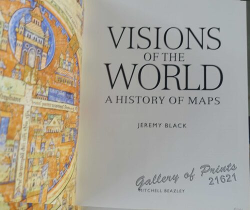
Visions of the World A History of Maps
₱
3,300.00
Add to cart
Details
Vingboons-Atlas
₱
49,500.00
Add to cart
Details
Ville de Manille / De Stad Manilha
₱
26,400.00
Add to cart
Details
Village of San Juento. Manila
₱
6,900.00
Add to cart
Details
Village mandaya (centre Mindanao)
₱
9,900.00
Add to cart
Details
VII. Provintiae seu Belgiu Foederatum exhibita Iohan Michael...
₱
3,300.00
Add to cart
Details
Viajes por Filipinas Reisen in den Philippinen [Travels in...
₱
61,600.00
Add to cart
Details
Viaje a Filipinas. – Moros-Moros, comedia y baile en e...
₱
11,000.00
Add to cart
Details
Viaje a Filipinas – Camino entre San Juan y Quinabla...
₱
11,000.00
Add to cart
Details
Vertooning van de kust vant Eyland Luconia digt by Manila.&#...
₱
15,700.00
Add to cart
Details
Unofficial Letters of an Official’s Wife
₱
13,200.00
Add to cart
Details
Ung habitant de lysle Capul [A native of the island of Capu...
₱
110,000.00
Add to cart
Details
Ung Batteau de Iapan dút Champan [A ship from Japan which t...
₱
50,600.00
Add to cart
Details
Une Rue de Manille [Manila Street]
₱
49,500.00
Add to cart
Details
Previous
1
2
3
4
5
6
7
…
61
62
63
Next
Shopping Cart
Maps & Civilization: Cartography in Culture and Society.
1
Régates de Saumur. [Saumur regattas]
1
Manila - Insurgent Attack on the Barracks of Co.C, 13th Minnesota Volunteers, during the Tondo fire.
1
Dr. A. Petermann's Mittheilungen aus Justus Perthes' Geographischer Anstalt. Herausgegeben von Dr. E. Behm. - Ergänzungsband XVI, 1883-1884 Inhalt: [Supplement Vol. 16 contents] No. 71. Choroschchin und v. Stein, die russischen Kosakenheere. No. 72. Schuver, Reisen im oberen Nilgebiet. No. 73. Schumann, kristische Untersuchungen über die Zimtländer. No. 74. Drude, die Florenreiche der Erde. No. 75. v. Lendenfeld, der Tasman-Gletscher und seine Umrandung.
1
Memoria geológico-minera de las Islas Filipinas [Geological-Mining Report of the Philippine Islands]
1
Calamion or Culion I. Port Culion
1
Leyte
1
Philippine Islands insets: 1) Manila to Dagupan 2) Manila 3) Philippine Islands and the China Sea 4) Batanes (Bashee) and Babuyanes Is. 5) Sulu Archipelago
1
Anchorages of Luzon, Mindoro and Marinduque. insets: 1) Luzon - West Coast. Bolinao Harbour. From the United States Government Survey of 1904. With additions and corrections from Philippine Gov't. Charts to 1964. 2) Luzon - West Coast. Port Masinloc and Port Matalvi. From the United States Government Surveys of 1937. With additions and corrections from Philippine Gov't. Charts to 1964. 3) Luzon - West Coast. Mariveles Harbour. From the United States Government Chart of 1940. With additions and corrections from Philippine Gov't. Charts to 1964. 4) Luzon - South - West Coast. Batangas. From the Philippine Government Chart of 1956. With additions and corrections to 1964. 5) Luzon - South - West Coast. Nasugbu Bay. From the Philippine Government Chart of 1956. 6) Marinduque. Port Balanacan. From the United States Government Survey of 1908. With additions and corrections from Philippine Gov't. Charts to 1964. 7) Marinduque. Santa Cruz Harbour. From the United States Government Survey of 1908. With additions and corrections from Philippine Gov't. Charts to 1964. 8) Mindoro - North Coast. Port Galera and Varadero Bay. From the United States Government Surveys to 1939. With additions and corrections from Philippine Gov't. Charts to 1964.
1
Die Ostindischen Inseln
1
Philippine Islands. Luzon Island. North of Latitude 16° 20' North. From the United States Cost Survey Charts to 1925. With additions and correctionsfrom the Philippine Gov't. Charts to 1963. Soundings in hairline enlarged from smaller scale charts.
1
Borneo
1
The Disturbances in China. Peking - The Forbidden City, as seen from the Imperial City
1
Islas de Leyte pl. 19, inset: Tacloban
1
Two Ethnographic Collectors in the Late Spanish Philippines: Alexander Schadenberg & P.K.A. Meerkamp van Embden
1
Tabula Geographica oder Stätt-Zeiger darin[n]en zusehen die Distantien Zwischen den Vornehmsten Stätten in Europa. [Distance Table in French Miles Between European Cities]
1
Zambales
1
Dr. A. Petermann's Mittheilungen aus Justus Perthes' Geographischer Anstalt. Herausgegeben von Dr. E. Behm. - Ergänzungsband XIV, 1880-1881 Inhalt: [Supplement Vol. 14 contents] No. 61. Rivoli, die Serra da Estrella. No. 62. Behm und Wagner, die Bevölkerung der Erde, VI. No. 63. Mohn, die Norwegische Nordmeer-Expedition. No. 64. Fischer, die Dattelpalme. No. 65. Berlepsch, die Gotthard-Bahn.
1
1. State of the Philippines in 1810; 2. Philippine Progress Prior to 1898
1
Twenty Years in the Philippine Islands: [A critical review with excerpts from the work of P. de la Gironiere. A rare original article from the Blackwood's Edinburgh Magazine.]
1
Mindanao - Philippine Islands
1
Manila Harbor Complimentary Map of the City of Manila.
1
Filipinas. 1) Filipinas. - Mujer Indigena. 2) Filipinas. - Hombre Indigena. 3) Filipinas. - Manila, Iglesia Sto. Domingo. 4) Filipinas. - Jolo, Entrada a la Ciudad. 5) Filipinas. - Ylo-Ylo, Calle Real. 6) Filipinas. - Manila, Iglesia Sta. Cruz. 7) Filipinas. - Manila, Vendedora. 8) Filipinas. - Aserrio de Maderas. 9) Filipinas. - Arando un Arrozal. 10) Filipinas. - Pagsanyan, Puerta Monumental. 12) Filipinas. - Manila, Calle de la Escolta.
1
1) Philippine Islands (to United States). 2) Tasmania. 3) North Borneo, Brunei & Sarawak (British) with prints on verso: 1. Borneo, Sumatra, Java, Etc. 2. Fiji Islands.
1
Admiral George Dewey, U.S.N. From His latest photograph, taken on board the flag-ship "Olympia," Manila.
1
Retrospect - Some of the Filipino Leaders. 1) Gregorio del Pilar. 2) Isidoro Torres. 3) Artimo Ricardo. 4) Tomas Mascardo. 5) Gen. Emilio Aguinaldo. 6) José Ignacio Pana. 7) Pantaleon Garcia. 8) Brig.-Gen. Cardeñas. 9) Francisco Prieto. 10) Aguinaldo's Wife. 11) Aguinaldo's Carriage at Malolos. 12) Aguinaldo's Father-in-Law. 13) Gen. Luna's Fencing-School in Manila. 14) Vilo Bellarmino. 15) Antonio Luna. 16) Felipe Agoncello. 17) Pedro Alejandro Paterno. 18) Pedro Lionzon. 19) Pio del Pilar.
1
Mouth of the Bay of Manilla.
1
El Sitio de Manila (1898). Memorias de un voluntario
1
East India Archipelago (Western Route to China. Chart No.6) London, Published by James Imray and Son, 89 & 102 Minories, 1872
1
Rue Saint-Roque a Manille, apres le tremblement de terre (voy. p. 198). (San Roque St. after the earthquake at Manila)
1
New York- A Suggestion For the Improvement of the Hudson River Water-front presented before the Architectural League by Milton See Drawn by HM. Pettit from the architect's plans - [see Page 241]
1
[Bàye la baye.] (Gulf of Albay]
1
Antique Maps - Christie's Collectors Guide
1
Philippine Islands - Mindanao. Davao Gulf. From the Philippine Government Charts to 1956. With additions and corrections to 1962. insets: 1) Talomo Bay. From U.S Government Chart of 1933. With additions and corrections to 1962. 2) Lais. From U.S Government Chart of 1933. With additions and corrections to 1962. 3) Malita. From U.S Government Chart of 1933. With additions and corrections to 1962. 4) Port of Davao. From the Philippine Government Chart of 1956. With additions and corrections to 1962. 5) Pakiputan Strait. From U.S Government Chart of 1933. With additions and corrections to 1962.
1
Fructus Jambosae Domesticae. Rumph. [English: Malaysian Apple] [Local Name: Makopa]
1
Philippine Air Lines Travel Information World Routes
1
Yesterdays in the Philippines
1
Notes on the Spanish-American War
1
Cart
Checkout
Continue Shopping
38