Tel : +63(2)-7729-8168 | Mobile: +63 917 806 4291
|
Email: gallery@gop.com.ph
My Account
Remember Me
Register
29 Item(s)
-
₱
634,940.00
Les Isles Philippines 1682
1 x
₱
22,000.00
La Guerra en Filipinas. - Las Canteras de Montalbán (Manila), donde fueron derrotados los insurrectos por la columna del comandante Olaguer. [The War in the Philippines. - The Montalban Quarries (Manila), where the insurgents were defeated by Commander Olaguer's column.]
1 x
₱
3,300.00
Indiae Orientalis, nec non Insularum Adiacentum Nova Descriptio
1 x
₱
110,000.00
Luzon pl. 9 inset: Laguna de Taal [Bataan, Morong, Manila, Cavite, Laguna, Batangas]
1 x
₱
6,600.00
Expedition and Engagement of Pinauran November !22!1900
1 x
₱
5,500.00
Action between 28" Inf. U.S.V. and Filipino Rebels July 17, 1900 at Bario Jalang, Pueblo San Louis, Province of Batangas, Luzon
1 x
₱
5,500.00
Pic surnommé le Cardinal de l'Isle de Luçon. [Peak named the Cardinal in the Island of Luzon]
1 x
₱
6,600.00
The Philippine Islands showing location of Resources and Industries Isthmian Canal Commission Economic Report 1901. Authority for Topographic Data Foreman. The Philippine Islands. 1899. Note: Facts from Foreman verified in most cases by U.S. Government Reports
1 x
₱
46,200.00
Poinsettia Pulcherrima. Grah. [English: Poinsettia. Spanish: Pascuas] [Local Name: Christmas Flower]
1 x
₱
26,400.00
Isla de Luzon pl. 7 (Ilocos Norte, Ilocos Sur, La Union, Benguet, Isabela, Nueva Viscaya, Cagayan…)
1 x
₱
6,600.00
Location of Troops in the Philippine Islands March 31, 1900.
1 x
₱
16,500.00
1. Igorot Spinster House in the Mountain Province of Bontoc; 2. Ilongot House on Stilts in the Province of Nueva Viscaya.
1 x
₱
4,400.00
Vue de Sambouangue [View of Zamboanga]
1 x
₱
26,400.00
[Luzon & Visayas]]
1 x
₱
145,000.00
A view of Cape Espiritu Santo, on Samal, one of the Phillippine Islands… Centurion engag’d and took the Spanish Galeon call’d Nostra Seigniora de Cabadonga, from Acapulco bound to Manila.
1 x
₱
13,200.00
The Philipine Isles
1 x
₱
61,600.00
Colombes et Lis, Étoffe Imprimée. [Doves and Lilies, Printed Fabric]
1 x
₱
6,600.00
[ Mayon Volcano]
1 x
₱
4,400.00
Spanish Bridge, Manila.
1 x
₱
2,200.00
Sheet No. 4. Road Map from S. Manuel to Sto. Tomas plotted during Advance of Gen. Young's Brigade of 1st Div. 8th A. C. Maj. Gen. H. W. Lawton U. S. V. Commanding. Prepared under direction of John C. Oakes. 1st Lieut Corps of Engineers Division Engineer.
1 x
₱
8,800.00
Manila. - El Hospital de San Juan de Dios.
1 x
₱
5,500.00
Sheet No. 7. Road Map from Sta. Cruz to Santa plotted during Advance of Gen. Young's Brigade of 1st Div. 8th A. C. Maj. Gen. H. W. Lawton U. S. V. Commanding. Prepared under direction of John C. Oakes. 1st Lieut Corps of Engineers Division Engineer.
1 x
₱
8,800.00
Engagement of March 7, 1899 [Near San Pedro Macati, Luzon
1 x
₱
2,200.00
[Asia] Asiens Theile seyn: …
1 x
₱
31,900.00
San Miguel (Filipinas). - Camarin de Azúcar. La República Tagala. [Sugar Preparation Area]
1 x
₱
5,500.00
1) Mus callitrichus. [Beautiful-tailed Rat, Lovely-haired Rat, Greater Taeromys] 2-10) Mus hellwaldi. [Hellwald's Spiny Rat]
1 x
₱
2,200.00
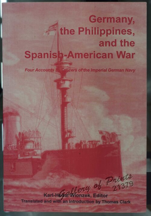
Germany, the Philippines, and the Spanish American War.
1 x
₱
440.00
Anchorages of Luzon, Mindoro and Marinduque. insets: 1) Luzon - West Coast. Bolinao Harbour. From the United States Government Survey of 1904. With additions and corrections from Philippine Gov't. Charts to 1964. 2) Luzon - West Coast. Port Masinloc and Port Matalvi. From the United States Government Surveys of 1937. With additions and corrections from Philippine Gov't. Charts to 1964. 3) Luzon - West Coast. Mariveles Harbour. From the United States Government Chart of 1940. With additions and corrections from Philippine Gov't. Charts to 1964. 4) Luzon - South - West Coast. Batangas. From the Philippine Government Chart of 1956. With additions and corrections to 1964. 5) Luzon - South - West Coast. Nasugbu Bay. From the Philippine Government Chart of 1956. 6) Marinduque. Port Balanacan. From the United States Government Survey of 1908. With additions and corrections from Philippine Gov't. Charts to 1964. 7) Marinduque. Santa Cruz Harbour. From the United States Government Survey of 1908. With additions and corrections from Philippine Gov't. Charts to 1964. 8) Mindoro - North Coast. Port Galera and Varadero Bay. From the United States Government Surveys to 1939. With additions and corrections from Philippine Gov't. Charts to 1964.
1 x
₱
11,000.00
Chart of the Coast of China and of the Japan Islands including the Marianes and a part of the Philippines. Compiled by order of Commodore M. C. Perry. U.S.N. from the latest authorities with additions and corrections by the U.S. Japan Expedition by Lieuts. W. L. Maury and S. Bent. U.S.N.
1 x
₱
39,600.00
View Cart
Checkout
Home
About Us
Publications
Shop Online
Framing Services
Exhibits
Picture Hanging System
Contact Us
View cart
You cannot add another "Spanish Bridge, Manila." to your cart.
Sort by
Default Order
Sort by
Default Order
Sort by
Name
Sort by
Price
Sort by
Date
Sort by
Popularity
Show
30 Products
Show
30 Products
Show
60 Products
Show
90 Products
Ein Tagalendorf auf Luzon. (Nach der Natur) [Tagal Village i...
₱
8,800.00
Add to cart
Details
Lucon et Palaouan [Map of Luzon / Visayas]
₱
7,700.00
Add to cart
Details
Men and Women of St. John (one of the Philippine Islands) in...
₱
5,500.00
Add to cart
Details
Natives of Luzon ( Phillippines ) [sic]
₱
15,800.00
Add to cart
Details
Carte des Indes et de la Chine…
₱
39,600.00
Add to cart
Details
Filipinas. – El General Lawton y su séquito en un des...
₱
5,500.00
Add to cart
Details
Partie de la Mer du Sud comprise entre les Philippines et la...
₱
61,600.00
Add to cart
Details
The Philippines in the 19th Century (A Collection of Prin...
₱
3,500.00
Add to cart
Details
Sketches in Manilla. 1. Cock-Fighting at Manilla; 2. Nipa Ho...
₱
9,900.00
Add to cart
Details
Femme de Soulou.
₱
3,300.00
Add to cart
Details
Ñora Goya.
₱
49,500.00
Add to cart
Details
El indio viejo [The Old Indio]
₱
39,600.00
Add to cart
Details
La Buyera.
₱
49,500.00
Add to cart
Details
Los Baños. (Provincia de la Laguna.)
₱
49,500.00
Add to cart
Details
Cascada del Botocan. Provincia de la Laguna. [Botocan Falls]...
₱
49,500.00
Add to cart
Details
Philippine Islands with insets: ‘1. Manila and Vicinit...
₱
4,400.00
Add to cart
Details
Flamants.
₱
5,500.00
Add to cart
Details
Canards Boschas.
₱
5,500.00
Add to cart
Details
China Sea – Macclesfield Bank. Surveyed by Commander W...
₱
6,600.00
Add to cart
Details
The Hakluyt Society. The Travels and Controversies of Friar ...
₱
6,600.00
Add to cart
Details
Postcards
₱
990.00
Add to cart
Details
1) Plan du port d’ Acapulco sur la Côte du Mexique da...
₱
26,400.00
Add to cart
Details
Carte des Nouvelles Philippines – Kaart der Nieuwe Phi...
₱
11,000.00
Add to cart
Details
De Stad Manilha
₱
88,000.00
Add to cart
Details
Previous
1
2
3
4
5
6
7
…
58
59
60
Next
Shopping Cart
Chart of the Coast of China and of the Japan Islands including the Marianes and a part of the Philippines. Compiled by order of Commodore M. C. Perry. U.S.N. from the latest authorities with additions and corrections by the U.S. Japan Expedition by Lieuts. W. L. Maury and S. Bent. U.S.N.
1
Anchorages of Luzon, Mindoro and Marinduque. insets: 1) Luzon - West Coast. Bolinao Harbour. From the United States Government Survey of 1904. With additions and corrections from Philippine Gov't. Charts to 1964. 2) Luzon - West Coast. Port Masinloc and Port Matalvi. From the United States Government Surveys of 1937. With additions and corrections from Philippine Gov't. Charts to 1964. 3) Luzon - West Coast. Mariveles Harbour. From the United States Government Chart of 1940. With additions and corrections from Philippine Gov't. Charts to 1964. 4) Luzon - South - West Coast. Batangas. From the Philippine Government Chart of 1956. With additions and corrections to 1964. 5) Luzon - South - West Coast. Nasugbu Bay. From the Philippine Government Chart of 1956. 6) Marinduque. Port Balanacan. From the United States Government Survey of 1908. With additions and corrections from Philippine Gov't. Charts to 1964. 7) Marinduque. Santa Cruz Harbour. From the United States Government Survey of 1908. With additions and corrections from Philippine Gov't. Charts to 1964. 8) Mindoro - North Coast. Port Galera and Varadero Bay. From the United States Government Surveys to 1939. With additions and corrections from Philippine Gov't. Charts to 1964.
1
Germany, the Philippines, and the Spanish American War.
1
1) Mus callitrichus. [Beautiful-tailed Rat, Lovely-haired Rat, Greater Taeromys] 2-10) Mus hellwaldi. [Hellwald's Spiny Rat]
1
San Miguel (Filipinas). - Camarin de Azúcar. La República Tagala. [Sugar Preparation Area]
1
[Asia] Asiens Theile seyn: …
1
Engagement of March 7, 1899 [Near San Pedro Macati, Luzon
1
Sheet No. 7. Road Map from Sta. Cruz to Santa plotted during Advance of Gen. Young's Brigade of 1st Div. 8th A. C. Maj. Gen. H. W. Lawton U. S. V. Commanding. Prepared under direction of John C. Oakes. 1st Lieut Corps of Engineers Division Engineer.
1
Manila. - El Hospital de San Juan de Dios.
1
Sheet No. 4. Road Map from S. Manuel to Sto. Tomas plotted during Advance of Gen. Young's Brigade of 1st Div. 8th A. C. Maj. Gen. H. W. Lawton U. S. V. Commanding. Prepared under direction of John C. Oakes. 1st Lieut Corps of Engineers Division Engineer.
1
Spanish Bridge, Manila.
1
[ Mayon Volcano]
1
Colombes et Lis, Étoffe Imprimée. [Doves and Lilies, Printed Fabric]
1
The Philipine Isles
1
A view of Cape Espiritu Santo, on Samal, one of the Phillippine Islands… Centurion engag’d and took the Spanish Galeon call’d Nostra Seigniora de Cabadonga, from Acapulco bound to Manila.
1
[Luzon & Visayas]]
1
Vue de Sambouangue [View of Zamboanga]
1
1. Igorot Spinster House in the Mountain Province of Bontoc; 2. Ilongot House on Stilts in the Province of Nueva Viscaya.
1
Location of Troops in the Philippine Islands March 31, 1900.
1
Isla de Luzon pl. 7 (Ilocos Norte, Ilocos Sur, La Union, Benguet, Isabela, Nueva Viscaya, Cagayan…)
1
Poinsettia Pulcherrima. Grah. [English: Poinsettia. Spanish: Pascuas] [Local Name: Christmas Flower]
1
The Philippine Islands showing location of Resources and Industries Isthmian Canal Commission Economic Report 1901. Authority for Topographic Data Foreman. The Philippine Islands. 1899. Note: Facts from Foreman verified in most cases by U.S. Government Reports
1
Pic surnommé le Cardinal de l'Isle de Luçon. [Peak named the Cardinal in the Island of Luzon]
1
Action between 28" Inf. U.S.V. and Filipino Rebels July 17, 1900 at Bario Jalang, Pueblo San Louis, Province of Batangas, Luzon
1
Expedition and Engagement of Pinauran November !22!1900
1
Luzon pl. 9 inset: Laguna de Taal [Bataan, Morong, Manila, Cavite, Laguna, Batangas]
1
Indiae Orientalis, nec non Insularum Adiacentum Nova Descriptio
1
La Guerra en Filipinas. - Las Canteras de Montalbán (Manila), donde fueron derrotados los insurrectos por la columna del comandante Olaguer. [The War in the Philippines. - The Montalban Quarries (Manila), where the insurgents were defeated by Commander Olaguer's column.]
1
Les Isles Philippines 1682
1
Cart
Checkout
Continue Shopping
29