Tel : +63(2)-7729-8168 | Mobile: +63 917 806 4291
|
Email: gallery@gop.com.ph
My Account
Remember Me
Register
21 Item(s)
-
₱
570,500.00
Interior of the Crater of the Volcano at Taal
1 x
₱
8,800.00
The Making of the Nuremberg Chronicle
1 x
₱
8,800.00
1.) Hotel Inglaterra and Central Park, Havana; 2.) Primitive Farming Implement in the Philippines; 3.) Main Business Street in Manila; 4.) A Country on Cart Entering Havana; 5.) A View of Santiago; 6.) Torpedo Assembling Department; 7.) Munitions of War on Way to Transports.
1 x
₱
9,900.00
The Philippine Islands. with inset - Manila Bay
1 x
₱
4,400.00
Scandinavia complectus Sueciae Daniae et Norvegiae Regna excusa a Iohan Michael Probst Aug: Vind
1 x
₱
3,300.00
Sketches in Manilla. 1. Cock-Fighting at Manilla; 2. Nipa Houses at Manilla; 3. Market women of Manilla; 4. The Rainy Season, Manilla
1 x
₱
9,900.00
Visions of the World A History of Maps
1 x
₱
3,300.00
Die Palau - Inseln im Stillen Ocean Reiseerlebnisse.
1 x
₱
17,700.00
Ein Tagalendorf auf Luzon. (Nach der Natur) [Tagal Village in Luzon]
1 x
₱
8,800.00
Pont de Manille (Iles Philippines.) [Manila Bridge (Philippine Islands) and Costumes]
1 x
₱
330,000.00
Anchorages of Luzon, Mindoro and Marinduque. insets: 1) Luzon - West Coast. Bolinao Harbour. From the United States Government Survey of 1904. With additions and corrections from Philippine Gov't. Charts to 1964. 2) Luzon - West Coast. Port Masinloc and Port Matalvi. From the United States Government Surveys of 1937. With additions and corrections from Philippine Gov't. Charts to 1964. 3) Luzon - West Coast. Mariveles Harbour. From the United States Government Chart of 1940. With additions and corrections from Philippine Gov't. Charts to 1964. 4) Luzon - South - West Coast. Batangas. From the Philippine Government Chart of 1956. With additions and corrections to 1964. 5) Luzon - South - West Coast. Nasugbu Bay. From the Philippine Government Chart of 1956. 6) Marinduque. Port Balanacan. From the United States Government Survey of 1908. With additions and corrections from Philippine Gov't. Charts to 1964. 7) Marinduque. Santa Cruz Harbour. From the United States Government Survey of 1908. With additions and corrections from Philippine Gov't. Charts to 1964. 8) Mindoro - North Coast. Port Galera and Varadero Bay. From the United States Government Surveys to 1939. With additions and corrections from Philippine Gov't. Charts to 1964.
1 x
₱
11,000.00
Europe
1 x
₱
3,300.00
Map showing Locations of Temporary Field Works Erected by the Spanish for The Land Defense of Havana, 1897-1898.
1 x
₱
13,200.00
White Man and Brown Man in the Philippines
1 x
₱
4,400.00
The Hakluyt Society. The Travels and Controversies of Friar Domingo Navarette (1618-1686). Second Series: No. 118 [volume I] Second Series: No. 119 [volume II]
1 x
₱
4,400.00
Manilia
1 x
₱
39,600.00
Die Ostindischen Inseln...
1 x
₱
39,600.00
Quaint Corners of Ancient Empires: Southern India, Burma and Manila
1 x
₱
9,900.00
The Murillo Bulletin, Journal of PHIMCOS, Issue No. 9
1 x
₱
600.00
Les Isles Philippines - Islas de los Ladrones... ou Isles des Larrons
1 x
₱
33,000.00
Albay (Islas Filipinas). - Panorama de la Monataña y peligroso Volcan del mayon. (De un dibujo del natural.)
1 x
₱
6,600.00
View Cart
Checkout
Home
About Us
Publications
Shop Online
Framing Services
Exhibits
Picture Hanging System
Contact Us
Blogs
View cart
“Albay (Islas Filipinas). – Panorama de la Monataña y peligroso Volcan del mayon. (De un dibujo del natural.)” has been added to your cart.
Sort by
Popularity
Sort by
Default Order
Sort by
Name
Sort by
Price
Sort by
Date
Sort by
Popularity
Show
30 Products
Show
30 Products
Show
60 Products
Show
90 Products
Vista de Manila por la parte del mar.
₱
5,500.00
Add to cart
Details
Manila and the Philippine Islands. An Up-to-date Handbook of...
₱
8,800.00
Add to cart
Details
Abendunterhaltung in einer Tagalenfamilie. [Evening Entertai...
₱
9,900.00
Add to cart
Details
Manila Harbor Complimentary Map of the City of Manila
₱
22,000.00
Add to cart
Details
The Mapping of the Heavens
₱
1,980.00
Add to cart
Details
Philippines
₱
8,800.00
Add to cart
Details
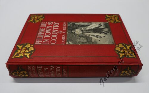
Philippine Life in Town & Country.
₱
8,800.00
Add to cart
Details
Rizal
₱
17,600.00
Add to cart
Details
Bohol
₱
17,600.00
Add to cart
Details
Leyte
₱
17,600.00
Add to cart
Details
Zambales
₱
17,600.00
Add to cart
Details
Map of Pacific Ocean by Robinson H. E. C. Pty. Ltd. Mercat...
₱
14,700.00
Add to cart
Details
South Island New Zealand
₱
4,400.00
Add to cart
Details
Northern Island New Zealand
₱
4,400.00
Add to cart
Details
The Mysteries of Taal: A Philippine Volcano and Lake, Her S...
₱
900.00
Add to cart
Details
Iloilo A Rich and Noble Land
₱
7,500.00
Add to cart
Details
When Britain Ruled the Philippines 1762-1764
₱
2,200.00
Add to cart
Details
Spanish Galleon 1530 – 1690 New Vanguard # 96
₱
2,200.00
Add to cart
Details
The Manila-Acapulco Galleons: The Treasure Ships of the Paci...
₱
4,400.00
Add to cart
Details
The National Geographic Magazine September, 1952, vol. CII, ...
₱
1,100.00
Add to cart
Details
Karte der St. Gotthard-Bahn, Taf.2 [Map of The Gotthard-Rail...
₱
6,600.00
Add to cart
Details
The Far East Compiled and Drawn in the Cartographic Section ...
₱
6,600.00
Add to cart
Details
Philippine Religious – Carvings in Ivory
₱
2,500.00
Add to cart
Details
Filipino Master – Damian Domingo
₱
2,500.00
Add to cart
Details
The Age of Trade The Manila Galleons and the Dawn of the Glo...
₱
6,600.00
Add to cart
Details
Adios, Patria Adorada [The Filipino as Ilustrado, The Ilustr...
₱
990.00
Add to cart
Details
Blue Book of the First Year of the Republic of the Philippin...
₱
24,500.00
Add to cart
Details
Evangelización de Filipinas y del Japon Historia de las Isl...
₱
2,200.00
Add to cart
Details
The Golden Atlas: The Greatest Explorations, Quests and Dis...
₱
3,300.00
Add to cart
Details
Early Mapping of the Pacific The Epic Story of Seafarers, Ad...
₱
6,600.00
Add to cart
Details
Previous
1
2
3
4
5
6
…
61
62
63
Next
Shopping Cart
Albay (Islas Filipinas). - Panorama de la Monataña y peligroso Volcan del mayon. (De un dibujo del natural.)
1
Les Isles Philippines - Islas de los Ladrones... ou Isles des Larrons
1
The Murillo Bulletin, Journal of PHIMCOS, Issue No. 9
1
Quaint Corners of Ancient Empires: Southern India, Burma and Manila
1
Die Ostindischen Inseln...
1
Manilia
1
The Hakluyt Society. The Travels and Controversies of Friar Domingo Navarette (1618-1686). Second Series: No. 118 [volume I] Second Series: No. 119 [volume II]
1
White Man and Brown Man in the Philippines
1
Map showing Locations of Temporary Field Works Erected by the Spanish for The Land Defense of Havana, 1897-1898.
1
Europe
1
Anchorages of Luzon, Mindoro and Marinduque. insets: 1) Luzon - West Coast. Bolinao Harbour. From the United States Government Survey of 1904. With additions and corrections from Philippine Gov't. Charts to 1964. 2) Luzon - West Coast. Port Masinloc and Port Matalvi. From the United States Government Surveys of 1937. With additions and corrections from Philippine Gov't. Charts to 1964. 3) Luzon - West Coast. Mariveles Harbour. From the United States Government Chart of 1940. With additions and corrections from Philippine Gov't. Charts to 1964. 4) Luzon - South - West Coast. Batangas. From the Philippine Government Chart of 1956. With additions and corrections to 1964. 5) Luzon - South - West Coast. Nasugbu Bay. From the Philippine Government Chart of 1956. 6) Marinduque. Port Balanacan. From the United States Government Survey of 1908. With additions and corrections from Philippine Gov't. Charts to 1964. 7) Marinduque. Santa Cruz Harbour. From the United States Government Survey of 1908. With additions and corrections from Philippine Gov't. Charts to 1964. 8) Mindoro - North Coast. Port Galera and Varadero Bay. From the United States Government Surveys to 1939. With additions and corrections from Philippine Gov't. Charts to 1964.
1
Pont de Manille (Iles Philippines.) [Manila Bridge (Philippine Islands) and Costumes]
1
Ein Tagalendorf auf Luzon. (Nach der Natur) [Tagal Village in Luzon]
1
Die Palau - Inseln im Stillen Ocean Reiseerlebnisse.
1
Visions of the World A History of Maps
1
Sketches in Manilla. 1. Cock-Fighting at Manilla; 2. Nipa Houses at Manilla; 3. Market women of Manilla; 4. The Rainy Season, Manilla
1
Scandinavia complectus Sueciae Daniae et Norvegiae Regna excusa a Iohan Michael Probst Aug: Vind
1
The Philippine Islands. with inset - Manila Bay
1
1.) Hotel Inglaterra and Central Park, Havana; 2.) Primitive Farming Implement in the Philippines; 3.) Main Business Street in Manila; 4.) A Country on Cart Entering Havana; 5.) A View of Santiago; 6.) Torpedo Assembling Department; 7.) Munitions of War on Way to Transports.
1
The Making of the Nuremberg Chronicle
1
Interior of the Crater of the Volcano at Taal
1
Cart
Checkout
Continue Shopping
21