Tel : +63(2)-7729-8168 | Mobile: +63 917 806 4291
|
Email: gallery@gop.com.ph
My Account
Remember Me
Register
16 Item(s)
-
₱
572,400.00
Spanish Galleon 1530 - 1690 New Vanguard # 96
1 x
₱
2,200.00
Isla de Mindoro pl. 15 inset: Puerto Galera
1 x
₱
6,600.00
[Carte Reduite] Carte Réduite des Isles Philippines Pour Servir Aux Vaisseaux du Roy Dressée au Dépost des Cartes Plans et Journaux de la Marine
1 x
₱
425,000.00
Isla de Negros pl. 21, with Inset of Bacolod & Surroundings
1 x
₱
6,600.00
Une rue de Davao (sud-est de Mindanao)
1 x
₱
7,700.00
[Emperor Moth]
1 x
₱
6,600.00
Carte des Nouvelles Philippines [Map of the New Philippines]
1 x
₱
6,600.00
Carte d' Espagne et des principaux etats appartments a Cette Monarchie dans les Parties du Monde. 1. Isles Philipines. 2. Duche de Millan. 3. Royaume de Naples. 4. Royaume de Sicille. 5. Isles Antilles. 6. Nouveau Mexique. 7. Nouvelle Espagne. 8. Terre Ferme. 9. Le Perou. 10. Chili. 11. Rio de Plata ou Paraguay. 12. Pais Bas Catolique. 13. Isles de Sardaigne. 14. Isles Canaries ou Isles Fortunees. 15. Espagne.
1 x
₱
39,600.00
Bird's-eye view of Manilla, Luzon, Philippine Islands.
1 x
₱
4,400.00
La Danese [The Danish]
1 x
₱
6,600.00
The National Geographic Magazine, vol.XXIII, no. 9. Head-Hunters of Northern Luzon
1 x
₱
4,400.00
Pisonia Sylvestris. T. et B. Pisonia Alba. Spink [English: Lettuce Tree. Tagalog: Maluko] [Named after the Dutch Botanist - Willem Pison]
1 x
₱
26,400.00
VII. Provintiae seu Belgiu Foederatum exhibita Iohan Michael Probst Augusta Vindelicomaro. [insets:] 1. Ost India Hollan. 2. West India Hollan
1 x
₱
3,300.00
Leyte, East Coast, Tacloban Harbor San Pedro and San Pablo Bay
1 x
₱
8,800.00
Islas Filipinas. - Grupo de Luzon. inset: [Batanes and Babuyan Islands]
1 x
₱
11,000.00
The Age of Trade The Manila Galleons and the Dawn of the Global Economy
1 x
₱
6,600.00
View Cart
Checkout
Home
About Us
Publications
Shop Online
Framing Services
Exhibits
Picture Hanging System
Contact Us
Blogs
View cart
“The Age of Trade The Manila Galleons and the Dawn of the Global Economy” has been added to your cart.
Sort by
Popularity
Sort by
Default Order
Sort by
Name
Sort by
Price
Sort by
Date
Sort by
Popularity
Show
30 Products
Show
30 Products
Show
60 Products
Show
90 Products
Philippines
₱
8,800.00
Add to cart
Details
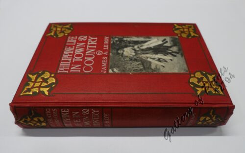
Philippine Life in Town & Country.
₱
8,800.00
Add to cart
Details
Rizal
₱
17,600.00
Add to cart
Details
Bohol
₱
17,600.00
Add to cart
Details
Leyte
₱
17,600.00
Add to cart
Details
Zambales
₱
17,600.00
Add to cart
Details
Map of Pacific Ocean by Robinson H. E. C. Pty. Ltd. Mercat...
₱
14,700.00
Add to cart
Details
South Island New Zealand
₱
4,400.00
Add to cart
Details
Northern Island New Zealand
₱
4,400.00
Add to cart
Details
The Mysteries of Taal: A Philippine Volcano and Lake, Her S...
₱
900.00
Add to cart
Details
Iloilo A Rich and Noble Land
₱
7,500.00
Add to cart
Details
When Britain Ruled the Philippines 1762-1764
₱
2,200.00
Add to cart
Details
Spanish Galleon 1530 – 1690 New Vanguard # 96
₱
2,200.00
Add to cart
Details
The Manila-Acapulco Galleons: The Treasure Ships of the Paci...
₱
4,400.00
Add to cart
Details
The National Geographic Magazine September, 1952, vol. CII, ...
₱
1,100.00
Add to cart
Details
Sale!
Karte der St. Gotthard-Bahn, Taf.2 [Map of The Gotthard-Rail...
₱
6,600.00
₱
5,280.00
Add to cart
Details
The Far East Compiled and Drawn in the Cartographic Section ...
₱
6,600.00
Add to cart
Details
Philippine Religious – Carvings in Ivory
₱
2,500.00
Add to cart
Details
Filipino Master – Damian Domingo
₱
2,500.00
Add to cart
Details
The Age of Trade The Manila Galleons and the Dawn of the Glo...
₱
6,600.00
Add to cart
Details
Adios, Patria Adorada [The Filipino as Ilustrado, The Ilustr...
₱
990.00
Add to cart
Details
Blue Book of the First Year of the Republic of the Philippin...
₱
24,500.00
Add to cart
Details
Evangelización de Filipinas y del Japon Historia de las Isl...
₱
2,200.00
Add to cart
Details
The Golden Atlas: The Greatest Explorations, Quests and Dis...
₱
3,300.00
Add to cart
Details
Early Mapping of the Pacific The Epic Story of Seafarers, Ad...
₱
6,600.00
Add to cart
Details
Early Maps of South-East Asia
₱
4,400.00
Add to cart
Details
Hinter-Indien und Ostindische Inseln. [Farther India and Eas...
₱
8,800.00
Add to cart
Details
Southeast Asia and Pacific Islands from the Indies and the ...
₱
4,400.00
Add to cart
Details
Habts. des iles Philippines. [Inhabitants of the Philippine...
₱
6,600.00
Add to cart
Details
Num. 18201 Accion de doscientos cincuenta Pesos … [Share o...
₱
50,600.00
Add to cart
Details
Previous
1
2
3
4
5
6
…
61
62
63
Next
Shopping Cart
The Age of Trade The Manila Galleons and the Dawn of the Global Economy
1
Islas Filipinas. - Grupo de Luzon. inset: [Batanes and Babuyan Islands]
1
Leyte, East Coast, Tacloban Harbor San Pedro and San Pablo Bay
1
VII. Provintiae seu Belgiu Foederatum exhibita Iohan Michael Probst Augusta Vindelicomaro. [insets:] 1. Ost India Hollan. 2. West India Hollan
1
Pisonia Sylvestris. T. et B. Pisonia Alba. Spink [English: Lettuce Tree. Tagalog: Maluko] [Named after the Dutch Botanist - Willem Pison]
1
The National Geographic Magazine, vol.XXIII, no. 9. Head-Hunters of Northern Luzon
1
La Danese [The Danish]
1
Bird's-eye view of Manilla, Luzon, Philippine Islands.
1
Carte d' Espagne et des principaux etats appartments a Cette Monarchie dans les Parties du Monde. 1. Isles Philipines. 2. Duche de Millan. 3. Royaume de Naples. 4. Royaume de Sicille. 5. Isles Antilles. 6. Nouveau Mexique. 7. Nouvelle Espagne. 8. Terre Ferme. 9. Le Perou. 10. Chili. 11. Rio de Plata ou Paraguay. 12. Pais Bas Catolique. 13. Isles de Sardaigne. 14. Isles Canaries ou Isles Fortunees. 15. Espagne.
1
Carte des Nouvelles Philippines [Map of the New Philippines]
1
[Emperor Moth]
1
Une rue de Davao (sud-est de Mindanao)
1
Isla de Negros pl. 21, with Inset of Bacolod & Surroundings
1
[Carte Reduite] Carte Réduite des Isles Philippines Pour Servir Aux Vaisseaux du Roy Dressée au Dépost des Cartes Plans et Journaux de la Marine
1
Isla de Mindoro pl. 15 inset: Puerto Galera
1
Spanish Galleon 1530 - 1690 New Vanguard # 96
1
Cart
Checkout
Continue Shopping
16