Tel : +63(2)-7729-8168 | Mobile: +63 917 806 4291
|
Email: gallery@gop.com.ph
My Account
Remember Me
Register
18 Item(s)
-
₱
1,645,700.00
Bincungan, village moro.
1 x
₱
4,400.00
Bahia de Bacoor
1 x
₱
9,900.00
Port of Manila, Trade Center of the Pacific Year Book 1929
1 x
₱
8,800.00
Historia de la Provincia de Philipinas de la Compañia de Jesus. Segunda Parte, que comprehende los progresos de esta Provincia desde el Año de 1616, hasta el de 1716.
1 x
₱
550,000.00
A Chart of the China Sea, and Philippine Islands, with the Archipelagos of Felicia and Sooloo, shewing… …Canton and Balambangan,… composed from an original drawing, communicated by Capt. Robert Carr. and compared with the map of Pedro Murillo de Velarde, engraved at Manilla in 1734…. insets: 1) The Ports of Ylocos, on the West Coast of Luzon. 2) The Bay of Subic, on the West Coast of Luzon.
1 x
₱
780,000.00
Vüe du Fort de Sambouangue [View of Zamboanga Fort]
1 x
₱
26,400.00
Sketch of Combat at Trench Near Marilao. March 27th
1 x
₱
4,400.00
Habitans des isles Philippines, Moluques &c
1 x
₱
6,600.00
Carte Reduite du Globe Terrestre
1 x
₱
56,100.00
Flores Jambosae Domesticae. Rumph. [English: Malaysian Apple] [Local Name: Makopa]
1 x
₱
26,400.00
Les Indes Orientales et leur Archipel ...
1 x
₱
26,400.00
Karte der Nordpolarregion [Map of the Northern Polar Region] insets: Nowaja Semlja; Spitzbergen und die Bären Insel; Süd-West Grönland; Küste von Ost-Grönland….
1 x
₱
4,400.00
Iaponia Japan theilet sich: …
1 x
₱
31,900.00
XI. Von Batavia nach Luzon (Manila) [From Jakarta to Luzon (Manila)]
1 x
₱
3,300.00
14. Spotted Kingfisher. (Alcedo guttatus)
1 x
₱
3,300.00
Oceanie. Description Historique sur L'Oceanie.
1 x
₱
17,600.00
The Philippine Islands showing location of Resources and Industries Isthmian Canal Commission Economic Report 1901. Authority for Topographic Data Foreman. The Philippine Islands. 1899. Note: Facts from Foreman verified in most cases by U.S. Government Reports
1 x
₱
46,200.00
Typus freti Manilensis detroit de Manilles [Straits of Manila]
1 x
₱
39,600.00
View Cart
Checkout
Home
About Us
Publications
Shop Online
Framing Services
Exhibits
Picture Hanging System
Contact Us
Blogs
View cart
“Typus freti Manilensis detroit de Manilles [Straits of Manila]” has been added to your cart.
Sort by
Default Order
Sort by
Default Order
Sort by
Name
Sort by
Price
Sort by
Date
Sort by
Popularity
Show
30 Products
Show
30 Products
Show
60 Products
Show
90 Products
Philippine Religious – Carvings in Ivory
₱
2,500.00
Add to cart
Details
The Far East Compiled and Drawn in the Cartographic Section ...
₱
6,600.00
Add to cart
Details
Sale!
Karte der St. Gotthard-Bahn, Taf.2 [Map of The Gotthard-Rail...
₱
6,600.00
₱
5,280.00
Add to cart
Details
The National Geographic Magazine September, 1952, vol. CII, ...
₱
1,100.00
Add to cart
Details
The Manila-Acapulco Galleons: The Treasure Ships of the Paci...
₱
4,400.00
Add to cart
Details
Spanish Galleon 1530 – 1690 New Vanguard # 96
₱
2,200.00
Add to cart
Details
When Britain Ruled the Philippines 1762-1764
₱
2,200.00
Add to cart
Details
Iloilo A Rich and Noble Land
₱
7,500.00
Add to cart
Details
The Mysteries of Taal: A Philippine Volcano and Lake, Her S...
₱
900.00
Add to cart
Details
Northern Island New Zealand
₱
4,400.00
Add to cart
Details
South Island New Zealand
₱
4,400.00
Add to cart
Details
Map of Pacific Ocean by Robinson H. E. C. Pty. Ltd. Mercat...
₱
14,700.00
Add to cart
Details
Zambales
₱
17,600.00
Add to cart
Details
Leyte
₱
17,600.00
Add to cart
Details
Bohol
₱
17,600.00
Add to cart
Details
Rizal
₱
17,600.00
Add to cart
Details
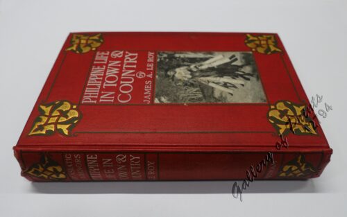
Philippine Life in Town & Country.
₱
8,800.00
Add to cart
Details
Philippines
₱
8,800.00
Add to cart
Details
The Mapping of the Heavens
₱
1,980.00
Add to cart
Details
Manila Harbor Complimentary Map of the City of Manila
₱
22,000.00
Add to cart
Details
Previous
1
2
3
…
29
30
31
32
Shopping Cart
Typus freti Manilensis detroit de Manilles [Straits of Manila]
1
The Philippine Islands showing location of Resources and Industries Isthmian Canal Commission Economic Report 1901. Authority for Topographic Data Foreman. The Philippine Islands. 1899. Note: Facts from Foreman verified in most cases by U.S. Government Reports
1
Oceanie. Description Historique sur L'Oceanie.
1
14. Spotted Kingfisher. (Alcedo guttatus)
1
XI. Von Batavia nach Luzon (Manila) [From Jakarta to Luzon (Manila)]
1
Iaponia Japan theilet sich: …
1
Karte der Nordpolarregion [Map of the Northern Polar Region] insets: Nowaja Semlja; Spitzbergen und die Bären Insel; Süd-West Grönland; Küste von Ost-Grönland….
1
Les Indes Orientales et leur Archipel ...
1
Flores Jambosae Domesticae. Rumph. [English: Malaysian Apple] [Local Name: Makopa]
1
Carte Reduite du Globe Terrestre
1
Habitans des isles Philippines, Moluques &c
1
Sketch of Combat at Trench Near Marilao. March 27th
1
Vüe du Fort de Sambouangue [View of Zamboanga Fort]
1
A Chart of the China Sea, and Philippine Islands, with the Archipelagos of Felicia and Sooloo, shewing… …Canton and Balambangan,… composed from an original drawing, communicated by Capt. Robert Carr. and compared with the map of Pedro Murillo de Velarde, engraved at Manilla in 1734…. insets: 1) The Ports of Ylocos, on the West Coast of Luzon. 2) The Bay of Subic, on the West Coast of Luzon.
1
Historia de la Provincia de Philipinas de la Compañia de Jesus. Segunda Parte, que comprehende los progresos de esta Provincia desde el Año de 1616, hasta el de 1716.
1
Port of Manila, Trade Center of the Pacific Year Book 1929
1
Bahia de Bacoor
1
Bincungan, village moro.
1
Cart
Checkout
Continue Shopping
18