Tel : +63(2)-7729-8168 | Mobile: +63 917 806 4291
|
Email: gallery@gop.com.ph
My Account
Remember Me
Register
15 Item(s)
-
₱
1,331,650.00
L'Insulinde
1 x
₱
9,900.00
Philippine Islands. Mindoro and Adjacent Islands. Cuyo Is. To Cabra I. Including Mindoro Strait and Sibuyan Sea. From the United States Cost Survey Charts to 1922.
1 x
₱
11,000.00
To U.S. Military Welcome to Manila and USO Club, Manila Hotel
1 x
₱
1,200.00
Interior de una casa en Manila (Cayda) [Interior of a House in Manila. (Fall)]
1 x
₱
220,000.00
Sketches in Manilla. The Rainy Season, Manilla.
1 x
₱
5,500.00
Germany, the Philippines, and the Spanish American War.
1 x
₱
550.00
The Philippine Islands.
1 x
₱
15,400.00
Chart of the Coast of China and of the Japan Islands including the Marianes and a part of the Philippines. Compiled by order of Commodore M. C. Perry. U.S.N. from the latest authorities with additions and corrections by the U.S. Japan Expedition by Lieuts. W. L. Maury and S. Bent. U.S.N.
1 x
₱
39,600.00
Citrus Limonia off. Citrus Medica. Bot. Citrone [Mandarin Lime]
1 x
₱
13,200.00
XI. Von Batavia nach Luzon (Manila) [From Jakarta to Luzon (Manila)]
1 x
₱
3,300.00
Bahia de Bacoor
1 x
₱
9,900.00
Northern Island New Zealand
1 x
₱
4,400.00
1) Ponape or Ponapei. 2) Wap or Yap. 3) Kusaie. Kuthiu or Ualan. 4) Mokil Is. 5) Pingelap Is. 6) Caroline Islands.
1 x
₱
6,600.00
Reduzirte Karte von den Philippinen und den Sulu Inseln [Reduced Map of the Philippines and the Sulu Islands] {insets:}. inset 1: Plan von der Bucht von Manila [Plan of Manila Bay]. inset 2: Islas Batanes. inset 3: Die Nordseite des Mindoro Kan. mit dem Volcan de Taal [Northern Mindoro Channel with Taal Volcano]. inset 4: Sulu-Gebiet an der NW-Küste von Borneo [Sulu-Area near the NW-Coast of Borneo]. inset 5: Südlicher Theil der Sûlûschen Borneo-Küste [Southern Sulu near Borneo Coast]. inset 6: Plan von der Bongobucht [Plan of Bongo Bay].
1 x
₱
990,000.00
The National Geographic Magazine September, 1952, vol. CII, No.3 New 10-Color Map of the Far East
1 x
₱
1,100.00
View Cart
Checkout
Home
About Us
Publications
Shop Online
Framing Services
Exhibits
Picture Hanging System
Contact Us
Blogs
View cart
“The National Geographic Magazine September, 1952, vol. CII, No.3 New 10-Color Map of the Far East” has been added to your cart.
Sort by
Popularity
Sort by
Default Order
Sort by
Name
Sort by
Price
Sort by
Date
Sort by
Popularity
Show
30 Products
Show
30 Products
Show
60 Products
Show
90 Products
Philippines
₱
8,800.00
Add to cart
Details
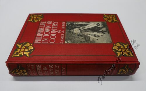
Philippine Life in Town & Country.
₱
8,800.00
Add to cart
Details
Rizal
₱
17,600.00
Add to cart
Details
Bohol
₱
17,600.00
Add to cart
Details
Leyte
₱
17,600.00
Add to cart
Details
Zambales
₱
17,600.00
Add to cart
Details
Map of Pacific Ocean by Robinson H. E. C. Pty. Ltd. Mercat...
₱
14,700.00
Add to cart
Details
South Island New Zealand
₱
4,400.00
Add to cart
Details
Northern Island New Zealand
₱
4,400.00
Add to cart
Details
The Mysteries of Taal: A Philippine Volcano and Lake, Her S...
₱
900.00
Add to cart
Details
Iloilo A Rich and Noble Land
₱
7,500.00
Add to cart
Details
When Britain Ruled the Philippines 1762-1764
₱
2,200.00
Add to cart
Details
Spanish Galleon 1530 – 1690 New Vanguard # 96
₱
2,200.00
Add to cart
Details
The Manila-Acapulco Galleons: The Treasure Ships of the Paci...
₱
4,400.00
Add to cart
Details
The National Geographic Magazine September, 1952, vol. CII, ...
₱
1,100.00
Add to cart
Details
Karte der St. Gotthard-Bahn, Taf.2 [Map of The Gotthard-Rail...
₱
6,600.00
Add to cart
Details
The Far East Compiled and Drawn in the Cartographic Section ...
₱
6,600.00
Add to cart
Details
Philippine Religious – Carvings in Ivory
₱
2,500.00
Add to cart
Details
Filipino Master – Damian Domingo
₱
2,500.00
Add to cart
Details
The Age of Trade The Manila Galleons and the Dawn of the Glo...
₱
6,600.00
Add to cart
Details
Adios, Patria Adorada [The Filipino as Ilustrado, The Ilustr...
₱
990.00
Add to cart
Details
Blue Book of the First Year of the Republic of the Philippin...
₱
24,500.00
Add to cart
Details
Evangelización de Filipinas y del Japon Historia de las Isl...
₱
2,200.00
Add to cart
Details
The Golden Atlas: The Greatest Explorations, Quests and Dis...
₱
3,300.00
Add to cart
Details
Early Mapping of the Pacific The Epic Story of Seafarers, Ad...
₱
6,600.00
Add to cart
Details
Early Maps of South-East Asia
₱
4,400.00
Add to cart
Details
Hinter-Indien und Ostindische Inseln. [Farther India and Eas...
₱
8,800.00
Add to cart
Details
Southeast Asia and Pacific Islands from the Indies and the ...
₱
4,400.00
Add to cart
Details
Habts. des iles Philippines. [Inhabitants of the Philippine...
₱
6,600.00
Add to cart
Details
Num. 18201 Accion de doscientos cincuenta Pesos … [Share o...
₱
50,600.00
Add to cart
Details
Previous
1
2
3
4
5
6
…
61
62
63
Next
Shopping Cart
The National Geographic Magazine September, 1952, vol. CII, No.3 New 10-Color Map of the Far East
1
Reduzirte Karte von den Philippinen und den Sulu Inseln [Reduced Map of the Philippines and the Sulu Islands] {insets:}. inset 1: Plan von der Bucht von Manila [Plan of Manila Bay]. inset 2: Islas Batanes. inset 3: Die Nordseite des Mindoro Kan. mit dem Volcan de Taal [Northern Mindoro Channel with Taal Volcano]. inset 4: Sulu-Gebiet an der NW-Küste von Borneo [Sulu-Area near the NW-Coast of Borneo]. inset 5: Südlicher Theil der Sûlûschen Borneo-Küste [Southern Sulu near Borneo Coast]. inset 6: Plan von der Bongobucht [Plan of Bongo Bay].
1
1) Ponape or Ponapei. 2) Wap or Yap. 3) Kusaie. Kuthiu or Ualan. 4) Mokil Is. 5) Pingelap Is. 6) Caroline Islands.
1
Northern Island New Zealand
1
Bahia de Bacoor
1
XI. Von Batavia nach Luzon (Manila) [From Jakarta to Luzon (Manila)]
1
Citrus Limonia off. Citrus Medica. Bot. Citrone [Mandarin Lime]
1
Chart of the Coast of China and of the Japan Islands including the Marianes and a part of the Philippines. Compiled by order of Commodore M. C. Perry. U.S.N. from the latest authorities with additions and corrections by the U.S. Japan Expedition by Lieuts. W. L. Maury and S. Bent. U.S.N.
1
The Philippine Islands.
1
Germany, the Philippines, and the Spanish American War.
1
Sketches in Manilla. The Rainy Season, Manilla.
1
Interior de una casa en Manila (Cayda) [Interior of a House in Manila. (Fall)]
1
To U.S. Military Welcome to Manila and USO Club, Manila Hotel
1
Philippine Islands. Mindoro and Adjacent Islands. Cuyo Is. To Cabra I. Including Mindoro Strait and Sibuyan Sea. From the United States Cost Survey Charts to 1922.
1
L'Insulinde
1
Cart
Checkout
Continue Shopping
15