Tel : +63(2)-7729-8168 | Mobile: +63 917 806 4291
|
Email: gallery@gop.com.ph
My Account
Remember Me
Register
11 Item(s)
-
₱
283,000.00
Map of the Philippines. Prepared By Reduction From the Map of the Bureau of Insular Affairs, War Department. Relief Compiled from Maps of the Corps of Engineers, US Army, And from Spanish Surveys
1 x
₱
30,900.00
Map of the Island of Luzon
1 x
₱
7,700.00
Harper's Weekly - A Journal of Civilization with frontispiece: The End of the Coast. - Drawn by A. B. Frost.
1 x
₱
17,600.00
India Orientalis et Insulae Adiecentes
1 x
₱
48,600.00
A New Map of the East Indies, Taken from Mr. de Fer's Map of Asia, Shewing their Chief Divisions, Cities, Towns, Ports, Rivers, Mountains & c. Dedicated to His Highness William Duke of Glocester.
1 x
₱
49,500.00
When Britain Ruled the Philippines 1762-1764
1 x
₱
2,200.00
The Far East Compiled and Drawn in the Cartographic Section of the National Geographic Society for The National Geographic Magazine inset: Korea
1 x
₱
6,600.00
Anchorages of Luzon, Mindoro and Marinduque. insets: 1) Luzon - West Coast. Bolinao Harbour. From the United States Government Survey of 1904. With additions and corrections from Philippine Gov't. Charts to 1964. 2) Luzon - West Coast. Port Masinloc and Port Matalvi. From the United States Government Surveys of 1937. With additions and corrections from Philippine Gov't. Charts to 1964. 3) Luzon - West Coast. Mariveles Harbour. From the United States Government Chart of 1940. With additions and corrections from Philippine Gov't. Charts to 1964. 4) Luzon - South - West Coast. Batangas. From the Philippine Government Chart of 1956. With additions and corrections to 1964. 5) Luzon - South - West Coast. Nasugbu Bay. From the Philippine Government Chart of 1956. 6) Marinduque. Port Balanacan. From the United States Government Survey of 1908. With additions and corrections from Philippine Gov't. Charts to 1964. 7) Marinduque. Santa Cruz Harbour. From the United States Government Survey of 1908. With additions and corrections from Philippine Gov't. Charts to 1964. 8) Mindoro - North Coast. Port Galera and Varadero Bay. From the United States Government Surveys to 1939. With additions and corrections from Philippine Gov't. Charts to 1964.
1 x
₱
11,000.00
Memoria acerca de Mindanao por Don Julian Gonzalez Parrado General de Brigada
1 x
₱
77,000.00
The Palace of the Captain-General, on the Pasig River, Manila
1 x
₱
5,500.00
Lagerstroemia Regia. Roxb. [Tagalog: Banaba Tree]
1 x
₱
26,400.00
View Cart
Checkout
Home
About Us
Publications
Shop Online
Framing Services
Exhibits
Picture Hanging System
Contact Us
Blogs
View cart
“Lagerstroemia Regia. Roxb. [Tagalog: Banaba Tree]” has been added to your cart.
Sort by
Price
Sort by
Default Order
Sort by
Name
Sort by
Price
Sort by
Date
Sort by
Popularity
Show
30 Products
Show
30 Products
Show
60 Products
Show
90 Products
Die letzten Drei der Albatros [The Last Three of the ‘...
₱
8,800.00
Add to cart
Details
Vue générale de la ville de Manille, ravagée par un tremb...
₱
8,800.00
Add to cart
Details
Manille: Types et Costumes des differentes classes.
₱
8,800.00
Add to cart
Details
Port of Manila, Trade Center of the Pacific Year Book 1936...
₱
8,800.00
Add to cart
Details
Port of Manila, Trade Center of the Pacific Year Book 1929...
₱
8,800.00
Add to cart
Details
Leyte, East Coast, Tacloban Harbor San Pedro and San Pablo B...
₱
8,800.00
Add to cart
Details
Leyte, East Coast, Tacloban Harbor San Pedro and San Pablo B...
₱
8,800.00
Add to cart
Details
Mandayaniederlassung am Tágum.
₱
8,800.00
Add to cart
Details
La Perruche à collier de l’Isle de Luçon [Necklace P...
₱
8,800.00
Add to cart
Details
The Spanish-American War: Views in the Philippine Islands 1...
₱
8,800.00
Add to cart
Details
Native types – The Portrait of a Well Born Filipino�...
₱
8,800.00
Add to cart
Details
La Révolte aux Philippines – Voir page 798 1. Cathéd...
₱
8,800.00
Add to cart
Details
Philippine Islands
₱
8,800.00
Add to cart
Details
The Philippines
₱
8,800.00
Add to cart
Details
The Philippines- Our Artist with the Firing-Line during the ...
₱
8,800.00
Add to cart
Details
The Philippines- Our Artist with the Firing-Line during the ...
₱
8,800.00
Add to cart
Details
Tipos Filipinos. 1. Gobernadorcillo 2. Chino cargador de a...
₱
8,800.00
Add to cart
Details
Sketches from Manilla and Hongkong 1. “Our Street̶...
₱
8,800.00
Add to cart
Details
R. valentinianum [Rhododendron valentinianum, bright yellow ...
₱
8,800.00
Add to cart
Details
Philippines. Propriete de Mr. La Geroniere
₱
8,800.00
Add to cart
Details
Campagne des Environs de Manille (Oceanie) [Countryside near...
₱
8,800.00
Add to cart
Details
MADRID. – Exposicion de Filipinas: Exterior de los edi...
₱
8,800.00
Add to cart
Details
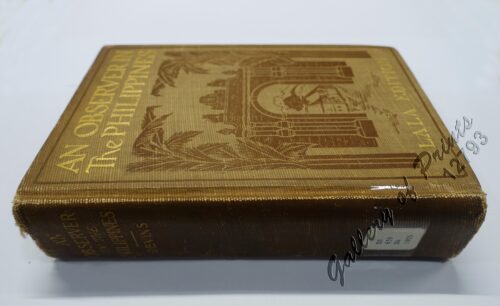
An Observer in the Philippines or Life in Our New Possession...
₱
8,800.00
Add to cart
Details
Ostindische Inseln (Spezialkarten)
₱
8,800.00
Add to cart
Details
Filipinas. 1) Filipinas. – Mujer Indigena. 2) Filipina...
₱
8,800.00
Add to cart
Details
España, sus monumentos y artes, su naturaleza e historia. C...
₱
8,800.00
Add to cart
Details
1. Vue Generale de Manille; 2. Nuestro Senor ……&...
₱
8,800.00
Add to cart
Details
Panorama des Taal-Gebietes. von der Spitze des Maquiling [Pa...
₱
8,800.00
Add to cart
Details
Ein Tagalendorf auf Luzon. (Nach der Natur) [Tagal Village i...
₱
8,800.00
Add to cart
Details
Soirée d’une famille tagale
₱
8,800.00
Add to cart
Details
Previous
1
2
3
…
23
24
25
26
27
28
29
…
61
62
63
Next
Shopping Cart
Lagerstroemia Regia. Roxb. [Tagalog: Banaba Tree]
1
The Palace of the Captain-General, on the Pasig River, Manila
1
Memoria acerca de Mindanao por Don Julian Gonzalez Parrado General de Brigada
1
Anchorages of Luzon, Mindoro and Marinduque. insets: 1) Luzon - West Coast. Bolinao Harbour. From the United States Government Survey of 1904. With additions and corrections from Philippine Gov't. Charts to 1964. 2) Luzon - West Coast. Port Masinloc and Port Matalvi. From the United States Government Surveys of 1937. With additions and corrections from Philippine Gov't. Charts to 1964. 3) Luzon - West Coast. Mariveles Harbour. From the United States Government Chart of 1940. With additions and corrections from Philippine Gov't. Charts to 1964. 4) Luzon - South - West Coast. Batangas. From the Philippine Government Chart of 1956. With additions and corrections to 1964. 5) Luzon - South - West Coast. Nasugbu Bay. From the Philippine Government Chart of 1956. 6) Marinduque. Port Balanacan. From the United States Government Survey of 1908. With additions and corrections from Philippine Gov't. Charts to 1964. 7) Marinduque. Santa Cruz Harbour. From the United States Government Survey of 1908. With additions and corrections from Philippine Gov't. Charts to 1964. 8) Mindoro - North Coast. Port Galera and Varadero Bay. From the United States Government Surveys to 1939. With additions and corrections from Philippine Gov't. Charts to 1964.
1
The Far East Compiled and Drawn in the Cartographic Section of the National Geographic Society for The National Geographic Magazine inset: Korea
1
When Britain Ruled the Philippines 1762-1764
1
A New Map of the East Indies, Taken from Mr. de Fer's Map of Asia, Shewing their Chief Divisions, Cities, Towns, Ports, Rivers, Mountains & c. Dedicated to His Highness William Duke of Glocester.
1
India Orientalis et Insulae Adiecentes
1
Harper's Weekly - A Journal of Civilization with frontispiece: The End of the Coast. - Drawn by A. B. Frost.
1
Map of the Island of Luzon
1
Map of the Philippines. Prepared By Reduction From the Map of the Bureau of Insular Affairs, War Department. Relief Compiled from Maps of the Corps of Engineers, US Army, And from Spanish Surveys
1
Cart
Checkout
Continue Shopping
11