Description
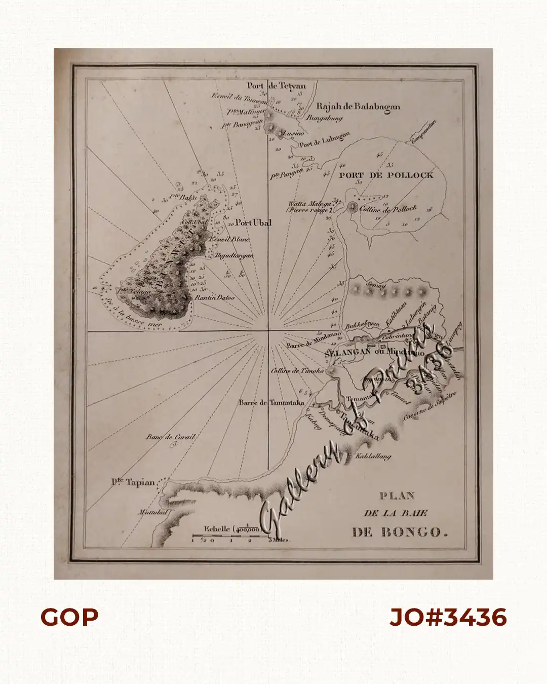
steel engraving. EXTREMELY RARE map from the Atlas “Les Philippines. Histoire, Geographie, Moeurs, Agriculture, Industrie et Commerce des Colonies Espagnoles dans l’Oceanie.”, only edition, published by Arthus Bertrand, editor of the Libraire de la Societe de Geographie, Paris.
Jean Mallat (1806-1863), a medical doctor, made three voyages to the Philippines, the first in 1838. His work probably rates the rarest of all 19th century French publications containing Philippine illustrated material. In the opinion of T.H. Pardo de Tavera [Biblioteca Filipina], “this is a very important work whose merit lies not in its originality but in the method and good order that was obviously given to the material”. As a young man Mallat went to Barcelona where he practised medicine. Subsequently, he was appointed Doctor at San Juan de Dios Hospital in Manila by the Spanish government. In 1844, he was named the Agent for Colonial France for the Indo-China Seas. In recognition of his participation during the French possession of Basilan Island, the Emperor granted him the addition of this island’s name to his family name. His coveted 10 hand-coloured lithographic prints of scenes and costumes in the Philippines are thus among the rarest prints one will be able to find on this topic, and – along with the 8 maps contained in the atlas album – is usually only found as a complete set at prices inaccessible to even the most dedicated collector. We are thus fortunate to have acquired these prints individually.
![Isla de Luzon pl. 10, inset: Pto. de Banacalan [Marinduque] (Quezon [or Tayabas], Camarines Norte, Marinduque, Balegin [Balesin], Calbalete [Cagbalete]… )](https://www.gop.com.ph/wp-content/uploads/2023/08/JO64134-Algue-1900-Isla-de-Luzon-scaled-1-600x750.webp)

![Typus freti Manilensis detroit de Manilles [Straits of Manila]](https://www.gop.com.ph/wp-content/uploads/2015/05/JO54051-Renneville-1725-Philippines-Manila-Samar-Mindoro-Luzon-scaled-1-600x750.webp)