Description
hand-coloured copper engraving. RARE.
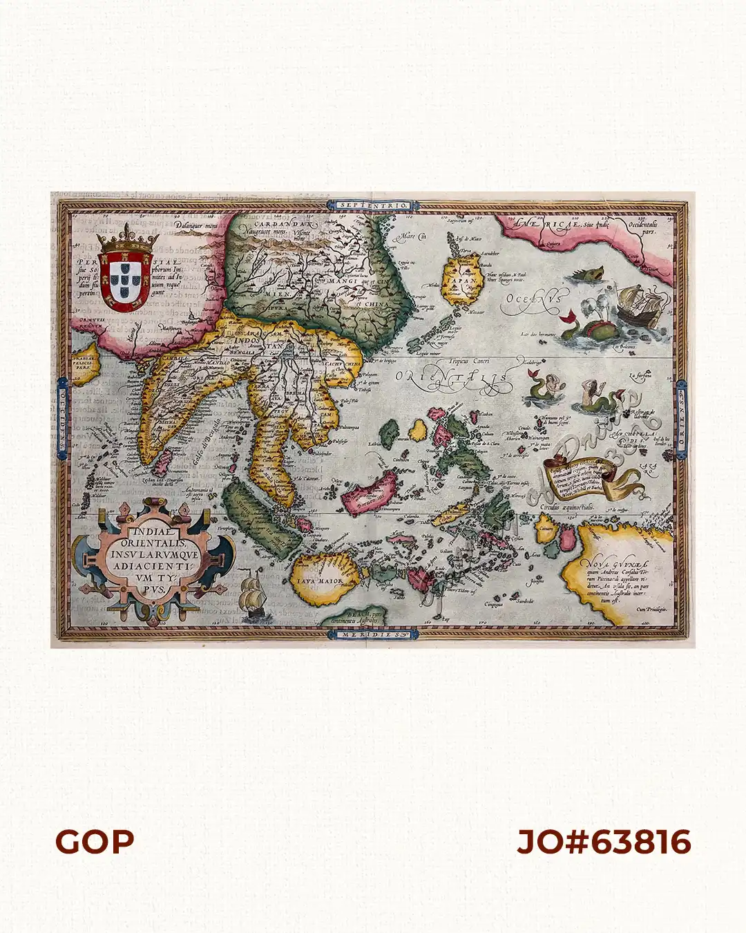
Stunning well-known map from ‘Theatre de L’Univers contenant les cartes de tout le monde’.
This is the first French edition of his celebrated atlas – the FIRST in the World: ‘Theatrum Orbis Terrarum” which was first published in Latin in 1570. The work was published by Christofle Plantin for Ortelius between 1581 and 1582 in Anvers (Antwerp), Belgium.
Shows India and Indonesia, Japan and the Philippines still without Luzon and parts of the American and Australian coastlines and the first Western map to show Formosa (Taiwan).
Ortelius was a notable Dutch cartographer, and ‘the publication of this atlas in 1570 marked an epoch in the history of cartography. It was the first uniformly sized, systematic collection of maps of the countries of the world based only on contemporary knowledge since the days of Ptolemy, & in that sense may be called the first modern atlas; although that term itself was not used until 20 years later by Mercator. The Theatrum was re-issued in 42 editions with 5 supplements. With text in Latin, Dutch, German, French, Spanish, Italian & English between the years 1570-1612. The protrusion of a Southern landmass, initially called ‘Beach’ by Marco Polo, is shown South of “Java Major”, alluding to another “necessary” suspected landmass to keep the round earth balanced: Australia…
![Typus freti Manilensis detroit de Manilles [Straits of Manila]](https://www.gop.com.ph/wp-content/uploads/2015/05/JO54051-Renneville-1725-Philippines-Manila-Samar-Mindoro-Luzon-scaled-1-600x750.webp)