Description
hand-coloured copper engraving, with Latin text on verso.
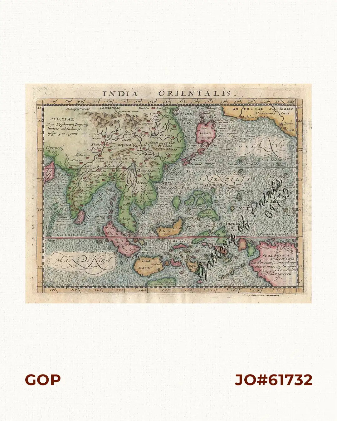
Re-engraved map from the 1617 Latin printing of Giovanni Antonio Magini’s edition of Claudius Ptolemy’s Geographia’, published by Jan Jansson. Philippines still shown without Luzon although known since 1575. Girolamo Porro (c. 1520-1604) was an Italian engraver active in Venice and his native Padua, working predominantly as a map engraver for Tommaso Porcacchi, and Girolamo Ruscelli. Giovanni Antonio Magini (1555-1615) was an Italian scientist, cartographer, and chair of mathematics at the University of Bologna. Johannes Janssonius (1588 – 1664) was a famed cartographer and print publisher. More commonly known as Jan Jansson, he was born in Arnhem/Netherlands where his father, Jan Janszoon the Elder, was a bookseller and publisher. In 1612 he married the daughter of the cartographer and publisher Jodocus Hondius, and then set up in business in Amsterdam as a book publisher.


![Plan du Port de Subec, en I'Isle de Lucon [Plan of The Port of Subic on Luzon Island]](https://www.gop.com.ph/wp-content/uploads/2015/05/JO55439-de-Mannevillete-c1775-Plan-du-Port-de-Subec-600x750.webp)