Tel : +63(2)-7729-8168 | Mobile: +63 917 806 4291
|
Email: gallery@gop.com.ph
My Account
Remember Me
Register
22 Item(s)
-
₱
1,861,590.00
Map of the North Atlantic Ocean showing European Colonial Possessions under their National Flags. 1898. Mercator's Projection
1 x
₱
6,600.00
Plan de la Baye de Manille…
1 x
₱
26,400.00
Le Mayon. - Vue Generale
1 x
₱
6,600.00
Insulae Philippinae… [inset: Manila]
1 x
₱
1,250,000.00
Afrique Meridionale
1 x
₱
5,500.00
East India Archipelago [Eastern Passages to China and Japan][Chart No.4] London, Published by James Imray and Son, 89 & 102 Minories, 1884
1 x
₱
49,600.00
La bataille d'autre nous et contre cieux de Manille faicte le 14 Decembre ano 1600 [The battle between us and those of Manila on 14 December of the year 1600]
1 x
₱
77,000.00
Pitta Kochi [The Whiskered Pitta]
1 x
₱
7,700.00
Isles de l'Inde Orientale [East India Islands]
1 x
₱
34,100.00
East India Archipelago [Eastern Passages to China and Japan][Chart No.6] London, Published by James Imray and Son, 89 & 102 Minories, 1872
1 x
₱
110,000.00
XI. Von Batavia nach Luzon (Manila) [From Jakarta to Luzon (Manila)]
1 x
₱
3,300.00
Hinter-Indien und Ostindische Inseln. [Farther India and East India Islands]
1 x
₱
8,800.00
Brachyurus Steerii, ad. et jur. (Steere's Pitta)
1 x
₱
9,900.00
The Murillo Bulletin, Journal of PHIMCOS, Issue No. 14
1 x
₱
790.00
International Map Collectors' Society IMCoS Journal December 2021 No.167
1 x
₱
1,400.00
De Sinu Baye La Baye (Gulf of Albay]
1 x
₱
56,000.00
Los Baños. (Provincia de la Laguna.)
1 x
₱
49,500.00
A Chart of the Channel in the Phillippine [sic] Islands through which the Manila Galleon Passes Together with the Adjacent Islands
1 x
₱
39,600.00
Plan du Port de Subec, en I'Isle de Lucon [Plan of The Port of Subic on Luzon Island]
1 x
₱
26,400.00
The Molucca Ilands & C. [The Molucca Islands]
1 x
₱
26,400.00
The Philipine Isles
1 x
₱
61,600.00
1) La rue de l'Arsenal, à Cavite. 2) Le chemin royal Nagsubu à Cavite [Royal Road…]
1 x
₱
4,400.00
View Cart
Checkout
Home
About Us
Publications
Shop Online
Framing Services
Exhibits
Picture Hanging System
Contact Us
Blogs
Sort by
Date
Sort by
Default Order
Sort by
Name
Sort by
Price
Sort by
Date
Sort by
Popularity
Show
30 Products
Show
30 Products
Show
60 Products
Show
90 Products
The Mapmaker’s Art (A History of Cartography)
₱
9,900.00
Add to cart
Details
The Mapping of Terra Australis
₱
5,500.00
Add to cart
Details
Bel et Utile: The Work of the Robert de Vaugondy Family of M...
₱
6,600.00
Add to cart
Details
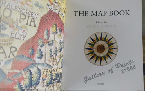
The Map Book
₱
3,300.00
Add to cart
Details
Investing in Maps
₱
2,500.00
Add to cart
Details
Antique Maps and their Cartographers
₱
5,500.00
Add to cart
Details
Shopping Cart
1) La rue de l'Arsenal, à Cavite. 2) Le chemin royal Nagsubu à Cavite [Royal Road…]
1
The Philipine Isles
1
The Molucca Ilands & C. [The Molucca Islands]
1
Plan du Port de Subec, en I'Isle de Lucon [Plan of The Port of Subic on Luzon Island]
1
A Chart of the Channel in the Phillippine [sic] Islands through which the Manila Galleon Passes Together with the Adjacent Islands
1
Los Baños. (Provincia de la Laguna.)
1
De Sinu Baye La Baye (Gulf of Albay]
1
International Map Collectors' Society IMCoS Journal December 2021 No.167
1
The Murillo Bulletin, Journal of PHIMCOS, Issue No. 14
1
Brachyurus Steerii, ad. et jur. (Steere's Pitta)
1
Hinter-Indien und Ostindische Inseln. [Farther India and East India Islands]
1
XI. Von Batavia nach Luzon (Manila) [From Jakarta to Luzon (Manila)]
1
East India Archipelago [Eastern Passages to China and Japan][Chart No.6] London, Published by James Imray and Son, 89 & 102 Minories, 1872
1
Isles de l'Inde Orientale [East India Islands]
1
Pitta Kochi [The Whiskered Pitta]
1
La bataille d'autre nous et contre cieux de Manille faicte le 14 Decembre ano 1600 [The battle between us and those of Manila on 14 December of the year 1600]
1
East India Archipelago [Eastern Passages to China and Japan][Chart No.4] London, Published by James Imray and Son, 89 & 102 Minories, 1884
1
Afrique Meridionale
1
Insulae Philippinae… [inset: Manila]
1
Le Mayon. - Vue Generale
1
Plan de la Baye de Manille…
1
Map of the North Atlantic Ocean showing European Colonial Possessions under their National Flags. 1898. Mercator's Projection
1
Cart
Checkout
Continue Shopping
22