Tel : +63(2)-7729-8168 | Mobile: +63 917 806 4291
|
Email: gallery@gop.com.ph
My Account
Remember Me
Register
1 Item(s)
-
₱
13,200.00
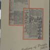
Philippine Islands. Western Part of Mindanao Sea with Bohol Strait and Part of Tañon Strait. From the United States Government Charts to 1937.
1 x
₱
13,200.00
View Cart
Checkout
My Account
1 Item(s)
-
₱
13,200.00
Home
About Us
Publications
Shop Online
Framing Services
Exhibits
Picture Hanging System
Contact Us
Blogs
Home
About Us
Publications
Shop Online
Framing Services
Exhibits
Picture Hanging System
Contact Us
Blogs
View cart
“Philippine Islands. Western Part of Mindanao Sea with Bohol Strait and Part of Tañon Strait. From the United States Government Charts to 1937.” has been added to your cart.
The Making of the Nuremberg Chronicle
₱
15,400.00
In Stock
In Stock
Add to cart
Author:
Adrian Wilson Joyce Lancaster Wilson [assist] Peter Zahn [intro]
Publisher:
Nico Israel in Amsterdam.
Year:
1978 [1976]
Size:
35 x 25.5 cm folio
Reference:
SKU:
20874
Category:
Vintage Prints/Maps/Views[1926-1999]
Tag:
Nuremberg incunable 1
Condition
Condition
fine
Share On Facebook
Tweet This Product
Pin This Product
Mail This Product
Related products
Philippine Islands – Mindanao. Davao Gulf. From the Philippine Government Charts to 1956. With additions and corrections to 1962. insets: 1) Talomo Bay. From U.S Government Chart of 1933. With additions and corrections to 1962. 2) Lais. From U.S Government Chart of 1933. With additions and corrections to 1962. 3) Malita. From U.S Government Chart of 1933. With additions and corrections to 1962. 4) Port of Davao. From the Philippine Government Chart of 1956. With additions and corrections to 1962. 5) Pakiputan Strait. From U.S Government Chart of 1933. With additions and corrections to 1962.
₱
11,000.00
Add to cart
Details
Ports in the Philippine Islands. insets: 1) Luzon I. – West Coast. Manila and Cavite Anchorages. From the United States Government Chart of 1950. with additions and corrections to 1969. 2) Luzon I. – West Coast. Manila Harbour. From the United States Government Chart of 1950. with additions and corrections to 1969.
₱
11,000.00
Add to cart
Details
Philippine Islands. Tablas Strait with Part of Sibuyan Sea. From the United States Government Charts of 1935.
₱
11,000.00
Add to cart
Details
Philippine Islands. Luzon Island. North of Latitude 16° 20′ North. From the United States Cost Survey Charts to 1925. With additions and correctionsfrom the Philippine Gov’t. Charts to 1963. Soundings in hairline enlarged from smaller scale charts.
₱
11,000.00
Add to cart
Details
Anchorages of Luzon, Mindoro and Marinduque. insets: 1) Luzon – West Coast. Bolinao Harbour. From the United States Government Survey of 1904. With additions and corrections from Philippine Gov’t. Charts to 1964. 2) Luzon – West Coast. Port Masinloc and Port Matalvi. From the United States Government Surveys of 1937. With additions and corrections from Philippine Gov’t. Charts to 1964. 3) Luzon – West Coast. Mariveles Harbour. From the United States Government Chart of 1940. With additions and corrections from Philippine Gov’t. Charts to 1964. 4) Luzon – South – West Coast. Batangas. From the Philippine Government Chart of 1956. With additions and corrections to 1964. 5) Luzon – South – West Coast. Nasugbu Bay. From the Philippine Government Chart of 1956. 6) Marinduque. Port Balanacan. From the United States Government Survey of 1908. With additions and corrections from Philippine Gov’t. Charts to 1964. 7) Marinduque. Santa Cruz Harbour. From the United States Government Survey of 1908. With additions and corrections from Philippine Gov’t. Charts to 1964. 8) Mindoro – North Coast. Port Galera and Varadero Bay. From the United States Government Surveys to 1939. With additions and corrections from Philippine Gov’t. Charts to 1964.
₱
11,000.00
Add to cart
Details
Philippine Islands. Sibuyan Sea to San Bernardino Strait. From the United States Government Charts to 1934.
₱
11,000.00
Add to cart
Details
Plans in the Philippine Island. insets: 1) Luzon – North Coast. Aparri. From the Philippine Government Chart of 1954. 2) Bataan I. Basco. From the Philippine Government Chart of 1954. 3) Luzon – West Coast. Santa Cruz. From the Philippine Government Chart of 1952. 4) Bataan I. Balugan Bay. From the Philippine Government Chart of 1953.
₱
11,000.00
Add to cart
Details
Philippine Islands. Surigao Srait with Leyte Gulf and Hinatuan Passage. From the United States Government Charts to 1933. With addition and correctionsto 1954.
₱
11,000.00
Add to cart
Details
Philippine Islands. Mindoro and Adjacent Islands. Cuyo Is. To Cabra I. Including Mindoro Strait and Sibuyan Sea. From the United States Cost Survey Charts to 1922.
₱
11,000.00
Add to cart
Details
Shopping Cart
Philippine Islands. Western Part of Mindanao Sea with Bohol Strait and Part of Tañon Strait. From the United States Government Charts to 1937.
1
Cart
Checkout
Continue Shopping
1
")

")
")