Tel : +63(2)-7729-8168 | Mobile: +63 917 806 4291
|
Email: gallery@gop.com.ph
My Account
Remember Me
Register
32 Item(s)
-
₱
423,120.00
Traubige Passionsblume. Fig. 921. [Grapy Passionflower]; Vierkantige Passionsblume. Fig. 922. [Tetragonal Passionflower]; Rothe Passionsblume. Fig. 923. [Red Passionflower]; Aepfeltragende Passionsblume. Fig. 924. [Apple-carrying Passionflower]; Carminrothe Passionsblume. Fig. 925 [Carmine-red Passionflower]
1 x
₱
5,500.00
The Philippine Crisis: Scenes of the Conflict. 1. A Filipino Village just outside the American Lines near Manila; 2. Outposts in Touch: American on the near side of the Bridge, Filipino beyond; 3. A Spanish Fort at Manila mounted with old Muzzle-loading Guns; 4. At Cavite: a Spanish Gun-boat "Scuppered" by her Crew.
1 x
₱
7,700.00
An Interesting Group.
1 x
₱
2,200.00
Anna and the King of Siam
1 x
₱
2,200.00
Philippinen - Exotische Inselwelt La vie exotique des îles Philippines La vita exotica dell'isola Filipina [Philippines - Exotic Island World] 1) [Tribal Dancing / Celebration] 2) [Igorot Weapons] 3) [Washing Clothes Along River] 4) [Carabao Bathing] 5) [Igorot Houses] 6) [Igorot Male]
1 x
₱
5,500.00
Voyage Autour du Monde ... 1826, 1827, 1828, et 1829
1 x
₱
19,800.00
Mar del Zur insets: Nova Guinea Tierra del Fuogo
1 x
₱
7,700.00
Dendrobium Macrophyllum A. Rich. [Large-leaved Dendrobium or Pastor's Orchid]
1 x
₱
7,700.00
Emergent Literature Essays on Philippine Writing
1 x
₱
600.00
Investing in Maps
1 x
₱
2,500.00
Philippine Islands Mindanao I. - South East Coast Pujaga Bay
1 x
₱
4,400.00
China Sea - Macclesfield Bank. Surveyed by Commander W.U. Moore and the Officers of H.M. Surveying Ship Penguin, 1892. and by Commander A. Mostyn Field and the Officers of H.M. Surveying Ship Egeria,1893.
1 x
₱
6,600.00
1) Parao, Bateau de Passage de Manille (Parao, ferryboat of Manila); 2) Sarambeau, Radeau de Peche de Manille (Sarambao, fish trap of Manila)
1 x
₱
22,000.00
South Part of Samar
1 x
₱
4,400.00
Panorama des Taal-Gebietes. von der Spitze des Maquiling [Panorama of the Taal Area as Seen from the Top of Mt. Makiling]
1 x
₱
8,800.00
Anchorages of Luzon, Mindoro and Marinduque. insets: 1) Luzon - West Coast. Bolinao Harbour. From the United States Government Survey of 1904. With additions and corrections from Philippine Gov't. Charts to 1964. 2) Luzon - West Coast. Port Masinloc and Port Matalvi. From the United States Government Surveys of 1937. With additions and corrections from Philippine Gov't. Charts to 1964. 3) Luzon - West Coast. Mariveles Harbour. From the United States Government Chart of 1940. With additions and corrections from Philippine Gov't. Charts to 1964. 4) Luzon - South - West Coast. Batangas. From the Philippine Government Chart of 1956. With additions and corrections to 1964. 5) Luzon - South - West Coast. Nasugbu Bay. From the Philippine Government Chart of 1956. 6) Marinduque. Port Balanacan. From the United States Government Survey of 1908. With additions and corrections from Philippine Gov't. Charts to 1964. 7) Marinduque. Santa Cruz Harbour. From the United States Government Survey of 1908. With additions and corrections from Philippine Gov't. Charts to 1964. 8) Mindoro - North Coast. Port Galera and Varadero Bay. From the United States Government Surveys to 1939. With additions and corrections from Philippine Gov't. Charts to 1964.
1 x
₱
11,000.00
Coucou, des Philippines [Philippine Coucal] [Sabukot/ Tsabukot] [Centropus Viridis]
1 x
₱
14,700.00
F.v. Richthofen's Reisen in China Sept. 1868 - 31 Mai 1870, Ney Elias' Aufnahme des Hoangho von Khaifung bis zur Mündung, 1868, Shufeldt's & Febiger's Aufnahmen in Korea, 1867/8.
1 x
₱
6,600.00
The Murillo Bulletin, Journal of PHIMCOS, Issue No.4
1 x
₱
540.00
Carte des Isles Philippines, Celebes et Moluques [Kaart van de Filippynse, Celebes, en Molukse-Eilanden]
1 x
₱
13,200.00
Sketches from Manilla and Hong-Kong. 1. "Soiree Musicale" at Manilla. 2. Chinese Nursemaid on the Parade- Ground, Hongkong.
1 x
₱
11,000.00
Mittheilungen aus Justus Perthes' Geographischer Anstalt. über wichtige neue Erforschungen auf dem Gesammtgebiete der Geographie von Dr. A. Petermann. - Ergänzungsband VI, 1869-71 Inhalt:[Supplement Vol. 6 contents] No. 26. Lindemann, die arktische Fischerei der Deutschen Seestädte 1620-1868 No. 27. Payer, die südlichen Ortler-Alpen No. 28. Koldewey und Petermann, die erste Deutsche Nordpolar-Expedition, 1868 No. 29. Petermann, Australien in 1871. Mit geograph.- statistischem Compendium von Meinicke
1 x
₱
8,600.00
Rare Pacific Voyage Books, part 2
1 x
₱
3,300.00
Une rue de Davao (sud-est de Mindanao)
1 x
₱
7,700.00
The Illustrated London News Vol. 32 - No. 897
1 x
₱
6,600.00
The Philipine Isles
1 x
₱
88,000.00
Binangonan
1 x
₱
6,600.00
Natives of Luzon ( Phillippines ) [sic]
1 x
₱
15,800.00
The Renewed Conflict in the Philippines: Scenes of the Engagements on February 4 and 5. 1. Santa Ana. 2. Iloilo. 3. Agoncillo, Filipino Agent at Washington. 4. Village of Santa Mesa, the scene of the first fight on February 4. 5. Paco: The Church and Cemetery.
1 x
₱
7,700.00
The Philippine Islands and others of the East Indies
1 x
₱
27,280.00
Karte des südlichen Theiles von Luzon und benachbarter Inseln auf Grundlage der Coello'schen [Map of Southern Luzon and Adjacent Islands Based on Coello's Map]. insets: 1. Untere Fortsetzung [Lower Continuation]. 2. Übersichtskarte der Philippinen [Map of the Philippines]. . Die Kieselbrunnen Naglegbeng bei Tibi in Prov. Albáy [Paved Wells Neglegbeng near Tiwi in Albay Province]
1 x
₱
77,000.00
The Philippines and Round About.
1 x
₱
9,900.00
View Cart
Checkout
Home
About Us
Publications
Shop Online
Framing Services
Exhibits
Picture Hanging System
Contact Us
Blogs
View Cart
You cannot add that amount to the cart — we have 1 in stock and you already have 1 in your cart.
Sort by
Date
Sort by
Default Order
Sort by
Name
Sort by
Price
Sort by
Date
Sort by
Popularity
Show
30 Products
Show
30 Products
Show
60 Products
Show
90 Products
Voyage Autour du Monde … 1826, 1827, 1828, et 1829...
₱
19,800.00
Add to cart
Details
Investing in Maps
₱
2,500.00
Add to cart
Details
Rare Pacific Voyage Books, part 2
₱
3,300.00
Add to cart
Details
The German Club Manila 1986 – 1996 / 1906 – ...
₱
2,500.00
Add to cart
Details
Philippine Islands. A Detailed Map. by Robinson H. E. C. Pt...
₱
34,200.00
Add to cart
Details
[Southeast Asia]
₱
26,400.00
Add to cart
Details
Spanning the Decades 1902-2002
₱
2,600.00
Add to cart
Details
Magsaysay of the Philippines
₱
7,700.00
Add to cart
Details
Miniature Antique Maps
₱
4,400.00
Add to cart
Details
The German Club Story Centennial Edition 1906 – 2006
₱
2,500.00
Add to cart
Details
The Cruise of the U.S. Flagship Olympia, from 1895-1899, fro...
₱
2,200.00
Add to cart
Details
The Calamansi Cook Book, An Expat’s Guide to Eating We...
₱
900.00
Add to cart
Details
Rizal, Philippine Nationalist and Martyr.
₱
2,900.00
Add to cart
Details
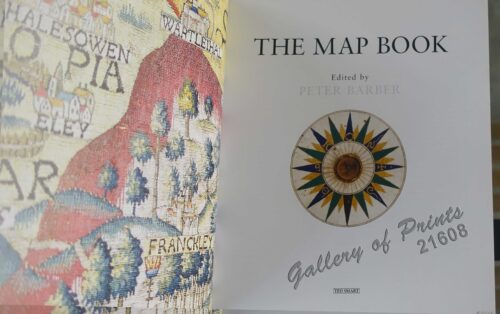
The Map Book
₱
3,300.00
Add to cart
Details
Previous
1
2
3
…
58
59
60
61
Shopping Cart
The Philippines and Round About.
1
Karte des südlichen Theiles von Luzon und benachbarter Inseln auf Grundlage der Coello'schen [Map of Southern Luzon and Adjacent Islands Based on Coello's Map]. insets: 1. Untere Fortsetzung [Lower Continuation]. 2. Übersichtskarte der Philippinen [Map of the Philippines]. . Die Kieselbrunnen Naglegbeng bei Tibi in Prov. Albáy [Paved Wells Neglegbeng near Tiwi in Albay Province]
1
The Philippine Islands and others of the East Indies
1
The Renewed Conflict in the Philippines: Scenes of the Engagements on February 4 and 5. 1. Santa Ana. 2. Iloilo. 3. Agoncillo, Filipino Agent at Washington. 4. Village of Santa Mesa, the scene of the first fight on February 4. 5. Paco: The Church and Cemetery.
1
Natives of Luzon ( Phillippines ) [sic]
1
Binangonan
1
The Philipine Isles
1
The Illustrated London News Vol. 32 - No. 897
1
Une rue de Davao (sud-est de Mindanao)
1
Rare Pacific Voyage Books, part 2
1
Mittheilungen aus Justus Perthes' Geographischer Anstalt. über wichtige neue Erforschungen auf dem Gesammtgebiete der Geographie von Dr. A. Petermann. - Ergänzungsband VI, 1869-71 Inhalt:[Supplement Vol. 6 contents] No. 26. Lindemann, die arktische Fischerei der Deutschen Seestädte 1620-1868 No. 27. Payer, die südlichen Ortler-Alpen No. 28. Koldewey und Petermann, die erste Deutsche Nordpolar-Expedition, 1868 No. 29. Petermann, Australien in 1871. Mit geograph.- statistischem Compendium von Meinicke
1
Sketches from Manilla and Hong-Kong. 1. "Soiree Musicale" at Manilla. 2. Chinese Nursemaid on the Parade- Ground, Hongkong.
1
Carte des Isles Philippines, Celebes et Moluques [Kaart van de Filippynse, Celebes, en Molukse-Eilanden]
1
The Murillo Bulletin, Journal of PHIMCOS, Issue No.4
-
Quantity
+
F.v. Richthofen's Reisen in China Sept. 1868 - 31 Mai 1870, Ney Elias' Aufnahme des Hoangho von Khaifung bis zur Mündung, 1868, Shufeldt's & Febiger's Aufnahmen in Korea, 1867/8.
1
Coucou, des Philippines [Philippine Coucal] [Sabukot/ Tsabukot] [Centropus Viridis]
1
Anchorages of Luzon, Mindoro and Marinduque. insets: 1) Luzon - West Coast. Bolinao Harbour. From the United States Government Survey of 1904. With additions and corrections from Philippine Gov't. Charts to 1964. 2) Luzon - West Coast. Port Masinloc and Port Matalvi. From the United States Government Surveys of 1937. With additions and corrections from Philippine Gov't. Charts to 1964. 3) Luzon - West Coast. Mariveles Harbour. From the United States Government Chart of 1940. With additions and corrections from Philippine Gov't. Charts to 1964. 4) Luzon - South - West Coast. Batangas. From the Philippine Government Chart of 1956. With additions and corrections to 1964. 5) Luzon - South - West Coast. Nasugbu Bay. From the Philippine Government Chart of 1956. 6) Marinduque. Port Balanacan. From the United States Government Survey of 1908. With additions and corrections from Philippine Gov't. Charts to 1964. 7) Marinduque. Santa Cruz Harbour. From the United States Government Survey of 1908. With additions and corrections from Philippine Gov't. Charts to 1964. 8) Mindoro - North Coast. Port Galera and Varadero Bay. From the United States Government Surveys to 1939. With additions and corrections from Philippine Gov't. Charts to 1964.
1
Panorama des Taal-Gebietes. von der Spitze des Maquiling [Panorama of the Taal Area as Seen from the Top of Mt. Makiling]
1
South Part of Samar
1
1) Parao, Bateau de Passage de Manille (Parao, ferryboat of Manila); 2) Sarambeau, Radeau de Peche de Manille (Sarambao, fish trap of Manila)
1
China Sea - Macclesfield Bank. Surveyed by Commander W.U. Moore and the Officers of H.M. Surveying Ship Penguin, 1892. and by Commander A. Mostyn Field and the Officers of H.M. Surveying Ship Egeria,1893.
1
Philippine Islands Mindanao I. - South East Coast Pujaga Bay
1
Investing in Maps
1
Emergent Literature Essays on Philippine Writing
1
Dendrobium Macrophyllum A. Rich. [Large-leaved Dendrobium or Pastor's Orchid]
1
Mar del Zur insets: Nova Guinea Tierra del Fuogo
1
Voyage Autour du Monde ... 1826, 1827, 1828, et 1829
1
Philippinen - Exotische Inselwelt La vie exotique des îles Philippines La vita exotica dell'isola Filipina [Philippines - Exotic Island World] 1) [Tribal Dancing / Celebration] 2) [Igorot Weapons] 3) [Washing Clothes Along River] 4) [Carabao Bathing] 5) [Igorot Houses] 6) [Igorot Male]
1
Anna and the King of Siam
1
An Interesting Group.
1
The Philippine Crisis: Scenes of the Conflict. 1. A Filipino Village just outside the American Lines near Manila; 2. Outposts in Touch: American on the near side of the Bridge, Filipino beyond; 3. A Spanish Fort at Manila mounted with old Muzzle-loading Guns; 4. At Cavite: a Spanish Gun-boat "Scuppered" by her Crew.
1
Traubige Passionsblume. Fig. 921. [Grapy Passionflower]; Vierkantige Passionsblume. Fig. 922. [Tetragonal Passionflower]; Rothe Passionsblume. Fig. 923. [Red Passionflower]; Aepfeltragende Passionsblume. Fig. 924. [Apple-carrying Passionflower]; Carminrothe Passionsblume. Fig. 925 [Carmine-red Passionflower]
1
Cart
Checkout
Continue Shopping
32