Description
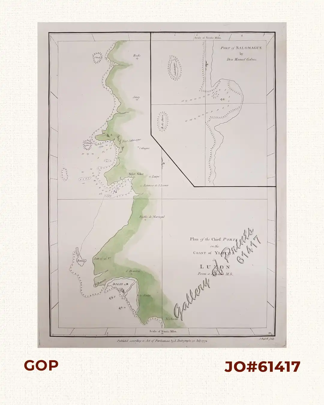
copper engraving, with green hand-coloured coastal outline. EXTREMELY RARE.
Both sea charts originate from Spanish sources. The Ylocos chart shows the Northwest coast of Luzon in the Ilocos Region, here ranging from Narvacan to Vigan City (Bigan) to Cabugao where Port Salomague is located. Gálvez provides a chart of Port Salomague although with little detail other than depth soundings for approaching the anchorage.


![Typus freti Manilensis detroit de Manilles [Straits of Manila]](https://www.gop.com.ph/wp-content/uploads/2015/05/JO54051-Renneville-1725-Philippines-Manila-Samar-Mindoro-Luzon-scaled-1-600x750.webp)