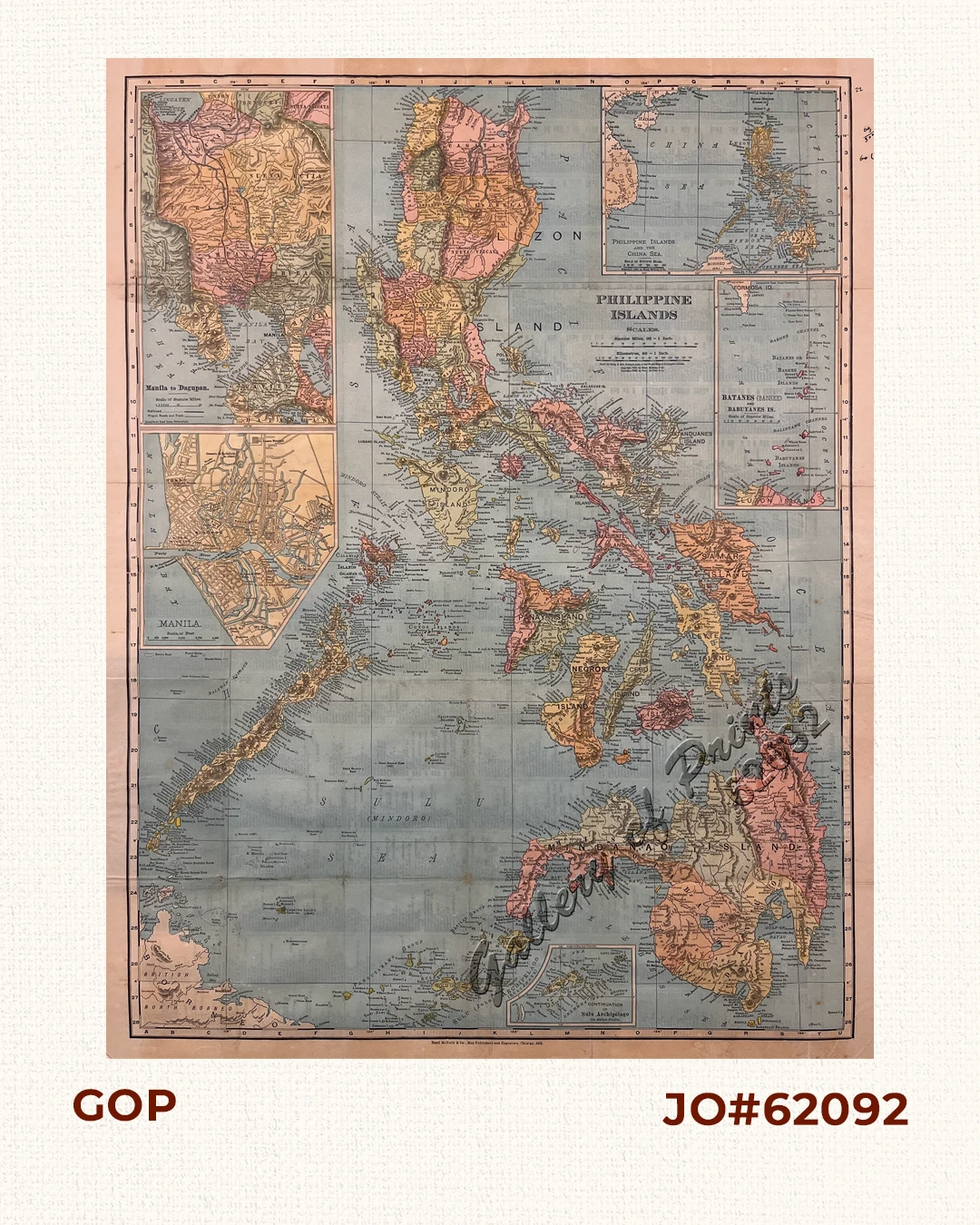
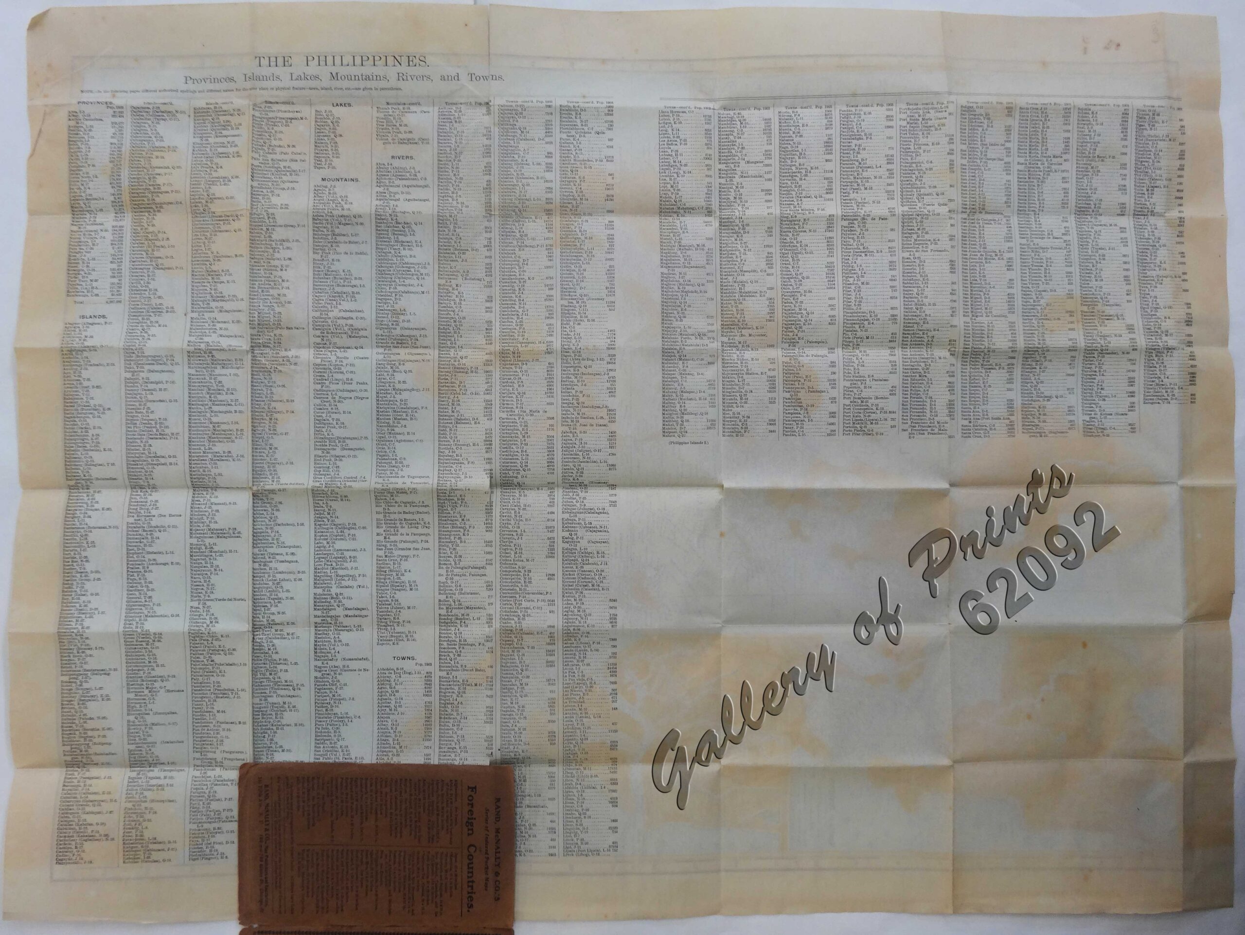
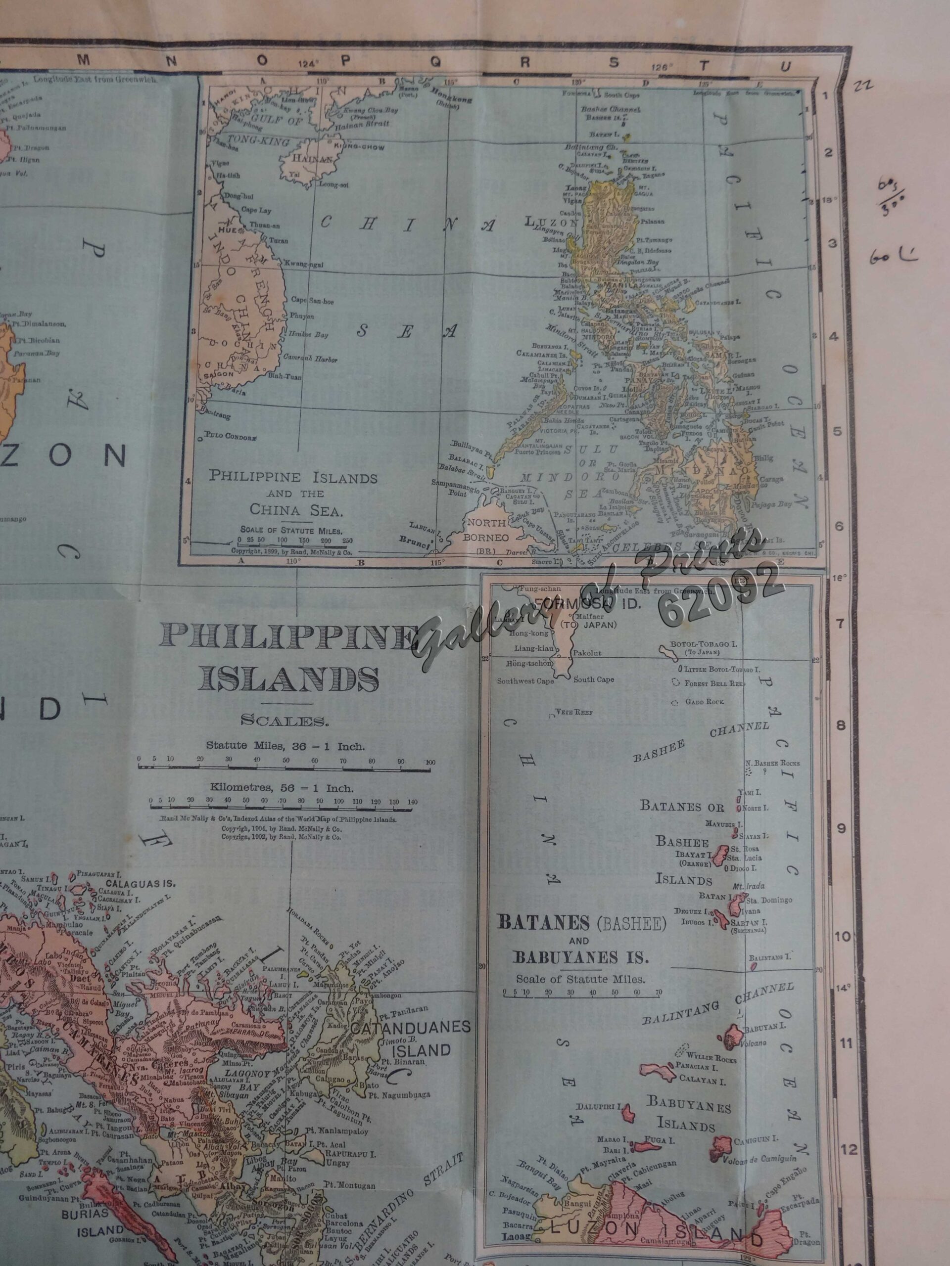
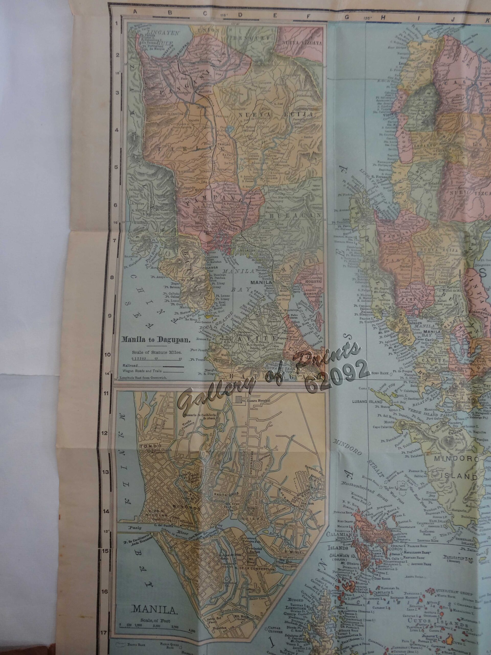
Description
original-colour lithograph.
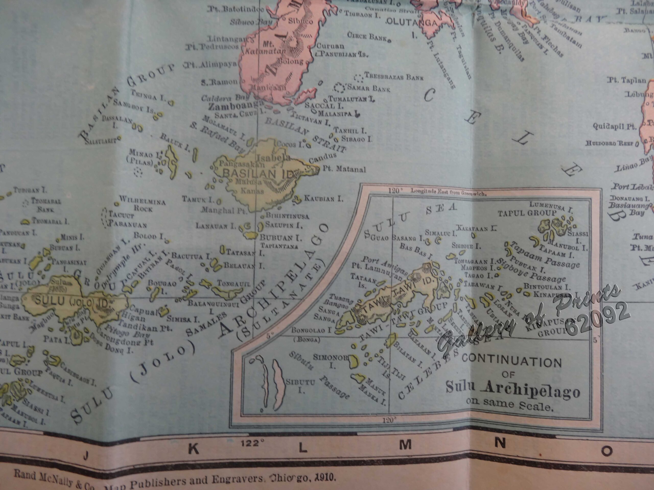
RARE pocket map from ‘Series of Indexed Pocket Maps of Foreign Countries’. The shipping routes between the main cities are printed in red dotted lines. On verso is a key to the principal cities. According to Rumsey, from the 33rd edition of this atlas, maps change from the 1890’s editions.


![Islas de Infanta y Polillo pl. 12 [Quezon Prov., Polilio Is., Pananongan I., Jomalig I.]](https://www.gop.com.ph/wp-content/uploads/2023/08/JO62585-Algue-1900-Quezon-Province-Polilo-Jomalig-Patnanongan-scaled-1-600x750.webp)