Philippinae Insulae

128,000.00

In Stock

In Stock

Author: Petrus Bertius / Jodocus Hondius

Publisher: Jodocus Hondius in Amsterdam.

Year: 1618 [1616] [1598]

Size: 9.5 x 13.7 cm

Reference: unrecorded - not in Quirino, but similar to Kaerius p. 78; not in Phillips; Antique Maps, pp.104-6; Koeman II, LAN 13A, Sabin 5014; Suarez, S.E.A. p. 188
SKU: 62736 Category: Tags: ,

Description

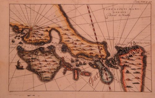
hand-coloured copper engraving. text verso in French: ‘Description des Isles Molucques’.

EXTREMELY RARE map from ‘Tabularum Geographicum’ Chapter: ‘Description des Philippines’, pp.753-754; first French edition. The second version of the oldest map showing the Philippines alone. The Kaerius map was redrawn: Palawan now angled. Essentially taken from Plancius “spice” map of 1592: Insulae Moluccae.


Price upon request

Condition

age toning, marginal browning and handling marks, some light damp staining in lower left corner and lower margin. Otherwise quite good.

Shopping Cart
There are no products in the cart!
Continue Shopping
0